
dear dioRey
hi today i basically just solved random notes and added some more farmland in the area i found not much to say
15th of September 2024, 12:12 AM, Poland
dear dioRey
hi today i basically just solved random notes and added some more farmland in the area i found not much to say
15th of September 2024, 12:12 AM, Poland

You know that classic email that starts with “Congratulations! We are pleased to offer you…”? Well, on July 1st, I got one of those from Hot Open Summit, awarding me a scholarship to attend State of the Map Global in Nairobi! Thanks Hot Open Summit! Let’s stay connected, we’ve got Manila SOTM 2025 coming up! 🫡🫡🙏🤩
First thing I did? Downloading offline maps of Nairobi with OSMAnd and Maps.me , I had to get those OSM maps in my hand, ready to go. I was feeling chill, knowing I was all set for my trip to Nairobi.
From Dar es Salaam to Nairobi, the journey kicked off with 7 of us heading there in one bus. We had a fun group Hawa next to me, Innocent chilling at the far end, Anastazia, Amour, Kombe, and Benedict. I couldn’t wait to get there, and OSMAnd was the trip MVP, keeping us informed like a road-trip soundtrack “Are we there yet?”
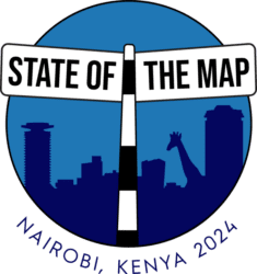
This year, I had the incredible privilege of attending the State of the Map 2024 conference, hosted in Nairobi, Kenya. Over the course of three unforgettable days, I participated in insightful opening talks, lightning sessions, and deep discussions on critical mapping issues, all while meeting and learning from experts from across the globe.
Nairobi proved to be a truly resourceful city for this conference. A country with diverse geography, Kenya is home to national parks, game reserves, and an airport conveniently located within the city, making it a unique blend of urban life and nature. The infrastructure was excellent, and it provided a comfortable environment for participants to learn, connect, and exchange ideas. The team behind the conference’s organization deserves a huge thank you for ensuring everything went smoothly. Their efforts made this an enriching experience for all.
DEar Diorey
hi today i basically just did like a few streetcomplete quests changed some stuff on vespucci and rn im just selecting some random part of poland and just editing that in josm thats basically all UPDATE found a piece of land with insane amounts of farmland but its gettin late so ima map it tmrw
13th of September 2024, 9:20 PM, Poland
tl;dr I created Maxspeed freshness tool where you can see if maxspeed tag exists, and if it does - how old it is!

This tool emerged from a need within the local community. In Serbia, we have more street-level cameras and volunteers capturing road data than ever before! We even have people actively editing data based on those captures (which are not necessarily same people😀). Good problems to have! The big question is: Where should we capture images next?
We needed a comprehensive view of highways missing maxspeed tags so that people could go there. Additionally, we noticed some major motorways had outdated information—some maxspeed tags hadn’t been updated in over a decade. Everything gets old, even maxspeed tags.
以前は建物を追加登録して送信したら、すぐに地図に反映されたのに最近は反映されないように見える。反映に時間がかかっているだけかもしれない
Last weekend was nothing short of magical. I had the incredible opportunity to attend my first ever global State of the Map conference in Nairobi, Kenya. This gathering of the OSM community was a fantastic space to connect with like-minded individuals and learn about the incredible work being done with geo-data technology across various sectors…Thanks to a generous travel grant from HOT Open Summit Program, I was now sure 100% I am going to make it to Nairobi. The conference itself spanned three days, from September 6th to 8th, and it was the shortest weekend I’ve ever experienced😄. Everyone was having such a great time that no one wanted to leave!
We arrived in Nairobi on September 5th, around 21:30 PM, and were greeted by the city’s chilly weather🥶. Despite the late hour and the cold, we managed to settle in and get ready for the conference. The next day, the conference kicked off, and I was both excited and nervous as I had a session scheduled for the first day, and I’d never presented in front of such a large and diverse audience before. However, the experience was incredibly rewarding, and I learned so much from the other speakers. I particularly enjoyed Diego Gonzalez Ferreiro’s presentation on UN-Maps: Supporting Peace with Open Data, Yvonne Darko’s talk on Photo Mapping from My Village to Pharmacies and Addresses, and of course, my own presentation on Women in Tech: What Worked Best for Me.😜😉
One of the best things about the conference was the opportunity to network with other attendees. I met some amazing people from all over the globe, and I was pleasantly surprised by how easy it was to strike up conversations. I am lowkey an introvert person🫣🤭 hahah so its kinda hard for me to start socializing with people but the people i met there were the coooolest people I have never see. I was comfortable talking to everyone around me (so cutesy,so demure as Hawa would say😅😅 ) . And the food? Let’s just say, the Kenyans did not disappoint! 🙌🙌🙌🙌🙌🙌
Trang ghi chú này sẽ sắp xếp các văn bản phân định các đơn vị cơ sở (khu phố, tổ dân phố, thôn, ấp, buôn, làng, v.v). Văn bản đầu tiên của mỗi đề mục là danh mục đơn vị hành chính của Cục Đo đạc và Bản đồ Việt Nam (văn bản duy nhất có toạ độ), sau đó là các văn bản sắp xếp lại kể từ khi văn bản đầu tiên được phát hành.
Sẽ có những văn bản thành lập tổ bảo vệ an ninh, nhưng không phải tỉnh nào sẽ viết đầy đủ tên đơn vị cơ sở. Đây là văn bản gần đây nhất (07/2024), rất hữu dụng cho mục đích đối chiếu với hiện tại và nên dùng cho Wikipedia.
Cập nhật 06/2025: Mục tỉnh đã lỗi thời, nhưng sẽ vẫn được liệt kê để phù hợp với các văn bản trước đây.

It’s really a difficult task penning down experiences that even I could not express physically, but all the same I will walk you through the mapping horizons – my journey through the incredible State of the Map Nairobi.
State of the Map (SotM) Nairobi wasn’t just a conference; it was a homecoming. This year, the first-ever Afrikan-hosted, global SotM, buzzed with the energy of passionate mappers from across the globe.
“Who did you say you wanted to share the room with?”
“Have you booked your airport pickup, using Little Cab?”
“I don’t want my Letwin to get lost in Nairobi :D”
“The eagle has landed 🔥”
“Are you in Nairobi now?”
We keep it at that so curiosity kills the cat….

The sessions were nothing short of insightful. From learning about JOSM and Open Route Service to exploring the latest web version of MapSwipe, there was so much to take in. Hearing from various OSM communities across the world was particularly inspiring, with MapKibera’s presentation standing out. Their work in promoting OSM to tackle different challenges in Kenya was truly remarkable—an inspiring example of how open mapping can drive real-world change.
We can improve user experience by providing verified, detailed and relevant information to OpenStreetMap. Let’s make OpenStreetMap a little bit better every day!
Now that I’ve taken a day off after the 14-hour bus trip from Nairobi to Dar es Salaam, I can finally sit and share my thoughts on State of the Map – the first time the global conference was held in Africa!!
Before starting my academic career last year, most of my 8+ years of work experience has been in the OSM and open mapping ecosystem. Check out my diary on OSM’s 19th birthday, where I shared more about my journey in this amazing community. To quote myself from that diary (I’m becoming a real academic now, haha): “OSM is a project that needs communicators, developers, managers, strategists, etc., working together to unlock its true value within the community.”
I was thrilled to see this in action in Nairobi! I met so many people working on diverse projects ranging from environment, health, climate, disaster, urban planning, etc. Most importantly, meeting people like myself (non-tech folks) focused on community organizing, communications, project management, etc, all under the OSM umbrella. This is why gatherings like these are crucial – they remind us that OSM is not just a map.
The conference experience was mixed for me because I was part of the organizing committee this time, so I got to see both sides (organizing and attending). If I had to choose, I’d probably prefer attending. But hey, if we all choose that, there would be nothing to attend, right!?
There were so many great talks! My favourite was probably On the Ground. The duo presentation was both fun and thought-provoking, making me think about how I’ve been mapping and what I could improve. Another highlight was the lightning talks - seeing young students and recent graduates so excited to share their OSM work and dreams was inspiring. It shows how OSM is shaping the next generation—boosting their confidence, networks, and more!
wie heeft iets die ik kan toevoegen, of wie heeft mij een vraag. laat me weten
groeten van Fernando Van Der Burg
Street Max Speed
9 September 2024
I have no idea what stop is. Precisely saying, I have no idea what Site.key.table.entry.stop is.
Oh yes, it should be a variable of this site: I found it TranslateWikiNet as an untranslated-to-Japanese variable, Osm:Site.key.table.entry.stop/ja. And it should be a certain map feature (to which site.key.table.entry.* is dedicated to). But I have not been able to figure what it is: I spent half a year already to pick it up on this website, vainly browsing here and there.
Any other language translations? Oh yes, I’ve noticed it since my first day of search. They’re Stop, Halte, 停车站 and so on. It lulls me to put it into 停留所 (ja: bus stop), but Google Image Search kept me from this temptation: it shows me some train station images too, which shouldn’t be called so in my language. Et voila, here we have Site.key.table.entry.bus stop already! So Site.key.table.entry.stop is likely for something else.
I find myself in a deadlock. Your suggestion will be appreciated. At best the pointer on this site, or on wiki, or screenshot. But for any input I’ll be grateful.
| Started using Open | Street Map and have enrolled for Transportation, Agriculture, Disaster Prevention and Disaster Recovery |
 Entrada y libro de Marjorie Grice-Hutchinson sobre la historia del Cementerio Inglés de Málaga. Fuente: trabajo propio.
El Cementerio Inglés de Málaga celebrará un día de puertas abiertas el próximo 27 de septiembre con motivo del Día Mundial del Turismo. La entrada será gratuita entre las 9 y las 14 horas. Será una buena oportunidad para visitarlo y colaborar en la mejora del mapeado de tumbas y arquitectura funeraria de Málaga.
Aunque la mayoría de tumbas significativas del Cementerio Inglés ya están en el mapa, algunas necesitan ser ubicadas con precisión, añadirles las inscripciones de las lápidas o documentarlas fotográficamente subiendo una imagen de la tumba a Wikimedia Commons: la categoría contenedora es Anglican Cemetery, Málaga.
Tivemos grande satisfação em participar do SotM 2024, que foi realizado na cidade de Nairobi (Kenya), e mostrar parte das pesquisas que estão em andamento. Dois pôsteres foram apresentados e mais uma sessão auto-organizada (self-organized session), com os resultados parciais de três projetos, especificamente:
Mapping the Infrastructure for Disaster Risk Reduction with OpenStreetMap, uMap and WordPress
| PDF da apresentação | Link para o projeto |
Journal Entry No.1
1.) Learned how to use OpenStreetMap interface, studied tutorials and watched videos to learn how to utilize the software.
2.) Similarities to Angle Ranking, Clinical Notes, Detail Oriented observed in utilizing this software effectively and efficiently.
Time Spent today: 2 Hours
~ End of Note ~


