OpenStreetMap logo OpenStreetMap

Users' Diaries

Recent diary entries

It’s been a while since I wrote about updates here.

Map.atownsend.org.uk is a map style that started out as a fork of OSM Carto in 2014, when it was obvious that the direction of travel for that style was towards “a map that was nice to look at” rather than “a map that was useful”.

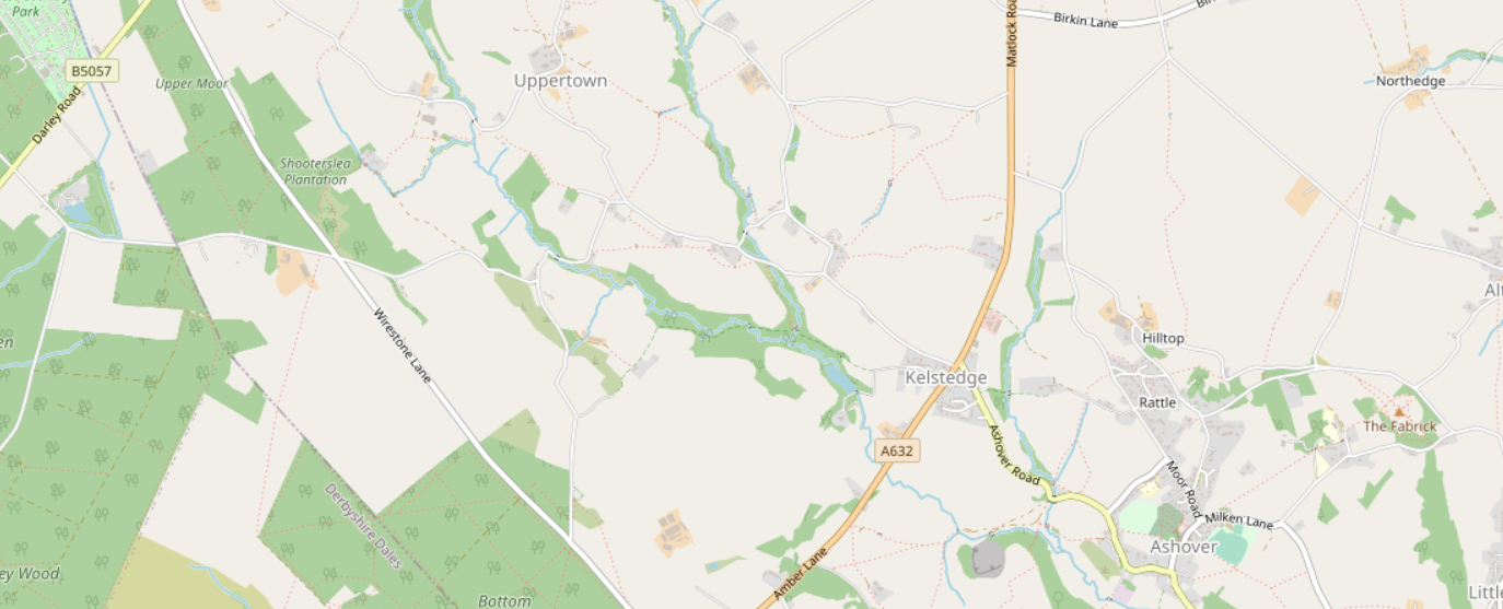
For example, here’s the area that I linked to then in OSM Carto now: Kelstedge on OSM Carto

See full entry

Location: Opportunity, Holt County, Nebraska, United States

HUB HOT AMERICA LATINA e UMBRAOSM Mapeando juntas em diversos projetos para o Brasil.

HUB HOT AMERICA LATINA and UMBRAOSM Mapping together in several projects for Brazil.

https://www.hotosm.org/updates/hub-de-mapeamento-aberto-en-latam-atualizacao-mayo-2022/

See full entry

Location: Cohab, Recife, Região Geográfica Imediata do Recife, Região Metropolitana do Recife, Região Geográfica Intermediária do Recife, Pernambuco, Região Nordeste, Brasil
  • 이 글의 원본은 GPS로 지리 데이터를 얻는 쉬운 방법 한 가지입니다.
    나중에 덧보태거나 하는 내용이 있을 수 있으므로 되도록이면 윗 글을 봐 주시고, 혹시라도 윗 글의 고리가 깨졌을 때를 대비해 여기에 본뜨기본[복사본]을 두도록 하겠습니다.
    ——

여기서는 우리가 흔히 가지고 있는 스마트 기기에 있는 GPS로 지리정보를 얻는 방법 가운데 꽤 쉬운 방법 한 가지를 적고자 합니다. (이 말이 어렵다고요? 쉽게 말하자면, 길(경로)이나 위치를 스마트폰으로 쉽게 기록하고 추출하는 방법을 적어 볼 겁니다. 특히 OSM에 올릴 것을 가정하고 되도록 쉬운 방법으로 적도록 하겠습니다.)

“산길샘” 소개

먼저 “산길샘” 소개를 좀 하겠습니다. 여기서는 굳이 왜 “산길샘”이라는 맞쓸모[응용프로그램;어플리케이션]로 하는 방법을 골랐나 하면, 산행을 하시는 분이 산행에서 필요한 여러가지 기능과 안전 같은 것을 생각해서 만든 모[어플리케이션]라서 덩치도 작고 전력도 적게 먹으며 작은 덩치에도 불구하고 무엇보다도 산행에서 필요한 왠만한 기능들이 들어 있으며 구글지도, 네이버지도는 물론이고 국토부 VWorld 지도를 모두 볼 수가 있고 조금 손을 보면 다음지도나 다른 지도들을 볼 수도 있습니다. 그리고 복잡한 기능이 없는 만큼 조금만 익히면 쓰기가 쉬우며, 무엇보다도 GPS 경로를 기록하고 추출하는 것이 아주 간단하고 쉽습니다. 다만 가장 안타까운 것은, 개인이 만들고 유지하는 것이라 사용자가 적은 iOS에서는 쓸 수가 없다는 것입니다.

다른 화려한 기능을 가진 모(어플리케이션)과 다른 점이 많아 좀 낯설 수는 있으나 기본 사용 방법은 그리 어렵지 않습니다. 조금만 갖고 놀다 보면 쉽게 익힐 수 있을 것이며 어려운 것이 있다면 ‘산길샘 동호회‘에서 도움을 받을 수 있으며 특히 ‘사용 설명서‘를 꼭 잘 읽어 보시기 바랍니다. 특히 기록 간격을 결정지을 ‘GPS 모드 설정’을 알맞게 설정하시고, 미리 연습을 통해서 기록을 하는 가운데 “산길샘”이 중지되지 않도록 여러가지 설정을 잘 살펴 놔야 합니다.(특히 ‘전원 절약 모드’ 같은 것은 맞쓸모들이 뒤[백그라운드]에서 작업하는 걸 닫아 버릴 수도 있으므로 실 테스트를 통해 꼭 미리 확인하시기 바랍니다.)

“산길샘”으로 경로 기록하고 내려 받기

모든 맞쓸모들이 거의 그렇지만 잘 활용하려면 나에게 맞는 설정 조정과 약간의 연습과 현장 테스트까지 하시면 좋습니다.(나들이 갔는데 기능을 잘 몰라 제대로 활용을 못 하거나, 애써 기록한다고 했는데 나중에 보니 하나도 안 되어 있는 낭패를 보기 싫다면 말입니다. ^^)

기록을 시작할 곳에서 “산길샘”을 켜고 기록을 시작합니다. 경로 기록이 끝나면 ‘트랙 리스트’에 기록된 길자욱[경로]이 보이고 이것을 ‘공유’ 기능을 통해서 바로 다른 곳으로 보낼 수도 있으며 ‘내보내기’를 하면 파일로 저장할 수 있습니다.(어느 폴더에 저장하도록 되어 있는지 잘 봐 두십시오.) 이렇게 뽑아낸 파일을 다른 곳에서 불러 들여 편집을 하거나 참고를 할 수도 있습니다. 이게 끝입니다. (차암 쉽죠잉~ ^^)

이 파일을 이용 혹은 활용하는 방법에 대해서는 다른 글에서 다루겠습니다.(더 필요하시면 물어봐 주시거나 찾아 봐 주시기 바랍니다.)

Niedawno OSMP nawiązało kontakty ze społecznością osób niewidomych w Polsce. Dzięki temu zapoznaliśmy się z ich potrzebami oraz dowiedzieliśmy się jak bardzo dane OpenStreetMap pomagają im w codziennym życiu. Okazało się że większość aplikacji, które wykorzystują do poruszania, opiera się na informacjach pozyskanych z OpenStreetMap.

Obecnie przygotowuję założenia programu skierowanego do edytorów OpenStreetMap, by zwracali przy mapowaniu szczególną uwagę na oznaczanie obiektów, które ułatwią poruszanie osobom niewidomym.

Do grupy takich obiektów należą między innymi: drzwi do budynków, oznaczenia przejść dla pieszych w tym przejścia z drogami rowerowymi, schody oraz bariery komunikacyjne.

Zamierzamy także nawiązać również współpracę w zakresie oznaczania w OSM przystanków komunikacji miejskiej, tak by można było te informacje wykorzystywać do nawigacji głosowej. Taki program pilotażowy indeksacji przystanków w Katowicach już przygotował i dzięki swojemu uporowi i ogromnemu nakładowi pracy wdrożył jeden z polskich edytorów (Chwalmy Luktara!). Zapraszam do poczytania w tym wątku na Forum. Obecnie przygotowuje podobny projekt na terenie Krakowa, OSMP zamierza go w tym wspomóc i jednocześnie zorganizować takie projekty dla innych polskich miast.

Informacje o postępie prac w ramach projektów będą publikowane tutaj, na stronie OSMP oraz na naszych grupach na Facebooku. Zapraszam do śledzenia oraz aktywnego udziału w projekcie.

Posted by Cristoffs on 31 May 2022 in English.

Recently OSMP has established contacts with the community of blind people in Poland. Thanks to that we got to know their needs and learned how much OpenStreetMap data helps them in everyday life. It turned out that most of the applications they use to move around are based on information obtained from OpenStreetMap.

Currently I am preparing assumptions of the program directed to editors of OpenStreetMap, so that they would pay special attention to marking objects during mapping, which will facilitate movement of blind people.

The group of such objects includes among others: doors to buildings, markings of pedestrian crossings including crossings with bicycle paths, stairs and communication barriers.

We also intend to collaborate on marking public transportation stops at OSM so that this information can be used for voice navigation. Such a pilot program of indexing bus stops in Katowice has already been prepared by one of Polish editors (Let’s praise Luktar!) and, thanks to his persistence and huge amount of work, has been implemented. I invite you to read it in this thread on the Forum. He is currently preparing a similar project in Krakow, OSMP intends to assist him in it and at the same time organize such projects for other Polish cities.

Information about the progress of the projects will be published here, on the OSMP website and on our Facebook groups. I invite you to follow and actively participate in the project.

Dear board members, it has come to my attention that many community members feel that openstreetmap-carto is stagnating. Some feel that there is no vision, no project goals, and that maintainers don’t care about the community instead trying to follow their own agendas. I am concerned that it may negatively impact long term health of the project.

As the first/default style that is visible on https://openstreetmap.org openstreetmap-carto can be considered one of core OpenStreetMap projects. While it may not be as important as the backend API and database it is the first thing that anyone going to OSM’s site sees. It is therefore of great interest to the entire project that the style is maintained and community is involved and proud of the results.

OpenStreetMap grew as a project and right now it is one of the largest open datasets of geospatial data. Many researchers as well as companies from startups to FAANG rely on OSM. There are more mappers than ever. For a very long time it was all serviced by volunteers but with that growth there is a need for more time and professionalism from maintainers.

As the project grows so does the responsibility. We know that OSM Foundation is trying to help by e.g. hiring new SRE, hiring iD developer, organizing committees and working groups, creating grant programmes. I believe that openstreetmap-carto should at least get involved in Software dispute resolution panel and if possible start leveraging paid resources to help with maintenance and design.

See full entry

위성이미지의 정확도와 보정에 대해 궁금증을 가지는 분들이 가끔 계신 것 같아 제가 아는 대로 정리해 두고자 합니다. 덧붙여 GPS 보정 방법에 대해서도 함께 덧붙여 두겠습니다.

위성이미지의 정확도와 보정에 대하여

먼저 OSM 편집 화면에서는 빙 위성지도, ESRI 위성지도, Mapbox 위성지도를 볼 수 있지만 같은 곳을 비교해 보면 서로 꽤 어긋나는 경우도 있고 심지어 반듯한 구조물이 삐뚤빼뚤 이그러진 걸 볼 수도 있습니다.
또, 이 지도에서 좌표를 찍고 저 위성지도와 견줘 보면 꽤 어긋난 경우도 있고, 심지어 한 지도 안에서도 어떤 곳은 비교하는 지도 좌표와 얼추 비슷하지만 다른 곳은 꽤 크게 어긋나는 경우도 있습니다.
그 밖에도 바탕에 까는 위성이미지가 무엇이냐에 따라서 어떤 경우에는 꽤 많이 어긋나는 경우도 있고, 심지어 한 위성 우미지임에도 좌표 어긋남이 차이가 나는 경우도 있습니다.
여기서 잠깐, 국내 모든 지도 서비스와 구글지도 같은 경우에는 국내에 서버를 두고 서비스 되고 있기 때문에 이 지리 데이터가 한국 밖으로 나가는 것은 불법입니다. 이에 관해서는 국내 지도를 바탕으로 OSM을 그리면 법에 걸리는가?를 봐 주십시오.

위성사진을 찍을 때 구역을 나눠서 찍게 되는데 쉽게 말해 영역을 나눠서 찍고는 그것을 나중에 이어붙인다고 합니다. 그리고 그 이어지는 부분은 종이 오려붙이듯이, 칼로 자른듯이 이어붙이는 것이 아니라 영역이 이어지도록 보정을 한다고 하는데 건물이 찌그러져 보이거나 곧은 길이 갑자기 좀 휘어지는 것은 그런 데서 비롯되는 것 같습니다.
게다가 정확히 그 곳 위에서 찍는 것이 아니라 약간 엇비껴서 찍는 것 같은데, 좀 높은 빌딩의 경우에는 그 옆면이 꽤 많이 보이는 것을 알 수 있습니다.
그러다 보니 고도가 높은 구조물이나 특히 주변보다 갑자기 훨씬 높아진 지형에 있는 지물은 제자리에서 벗어나서 보이는 경우도 있으며, 앞 보기와 더해져서 높은 빌딩이 우글쭈글 비뚤어진 경우도 가끔 있고 뾰족하게 솟아오른 지형이 찌그러져 보이는 경우도 있습니다.
(나중에 보기 이미지를 좀 덧붙여 보겠습니다.)

따라서, 너무 한 가지 위성지도에만 기대지 말고 좀더 정확한 위성지도를 찾거나 GPS 좌표 자료를 참고해서 그릴 필요가 있을 것 같습니다.

GPS의 보정에 대하여

요즘은 GPS 전문기기나 스마트폰이라도 몇몇 최신 폰의 경우에는 듀얼밴드 GPS를 지원하기 때문에 훨씬 정확한 좌표를 얻을 수 있습니다.
그렇지 않고 싱글밴드 GPS를 쓰는 기기나, 어쨋거나 GPS 정확도를 재 보고 싶은 경우에 지리 측량의 기준이 되는 ‘삼각점‘을 이용해서 보정을 해 볼 수 있습니다.(하지만 어차피 기기의 특성을 따르기 때문에 전문 장비가 아닌 경우에는 얼마간의 오차는 어쩔 수 없다는 것은 받아들이시기 바랍니다.)
주요 삼각점에는 안내판과 함께 그 곳의 위도, 경도 좌표를 적어둔 곳도 있고 혹시 없다면 국토정보맵 ‘기준점’ 항목에서 지역을 찾아서 보시면 삼각점이 있는 위치와 함께 그 곳에 대한 위도, 경도, 표고(해발고도) 등의 정보가 적혀 있습니다.(국토정보맵에서 가까운 곳에 있는 삼각점의 위치를 찾아 볼 수도 있습니다.)
그 삼각점의 돌의 위에 GPS 기기를 두시고 좌표 측정을 하시면 그 곳의 실제 좌표와 기기의 좌표의 오차를 알 수 있습니다.(특히 해발고도를 보정하는 데에는 꽤 쓸모가 있습니다.)
이것은 기기의 오차를 아는 데에는 도움이 되지만 실제 정밀측량 장비가 아니라면 기기에 미치는 여러가지 영향 때문에 실제로는 큰 도움은 되지 못할 것입니다.
깊은 골짜기나 높은 건물이 많은 곳에서는 왜곡이 심할 수 밖에 없다고 합니다. 결국에는 기기가 얼마나 정확하게 측정을 해 주는지가 중요할 뿐 보정을 한다고 해서 기기의 정확도를 높여 주지는 못합니다.(다만 해발고도 같은 경우에는 보정값이 꽤 도움이 됩니다.)

Posted by milo22948392 on 30 May 2022 in English.

Hey, i want to calculate the area of trees in a city (Zürich, Switzerland), but when i do this (Python or QGIS) the result is 0. When you take a look on the map, there are many trees found with “natural=tree”. How does the calculation of Nodes work? And what is the area of the tree that is calculated - only the trunk? And maybe it’s just a really small number that the output is 0? Thanks for your help.

Today, I was able to map about 133 builds as part of my contribution to the ongoing project organized by the OSM local team UniqueMappers Nigeria. All thanks to my coordinator @vicksun, for his encouragement and support as we voluntarily contributed to the social good of our local communities here in Nigeria and the world at large.

Location: Alakahia, Obio/Akpor, Rivers State, 500004, Nigeria

und das ist auch gut so.

Wenn ich das heute richtig mitbekommen habe, merkt Osmand mittlerweile, dass man nicht gewillt ist in einen laut OSM befahrbaren Weg einzufahren, sondern nimmt direkt den nächstzweitbesten aber längeren, wenn man “absichtlich” vorbeifährt.

Wenn das tatsächlich so ist (und kein Zufall war), dann begrüsse ich das ausserordentlich.

(In meinem Routing ging es um eine etwas komplizierte Baustelle, die zu umfahren nicht trivial war)