Posted by AndreyGeograf on 3 January 2022 in Russian (Русский).
Last updated on 11 April 2022.
Раньше тут была первая запись в дневнике.
Раньше тут была первая запись в дневнике.
Progetto di viaggio in moto estate 2023
Circa tre mesi di durata, circa 20.000 Km
Paesi da attraversare in ordine d’ingresso: Italia - Slovenia - Croazia - Serbia - Bulgaria - Turchia - Iran - Turkmenistan - Uzbekistan - Tagikistan - Kirghistan - Kazakistan - Russia - Ucraina - Ungheria - Slovenia - Italia
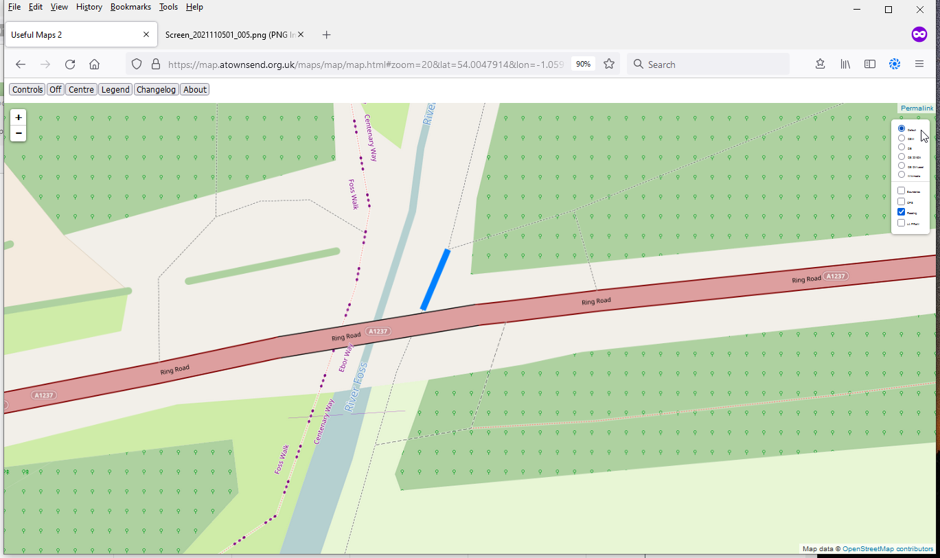
In England, the Environment Agency has an extensive network of river level monitors that are used to provide flood warnings such as (at the time of writing) this one.
However, these alerts tend to be only issued when land or property is likely to flood, and there are many paths that flood much earlier. An example is here, where if the downstream station reads just over 1m, you’ll get your feet wet. The Environment Agency doesn’t issue a warning at that level because it’s well within the normal range, and the river’s still well within the levees that have been provided for it for the last 50 years.
I wrote a module for #OpenStreetMap web maps using the #LeafletJS API: With https://github.com/plepe/leaflet-overpass-lens you can query map items around the mouse pointer.

See the short screencast: https://www.youtube.com/watch?v=JTzVa9E0Yo8
Demo application: https://xover.mud.at/~skunk/leaflet-overpass-lens/
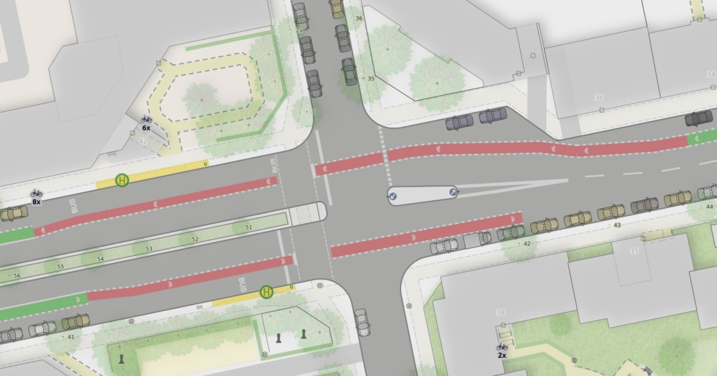
I wrote a blog post to show and explain the many improvements to the “Straßenraumkarte” that Alex @Supaplex030 worked on for the last few month: https://supaplexosm.github.io/strassenraumkarte-neukoelln/posts/2021-12-31-micromap-update
With this public space map for Neukölln, Berlin Alex continues to push the boundaries of the level of detail that can be rendered based on OSM data.
The blogpost shows many interesting details like cycleways, turn lanes and junctions and explains how the data is processed to allow this rendering.
One conclusion is, that a collaboration on pre-processed OSM data for streets would be a huge benefit.
Please use this place here to comment on the blog post.
Раньше тут была вторая запись в дневнике. На данный момент всё что было написано уже не актуально.
In the ideal world all tasks would be validated to a high standard but unfortunately this doesn’t happen.
I’ve seen HOT projects with nearly two thousand duplicate buildings, I’ve seen some with two or three hundred untagged buildings. Some are well mapped and have no errors.
So this a method to clean up after the event. Basically you load up the area into JOSM and run the duplicate building script and JOSM validator. It won’t catch everything but it’s a lot faster than validating each tile. The todo and Mapathoner plugin are required.
select the errors then add them to the todo list and work your way through them.
The key is aoiBBOX”: [6.473334,5.172193,6.870011,5.730142] which is found here: https://tasking-manager-tm4-production-api.hotosm.org/api/v2/projects/10756 for project 10756. You’ll need to search the text to extract it.
You can either feed these coordinates into JOSM and download the area directly or feed them into an overpass query or extract them from an off line version of the map. https://osm-internal.download.geofabrik.de/ is one source. If you work with the off line version you can locate the errors then just directly redownload the tiny bit to ensure the map is up to date before you correct the error.
An example of a .bat file to extract the area from an offline file is osmconvert64 e:\downloads\nigeria-latest-internal.osm.pbf -b=6.473334,5.172193,6.870011,5.730142 -o=f:\maps\nigeria10756.osm Just load nigeria10756.osm as a local file into JOSM.
Note this is not validation since no feedback is given in task manager to the mapper. It is recommended it is used when there are no active mapping taking place so a month or so after the mapping has petered out is a good time.
It’s two years since the Divide and map. Now. has been published. I would like to summarize the second year of the development.
What is it about? Divide and map. Now. – the damn project – helps mappers by dividing some big area into smaller squares that a human can map.
Why should I care? Divide and map. Now. is proven to handle a mapathon with 200 mappers. There are four clients available for mappers and multiple mapping workflows. There is deployment guide for admins. You may create new or modify existing areas, use RSS to track areas’ changes, and check abandoned or overlapping areas by Python3 scripts.
In 2021 I’ve refactored the server and load tested it. There is the API documentation that is stable for more than half a year now. The web clients were also refactored: the light is text-only web client for beginners, the panel is for advanced mappers and looks like it’s integrated into the iD editor, and the mappy web client has square-based graphical interface. The web clients include improved statistics that can show OpenStreetMap contributors that haven’t used Divide and map. Now. when mapping in the same area. The damn JOSM plugin was updated to the new API and loads temporary data stored in the server when available.
I’ve got inspired by the Tanga Building Footprints Import, mapping highways’ radars and mirrors, and documented the mapping workflows available in the different clients.
I’ve implemented Python3 client with the scripts to find abandoned or intersecting areas based on the potential HOT tasking manager improvements and looked at the competing HOT Tasking Manager and SimpleTaskManager issues from the damn project point of view.
I’ve created the finished areas read-only service and announced the policy for finished areas.
http://osm.sbin.ru/esr/ http://osm.sbin.ru/ov3/info http://osm.sbin.ru/stat/ https://github.com/shurshur/ptproc/ osm.wiki/RU:Как_обозначить http://tools.geofabrik.de/mc/#10/51.2966/37.7131&num=2&mt0=mapnik&mt1=google-hybrid http://osmstats.neis-one.org/?item=countries&country=Russia http://hdyc.neis-one.org/?Sowa1980 http://resultmaps.neis-one.org/oooc?zoom=10&lat=52.73001&lon=41.54283&layers=B0TFFFFFT
Vi sier takk for det gamle året og håper 2022 bringer gleder og fantastiske opplevelser 🎉🎊
A localização no Instagram está incorreta, a cidade não é Foz do Iguaçu é Maringá atualmente
My annual diary post from last year is here, for which the summary of the targets set back then is now:
I definitely stayed in the top 10 #osmIRL contributors for the whole year. There was more to that of course, as in 2021 I contributed more mapping days than ever before, missing only 16 out of 365.
In August 2021 I reached 200,000 contributions in 60 days, this is the most intense contribution to OpenStreetMap I have ever achieved, and i wrote about that here
I undertook “as an extra kick” to build a tool to visual osm for the whole island. This is here, but needs a bit more work, especially a process to keep it up to date. Thanks to Rusty and Amanda for helping plan and execute this.
I set myself a “not hard target” of raising my mapillary contributions to 1.5 million. While I did add around another 100k images mapillary changed a load of things about their upload process and web app in the year, making it nigh-on impossible for me to report exact numbers, and also leaving me with an upload queue that I carry into 2022.
I met my StreetComplete Target of raising myself to be #3 in Ireland. For most of the year I was #2 with huge early progress in the first #8 months. I am now #3 so this target is achieved.
I didn’t clear up all the gaps I mentioned, because a demon keeps asking me to help with bits of rural Ireland. However, I addressed a huge number of gaps in buildings that I didn’t already know about. From now on this task has the gaps and if you feel like helping me jump in there :)
My rating: Looking at these, using mild re-interpretations of the targets I am giving myself 4.5 out of 6. I didn’t fail completely in any area.
Created location on osm, but it’s showing up in Instagram
Deixo de anotar os cambios que fago por concellos porque me estou a estender demasiado e resulta tedioso ir tomando notas.
L’itinéraire est indiqué dans le dépliant touristique de la balade disponible à https://ville-argentiere.fr/wp-content/uploads/delightful-downloads/2017/02/sentier-thematique-L-Argentiere-la-Bessee.pdf.
-
I’m getting close to finishing all buildings south of Corbin Street, which would mark about 65% of the town’s buildings mapped, hopefully the suburbs in the north will be easier and I should hopefully finish all those buildings if I continue at my pace of work by February