GOwin's Comments
| Post | When | Comment |
|---|---|---|
| Just starting! | We’re glad to have you, and we’re excited to see more of your OSM edits soon! If you’re interested in doing small edits while you’re on the move, check out the easy mobile options (e.g. MapComplete, StreetComplete) or if you prefer something more advanced: Vespucci, or EveryDoor. On Apple, I think the consensus is GoMaps! (iOS, macOS) is an awesome editor. |
|
| Disaster Respond | Hi there! Can you elaborate about the source of the map you linked to, and their licensing? |
|
| Point Of Inters (POI) | That’s cool. You may find it interesting to know that there are many OSM-based apps that can utilize these photos, in case you’re interested in sharing any. I think the easiest to use for capturing any would be the MapComplete themes, which will let you add any photo for many POIs or features. |
|
| Point Of Inters (POI) | Thank you for making OSM awesome! 🫡 Do you also bother to add the photos on street-level imagery services (Panoramax, Mapillary, Kartaview)? |
|
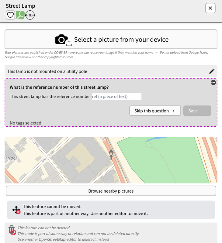
| Physically visiting the location is fun | Kudos! Mapping on the ground is always a different kind of mapping experience. Apart from POIs, and road surfaces, there are countless other things you can do, depending on your interest and time you want to spend for it. Here are some ideas: * checking for new and defunct POIs, * opening hours, * street addresses, * improving (wheelchair) accessibility* kerbs and crossings, * traffic signals * adding building names, entrances Have you tried collecting imagery? If you’re not planning to collect street-level imagery using Panoramax, or Mapillary, you can try to collect photos of the features themselves (e.g. especially interesting streetlamps, maybe?). Check out the Streelight theme is available from MapComplete, and it has the ability to take photos.
|
|
| 10 Years of OpenStreetMapping | What a milestone! Kudos! Thank you for your contributions, and I hope that you will remain motivated to share your local knowledge, and improve OSM. |
|
| 가산동 라이브 방송 스튜디오 세븐시스템 | Hi there, and welcome to OpenStreetMap (OSM)! There are no official (mobile) app for OpenStreetMap, but there are numerous third-party developers who make their own apps, and utilize OSM data in various ways. Here’s a wiki page of some known apps for iOS: osm.wiki/Comparison_of_iOS_applications You may also find web certain web apps interesting: osm.wiki/Category:Web_software. A web app I really enjoy using is OsmAPP: osm.wiki/OsmAPP |
|
| Obstbäume | Thanks for sharing the repo. Have you had any chance to try the trees theme from MapComplete: https://mapcomplete.org/trees ? |
|
| Obstbäume | That sounds interesting! Where can we find the “Treewarden” app, and is there an English interface? |
|
| My profile in english langage (Mon profil en langue anglaise) | I’m glad that you decided to write a diary entry of your OSM experience. You managed to summarize it quite nicely, and I hope that you’ll continue to have fun while contributing to the project. |