AngocA's Comments
| Post | When | Comment |
|---|---|---|
| Comparación de características de Google con el econsistema de OSM | Página de reviews en el wiki osm.wiki/Reviews derivado de https://community.openstreetmap.org/t/a-crowd-sourced-review-service-for-openstreetmap/136235 |
|
| State of the Map América Latina en Medellin 2025 | It’s important to clarify that Céline Jacquin, known as Mapeadora, has been an active contributor to OpenStreetMap long before artificial intelligence became a common tool in our communities. Her work—both in the field and in regional coordination—is widely recognized and valued. Accusing a real and committed person of being an “AI account” is not only unfair, it also erodes the trust and respect that should guide our community interactions. If there are doubts or disagreements, the least we can do is address them with openness, arguments, and respect. Furthermore, there are no OpenStreetMap guidelines prohibiting the use of AI tools, especially for translation or improving writing in other languages. Expecting OSM to remain frozen in 2006 ignores its natural evolution. Today, initiatives like MapWithAI and other integrations show that the community is moving forward—not backward. I invite those who criticize the use of AI to explore it with discernment. Knowing how to use it is part of our collective learning. Translating with AI doesn’t make anyone “satanic” or spam. On the contrary, it’s a legitimate way to broaden the reach of our messages. And if there are accusations like “inviting to games” or “spamming,” the least we can ask is: where is the exact link that shows this? Because so far, what we see is participation—not manipulation. Let’s not lose sight of what binds us: the shared map, the shared effort, the shared future. Kota volonpartr—we all share the map, and we all share the responsibility to protect each other’s dignity. Note: This message was drafted with the help of Microsoft Copilot, an AI companion that supports clarity, multilingual communication, and respectful dialogue. The goal is to foster constructive conversation and defend community members from unfounded accusations. Es importante aclarar que Céline Jacquin, conocida como Mapeadora, ha sido una contribuyente activa en OpenStreetMap desde mucho antes de que la inteligencia artificial se volviera una herramienta común en nuestras comunidades. Su trabajo —tanto en campo como en la articulación regional— es ampliamente reconocido y valorado. Acusar a una persona real y comprometida con el proyecto de ser una “cuenta de IA” no solo es injusto, sino que también erosiona la confianza y el respeto que deberían guiar nuestras interacciones comunitarias. Si hay dudas o desacuerdos, lo mínimo que podemos hacer es abordarlos con apertura, argumentos y respeto. Además, no existe ningún lineamiento en OpenStreetMap que prohíba el uso de herramientas de IA, especialmente para traducción o para mejorar la redacción en otros idiomas. Pretender que OSM se quede congelado en 2006 es ignorar su evolución natural. Hoy en día, iniciativas como MapWithAI y otras integraciones demuestran que la comunidad está avanzando, no retrocediendo. Invito a quienes critican el uso de IA a que la exploren con criterio. Saber usarla es parte del aprendizaje colectivo. Traducir con IA no convierte a nadie en “satánico” ni en spam. Al contrario, es una forma legítima de ampliar el alcance de nuestros mensajes. Y si hay acusaciones como “invitar a juegos” o “hacer spam”, lo mínimo que podemos pedir es: ¿dónde está el enlace exacto que lo demuestra? Porque hasta ahora, lo que vemos es participación, no manipulación. No perdamos de vista lo que nos une: el mapa compartido, el esfuerzo compartido, el futuro compartido. Kota volonpartr — todos compartimos el mapa, y todos compartimos la responsabilidad de proteger la dignidad de quienes lo construyen. Nota: Este mensaje fue redactado con el apoyo de Microsoft Copilot, un compañero de inteligencia artificial que promueve la claridad, la comunicación multilingüe y el diálogo respetuoso. El objetivo es fomentar una conversación constructiva y defender a los miembros de la comunidad frente a acusaciones infundadas.
Photo of the two real human mappers that assisted and helped organize these state of the map latam events. |
|
| OpenStreetMap NextGen Development Diary #24 — Public Launch | Don’t worry, I’ve already started a thread in the community: https://community.openstreetmap.org/t/openstreetmap-logo-seems-obsolete/125420 The issue is that the current OSM logo poses a copyright problem for osm-ng. Therefore, launching a call for a new logo could help resolve this issue. |
|
| OpenStreetMap NextGen Development Diary #24 — Public Launch | This could be the opportunity to change that old and now ugly logo of openstreetmap. Something that represent things in 2025, not something that has not been changed since 2000’s. Osm logo depicts things that few people use in 2025: a printed map and a magnifying glass. People in 2025 use the cell phone for both things. We need a logo, simpler, no blurs, less colors, no shadows, and something that includes the name of the project. |
|
| Comparación de características de Google con el econsistema de OSM | Aquí un listado de opciones en Google Maps - https://www.howtogeek.com/google-maps-does-more-than-directions-heres-how-the-app-helps-me-travel/?utm_medium=newsletter&utm_campaign=HTG-202505270600&utm_source=HTG-NL&user=YW5nb2NhQHlhaG9vLmNvbQ&lctg=5ba62674a08f04dbe6a4e2da912a397b5a67486ae41068754b4761db9617d255 |
|
| Mapeando el Humedal El Totoral con ChatMap: Ciencia Ciudadana para la Conservación | Felicidades Sebas, que buen ejercicio en terreno, y que el artículo está explicando cómo usar la herramienta. |
|
| 2024 - Learning and Contributing to OpenStreetMap :) | It is a pleasure to have you on board. |
|
| # My Experience Mapping Trees With High School Students at Instituto Técnico Industrial Francisco José de Caldas | Lud, estamos ansiosos de ver este articulo |
|
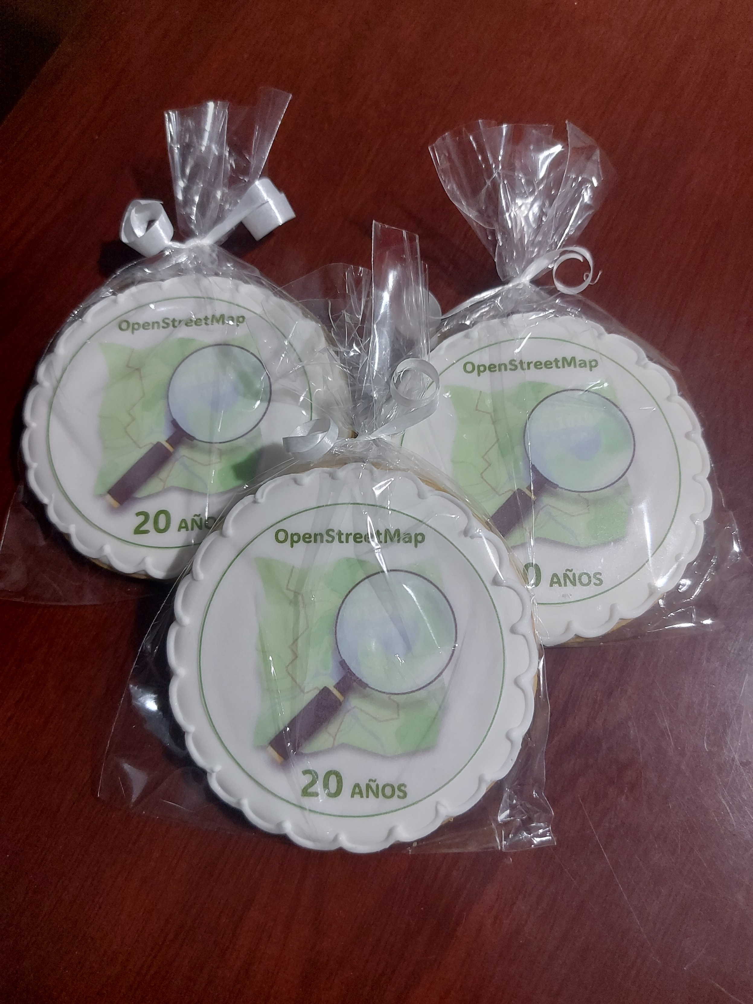
| Happy 20th birthday OpenStreetMap! | These were the cookies we prepared for the OSM Birthday in Bogota, Colombia
|
|
| Introducing Communities: A Proposed Feature for OpenStreetMap | There is also another “community” thing in OSM: osm.org/communities Names could be refactored as part of the deployment of this great feature. |
|
| Call for ideas from Microsoft | Hi Branko Most mappers use the Result Maps tool from Pascal Neis (HDYC, notes, etc.); however, in the last few days, it has been down, producing issues for the mappers (from my side to identify the new notes in my country). It would be interesting to have a similar tool for OSM profiles and provide near real-time stats about different elements of OSM. A tool developed as OpenSource and hosted in a shared platform in a way that many admins and developers could help. As part of the OSM Latam community, we have started a project focused on notes to provide analytics: https://github.com/OSMLatam/OSM-Notes-profile |
|
| Es momento de un descanso | Hola Omar, Me encuentro con sorpresa con esta entrada de diario, de la cual me había comentado risturiz. Me deja triste de que una persona tan activa en diferentes frentes de OSM, tan polifacética en la comunidad LatAm, se desmotive. Puede que lo que estés viviendo nos haya pasado a todos en nuestra historia de OSM, a mi también me pasó, pero aquí estoy de nuevo. Lo mejor es tomarlo como una pausa, un descanso, para interiorizar, analizar el valor que tienes en la comunidad, de tu experiencia, y así poder volver más fuerte, atacando otros problemas. Toma tu tiempo, descansa, y espero que vuelvas, y que sea pronto, ojalá como miembro de algún working group, y así tener más representación de Latam. Andrés Gómez |
|
| iD on a phone | osm.org/id could also work |
|
| Aplicaciones para mejorar el mapeo en terreno | I wrote another entry in my diary for the websites that are easy to use from mobile devices to improve OSM data: @AngocA/diary/401426 |
|
| Photomapping + Notes | It seems the only persistent option will be fediphoto: https://www.howtogeek.com/887420/imgur-is-about-to-break-the-world-wide-web/ |
|
| Aplicaciones para mejorar el mapeo en terreno | Thank you Mateusz. I corrected it. |
|
| Aplicaciones para mejorar el mapeo en terreno | I didn’t include editors (Like Vespucci or GoMap) or POI editors. I focused this article on listing simple applications to improve OSM quality. Especially applications for newbies or people that do not want to learn of the details of nodes, ways, relations, and tags. |
|
| Aplicaciones para mejorar el mapeo en terreno | Gracias @TrickyFoxy, corrected! |
|
| Portales para fotos a nivel de calle | Thank you @gendy54 and @!¡! for your comments. Once the platform is open for everyone, I will include it here. Very interesting project. |
|
| Photomapping + Notes | Super por esta entrada y toda la iniciativa que tuviste para que se incorporar la funcionalidad de Notas en Fediphoto. |