Learning maps and shit
Users' Diaries
Recent diary entries
Posted by LegzDev on 4 February 2023 in Spanish (Español).
Last updated on 5 February 2023.
Educacion primaria y secundaria básica:
Circulo infantil, Jardin de niños (0 a 5 años):
- name=*
- amenity=kindergarten
- isced:level=0
- operator=Ministerio de Educación (MINED)
- operator:type=public
- operator:wikipedia=es:Ministerio_de_Educación_(Cuba)
Primaria (Preescolar a 6to grado):
- name=*
- amenity=school
- isced:level=1
- operator=Ministerio de Educación (MINED)
- operator:type=public
- operator:wikipedia=es:Ministerio_de_Educación_(Cuba)
Secundaria Básica (7mo a 9no grado):
- name=*
- amenity=school
- isced:level=2
- operator=Ministerio de Educación (MINED)
- operator:type=public
- operator:wikipedia=es:Ministerio_de_Educación_(Cuba)
After having been involved with the organization of the last few global State of the Map (SotM) conferences, I recently got asked if I could provide some information about the technical side of how hybrid events work to one of the organizers of a future local SotM conference. While writing down some of these details, I figured that this might be of general interest, hence this diary post which also contains various aspects about hybrid events based on our hybrid SotM 2022.
The post will try to cover the last three global SotMs and thus not only technical aspects of a hybrid conference: SotM 2020 was originally planned to take place in Cape Town, South Africa, but had to be moved to a purely online format for well-known reasons. Still for the same reasons, SotM 2021 was planned as an online conference from the beginning. And finally, SotM 2022 in Firenze was our first hybrid conference.
Please note that all views, opinions and experiences expressed in this post are mine and not necessarily shared by the SotM Organizing Committee or other SotM Organizing Committee members. The post is also mostly based on my personal memory only, so I certainly missed or wasn’t aware of many aspects and details, especially in all the areas where I wasn’t involved at all. It also concentrates on the technical side of things and how we did them, not so much on e.g. more social aspects or why we did something in the specific way we did it.
Organization and planning
Recently found that tag replacing junction roundabout. People without license shouldn’t be driving, really.
We shouldn’t code driving rules into the map, neither provide directions to blind drivers.

Following the Global State of the Map in Italy, the Inaugural State of the Map Nigeria came to be this time with Mr Victor Sunday as the Chair.
The conference was organized by Unique Mappers Network Team and saw attendees from various states of Nigeria, from Hong Kong, Tanzania, Brazil, Zimbabwe just to mention a few. I was in for Quality Assurance and Volunteer Lead alongside Kaue de Moraes Vestena. It was great learning especially from the Nigerian Community how they are using FOSS, contributing to OSM and all. It was an honor launching this hybrid conference and paving way for many to come.
My gratitude goes to Mr Victor Sunday for also trusting my capability in this, the Unique Mappers Team at large and to the Humanitarian OpenStreetMap Team (HOT unSummit) for sponsoring me. So Mr Victor asked me again to give closing remarks like I did in Italy, if it’s now a calling I don’t even know. I am thrilled to be part of the Unique Mappers Network as an Intern – this also adds to the space. I am more than grateful.
Sharing with you again some of the things that Ruben and I have been excited about, and some of what’s coming up, in the HOT community and across the humanitarian open mapping movement.
Things that have excited us this week…
Congrats to the HOT training working group who had an impressive 52 participants at the advanced JOSM training last weekend!
Chisom Okwuchi shared a lovely OSM diary of her experiences as a Community Working Group mentorship lead…
… and, the organising group for the mentorship program is now planning for the next phase and will be looking for mentors and mentees in the next few months!
Shout out to Kraan46, one of HOT’s global validators, who has now validated on 360 days out of the last year — an impressive feat and huge contribution!
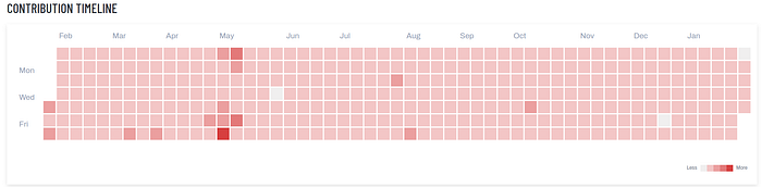
Contribution timeline for Kraan46!
Kudos to OSM Uganda, who have established a new MOU with the Terego district on integrating OSM learning into schools.
Posted by Jemimah Mukisa on 2 February 2023 in English.
Last updated on 3 February 2023.
Upon getting the news of being awarded a scholarship to attend and participate in the State of the Map Tanzania 2023, I was so excited to travel since it was my first time to visit Tanzania. I thank God that I made it to the conference which commenced on the 20th-23rd of January.
My highlights from the first day were from the Resilience Academy I was amazed by the tremendous work they do to impact the society through collaboration and partnerships to train young people with skills and knowledge to achieve the country’s sustainable development goals. My evening was sparked when I toured around the neighborhood I noticed that the transport system was properly planned with easy access and convenience.
The lightning talks were very insightful as people shared their experiences in OpenStreetMap and how they have been able to grow their communities. I realized that Tanzania has a wide network of mappers whereby they have established and promoted youth mapping chapters within their universities as compared to my country therefore I learned that more effort to grow our community here in Uganda is key in order to achieve the designed goals for the country with the use of OpenStreetMap.
I got a chance to participate in the Advanced QGIS training with the trainers Ian Coady and Steve Penson who did an amazing job teaching us the course exhaustively. I learnt a lot and I plan to use the knowledge to advance in my career. I was also given an opportunity to present the application of photomapping in OpenStreetMap with the use of Mapillary. https://youtu.be/OgoRLDUNhHQ
Meeting the Geochicas (women in Geospatial) was enlightening, we got to share experiences and the way forward to expand the number of women in this sector. The conference gathered many people from different parts of the world. Interacting and engaging with them broadened my thinking scope from their experiences in OpenStreetMap and beyond. I made so many friends and am grateful for having them join my network.
I am looking for a way of making an API call and obtain a list of routes that started within a given location and ended within a given location:
Inputs or columns from data table
Input variable the departure place: Lat range and Long range Input variable for arrival place: Lat range and Long range Input variable (range) for the duration of the trip Filtering per vehicle type, avoid certain routes per multiple variables….. Timespan for the search (data start and date end).
Output:
List of all the trips existing for the above, including :
date and times polyline format if possible Name of roads, turn left/right Speeds on the streets (optional)
Does anyone know if at all possible?
Posted by bufferclip on 1 February 2023 in German (Deutsch).

In diesem Blogpost zeige ich ein Python Skript mit dem osm2pgsql Importe automatisiert werden können. https://jakobmiksch.eu/post/osm2pgsql-replication-script/
In this blog post I show a Python script how to automate osm2pgsql imports: https://jakobmiksch.eu/post/osm2pgsql-replication-script/
Recently I found Streamlit which is a pretty cool Python library that makes it easy to create web apps for visualising data.
I converted changeset dump from planet.osm.org to Parquet file format and uploaded it to AWS S3 storage. Then created this streamlit app in their free cloud: https://ttomasz-tt-osm-changeset-analyzer-main-apdkpy.streamlit.app/ which displays some basic statistics.
The app leverages the power of DuckDB, a database engine that can query these files over internet on demand. Parquet files, which are a popular format in modern cloud data lakes, have several advantages over traditional file formats. They are column-oriented, compressed, and support range requests, which means that you can download only the portion of the file you need, instead of having to go through the entire file, making processing larger datasets much faster.
DuckDB works similarly to SQLite in that it doesn’t have a dedicated server. You run the queries locally [0]. This makes the setup super simple you either install the binary or configure connection in IDE like DBeaver and you can run SQL queries.
Running these simple SQL queries over remote Parquet files takes about a minute or two. Trying to do the same with a custom script on raw changesets.xml.bz2 file would run longer not to mention that the effort to prepare the code would be much much larger.
It would be great if OSM hosted more “consumption ready” data instead of relying on users to do their own coding and parsing.
Let me know if you have some ideas for charts/tables that could be added to the demo.
[0] - well in this case they are running on streamlit cloud’s server but you can run the queries locally on the same parquet files easily
O actual cruceiro da Alfarrapa é contemporáneo do situado no cruce de Refexón co Tabolado. O seu autor foi don Juan Míguez Domínguez. Anterior a eles é o do barrio da Torre. Os tres compóñense de pedestal, fuste octogonal e cruz. Non teñen imaxes.
O anterior cruceiro que aquí estaba caeu por mor dun carro que chocou con el, segundo unha versión. O párroco, don Esteban Viso, decidíu poñer os restos no muro da súa viña, ben visibles, e restauralo. Nunca pasou tal. Levantouse un novo cruceiro, por obra e desexo de don Juan Míguez (mesmo autor que o do Tabolado). Os restos están ben visibles no muro da antiga viña de don Esteban, no Pireiro, enfronte dun cruce de camiños, así que poden visitarse e fotografar con toda facilidade.

For this area beside the Blue Ridge Wilderness, I started out by adding what I knew of the Dangerous Park Trail and the Pueblo Park Interpretive Trail. There were a few miles of Dangerous Park already on the map, but they didn’t get all the way to the park. Unfortunately, the trail was diverging from what the Forest Service claims at the point I left it, so the little bit to the northern terminus includes guesswork. There’s some trail visible there.
I then worked on stuff in the wilderness and primitive area near the state line. It looks like someone has added in the trails from FS information (including attribution) in this area. I had a couple of adjustments based on my GPS, but the trail routes look good. I’m not sure if these are downloaded tracks or copied from the FSTopo. I’m seeing some changes between the two. The tracks that can be downloaded are more recent. I added signs to the mix. Guideposts and an information board. And parking.
I wanted to add the trails that connect to Dangerous Park, so I took the time to figure out downloading FS trail data again. There’s only about 4 different ways. Do they all connect to the same database or is it possible does one have to choose the right one to get the most recent data? All kinds of regulations are encoded into the tags on these trails. There’s also an indication of the state of the trail in “trail class”. Class 1 and 2 are generally represented here. Class 1 is minimally maintained and tread is intermittent and indistinct. Class 2 expects tread to be continuous, but still rough. Class 3 is continuous and obvious tread. These are trail_visibility statements! Always good to have that included.
So I got those trails added and while I was at it, I adjusted a few roads onto their route and added names and numbers. Lots of roads were called Saddle Mountain that are actually something else including a main one that is the Frisco Divide Road.
Posted by Pieter Vander Vennet on 29 January 2023 in English.
Last updated on 31 December 2023.

MapComplete has - for some thematic maps - the ability to leave a review on an entity with Mangrove.Reviews. Up till now, I had no idea how much this feature was used. However, due to technical reasons I had another look to the reviews module and discovered the ‘download all’-option on mangrove.reviews
Mangrove Clients
The analysis was made with data from 20 january 2023, downloaded around 17:00 UTC time.
This data contained 660 reviews. As the website making the review is recorded, we can make a breakdown of the top websites:
- https://mangrove.reviews is unsuprisingly the most popular website to make reviews on, with 318 reviews made
- MapComplete is the second (and the biggest ‘external’ website), with 192 reviews (of which 13 are made with the development version)
- toggenburg.swiss is third, with 35 reviews
A variety of smaller websites follows, each with a few reviews made. At first glance, most of them seem to be swiss or german.
Furthermore, there are 5 reviews made by localhost:1234 and 7 by localhost:5000. The former is probably me, testing the creation of reviews while developing.
The full table is listed below.
O cruceiro máis antigo de Louredo en pé. Sería o modelo no que se fixaron canteiros do pobo, como o señor Xaquín ou Juan Míguez, para tallar os outros dous?
O seu autor foi don Juan Míguez Domínguez. Este cruceiro, como o do Tabolado e o da Alfarrapa, segue un mesmo estilo sinxelo, de fuste octogonal e sen imaxes.
O único con inscricións, ilexibles inscripcións na súa base. Este pé de cruceiro ten varias (queda pendente revisar por cantas caras, pero alomenos son dúas (ollada onde se percorre o pé do cruceiro dende o frontal, pasando ó lateral esquerdo, traseira e lateral dereito: https://bit.ly/3Che3rK). Esta vese se te pos fronte a el e te agachas polo lado esquerdo. O solpor axuda a detectar os riscos, inda que eu non me atrevo a dicir que poñen. Xeralmente, data de confeción e donante.
Este cruceiro moveuse hai bastantes anos. Orixinalmente, ocupaba un recuncho, en curva, onda a casa “da raiana”, pretiño da casa do “grilo”.
O barrio da Torre queda en ladeira, limitando cos lugares dos Diestros e O Regueiro, na parte alta, co Cazapedo, por un lado, e O Outeiriño, polo outro.
Diante deste cruceiro pasa a procesión da festa do san Xoán, a da natividade do bautista. Pretiño del soe pararse a imaxe para a primeira oración (a segunda é na praza do Cazapedo) e a partir del enfílase cara o Cazapedo, comenzando a veces a tocar a banda que ameniza o paso.
Actualmente, o cruceiro de Louredo máis antigo que segue en pé (o máis antigo sería o que se conserva en parte, esnaquizado, no muro da viña do Pireiro, o único con imaxinería).
Situados na beira dun muro dunha viña, no lugar do Pireiro, estes anacos dun vello cruceiro son o testemuño máis antigo dun cruceiro en Louredo. Este situábase na Alfarrapa, preto da Telleira, e é un modelo único no pobo. Dispuña das imaxes do Crucificado, no alto, por riba dunha caveira, ós pés da cruz, onde estaban dúas imaxes máis: san Xoán e a Virxe. Digo que é único porque os cruceiros que viñeron despois son todos moi parecidos entre eles, sen imaxe algunha. Se o da Torre resulta ser o máis antigo en pé, podería ser o modelo que se seguí para os da Alfarrapa e Tabolado, ambos da autoría de don Juan Míguez Domínguez.
Este vello cruceiro caeu por mor dun carro que chocou con el, segundo unha versión, ou foi derribado por algúns republicanos en datas cercanas ó alzamento nacional, segundo outras fontes orais. O párroco, don Esteban, decidíu por os restos no muro da súa viña, ben visibles, e restauralo. Nunca pasou tal. Levantouse un novo cruceiro. Os restos están ben visibles no muro da antiga viña de don Esteban, enfronte dun cruce de camiños, así que poden visitarse e fotografar con toda facilidade.
Máis en:
In case you wanted to use my note viewer with another openstreetmap-website-based project - now you can. Although most likely you didn’t because there aren’t many of them and they don’t use notes actively. Additional projects that note-viewer is already configured to work with are:
- OpenHistoricalMap (note-viewer link) - without map tiles unfortunately, because they don’t have raster tiles
- OpenGeofiction (note-viewer link)
It’s not a surprise that notes aren’t heavily used in these projects. Often you place a note where the map diverges from reality and you can’t edit the map at the moment. But neither OpenHistoricalMap nor OpenGeofiction represent something that is currently real. Right now OpenGeofiction has less than 100 notes, and it’s not obvious if that project even needs notes. Maybe they might use notes to coordinate editing of their collaborative territories?
Now you can also edit the loaded and selected notes by commenting, closing or reopening them. This might be useful to deal with several notes at once. Actually it was one of the original plans for note-viewer. The situations where it’s helpful include someone modifying a lot of notes without a good reason. For example, users sometimes close existing notes without making any map modifications or providing reasons why the notes are irrelevant. They may do this because open notes look wrong (red with x marks) and closed notes look right (green with ticks). Closing a note may look like confirming it. Probably that’s why users sometimes close even their own notes without making any edits. Now it’s possible to quickly deal with such note modifications by searching for a given username, followed by filtering for user’s close actions, selecting all filtered notes and reopening them.
Posted by Kai Johnson on 28 January 2023 in English.
I’ve started a new project working with watmildon. While we were working together on applying the USGS Sq___ name changes to OSM we noticed was that there were often features in OSM that were out of sync with official name changes that happened years ago.
That got us thinking about walking through the USGS GNIS data set to find places where names had changed and OSM could be updated. After all, there are many features in OSM that have gnis:feature_id (and similar) tags that can be directly matched back to the GNIS data set.
After kicking the idea around for a while, we recently started writing some code. I’ve been working on a matching engine in C# that matches records from GNIS to OSM by Feature ID. The code also looks for likely matches where the feature name, primary tags, and geometry are close to the information from GNIS. So far the results are pretty good, but we’re still working on improving the matching.
Meanwhile, watmildon did some large scale statistical analysis on a local PBF file to look at the scale and scope of the problem. The results were very interesting!
Of the 2.3 million features in GNIS, there are only 1 million corresponding features with GNIS IDs in OSM. Some portion of these are surely existing features that just don’t have the gnis:feature_id (or similar) tags. But given our manual review of results from the matching code, there are a lot of GNIS features that are not present in OSM at all.
That’s not too much of a surprise. Some of the most common types of missing features are Streams, Valleys, Lakes, Springs, and Ridges – all things that not widely mapped in the US.

its what i do
تاسیس 1400/11/03 سهامی خاص سرمایه اولیه ** تجربه کاری 1.اصلاح هندسی میدان مادر 2اصلاح هندسی میدان نگین 3ایجاد گذر گاه عابر پیاده 4 فرهنگ سازی ترافیک بر مبحث شهر ساری نوین 5…..