This diary entry is also available as a personal page on the OSM wiki.
Some History of GNIS Imports
GNIS is a database developed by USGS that contains information about the official, standardized names for geographic features in the US.
From 2008 to 2011, there was an effort to import basic data into the US map, including records from GNIS and records from TIGER and NHD that are cross-referenced to GNIS. You can see some of the history of these imports based on the tags they used.
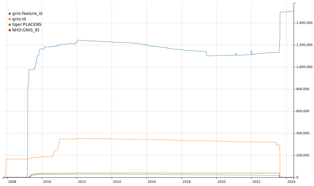
The gnis:feature_id tag was typically used for imports of many types of GNIS records. The gnis:id tag was used for imports of nodes for Populated Places, i.e. place=city, town, village, hamlet, etc. The tiger:PLACENS tag was used for imports of civil boundaries from the US Census Bureau datasets and contained a GNIS Feature ID value. The NHD:GNIS_ID tag was used for imports of waterways and other hydrographic features from the National Hydrography Dataset and also contained a GNIS Feature ID value.


 Villa Cele-María, edificio protegido en Paseo de Sancha, vivienda unifamiliar de estilo neomudéjar de finales del siglo XIX, antigua residencia del ingeniero