I just realized that a water well is sometimes privat and sometimes not even visible to people. I feel so sorry that I commited removal requests of some water wells in Portugal because I could not find drinking water there…. from now on I only search for “drinking water” or “spring” on osm.
Users' Diaries
Recent diary entries

Sharing from my post on https://blog.georeactor.com
Belgium’s Baarle-Hertog and the Dutch Baarle-Nassau overlap in one town riddled with border crossings and enclaves. Let’s take a look at OpenStreetMap:
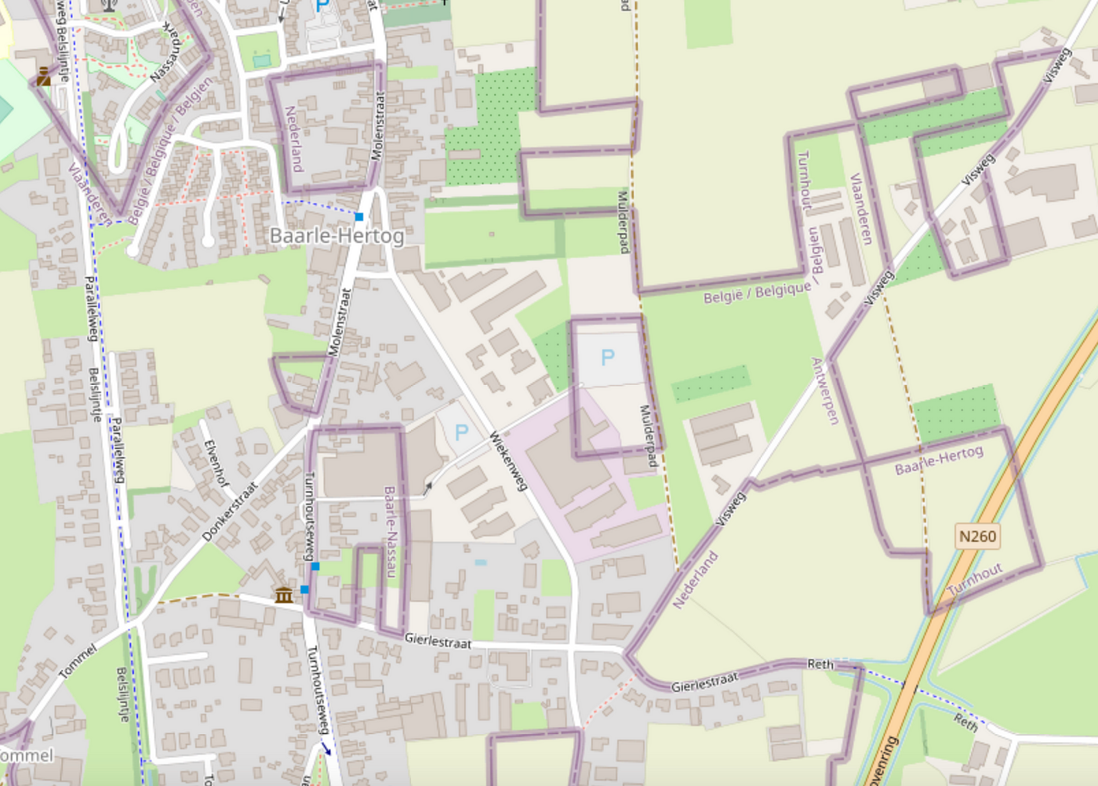
Wow, it looks complicated!
Legend depicts Baarle as a Kafkaesque theme park where buildings swap countries and laws are fluid. Sample anecdote:
There was a time when according to Dutch laws restaurants had to close earlier. For some restaurants on the border it meant that the clients simply had to change their tables to the Belgian side.
I likely learned about this town from the Google Sightseeing Blog a long time ago. As a maps nerd, I knew that I had to see it for myself one day.
Getting there
In April 2023, I took a train from Brussels to Antwerp, checked out the award-winning Port Authority Building, then another train onward to Turnhout, then a bus to Baarle-Hertog.
Posted by Giovanni Monni on 6 May 2023 in Italian (Italiano).
Last updated on 23 January 2025.
L’antico toponimo chiamato: “Sa Pedra de Vanda”nelle vicinanze di Arcu Procili de Monte Melas, nei pressi delle localita’ “Sa Scandula” “Baccu Eranu” “Baccu Eraneddu” “Monti Arbu” “Pedra Bianca” Baccu S’Acua Callenti” ecc. ecc. NB il suo vero nome è: “Sa Pedra de Vanda”. Attualmente viene conosciuta con il nome ( La Sfinge - La Mitra - o Su Cappeddu de su Papa o de Monzegniori). Ma tra noi che conosciamo questi luoghi da piu’ 60 anni continuiamo a chiamarla con l’antico toponimo “ SA PEDRA DE VANDA”. C’è da dire che anche noi ogni tanto usiamo questi toponimi per evitare di fare sbagliare l’itinerario alle nuove generazioni, e visitatori che frequentano questi luoghi. Dimostrazione pratica come la toponomastica è in continua evoluzione.
Even after all of the descriptions I’ve read, links I’ve clicked on, and groups I’ve joined on the subject, this whole OpenStreetMap thing still makes absolutely NO SENSE to me whatsoever. What is the objective? I want to be contributing to the greater good of SOMETHING, be it the Internet, Google maps, GPS, or whatever else. Perhaps the kramdown thing tossed in here is what’s further complicating everything for me, I don’t know. I’ll devote another hour of my energy, but if something doesn’t click by then, I’m opting out.

amenity=hitching_post
Short and easy, 214 uses.
tourism=trail_riding_rest
Well, it may contain one or more hitching posts. 1 use. That’ll be the person who wrote it up for the wiki and linked it about for good visibility. Ooh, and it’s rendered on the trail riding map. Perhaps it was made because other resting places are possible, so this becomes a unifying tag to look for if you are looking for a place to rest your horse? Much like a tourism=trail_riding_station seems to be a unifying tag to put on all the different things you can overnight your horse in? (1339 uses for that one, it’s doing a better job. Oh, except that I looked at how it was actually being used and some of it was for staging locations where overnighting would be illegal. So not all correct uses. And I can definitely see where the confusion comes from.) Although if these things are meant to be a unifying device, used in addition to the more specific tags, it probably ought to say that on the wiki page. Is that even how tags are meant to be used? I certainly see the utility.
amenity=animal_hitch
animal_hitch=ring/rail/post
horse=yes
er…
mule=yes
donkey=yes
llama=yes
Perhaps you should just be assuming your zebra/donkey cross or whatever other exotic bit of stock you’ve got =yes? Except if you’re in big horn sheep country, it very well might be that goat=no.
104 uses for all animals, but it isn’t popular enough to get combination details. For the type tag, there are 83 rings and 7 rails, but no posts at all. Nope, the people don’t want it for hitching posts. Well, except for the sorts who get particular about the post being horizontal between two other posts, AKA a rail. Or particular about there being a ring on the post, but the example dog_hitch (not kidding) is also a ring.
Oh, there’s also 2 uses of amenity=horse_hitch.
บ้านเลขที่99 หมู่มี่6 เทศบาลตำบลโพนทอง อำเภอเชียงยืน จังหวัดมหาสารคาม 44160
Utläggning av samtliga reklamstolpar.

- Rivers and lakes may move 10 meters in 5 years.
- When you map a river, treat it like low-poly art.
- Think of the next mapper 3 years from now. No 200 point rivers. No holding space bar.
Simple rivers enable simple change.
Posted by adreamy on 1 May 2023 in Korean (한국어).

OSM 위키문서에서 ‘길’ 갈래 가운데 주요길 갈래에는 motorway, trunk, primary, secondary, tertiary, unclassified, residential 같은 여러 값이 있습니다.(unclassified는 한국에는 해당하지 않음)
이 가운데 ‘motorway’는 ‘고속도로’, ‘trunk’는 ‘고속화도로’로 또렷하게 갈래지을 수 있겠습니다.(‘고속화도로’는 주요도로 가운데 계층적 성격에서는 살짤 벗어나기는 하지만 그 특성이 또렷하고 독립적이기에 계층적 갈래에 넣어도 문제가 없다고 봅니다.)
나머지는 우리나라 실정에서 갈래짓는 기준에 따라 조금씩 다르게 볼 수 있어 꼭맞게 떨어지도록 갈래짓기는 쉽지 않은 것 같습니다.
그럼에도 한국의 실정에만 맞게 새로 키 값을 만들기도 그렇고, 이왕이면 있는 공통 키 값에 가장 비슷하게 맞물리게 하고자, 여러 길의 속성들을 살펴 볼까 합니다.
먼저, 우리나라 길[도로] 체계부터 알아야 할텐데, ‘관리 주체에 따라’, ‘기능에 따라’ 혹은 ‘사용형태나 규모에 따라, 여러가지로 나눌 수가 있습니다.
“도로법”에 따르면 관리 주체에 따르면, 일부를 제외한 대부분의 노선은 공기업 한국도로공사가 국토교통부로부터 위탁받아 건설, 유지 및 관리를 하고 있는 ‘고속국도’(고속도로), 각 지방자치단체에 있는 지방국토관리청에서 관리하는 ‘일반 국도’, 특별시장·광역시장이 관리하는 ‘특별시도·광역시도’, 그 밖에 시장·도지사가 관리하는 ‘지방도’, 시장·군수·구청장이 관리하는 기타 군,시도 그리고 역시 시장·도지사가 관리하는 국가지원지방도(국지도)가 있습니다.
그렇다면 크게는 ‘고속국도’, ‘일반 국도‘그리고 광역 지자체장이 관리하는 ‘특별시도·광역시도’와 ‘지방도’를 묶어서 ‘지방도’, 시장·군수·구청장이 관리하는 ‘시도·군도·구도’ 정도로 뭉뚱그려 나눌 수 있지 않을까 싶습니다.
그 밖에도 차선 수나 넓이에 따라 나누기도 하고, 기능에 따라 ‘주도로’, ‘간선도로’, ‘집산도로’, 규모에 따라 ‘광로’, ‘대로’, ‘중로’, ‘소로’처럼 나누기도 하나 그 나눔이 그리 또렷하지는 않은 것 같습니다.
OSM의 계층적 분류에 따라 ‘고속국도’(고속도로)는 ‘highway=motorway’로, ‘일반 국도’는 ‘highway=primary’, ‘지방도’는 ‘highway=secondary’, 그 밖의 ‘시도·군도·구도’는 ‘highway=tertiary’로 나눌 수도 있을 것 같은데, 개념 상으로는 구분이 뚜렷하고 별 문제가 없으나, 일반 사람은 쉽게 알기 어려운 정보가 들어 있어, 이와 함께 좀더 알기 쉬운 기준과 함께 정리를 해 볼까 합니다.
먼저, 여러 분류 기준 가운데 가장 확실하고 ‘그나마’ 또렷한 기준은 ‘관리 주체’를 기준으로 한 분류겠으나 판단하기가 까다롭거나 어렵기 때문에, 국토지리정보원에서 제작한 지도를 기본으로 하고 있는 국토부 ‘브이월드‘나 상업지도 가운데 일부는 색깔로서 비교적 또렷하게 구분을 해 주고 있어 참고를 하기가 좋습니다.
Posted by adreamy on 1 May 2023 in Korean (한국어).
본디 글은 OSM에서 ‘길’(Key:highway)에 대한 정리입니다. 본디글이 나중에 더 다듬어 졌을 수 있습니다.(2023년 4월 29일 마지막 고침)
지도에서 중요한 요소이기도 한 ‘길‘이 OSM 편집에서는 참으로 애매하고 그래서 사람마다 받아들이는 것이 달라 제각각으로 규정하는 요소이기도 합니다.
여러 군데서 말했지만, 이는 아마도 일단 동양(동아시아?)와 서양(유럽과 미국?)이 발전해 온 역사하고도 상관이 있는 것 같고(서양은 ‘길’ 중심, 동양은 ‘마을’ 중심이라는 비교문화학 쪽의 해석도 있습니다.) 나라마다 사정이 다른 데에도 큰 까닭이 있는 것 같습니다.
그래서 여기서는 굳이 OSM 위키문서의 분류 기준에 우리나라 도로를 억지로 끼워넣지 않고, 그냥 개념을 이해하기 위한 해석 정도만 해 볼까 합니다.
‘주요도로‘에 대하여
‘주요도로’는 길(도로)의 등급 분류라고 볼 수 있습니다. 이것은 단계적 분류라고 볼 수도 있지만, 홀로 특성(요건)을 가진다는 뜻도 있습니다.(쉽게 말해 highway이면서 일부 residential 혹은 service의 속성도 가질 수는 없다는 뜻입니다.)
‘highway=motorway’는 확실히 고속도로가 해당이 되겠고, ‘highway=trunk’는 한국 실정에서는 ‘고속화도로’(도시고속도로 등)에 걸맞을 것 같습니다.(‘고속화도로’와 가끔 헷갈려 하는 ‘자동차 전용도로’ 설명은 아래에 있습니다.)
아~주 헷갈리는 것으로 ‘key:expressway‘가 있습니다.
‘highway=primary’, ‘highway=secondary’, ‘highway=tertiary’, ‘highway=unclassified’, ‘highway=residential’을 구분짓기는 쉽지 않은 것 같습니다.
어떤 분은 (motorway, trunk 말고는)도로의 차선 수나 도로 폭 같은 것을 기준으로 나누자고 하는 의견도 있으나 우리나라 도로체계와 실제 도로를 견줘보자면 차선 수나 도로 폭의 넓이가 도로의 계층적 구분 기준과 맞아떨어지지 않는다는 걸 알 수 있습니다.(이 부분은 아직까지는 도저히 제대로 정리가 되지 않으므로 더 공부해서 정리를 해 보도록 하겠습니다.)
아마도 이 부분이 ‘길’ 중심의 서양 혹은 땅이 넓은 나라와 ‘마을’ 중심의 동양 혹은 땅이 좁은 나라의 차이가 아닐까도 싶습니다.
highway=residential : 마을 사이를 연결하는 기능은 없으며 주택 접근 시 사용하는 도로. 여기서 ‘연결’은 마을 사이를 잇는 주도로로 쓰이지 않는다는 뜻이지 길로써 이어지지 않는다는 뜻은 아니라고 봅니다. OSM 의 웹편집기인 iD에서는 ‘주거 도로’라고 번역되어 있으나 아래 비주요도로와 함께 보자면 꽤 헷갈리는 번역이라고 봅니다.(번역 탓이 아닌 개념의 상대성 탓)
우리나라의 왠만한 마을 안길, 이면도로는 residential이거나 unclassified( 아주 가끔 다른 주거지와 연결하는 구실이 큰 경우에는 tertiary로 쓸 수 있지 않을까 싶습니다.OSM 위키문서에 남한에는 적용되지 않는다고 되어 있습니다.)
(다시 정리해서 조금 덧붙이자면, 우리나라 상황과 실정에 비추어 개념이 서로 좀 겹치는 것 같기는 하지만 우리나라에서 왠만한 주거지 안의 비주요도로, 이면도로는 living_street 보다는 residential 쪽이 더 알맞지 않나 하는 것입니다. 주택단지나 아파트 단지 안길은 오히려 living_street에 가까워 보이고…)
‘고속화도로’와 가끔 헷갈려 하는 ‘자동차 전용도로’는 도로의 분류 체계가 아니라 그냥 속성으로 보아야 합니다. 어차피 motorway나 trunk에는 그 길을 쓸 수 있는 교통구가 지정되어 있으므로 따로 덧붙일 필요가 없으며, 그 밖의 의 경우에는 주요도로의 속성에 ‘motorroad=yes’를 곁들여서 써야 한다고 합니다.(OSM 사랑방에서 ‘曹县18环’ 님 글.) – 자동차전용도로, 고속화도로(도시고속도로) 지도(비공식입니다.)
‘연결도로‘에 대하여
Opening June 29th over 2 km between existing roads Vejledalen and Mælkevejen in the town Vejle, Denmark - Please Update! :-)
Hi, everyone,
Between the end of April and mid-May, my former TomTom colleagues * and I posted a communications survey with the goal of gathering some information about how OSM users experience OSM community communications. Now that the survey is complete, I want to give it context as part of our presentation at State of the Map US in Richmond, Virginia.
At SotM US, we will be presenting on How to Use Data for Effective Community Communication. (The project is supported by TomTom and informed by work that two of us have done for the CWG, but it’s not formally a TomTom or OSMF project.) Our primary source of data for this presentation is derived from a tool that scrapes publicly available, anonymized, channel data from OSM listservs and forums. To augment this data, we created a communications survey. We knew that we would not be able to get a broadly representative cross-section of the OSM user demographic with our limited time and resources, but we did believe we would get some additional details that could help inform our approach.
The survey had a mix of free answer and multiple choice questions about demographics, local community involvement, and experiences using the various forums, lists and other channels. We created 12 versions of the same survey to post in 12 different channel types so that we could get a sense of the user demographics per channel: community forum, mailing list, Telegram, Twitter, Discord, Slack, Mastodon, Reddit, IRC/Matrix, weekly OSM, Facebook, LinkedIn. We received 464 responses, with more responses from Europe and North America than from Latin America, Asia and Africa. We will present a few of the observable trends at our presentation, with the caveat that they are more impressionistic than representative.
Sanawad city boundry for Wikipedia by akmal khan
Posted by YPGGUUY on 30 April 2023 in Chinese (China) (中文(中国大陆)).
Last updated on 6 May 2023.
https://github.com/OSMChina/osm-busqc
简易的公交网络检查脚本
* 打印全部线路
* 检查线路主线/具体线路缺失
* 检查线名/站名缺失
* 检查首末站
可能倒闭也可能变质.
A little weekend project to check local bus network integrity.
* print all routes and stops
* check missing master routes/routes
* check missing names
* check inconsistent terminals name by comparing route[from]/[to] with platform[name]
may or may not maintain or further develop.
Depends on osm_easy_api, thanks to them.
samples:
首末站不正:
主线 2
2 路: 火车站综合体 -> 塔东路东堤湾
火车站综合体 波海公园 西江北路中 体育中心西门 体育中心南门 康乐北路 康乐市场 康乐中路 披云楼 北门 豪居路 中心市场 大柑园 工农北路南 友谊路口 和平路中 城东公园北门 前进中路 市公安局 前进南路 塔东路东堤湾 和平路西 华佗医院
wrong on route 13853854
AssertionError: inconsistent terminal
2 路: 塔东路东堤湾 -> 火车站综合体
塔东路东堤湾 前进南路 市公安局 前进中路 城东公园北门 和平路中 端州公安分局 端州四路东 工农北路 友谊路口 工农北路南 大柑园 中心市场 豪居路 北门 披云楼 康乐中路 康乐市场 康乐北路 体育中心南门 体育中心西门 西江北路中 蕉园 波海公园 火车站综合体
线路缺失:
主线 5B
5B 路: 火车站综合体 -> 岭塘村
火车站综合体 大桥路北 华英名都 惠民居 玑东路南 大鼎路中 一中实验学校 太和南路 端州七路中 睦岗 八中 棠下 肇庆大道西 三榕港 三榕水厂 黄禁 大龙桥 小湘军校 新屋村
wrong on route 14464670
AssertionError: inconsistent terminal
wrong on master 15749944
AssertionError: inconsistent route count
主线缺失:
wrong on master 35
AssertionError: missing master 35
wrong on master 36
AssertionError: missing master 36
wrong on master K01
AssertionError: missing master K01
Posted by Peter Elderson on 30 April 2023 in English.
Last updated on 13 May 2023.
Turbo roundabouts are relatively new. They first appeared in Nederland, but are now starting to appear in many countries, including the US. I have tried my hand at mapping one, guided by a few front runners, then did a second one on my own. This diary entry details what I learned. As I go on, I will add things learned to this diary entry!
See [roundabout=turbo] (roundabout=turbo)
Variations: It’s hard to find two turbo roundabouts that are exactly the same. This is what I learned: Take care to start with an easy one, and never blindly apply the prescriptions. You have to know what it’s for. That’s why this diary entry contains a lot of explanation: those are the things I learned from the experts! Too bad the three-lane rotor roundabout in Rosmalen has already been mapped.
Mapping a turbo roundabout with JOSM
Tools used
JOSM with a detailed aerial photo background layer and style Lane and Road attributes active. This job would be near impossible with Id.
Skills required
Basic OSM editing: drawing and tagging nodes, ways, areas and relations. Cutting ways (P). Link ways to existing nodes and ways (Esc-drop, M, N). Unkink ways. Extend ways. Combining ways (C). Reverse ways (R). Copy and paste elements (Control-C and Control-V).
Skilled editing: Adjusting lines with O (round) and Q (straight). Create turn restriction relations: tag, add elements and assign roles to, via from. Use existing turn restriction to duplicate and adapt for a new restriction. Route relations: download members, identify ordering problems and membership problems, and correct sorting errors.
What?
Anton Khorev’s post inspired me to see what would happen if I open the iD Editor in landscape instead of portrait.
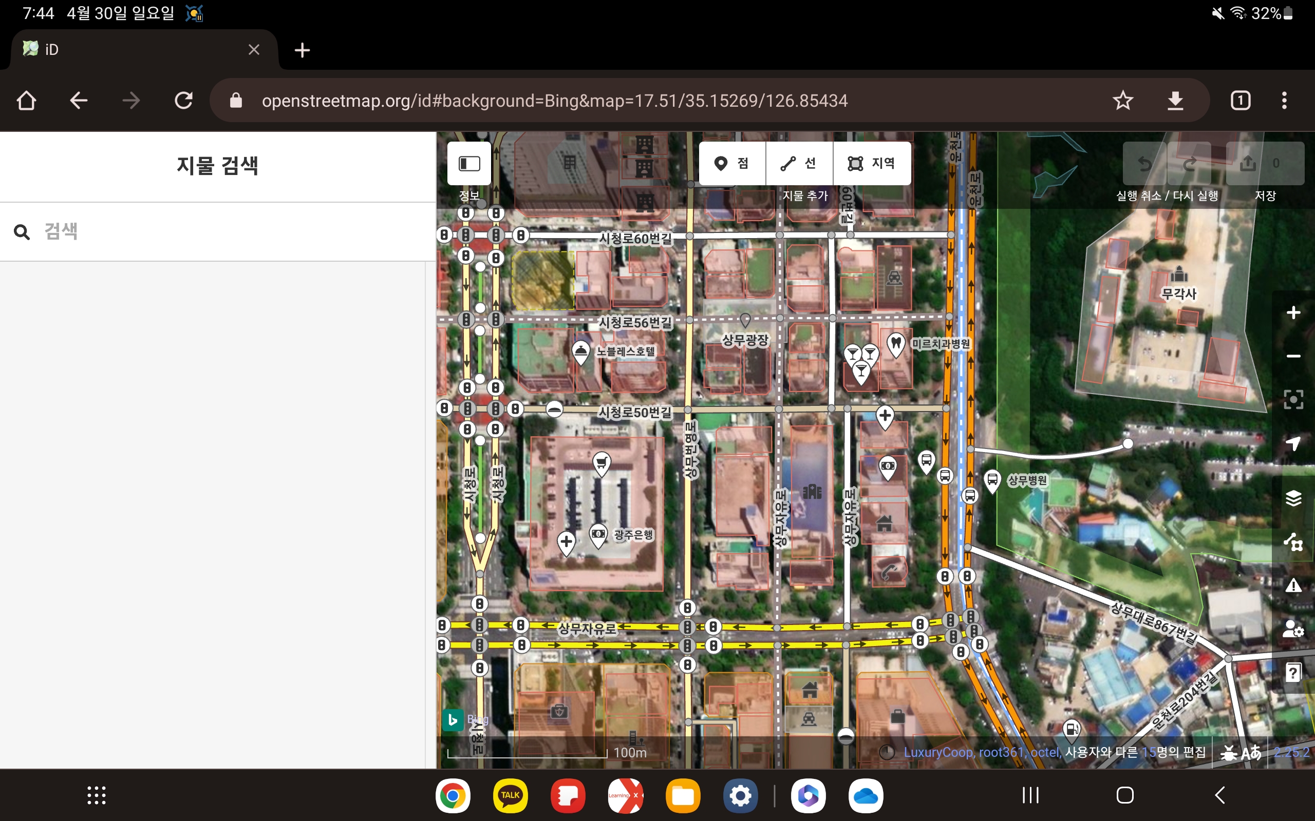
I’ve opened the iD editor in Google Chrome on my Galaxy Tab S7. it’s editable enough as it is, it would be nice to be able to turn it full screen.
Anton Khorev 님의 글을 보고 세로 화면이 아닌 가로 화면으로 iD 편집기를 열면 어떻게 될지 한번 알아보았습니다.
갤럭시 Tab S7에서 구글 크롬으로 iD 편집기를 열어 보았습니다. 이 상태에서도 충분히 편집이 가능하지만, 전체화면으로 바꿀 수 있다면 더 좋을 것 같습니다.
Posted by JaneAmerica12 on 29 April 2023 in English.
It was awesome and amazing
Today was a great day. I learnt how to map out a location and I contributed by mapping out some buildings and some pathways. I know I’m a a beginner in this but I find it surprisingly fun and interesting. I mapped out Abi Local government area and I’m happy.
Posted by Starman6059 on 29 April 2023 in English.
Contributed in mapping buildings and roads.