Humanitarian OSM Team/Program: Conflict & Displacement
| Page Under Construction! | ||||||||||||||||||
OverviewThis programs objective is to strengthen humanitarian efforts in complex emergencies. It focuses on data analysis, quality, accessibility and learning to support key humanitarian functions. This includes producing baseline infrastructure data, research on damage assessments methodologies, and data quality assessments. Through partnerships with OSM communities, academics, UN agencies and networks like H2H, the program has mobilized a global community to map buildings, roads, and infrastructure in OpenStreetMap for locations such as Sudan, Lebanon, Myanmar and Gaza, where information is often scarce or outdated. | ||||||||||||||||||

Context and Problem Statement
Effective humanitarian action in areas of conflict and displacement relies on precise, up-to-date information. The scale of need is significant, with one in eight people exposed to conflict in 2024 (ACLED), 73.5 million living in internal displacement from conflict (Dec 2024IDMC), and 9.8 million returning to conflict-affected areas (UNHCR). The need for reliable, actionable geographic data is critical for planning and coordinating aid in these complex environments.
The Humanitarian OpenStreetMap Team’s (HOT) Conflict & Displacement Program was established to address this need for open geospatial data. Initially, operating in such sensitive contexts presented a distinct challenge: how to provide vital mapping support while ensuring the safety and privacy of communities. This required developing a specialized approach. The cornerstone of this approach is our commitment to responsible data practices. Before initiating any mapping activity, strict processes are established. These include comprehensive data protection protocols, detailed risk assessments, and adherence to our published Data Principles and Data Protection Framework.
Geographic Focus & Target Populations
The program directs its efforts toward regions where the intersection of conflict, climate vulnerability, and large-scale displacement creates the most severe information gaps, thereby maximizing humanitarian impact. Mapping activities in these circumstances are designed to support specific vulnerable populations, including:
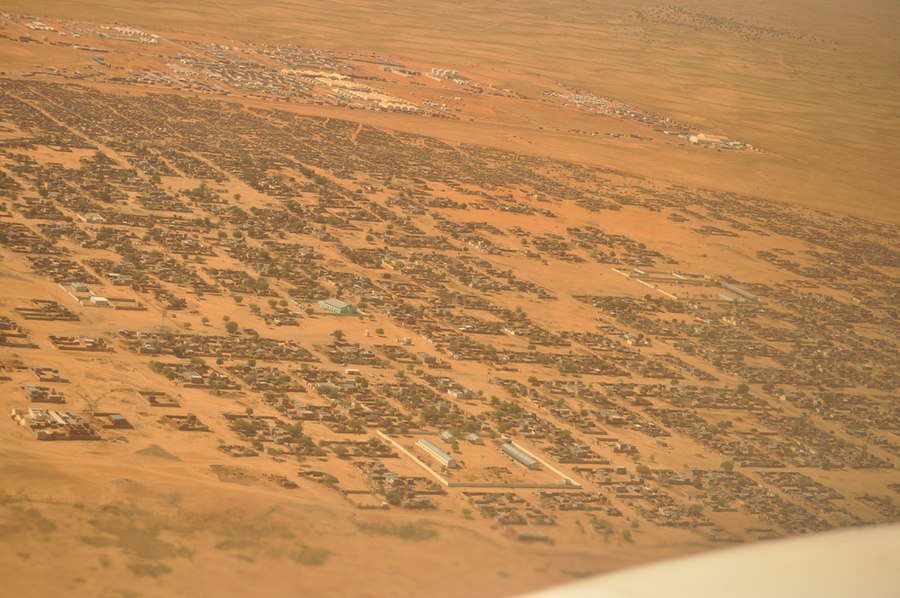
- Internally Displaced Persons (IDPs) and Refugees: Creating baseline maps of settlements and camps to improve advocacy, service delivery and resource planning for displaced communities.
- Host Communities: Mapping critical infrastructure in areas receiving large influxes of displaced people to assess strain on local resources and support integrated planning.
- Communities in Conflict-Affected Areas: Providing pre-crisis baseline data (like building footprints) to enable accurate post-conflict damage assessments and recovery planning.
- Populations Facing Compound Crises: Supporting communities where conflict overlaps with environmental disasters, such as flood-prone areas in Myanmar or Somalia, to facilitate layered risk analysis.
- Cultural Mapping: addressing the issue of the destruction of historical, social and cultural sites -- an often overlooked aspect of conflict.
The geographic scope is dynamic and expands in response to emerging crises and validated partner requests and local communities. Expansion is guided by humanitarian need, partner capacity on the ground, and the strict application of our data responsibility frameworks to ensure all work is conducted safely and ethically.
Activation Criteria & Trigger Mechanisms
Project activation in conflict zones follows a strict, principle-driven process. The default position is non-activation; any work requires explicit approval through a formal review.
Key Criteria:
- Validated Request: A documented need from an operational humanitarian partner.
- Risk Mitigation: Alignment with HOT’s Data Protection Framework and humanitarian principles. A mandatory risk assessment, including consultations with external experts and local OSM communities, must be completed.
- Humanitarian Imperative: A clear, likely life-saving benefit that outweighs any residual risk.
Final Decision: Activation requires senior leadership approval, serving as a final safeguard to ensure every project is ethically justified and operationally sound.
Key Objectives
- BRIDGE MAP DATA IN CONFLICT AREAS: Ensure the availability of accurate, open spatial data to serve as a baseline in conflict-affected areas for more accurate damage assessments through collaboration with global and local OpenStreetMap (OSM) communities.
 * Identify missing data for humanitarian partners’ needs.
 * Crowdsource of data collection on buildings, roads, etc.
 * Tailor projects to address data completeness in affected areas as highlighted by the Humanitarian Data Exchange (HDX).
- FACILITATE COORDINATION AND SHARING: Assist humanitarian stakeholders in identifying and utilizing open-source mapping solutions and tools, with practical applications in camp & displacement settings. Utilize OpenStreetMap and other collaborative platforms as the go-to data sharing and management platform between humanitarian agencies working with displaced communities
 * Foster a community of practice.
 * Participatory mapping of affected areas by those with direct knowledge.
 * Data sharing and easy access to commonly needed datasets.
- CAPACITY BUILDING Enhance collaboration and data-sharing efforts among humanitarian organizations and OSM communities in regions experiencing prolonged crises, supporting the connection of geospatial analysis with real world humanitarian applications.
 * Develop user guidance on open datasets related to conflict.
 * Create training programs for contributors interested in mapping complex emergencies.
 * Implement data protection project reviews.
Projects & Impact
- These entries are the list of projects in which the Conflict Program has been involved
| Program / Project Name | Country | Year / Period | Key Activities & Focus | Hashtags & Campaign Identifiers | Relevant Links |
|---|---|---|---|---|---|
| Gaza Building Footprints Pre-Conflict Update 2024 | Palestinian Territories | 2024 (Feb - Jul) | Remote mapping campaign to create a complete, pre-conflict baseline of building footprints in Gaza using pre-October 2023 imagery. Added 59,223 buildings to OSM. | #gazaUpdate | Project Page, Wiki |
| Geospatial Data for Humanitarian Response in Sudan Conflict | Sudan | 2024-2025 (Jun - Feb) | Project to address critical geospatial data gaps in Sudan (buildings, roads, cultural data). Involves collaboration with the Sudanese diaspora and uses tools like the Tasking Manager and uMap. | #WestDarfur2023 #2023sudanconflict #tawiladistrict #H2HMappingforSudan2024 | Project Page, Wiki |
| Lebanon H2H | Lebanon | 2025 (Start Jan) | Project to create precise pre-conflict building datasets and develop a community of practice for damage analysis in Lebanon. Supported by the H2H Network. | #LebanonUpdate2024 | Project Page, Wiki |
| Myanmar Earthquake Response 2025 | Myanmar | 2025 (Apr - Ongoing) | Response to the March 2025 earthquakes. Focuses on filling OSM data gaps (buildings, roads) and developing a crowdsourced damage assessment (CDA) methodology. Mobilized 3,296+ volunteers. | #help-mm-earthquake | Project Page, Wiki |
| Syria H2H Project | Syria | TBD | TBD | TBD |
Key Stats
- Below Is a table to keep key Metrics and stats for each one of the projects. Some are quantitative but also some are qualitative metrics
| Project | Contributors | # of Tasking Manager Projects | Buildings Mapped/Edited | Roads Mapped (Km) | Points of Interest (POIs) | Total Edits | Total Downloads | Mapathons / Trainings | People Trained | Other + Details | Notes / Sources |
|---|---|---|---|---|---|---|---|---|---|---|---|
| Lebanon Building Footprints (2024-25) | 354 | 12 | 184,182 | (Not a focus) | 107 (heritage sites) | 317,702 | 1,324 | 4 | 50 | 50 volunteers trained, 4 mapathons + trainings | Ohsome - Wiki |
| Sudan H2H | 468 | 438,553 | 12,495 | 300 | 284,331 | 2,866 | Engagement with Sudanese diaspora | 200 | 579km (Wadis/waterways) | Cultural landmarks, logistics data | |
| Gaza Pre-Conflict Update 2024 | |||||||||||
| Myanmar Earthquake Response 2025 | 3,296 (verify) | Part of an estimated 350+ global projects. | |||||||||
| Global Total | Compiled from project data above. |
to December 16 2025
News and Articles
- These entries are the list of news articles where the conflict program has been mentioned, where we have collaborated or where the data has been mentioned.
| Program / Project Name | Project | Publication | Year / Period | Summary | Relevant Links |
|---|---|---|---|---|---|
| Mapping in Conflict (Policy Article) | Na | HOTOSM | 2022 May | Outlines HOT's formal ethical guidelines and risk assessment framework for mapping in active conflict zones. Establishes default position of non-participation within active conflict zones unless strict criteria are met. | Article |
| OSM Building Dataset Complete for Southern Lebanon | Lebanon H2H | HOTOSM | 2024 - 2025 (Nov - Mar) | Volunteer campaign to complete OSM building footprints in four conflict-affected southern districts (Sour, Bint Jbeil, Marjayoun, El Nabatieh). 357 contributors made over 319,000 edits. | Update Post |
| Filling OSM Buildings Data Gaps in Lebanon | Lebanon H2H | HOTOSM | 2025 January | Early update on the crowdsourced project to map pre-conflict building footprints in southern Lebanon, highlighting data quality improvements over Microsoft ML datasets. | Update Post, Wiki |
| Lebanon's Recovery: Mapping a Path from Rubble to Resilience | Lebanon H2H | HOTOSM | 2025 | Reflections by a contributor on the situation of Lebanon and a path forward. | Article |
| Mapping Hope: Rebuilding Lebanon After Conflict | Lebanon H2H | Harvard Prevention lab | 2025 | Reflections by a contributor on the situation of Lebanon and a path forward. | Article |
| Data Gaps in Myanmar's 2025 Earthquake Response | Myanmar Earthquake Response 2025 | HOTOSM | 2025 August | Analysis article detailing findings from the Myanmar response, emphasizing the superiority of human-validated OSM data over AI-generated footprints and the relevance of people-led mapping. | Article |
| Humanitarian GIS Reflections (Collaborative Approach) | Na | HOTOSM | 2025 June | Advocacy article promoting OSM as a key shared resource for humanitarian GIS collaboration, especially amid funding cuts. Encourages partnership on core spatial data layers. | Article |
Events and Social Media
2025
- Navigating Remote Damage Assessments & Lessons Learned (webinar)
- [CNG 2025] Documenting the Impact of War with HOTOSM – Jessie Pechmann (Lightning Talk)
- Quick HOTOSM tutorial for beginners - Myanmar response
People and Structure + Contact Info
- Organizations: HOTOSM, OSM communities, partner experts
- Key contacts / directory: Jessie
- Advisors: Academics (J and C?)
- Funding sources and donor relationships: H2H
- Networks: IMWG and DDMG
Contact Information
Accountability & Protection (TBD)
- Data protection and privacy policies
- Inclusion strategy: gender, disability, older persons, minorities
Partnerships & Coordination
- Local & international partners (roles): [list]
- Coordination mechanisms: clusters, government coordination bodies
- Awards & recognitions: [list]
Resources + Data Viz / Maps?
- HOT Tools webpage
- Data protection resources
- Analysis & extraction tools (OBE, etc.)
Guides, Protection & Compliance
Program Activities and Tools
- Preparedness — data quality, post-processing, training, mapathons, events
- Response — rapid damage assessment, Tasking Manager projects, MapRoulette, rapid needs assessment (agile comparison framework)
- Recovery & Resilience — longer-term monitoring, impact reports
- Coordination & IM — data sharing, working groups, interoperability
Annexes
- Glossary of terms and acronyms
- Maps and demographic data (Map gallery in website)
- Photo gallery links (flickr)
- Publications