Category:State of the Map 2019/Posters
Jump to navigation
Jump to search
Submissions to the poster evening of the State of the Map 2019.
Media in category "State of the Map 2019/Posters"
The following 16 files are in this category, out of 16 total.
-
 Address Patterns.pdf 4,964 × 7,020; 319 KB
-
 Colomiers voxel island.jpg 14,043 × 9,933; 30.04 MB
-
 Contextualizing OpenStreetMap in Mapping Favelas in Brazil.pdf 4,964 × 7,020; 1.46 MB
-
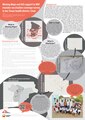
 Crowd2Map – mapping to fight Female Genital Mutilation.png 3,179 × 4,494; 4.29 MB
-
 Enriching Knowledge Graphs with Geo Data from OpenStreetMap and Wikidata.pdf 4,966 × 7,020; 11.04 MB
-
 Forêt d'Anlier.pdf 7,020 × 4,964; 28.45 MB
-
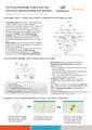
 How knowing the purpose of mapping impacts the map and mappers themselves.pdf 5,012 × 7,020; 6.13 MB
-
 London City Lights.png 14,043 × 9,933; 125.72 MB
-
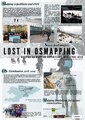 Lost in OSMapping - Rethinking mapping expeditions in Central Asia.pdf 4,966 × 7,020; 22.54 MB
-
-
 OSM for Mental Health aWHEREness.jpg 10,076 × 14,185; 28.52 MB
-
 Outdoor map by Freemap Slovakia.png 9,756 × 13,866; 198.2 MB
-
 Planning urban accessibility with OpenStreetMap.pdf 4,964 × 7,020; 12.88 MB
-
 Rennes atelier vagabond.png 9,933 × 14,043; 22.03 MB
-

-


