
Validating Basic Routing with CartoType Maps
Posted by ryebread on 3 August 2016 in English. Last updated on 23 November 2016.I am using various OSM-based applications as a daily driver for navigation purposes (this month I am fascinated by Magic Earth. They have recently added relief data and traffic-based routing, so go check them out).
I’ve been testing routing primarily with demo OSRM and Valhalla servers, but these services take time to be updated, and I want to make sure my changes don’t break things now.
While browsing the Routing I found CartoType Maps, which is a closed-source desktop application that renders and perform routing locally.
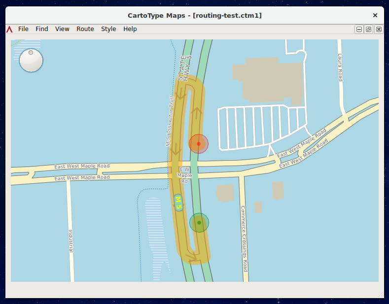
A separate makemap application is required to convert from OSM XML to CartoType internal representation.
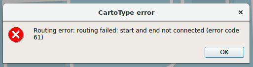
I found that sometimes the application gives false positives, claiming roads are not connected only because it does not seem to handle turn restrictions properly. Far from ideal, but still better than waiting for the remote servers to catch up.
What do you use to test routing?
Discussion
Comment from Graham Asher on 1 November 2017 at 13:03
Thanks for your feedback. You might like to try the latest version of the Maps App. I have fixed quite a lot of subtle problems with routing.