
Infohazard : Epilogue
Posted by rphyrin on 21 September 2025 in English. Last updated on 22 September 2025.This afternoon, while pondering and daydreaming about seriously quitting OSM for real, I ventured into the land of Wikimapia.
Then I stumbled upon a conversation between high-ranking admins over there.
“Why did you delete a number of TNB sub-stations from the map? Don’t you think those tags were useful, to some people at least? I think the user(s) who initially created those tags put a lot of effort in detailing the model nos., etc. for some of the sub-stations. Thanks.”
“The TNB sub stations is not a place. It just an OBJECT just like small bridges, security guard post, small jetty etc. Different with a PLACE such as Pulau Pinang Bridge or any big bridges, police station or a port such as Port Kelang. As you can see there are few users that like to tag a small roadside stall and a small public toilet. That also is in the list for deletion. You must know to differentiate what can be tag and what can’t.”
“I was under the impression that anything permanent of some importance (except personal houses) could be tagged. If that’s the case, people shouldn’t be tagging ATM machines, telco towers, transmission towers, etc. To be honest, I disagree with you on this point as TNB substations are permanent and important to some people as I mentioned before.”
“You may disagree with me but TNB sub stations is not an important objects for WM users. It just like tagging a bus stops and taxi stands if you know what I mean”
Well, maybe I should stay in OpenStreetMap.
Jokes aside, I’m quite surprised that Wikimapia is still active today. I still see several Wikimapia mappers still doing dedicated micromapping in their respective neighborhoods.
Then, I tried cross-checking Wikimapia’s entries with both Google Maps and OpenStreetMap. Surprisingly, there are some recent entries that exist in Wikimapia but are not found in either Google Maps or OpenStreetMap. When I verified them through publicly available street view images, it turned out they were actually correct. Cool.
So, it turns out that dedicated micromappers don’t exist solely in OpenStreetMap. They are also still active today in both Wikimapia and Google Maps (through Google Local Guides program), each with different “jurisdictions” regarding who has the authority to delete or reject contributions.
In OpenStreetMap, anyone can delete someone else’s contribution, i guess.
In Wikimapia, there are “elected local administrators” who can perform higher-level editing (such as road mapping and place classifications) and handle deletions.
In Google Maps, every edit is vetted by Google staff, I think.
So, if in the future you need a detailed, updated map of a certain region, there’s a chance that a dedicated local micromapper has contributed, whether in OpenStreetMap, Wikimapia, or Google Maps.
“So… should we convert dedicated Wikimapia micromappers to OpenStreetMap?”
Umm… I can’t answer that question yet, haha.
“How about the other way around? Encourage OpenStreetMap mappers to try Wikimapia.”
If you want a bit of fresh air, sure. Here’s a quick rundown of what you need to know:
- You start at the “beginner” level. At this point, your editing privileges are quite limited—you can only add places, not new roads. Add more places, gain experience points, and level up.
- To add a new place, draw the polygon, add the title, description, tags, and address. Everything here is a “way,” unlike OSM where you have nodes, ways, and relations. The title and description are very “wiki-page-like,” with separate entries for each language. The address part is special because it works like a category tag in Wikipedia/MediaWiki. It automatically groups “pages” into a hierarchy of addresses, from roads up through administrative boundaries, countries, and eventually the world.
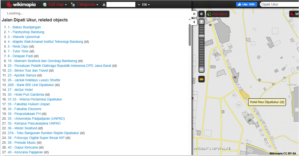
- The tagging system isn’t based on key:value like in OSM but uses simple, single-valued tags, such as “hotel,” “restaurant,” etc. For each place, you can add multiple tags.
- The atomic unit of contribution is not a “changeset” like in OSM, but simply a “place.” As a result, browsing someone’s contributions on Wikimapia is more enjoyable, since it looks like “traces of places this user has mapped,” rather than just “a list of changesets with vague descriptions.”
- Since it’s essentially a “vector tile” map, it offers a high-resolution browsing experience. You can zoom in to the maximum and see everything in the database. Contrast that with OpenStreetMap’s Carto map, where (1) even at max zoom you can’t see every detail, since some icons “collide” if they’re too close, and (2) not every tag is rendered, so plenty of detail remains hidden in the database.
- Each “place” has its own dedicated page where anyone can add photos and comments.
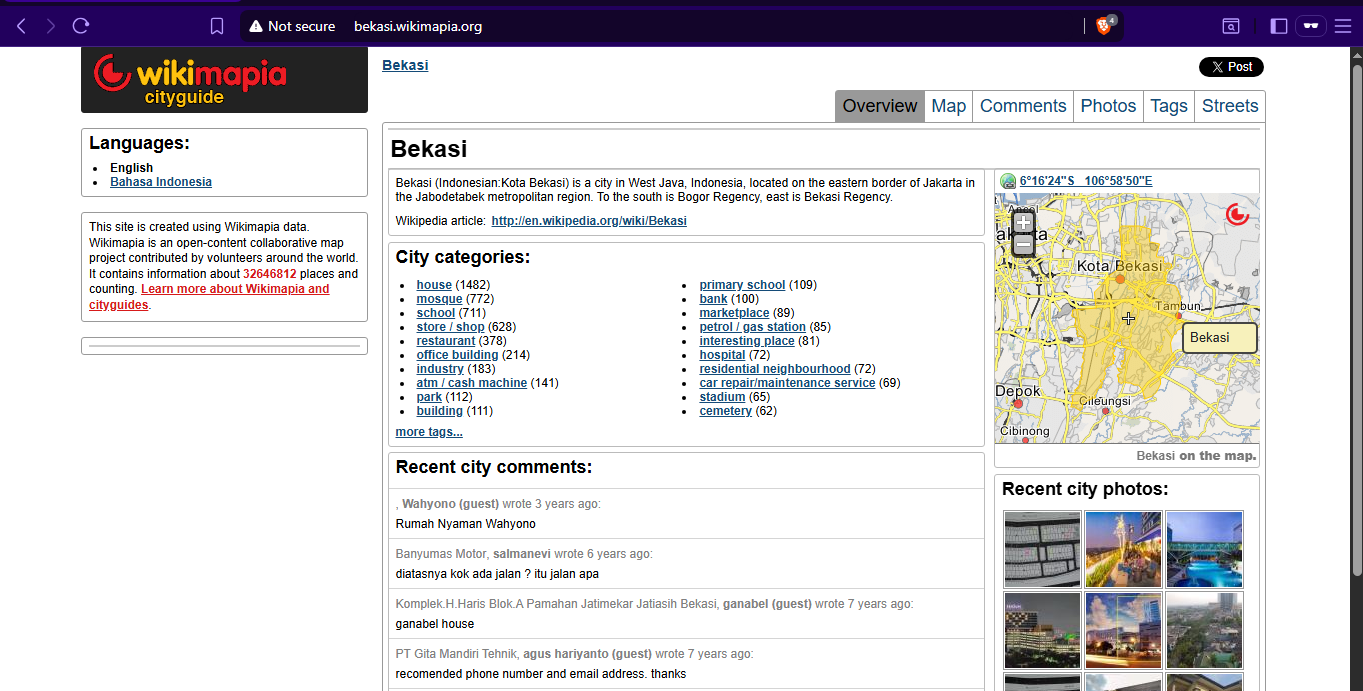
- Each city has its own [dedicated subdomain], summarizing everything there and updated every 10 minutes.
https://news.ycombinator.com/item?id=38090473
“One thing seemed a bit strange to me. It was the absence of initial clues on the Web about such a big local object.”
“OSM approach is different: objects are presented as they are, and can’t collect arbitrary comments, discussions, photos and other data (apart from regular edit descriptions). It is essentially a tool to make a static snapshot of current state of certain types of objects, which is fine for a map, but does not help people interested in local history.”
“Why haven’t similar communities in other big cities across the world created similar sites (“own/better Wikimapias”) to collect information on everything they find interesting in their neighborhoods?”
Well, I’ve been thinking about this problem for quite a long time. Actually, I built similar web apps several years ago to address this exact issue, but the funding ran out and they failed to reach the critical mass needed to build a self-sustaining online community to move forward. So I shelved the idea, but it still makes me curious, even now.
One potential immediate solution is to use the OSM Wiki to explain “the story part” behind each OSM object. That seems quite feasible. However, if this trend continues, it could add some infrastructural burden to the OSM Wiki (since its de facto raison d’être is simply for tagging documentation, right?). But if the quality of the wiki is good enough and worth preserving, I think it could be welcomed as “a new way to contribute” to OSM.
Discussion