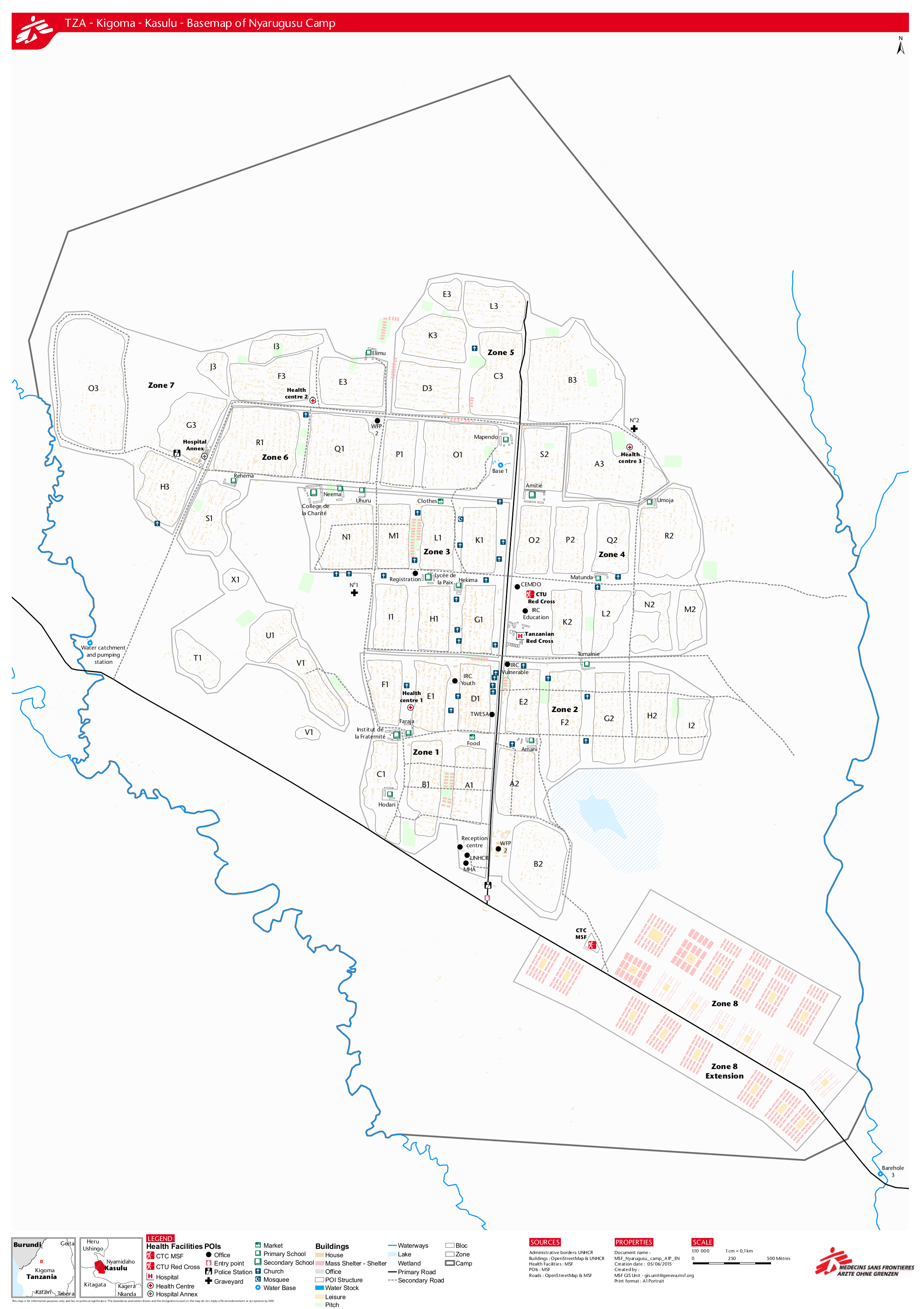
How did this London Missing Maps party not end up totally chaotic?
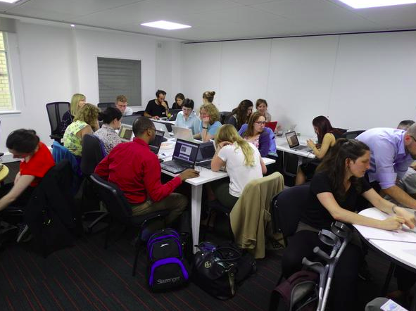
Posted by pedrito1414 on 8 July 2015 in English.Yesterday’s Missing Maps party in London looked like it was going to be completely chaotic. Both Astrid (who organises the mapping parties) and I had been on holiday til the day before and the new MSF office (which we only moved into a little while ago) was only ready for us to move around about ten minutes before we started.
But, by 1820 (twenty minutes after start time) all that could be heard was the clicking of mice and the low level buzz of excited, whispered conversations…
How did it go so smoothly when the opposite was looming?
Chatting with Astrid later, we came to the following conclusions, which I want to share here…