
A note on old imported landuse=quarry in the United States
Posted by mvexel on 22 November 2023 in English.In the early days of OSM, when the map was formless and empty, mappers in the United States conducted data imports without much discussion, because there were just not a lot of people to discuss with.
One example is a series of imports of USGS GNIS data. This is point data from the United States Geological Survey’s Geographic Names Information System. Some of this data was very useful, for example to populate the map with place nodes for smaller towns. But there’s also a lot of data that was not very good, and a lot of it is still on the map today.
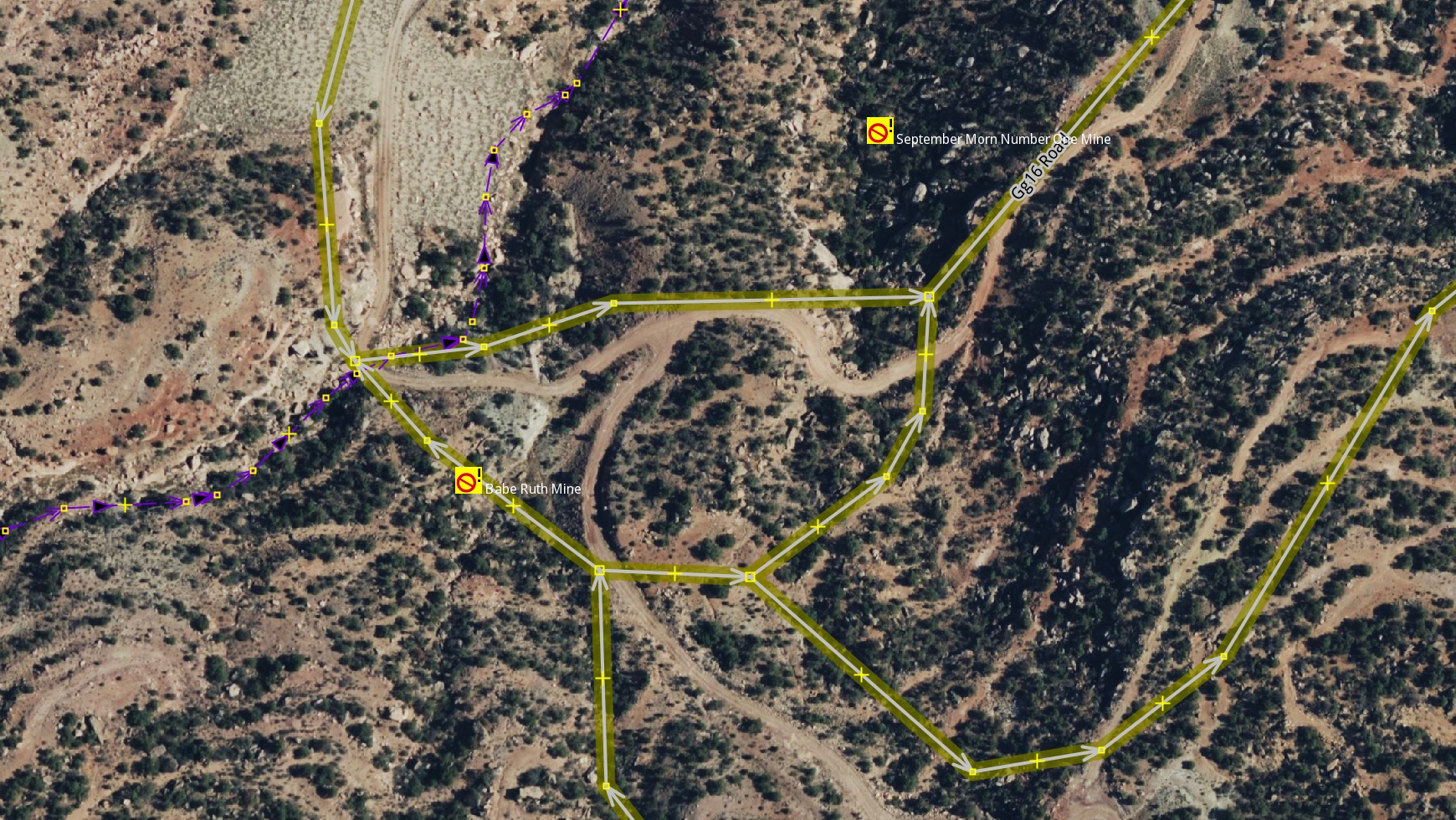
One example is the mines layer, imported with the tag https://wiki.openstreetmap.org/wiki/Tag:gnis:feature_type=Mine. For starters, a lot of these nodes represent historic mines, of which the United States has many, especially in the West. But they were imported as https://wiki.openstreetmap.org/wiki/Tag:landuse=quarry, a tag that should be used for nodes in the first place.
Fortunately, a lot of them are easy to fix, because in many cases nobody has touched these features since they were imported, and because they are nodes, so they stand on their own as individual features.
I created a MapRoulette Challenge a while ago to clean up these old nodes in my home state of Utah. There were almost 600 nodes that met the criteria I described above. This is a so-called ‘tag fix’ challenge, meaning that alternative tags are suggested by MapRoulette, in this case to remove https://wiki.openstreetmap.org/wiki/Tag:landuse=quarry and add https://wiki.openstreetmap.org/wiki/Tag:historic=mine. You just need to review the situation using the available aerial imagery. When the proposed tags look good to you, you can make the change in OSM from within MapRoulette just by accepting the tag change.
If you are interested in doing a challenge like this for your state, you can clone this one.
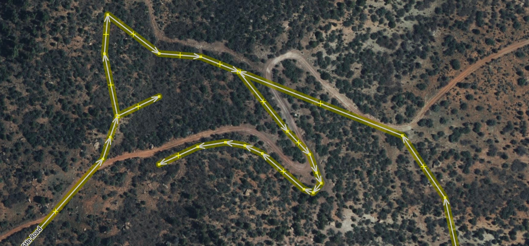
As a bonus, many of these old mine nodes have a lot of old road ways from the TIGER database, imported around the same time, see example above. If you want to spend extra time, you can clean those up while you’re in the area!
Discussion
Comment from Kai Johnson on 23 November 2023 at 17:56
Thanks for writing this up! All the old
https://wiki.openstreetmap.org/wiki/Tag:landuse=quarrynodes definitely need to be cleaned up.One tip is to look at the USGS Topo map for the area. If there’s an adit or shaft at the location (identified by specific USGS symbols), then it’s definitely a mine and not a quarry. Where the adits and shafts are still present, they can be mapped with
https://wiki.openstreetmap.org/wiki/Tag:man_made=aditorhttps://wiki.openstreetmap.org/wiki/Tag:man_made=mineshaft.If you’re feeling adventurous, you can even try to look up the mining records from the Mineral Resources Data System. Some of these records have historic information about the mine like the types of minerals that were being mined, which can go in the
https://wiki.openstreetmap.org/wiki/Key:resourcetag. And the Deposit ID can go inhttps://wiki.openstreetmap.org/wiki/Key:ref:US:MRDSto link back to the MRDS record. MRDS records are often transcribed from old handwritten documents and much of the data is missing or of poor quality. But if you dig deep enough, you may find some gems!Comment from Xvtn on 30 November 2023 at 20:51
Great write-up. I find cleaning up certain kinds of stale data really rewarding and fun. (Other types not so much.)
Comment from osmuser63783 on 3 December 2023 at 15:06
Thanks for the write-up.
I’ve noticed that there are about 800
https://wiki.openstreetmap.org/wiki/Tag:place=islandorhttps://wiki.openstreetmap.org/wiki/Tag:place=isletnodes with a GNIS tag, many apparently from the old import, where the same island is also mapped as an area. An example is here: node/357581849I’ve made a MapRoulette challenge, set to non-discoverable for now. I would welcome feedback if any more experienced mappers / MapRouletters have any thoughts on this. https://maproulette.org/challenge/42539/