
Providing visibility to the YMUP Chapter
Posted by mariotomo on 6 December 2020 in English. Last updated on 24 March 2021.YMUP
In Panamá there’s a YouthMappers chapter, at the Universidad de Panamá. This YMUP Chapter started quite late working at its visibility here on OSM, so their first activities went mostly unnoticed. They do produce quite a bit of action and boast a remarkable access to various types of resources.
My goal in this diary page is to document the groups initial organized activities, and I’m writing in English because I hope this will help reach a wider public.
who’s who
Member composition is dynamic, but a few members are sort of “resident”, definitely the two mentors María Adames de Newbill and Humberto Smith, professors at the University of Panamá. The support by Esri is also a constant, through Manuel Quintero and Jean Felix Guevara. fanny16 is possibly also part of the Chapter through Esri, I don’t know. Two other mappers closely tied to the YMUP are Karen Martínez and Martitza Rodríguez, who have been president of the chapter respectively from October 2018 to October 2019 and from October 2019 to October 2020, confirmed for one more year.
Further membership can only be inferred based on early participation to the mapathons and HOT projects. Given the logs, few of their mappers participated to mapathons in more than one calendar year. As of January 2021, according to their mentor, it’s 12 people in the group. Here an incomplete and possibly incorrect list: fanny16, Marianne_pty, Tinago, Yarilpa, Nwalachosky18, Brenda Soto, Mafe96, Angel Ortega…
blog entries
The YouthMappers International web portal has a blog link, and I’ve collected the entries related to YMUP:
the projects
It’s mostly buildings that they map, and I’m focusing on that only.
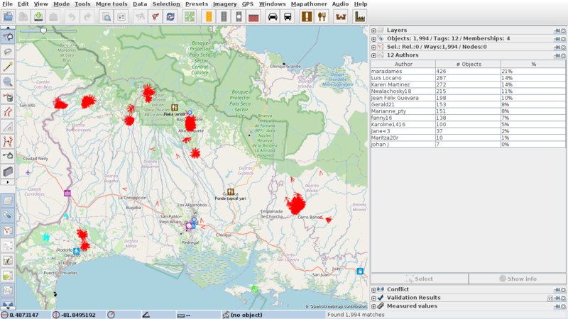
2018 - Chiriquí
This was project 4917 on HOT, and this is JOSM with the buildings edited 2018-07-01/2018-07-31:
2018 - GisDay at Nombre de Dios
GisDay is the yearly event by Esri, and YouthMappers obviously participates. In 2018 this was in minor tone, with the new mappers Milenaelizabethma, Daigeo, Génesis Yaiguili, Lati12, Maitée Oda, Melania30 and Karen Martínez as instructor. They chose a very easy place for initial mappers, a small, naturally delimited flat area, with buildings clearly delineated.
On the 13th of November they mapped 12 buildings, plus other ~30 by Karen a few days later. In my opinion what they have been missing here was GPS traces, which would have allowed them to align aerial photography more uniformly.
2019 - Guna Nega
This was some sort of emergency mapping, too bad there isn’t any HOT project associated to it, and too bad we can only read their declaration of intents in some of the changeset comments:
Los ríos cercanos a la comunidad de Kuna Nega estan totalmente contaminado sus aguas no son aptas para el consumo pero la comunidad se arriesga debido a que no cuenta con agua potable. #YMUP #YouthMappers #JovenesMapeadoresUP
A first exploration of this area was executed in the days 2019-03-20/26 by Esri associate Jean Felix Guevara and by fanny16. They focused on a central area of the settlement:
This activity took place while Esri was backing the YMUP Chapter, asking for help from the community, as you can read in this meeting report.
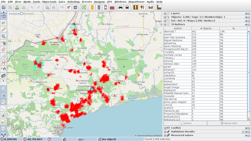
The main activity took place in the timeframe 2019-10-01/11-23, with 5 mapathons: 14th, 17th, 22nd and 25th of October, then the final peak the 13th of November:

Without a tasking manager, they could not avoid some obvious mistakes (up to three buildings on top of each other, and the inexperienced mappers produced an amount of questionable geometries). I pointed them at the issue, but after the final mapathon the group did not manage to come back to the area, so I edited them myself 6 weeks later:

Since I only merged the stacked buildings, a few absurd geometries resulted, something which triggered this YMUP review, 27th July 2020:
I hope someone will review this area, because the activity got interrupted, and in the meanwhile Maxar has updated their coverage for the area, telling us of a considerable expansion of the built up area (for license reasons: no Maxar screenshot here).

It’s a challenging area, not as flat as Nombre de Dios, more buildings hidden under the canopy, and more irregular shapes, orientation, sizes.
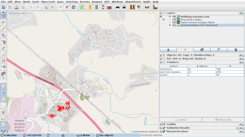
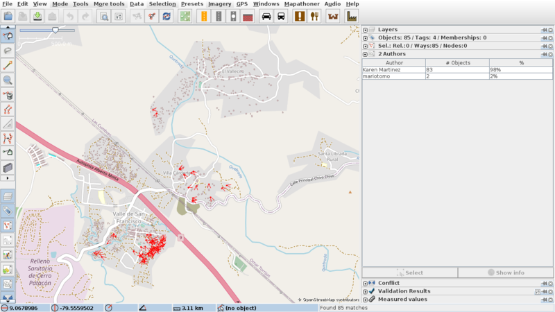
2020 - Distrito de Mariato
In the days around the 12th of October 2020 there was this activity, with very homogeneous changeset comments, mostly buildings.
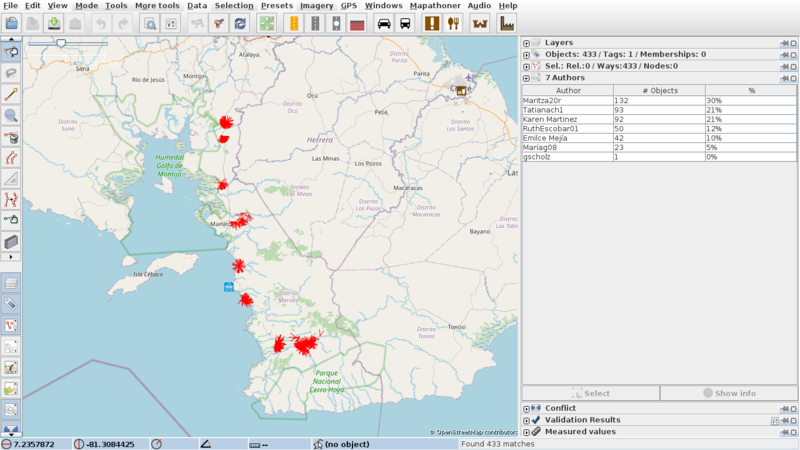
2020 - Eta
In reaction to the heavier-than-usual rainfall associated to Hurricane Eta, the YMUP has focused each of their members in different impacted areas, all in the Chiriquí Province:
The Mariato District was also impacted by overflowing rivers.
2020 - San Miguelito
this is HOT project 9844, and this attracted a record amount of mappers to Panama, around 80, while our previous daily record was below 15.
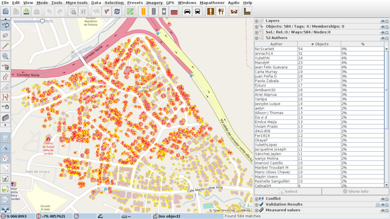
after the GisDay, we obviously needed to review the edits, which were mostly by beginners, as stated in the HOT project.
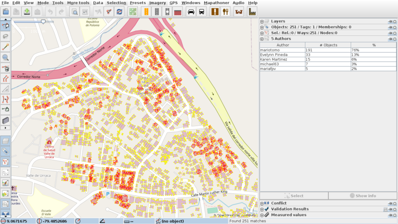
This is an ongoing project, and some of the YMUP mappers have expanded the area of activity outside the 9844 limits, which might make review more challenging. The review itself is being performed mostly by amymack, a fairly new OSM mapper, who’s quickly reached the “experienced” level on HOT. User shows no affiliation on profile page, has received invitations to join the local community, let’s see how it goes. I’ve been in contact with amymack through changeset comments, in my opinion pleasant and fruitful.

Discussion