
In the English Channel, technically outside of the UK, there are the Crown Dependencies of Jersey and Guernsey. Aside from the main island of Guernsey there are three related islands: Alderney, Herm, and Sark. I visited the latter two by ferry earlier this month.
You can find plenty of travel photos of these places, so I will try to focus on the niche topics of mapping and car-free communities.
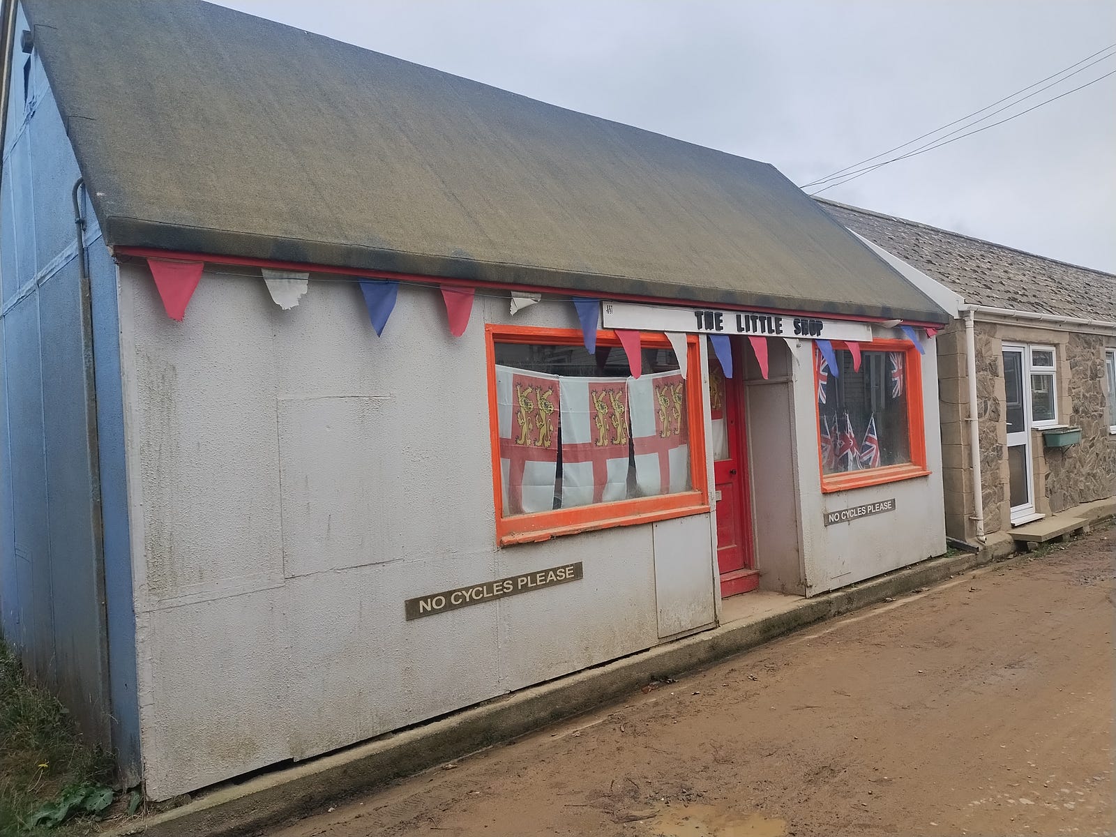
Herm is the smaller island with ~60 permanent residents. They have even banned bicycles? I had two hours and mapped a newer business and a sculpture near the quay. There is a one-person hut with a sign saying it’s their jail/gaol - I wasn’t sure if it was a joke?
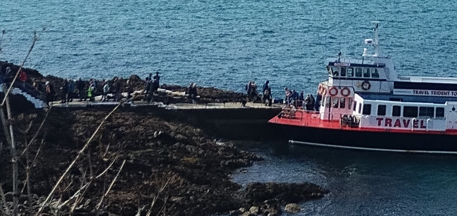
One of the boat landing sites was a bit precarious:
Sark has a larger area and population (~500), and still operates without cars. Tractors meet the boat. One pulls a streetcar ‘Tractor Bus’ up the hill. Any visit by a politician, celebrity, or royal will be sure to mention how they get from the harbor into town.
On the walking trail up that hill, there are a couple of benches which were already mapped. I’d say OSM coverage on Sark was pretty good. On the northern part of the island, there was another trail with some benches and cannons which I could feel productive adding.
Throughout town there are so many bike racks that you wouldn’t map them, in the way you wouldn’t map individual spaces in a lot. Bicycles are so prevalent, it’s common to discourage people from leaning their bikes wherever. There’s one parking area near the popular La Coupée that is strictly for carriages (added to OSM in 2012 with https://wiki.openstreetmap.org/wiki/Tag:parking=horse_and_carriage).
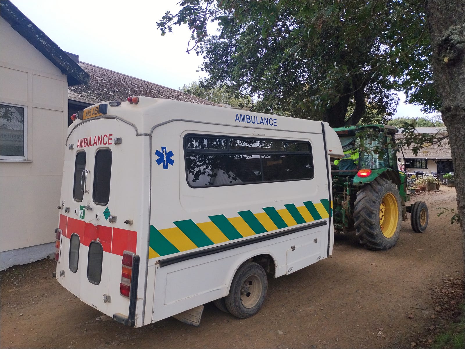
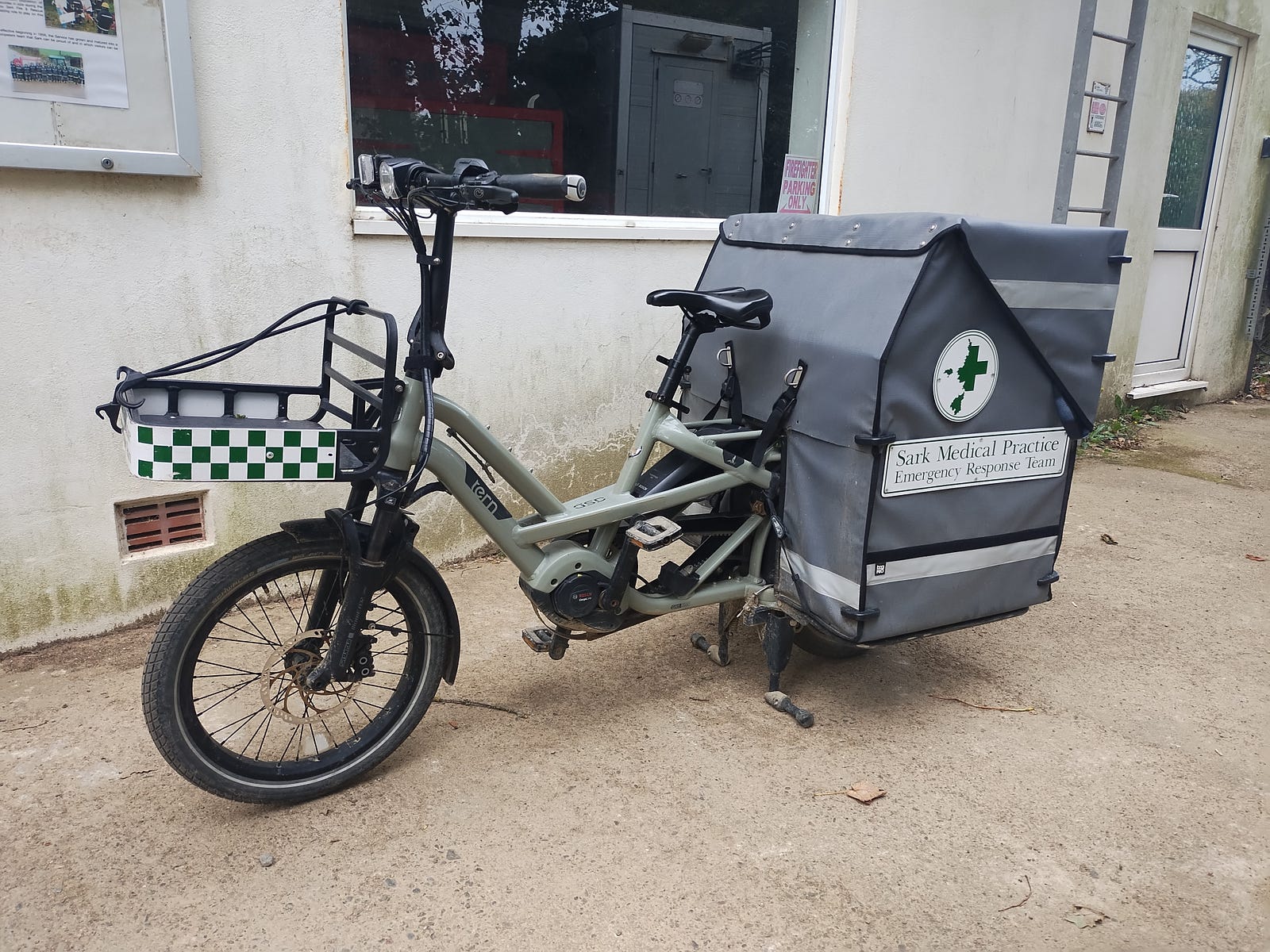
Medical staff have an ambulance trailer and a bike. The bike has a neat logo which is a mix between a green + and an island map. (Note: Sark is not part of the UK nor part of the NHS).
|
|
Welcome
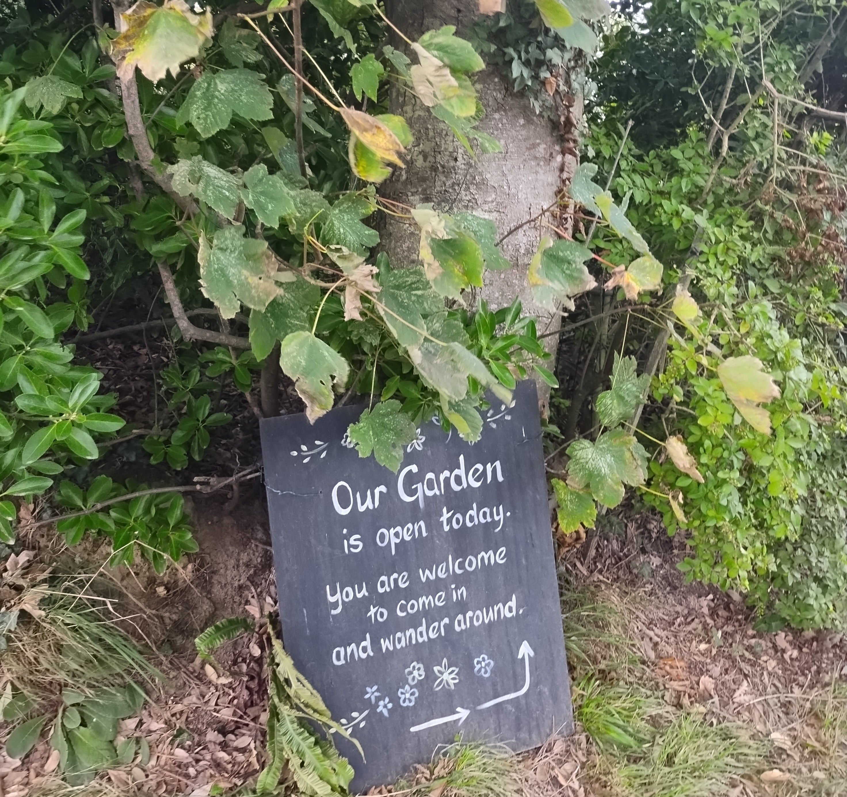
Sark embraces a tourist-friendly image of a quaint countryside on a remote island. This home welcomes people to wander through their garden:
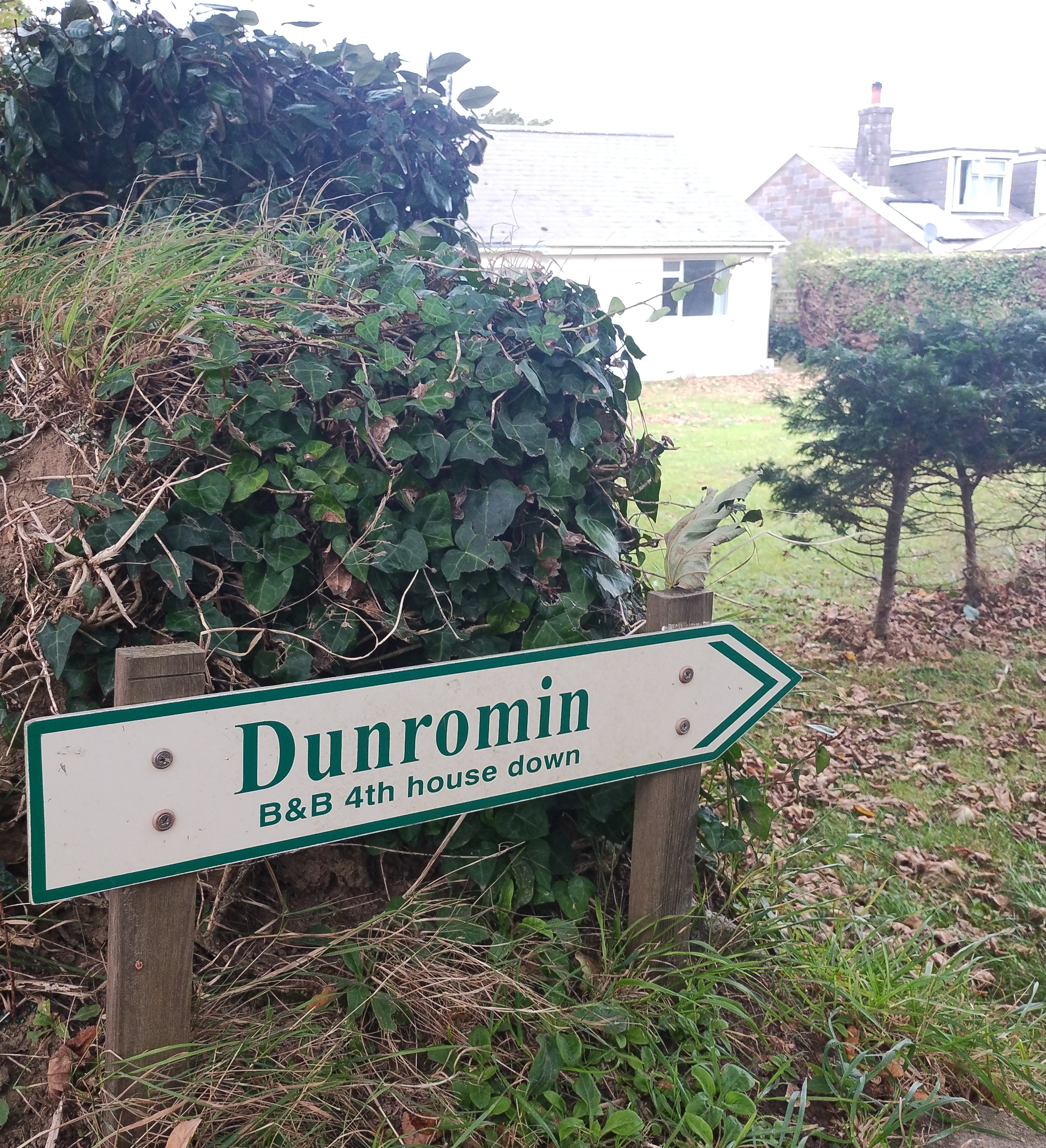
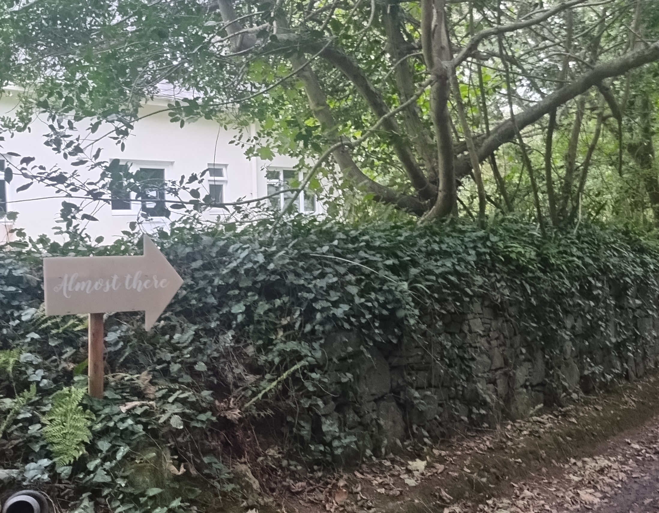
How do signs like these (one reading “Almost There”) affect addressing / wayfinding?
|
|
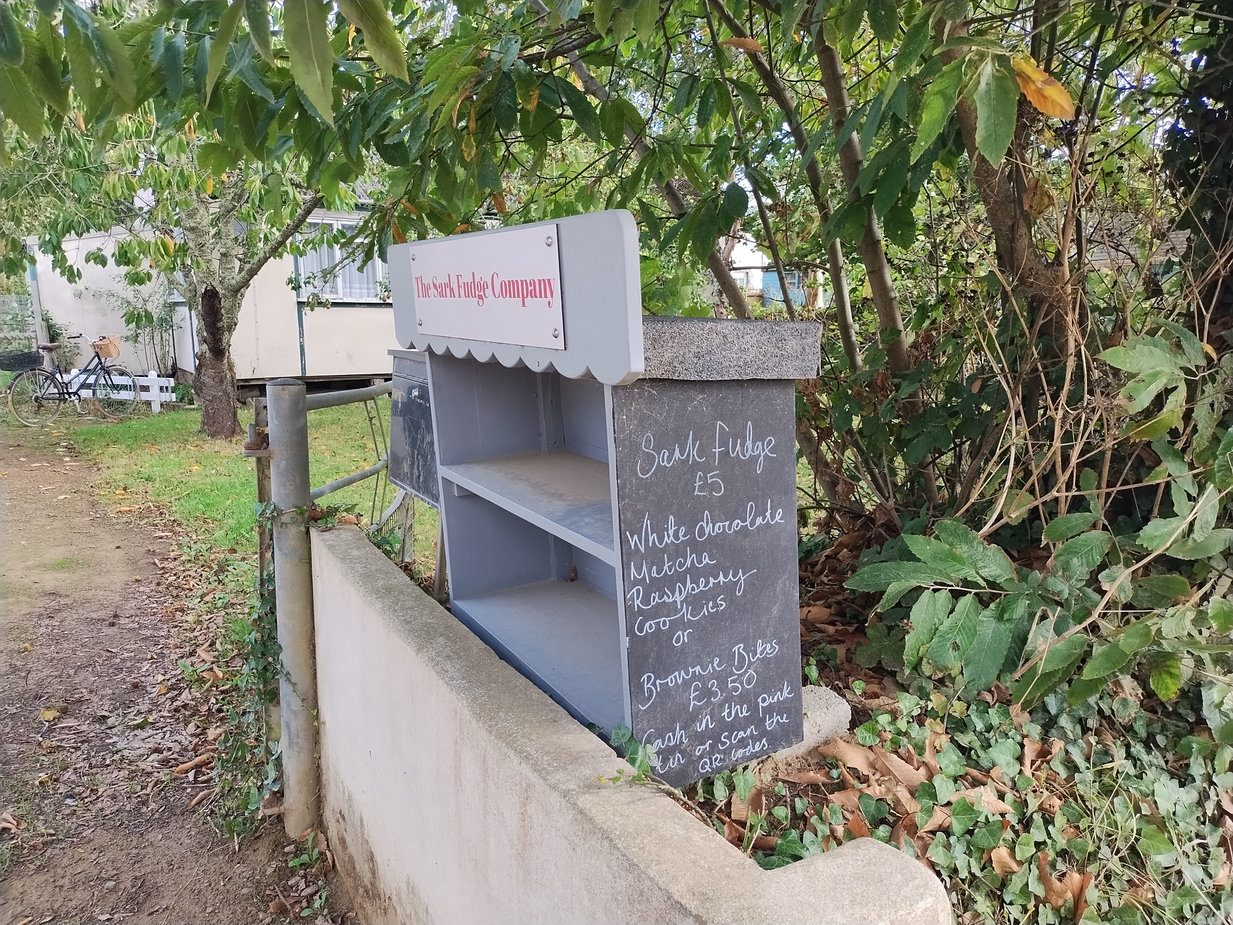
Here’s an ‘honesty box’ for fudge and other treats. Based on this thread, I followed convention to tag as a produce stand (https://wiki.openstreetmap.org/wiki/Tag:shop=farm).
It was empty, but I did snack on a candy bar from Caragh Chocolates.
Bikes are banned from crossing La Coupée. Moments after taking this photo an e-bike rushed past me and over the land bridge, even though this section of road is tagged https://wiki.openstreetmap.org/wiki/Tag:bicycle=no
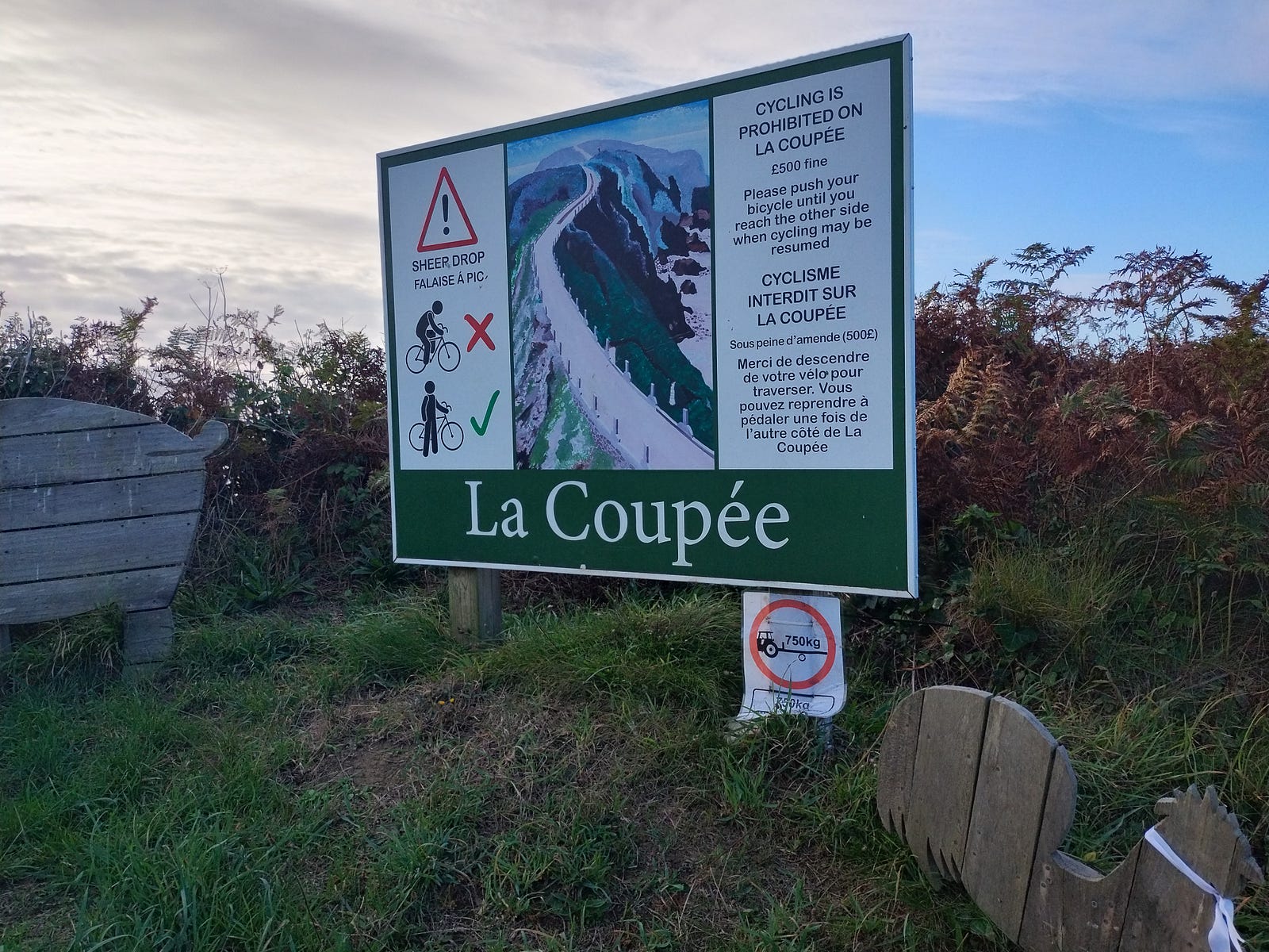
The path once had no railings and was greatly feared. Wikipedia describes children crawling and some visitors “unable to get across without shutting their eyes and being led between two persons”. Here’s a painting of it at the Guernsey Museum in Candie Gardens:

Trouble in Paradise
What are the downsides?
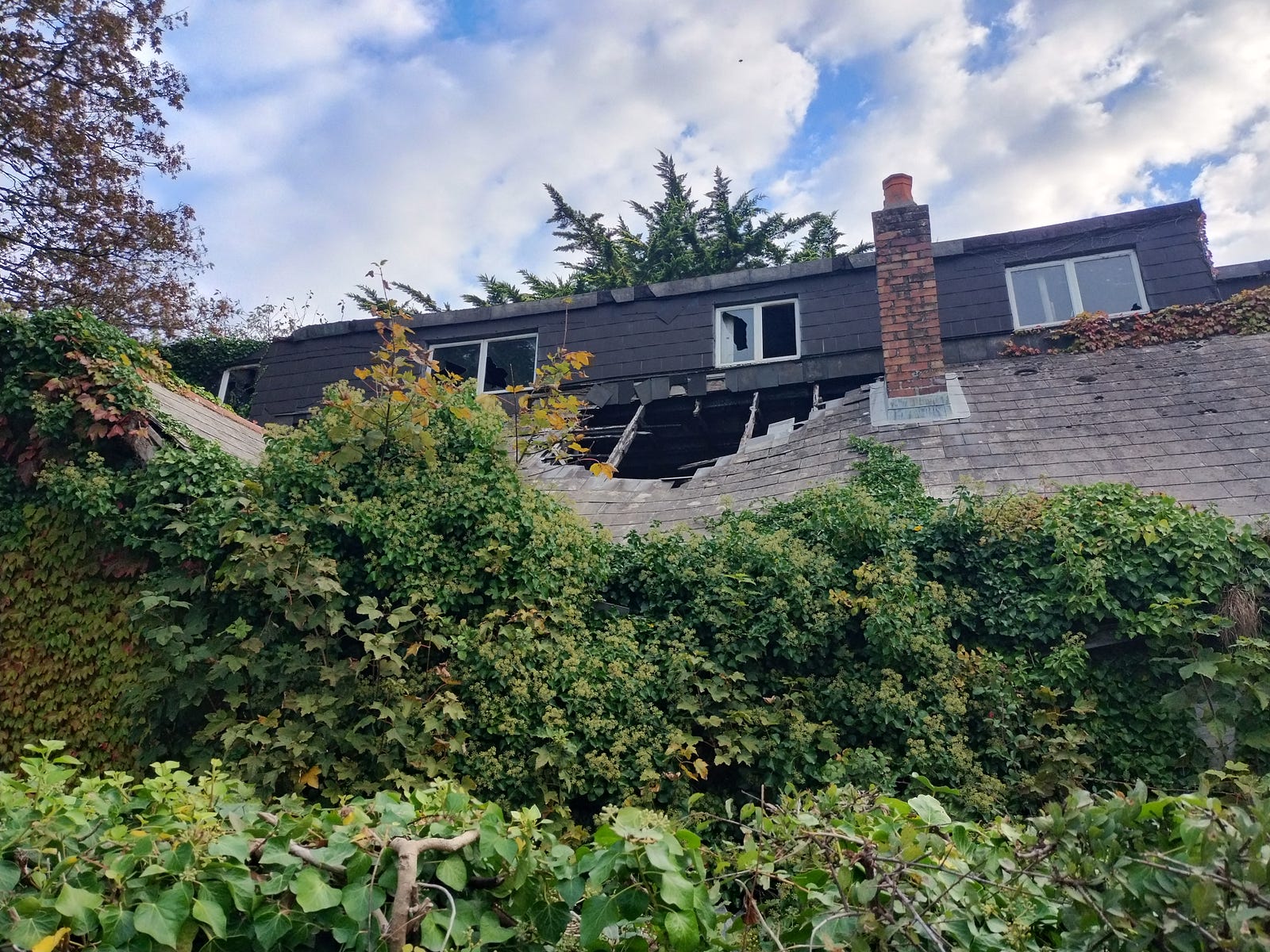
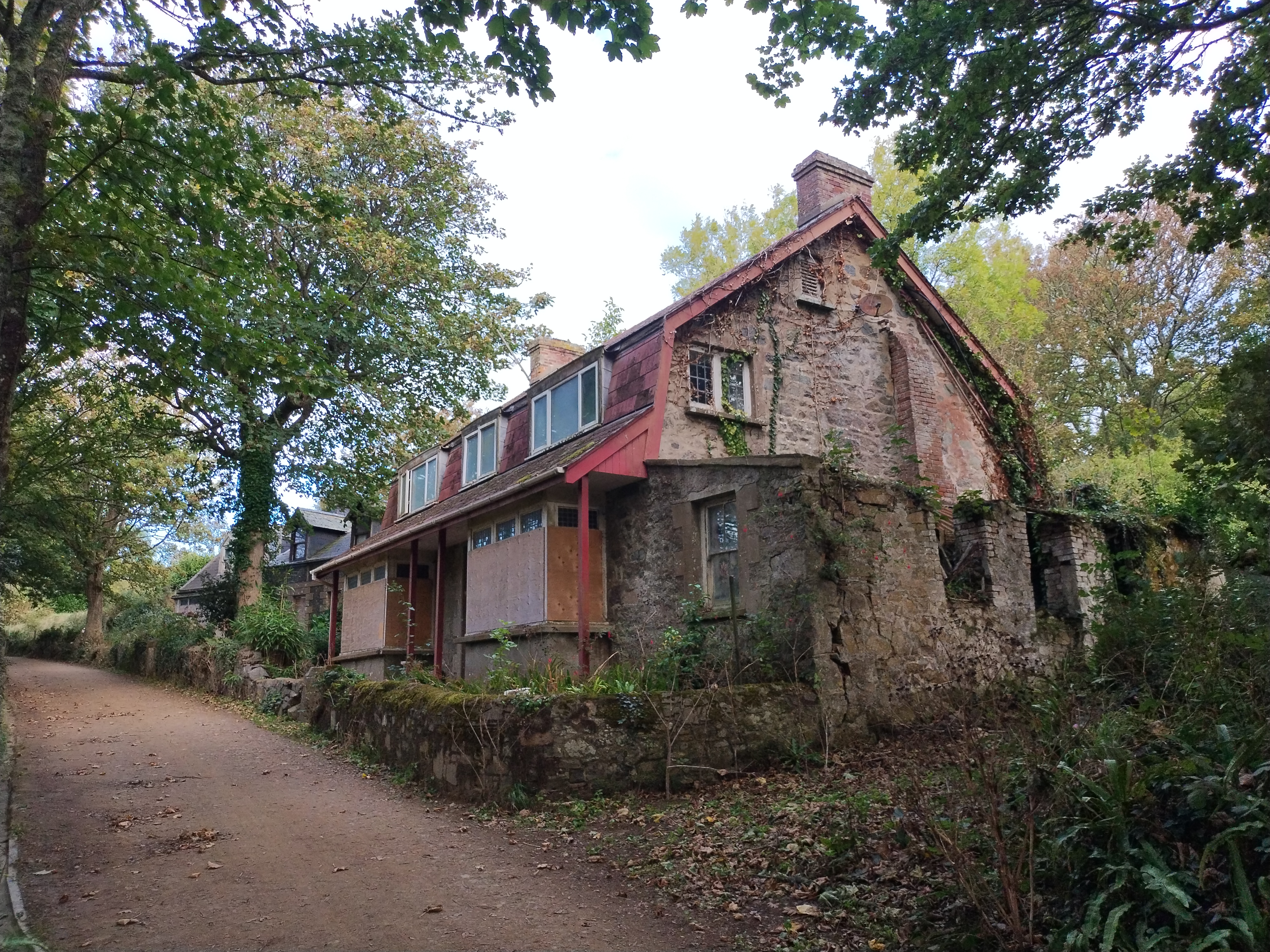
On the road you will see a few disused or decaying properties.
|
|
Some industries on Sark, such as vineyards and dairy farms, are no longer sustainable
A new governance and redevelopment plan by the Barclay brothers led to Sark’s first elections (this is the origin of the claim that feudalism ended on the island in 2008). But they failed to win over the islanders as explained in this London Review of Books article.
There are some libertarians who are fascinated with Sark’s legal status and minimal tax (“Sark: A Libertarian Paradise?”, 2022 with Swen Lorenz). In 2023 Lorenz appeared with the hereditary Seigneur of Sark at the Free Cities Foundation conference. Then they joined other investors in a cash bid for the Barclay properties on the island. That bid was rejected at the end of 2024, though they might revisit it in the future.
More recently Sark started an official TikTok https://www.openstreetmap.org/user/island.of.sark
Having taken a plane to Guernsey and ferry to Sark, both unpredictable in poor weather, I don’t see people with business in London or outside the UK relocating to Sark, especially in wintertime, unless they have an online business or would like to retire and keep up a B&B.
A professional gardener recently posted about his experience there:
3 years was long enough.. it felt like an extended holiday, a beautiful and fascinating place… but all a bit fucked up
my weird Sark connection
Sark’s ISO code 🇨🇶 was recently added to the Unicode’s RGI list so you should see it as an emoji on many devices. I nudged the UTC to add Sark to the CLDR regions in 2023, and had to pester them the following year about RGI. As exciting as it is to play a part in a new emoji, most normal people derail on the concept of a new emoji being created, or there being a deep voluntary bureaucracy. So I did not ask around, just let it soak in and picked up souvenir maps from the tourist info center.
Discussion
Comment from Firefishy on 28 September 2025 at 08:47
Thank you. Enjoyed reading about your Sark mapping adventure.