
OSM Benin mapping experience through HOT Microgrant
Posted by luckpogbe on 23 August 2018 in English.Benin OpenStreetMap community
Benin joins the OpenStreetMap global open source mapping community in 2013 at an OpenStreeMap awareness workshop organized by an international HOT volunteer serving in Togo.
Benin OpenStreetMa is a young volunteers community who conduct digital and free mapping activities. We have been carrying out voluntary activities to promote OpenStreetMap project to NGOs, international organizations, local authorities, academics, etc. or at local conferences. We organizes open and complete openstreetmap mapping parties via voluntary projects (Cotonou mapping and University of Abomey Calavi, Parakou city, Porto Novo etc.), remote data production with satellite imagery and field data collection. Mapathons are also organized with West African OSM communities and the global OSM community. In a context of limited logistical, financial and human resources, as well as a certain general ignorance of Open Data, each activity becomes a voluntary and passionate commitment.
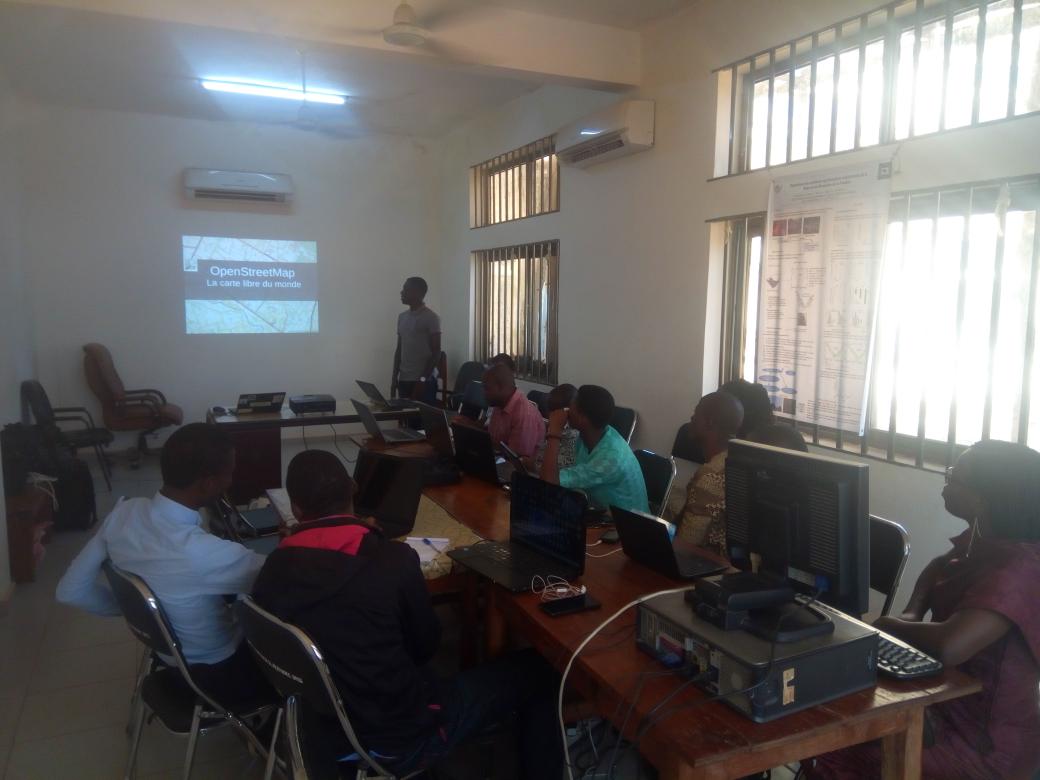
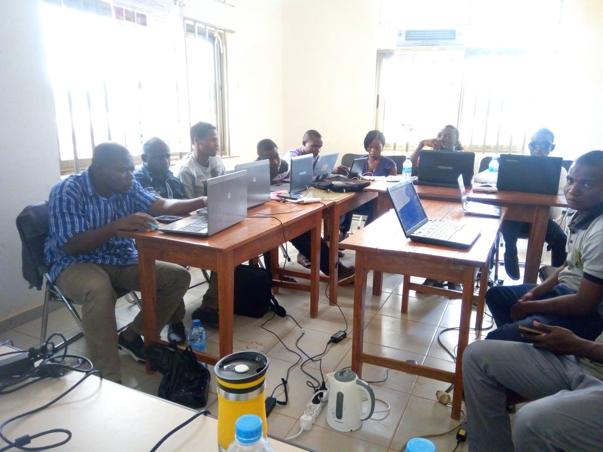
Since our inception, we have participated in several awareness and training activities in OpenStreetMap mapping and open geomatics in Benin and West Africa. These capacity building workshops are supported by the Direction de la Francophonie Économique et Numérique (DFEN/OIF) and implemented by experts from the Association les Libres Géographes (LLG) in collaboration with the Association Projet Espace OSM Francophone (EOF Project) and sister communities in West Africa. 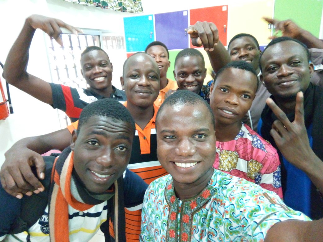 ## Benin territory
Benin is a West African country, covering an area of 114 764 km2 and located between coordinates 9° 30’ N and 2° 15’ E. Benin is a privileged tourist destination in the sub-region. But unfortunately this territory remains little known by the authorities and by all Beninese, because it remains very little mapped. The little existing cartographic and GIS data are not open to the populations, these data remain under the only responsibility and availability of the authorities in charge of these institutions. This is one of the reasons that motivates us to work more to make the basic map of Benin under OpenStreetMap very well mapped and open to everyone. This is how we conduct awareness and training activities in OpenStreetMap digital mapping.
## Microgrant activities running
In our various activities of promotion of the OpenStreetMap project we are confronted with difficulties especially financial, since we do not have an operating budget, the members contributed on own fund to carry out activities. This don’t help us from having more impact through our actions. This year we have the chance to be accompanied by HOT through its Microgrant program. Our abjective this year through this support is to map the border regions of Benin, especially the northern parts of the territory. These regions are very little mapped, little known by health authorities. It should be noted that these regions are areas at risk for cross-border diseases, this is due to transitions and migrations. We therefore want to map these regions in order to allow health authorities to have a better knowledge of the territory, and be able to react effectively in the event of crises or epidemics. Beyond mapping cities, our goal is to train young people in these regions to use OpenStreetMap, so they can continue to map and update the base map of their regions. Through microgrant, we were able to acquire smartphones for field data collection. At the halfway point, we have already done fieldmapping, training workshops and data creation. We have already finished mapping Tanguieta and added the points of interest click here. Tanguieta is a city located in Northern Benin. Now we are mapping task on Porga, a border town with Burkina faso.
![fieldmapping] (https://pbs.twimg.com/media/DjL6o3zWsAAmp7h.jpg)
## Benin territory
Benin is a West African country, covering an area of 114 764 km2 and located between coordinates 9° 30’ N and 2° 15’ E. Benin is a privileged tourist destination in the sub-region. But unfortunately this territory remains little known by the authorities and by all Beninese, because it remains very little mapped. The little existing cartographic and GIS data are not open to the populations, these data remain under the only responsibility and availability of the authorities in charge of these institutions. This is one of the reasons that motivates us to work more to make the basic map of Benin under OpenStreetMap very well mapped and open to everyone. This is how we conduct awareness and training activities in OpenStreetMap digital mapping.
## Microgrant activities running
In our various activities of promotion of the OpenStreetMap project we are confronted with difficulties especially financial, since we do not have an operating budget, the members contributed on own fund to carry out activities. This don’t help us from having more impact through our actions. This year we have the chance to be accompanied by HOT through its Microgrant program. Our abjective this year through this support is to map the border regions of Benin, especially the northern parts of the territory. These regions are very little mapped, little known by health authorities. It should be noted that these regions are areas at risk for cross-border diseases, this is due to transitions and migrations. We therefore want to map these regions in order to allow health authorities to have a better knowledge of the territory, and be able to react effectively in the event of crises or epidemics. Beyond mapping cities, our goal is to train young people in these regions to use OpenStreetMap, so they can continue to map and update the base map of their regions. Through microgrant, we were able to acquire smartphones for field data collection. At the halfway point, we have already done fieldmapping, training workshops and data creation. We have already finished mapping Tanguieta and added the points of interest click here. Tanguieta is a city located in Northern Benin. Now we are mapping task on Porga, a border town with Burkina faso.
![fieldmapping] (https://pbs.twimg.com/media/DjL6o3zWsAAmp7h.jpg) 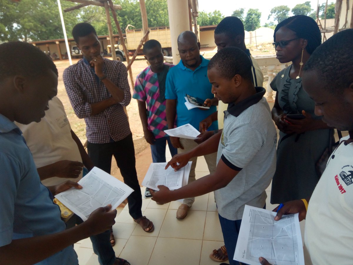
Upcoming activities?
For the future, we plan very soon to organize training workshops for girls, this will increase the number of girls in our community. We will also continue mapping the border areas of northern Benin through the Mapathons. We will organize them in collaboration with the young people we trained in Tanguieta. This will increase data creation. Data will be used by NGOs, humanitarian and research organizations, such as the Red Cross, IRD and others…for better coordination of actions in the field. ## Thanks to HOT for the support! We thank HOT for the support to OpenStreetMap communities in open data creation and promotion programs. We are therefore grateful to HOT for the support we have received this year. We hope next time to have chance to benefit from HOT another communities development programs. For example, we would like to be equipped with computers, which will facilitate training and data creation in rural areas, where most young people cannot afford computers. These computers will therefore be used during training and mapathons by people who do not have computers yet remain motivated to learn OpenStreetMap and participate in the creation of open geographic data for all. Thanks again to HOT for supporting us, HOT “a wà nû”!!!
Discussion