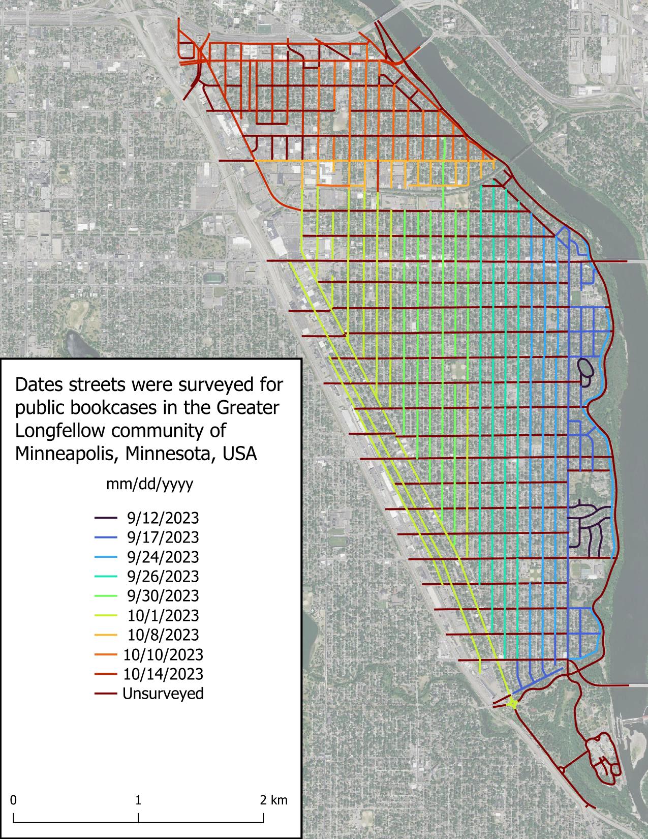
I surveyed most of Seward’s avenues today, but what I’m most excited about is having finished surveying the three streets I was least excited about (9th St S, Franklin Ave E, and Minnehaha Ave S), leaving calmer streets for the rest of the project.
Unsurprisingly, I found few public bookcases (PBs) today. I believe this is due to the non-single family home nature of the roads surveyed, and in the roads lined with single family homes, the economic conditions of the inhabitants.
Shoutout to the Feminist Book Club for being the only non-residential entity (witnessed so far) to host a PB.
Discussion
Comment from MxxCon on 15 October 2023 at 17:38
I don’t know how common these are in your area, but there’s also https://www.littlefreepantry.org/ So just because you see a small shelf/cabinet on a stick, doesn’t always means it’s a “library”. Maybe it’s worth double-checking it’s functionality.
Comment from gvwaal on 16 October 2023 at 04:21
In most cases, the PB faces the street and has a transparent door, so there’s no mistaking a PB for a public pantry. For the rare PB not facing the street, I view the front of the PB to determine whether it’s a Little Free Library or a PB. The two public pantries I’ve seen so far were obviously not PBs and were accurately labeled by the owner.