
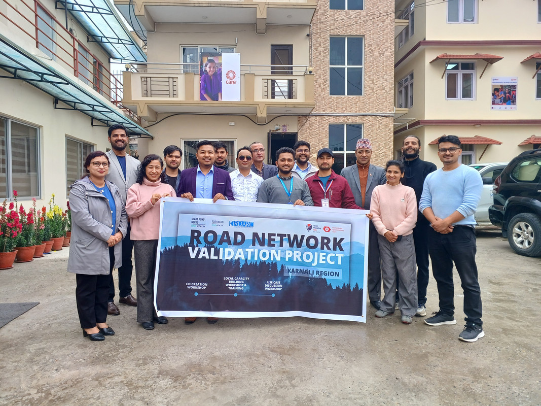
Co-Creation Workshop for Road Network Mapping in Karnali, Nepal
Posted by frozenrabi on 31 July 2025 in English.Co-Creation Workshop for Road Network Mapping in Karnali, Nepal
Date: 28 March 2024
Title: Planning & Co-Creation Workshop on Mapping Road Network of Karnali
Venue: Care Nepal, Sanepa
Organizer: Open Mapping Hub Asia Pacific
Led By: Rabi Shrestha, Sr. Field Mapping Expert & Prajwal Sharma, Jr. Field Mapping Expert
The rugged terrain of Nepal’s Karnali Province tells a story of resilience, isolation, and untapped potential. As the only province where road access remains severely limited—particularly in districts like Jumla—the need for a comprehensive and accurate road network is more urgent than ever. With this in mind, a collaborative Planning and Co-Creation Workshop was conducted to collectively address the challenges, gaps, and opportunities for mapping the road network of Karnali through open-source tools and community engagement.
Setting the Stage: Opening Remarks and Partner Introductions
The session opened with warm words from Pramila Madam of Start Fund Network(SFN), who thanked participants for their presence and encouraged open sharing. This sentiment was echoed by Niroj Sir (Forewarn) and Govinda Sir (KIRDARC), who emphasized that road infrastructure is the foundation for development in Karnali. “Reaching the unreached” is KIRDARC’s mission—and mapping roads is a critical part of that, says Govinda Sir.
Govinda Sir further highlighted the urgent need for reliable road infrastructure, citing heartbreaking examples where a lack of roads has led to preventable maternal deaths during childbirth. The Human Development Indicators (HDIs) in Karnali are among the lowest in Nepal, and improving road connectivity could be a catalyst for improving access to health, education, and livelihoods.
The Power of Open Mapping: HOTOSM and Project Introduction
Rabi Shrestha, representing Humanitarian OpenStreetMap Team (HOTOSM) and the Open Mapping Hub Asia Pacific, introduced the broader vision of open mapping for humanitarian and development work. HOTOSM supports 25 priority countries across Asia, focusing on community-driven mapping initiatives that serve real-world needs.

Rabi explained that unlike proprietary mapping services, OpenStreetMap (OSM) is community-owned. The project for Karnali began with remote mapping and validation of three districts: Jumla, Kalikot, and Mugu. Tools like Field Mapping Tasking Manager (FMTM), and platforms like explore.hotosm.org, were showcased to guide participants in mapping, validating, and understanding Data Quality Indicators (DQI).
Local Realities: Mapping Challenges on the Ground
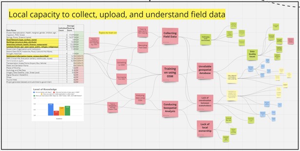
Resham Sir (KIRDARC) shared detailed insights into the poor data quality of road maps in Karnali. Inconsistent tagging, unmapped new roads, and disconnected networks pose major challenges to navigation and planning.
He emphasized that a lack of field validation and community engagement results in poor-quality data. Many places have multiple names, or map entries differ from local names. Sparse populations, cultural gaps, and harsh terrain make field verification difficult but not impossible—with the right model and incentives.
Understanding OSM: Tools, Governance & Community
Gaurav from People in Need(PIN) delivered a primer on OpenStreetMap, explaining its distinction from corporate platforms. He highlighted the value of OSM tools such as Kobo Toolbox, ODK, OSM Tracker, Organic Maps, and Mapillary which are essential for both data collection and quality assurance.
He reinforced the importance of open data and contributing to it for the greater good. He added collaboration with institutions like the Department of Water and Sanitation could improve the richness and usability of the datasets.
Voices from the Field: Real-World Experiences
Upendra Sir (Naxa)
Sharing his journey of field mapping in Humla, he reflected on logistical and emotional challenges. Female mappers faced cultural and physical challenges, including periods, homesickness, and communication barriers in areas without mobile networks.
Upendra emphasized the importance of providing technical training, field-ready tools, and supportive environments, especially when including women in remote data collection missions.
Biplob Sir (WFP)
From a humanitarian perspective, he shared that lack of spatial data hindered effective disaster response. Relief teams often received calls from unknown villages that couldn’t be located on any map.
WFP tackled this by creating the “Trail & Community Infrastructure Mapping” project. Seven districts were mapped and digital basemaps were handed to local units. However, sustaining and updating these maps remains a challenge—underlining the need for continuous community involvement and government backing.
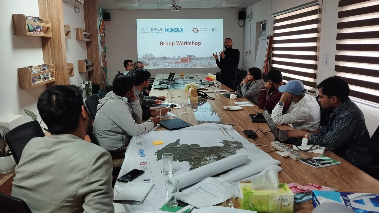
Group Discussions and Shared Vision
Participants divided into two groups to discuss data issues, usage, and needs. They stressed the importance of data-sharing between agencies, reducing duplication, and integrating layers like Digital Elevation Models (DEMs) and land use data from sources like ICIMOD.
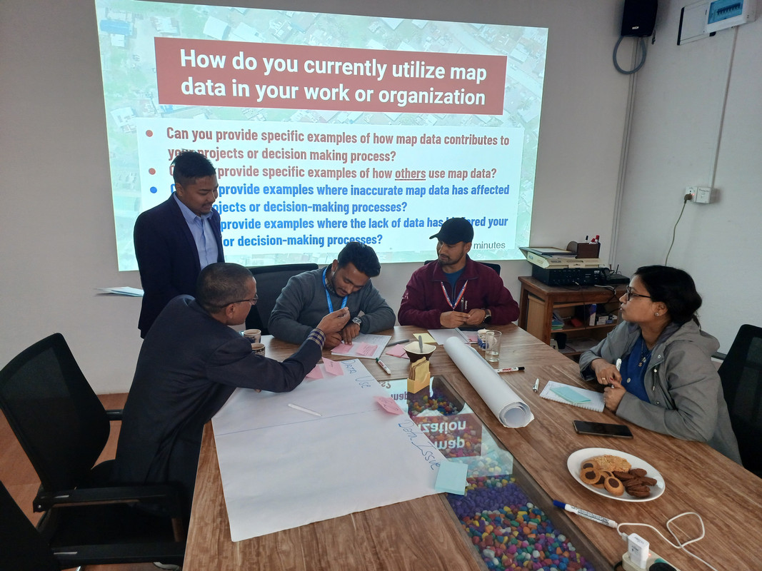
Questions arose about integrating census data with OSM, and defining key terms like “evacuation center” to create more meaningful survey forms.
Planning for the Field: Practical Considerations
Before conducting field surveys in Jumla, participants identified critical factors such as:
- Weather conditions (especially pre- and post-monsoon periods)
- Local holidays (like Nepali New Year)
- Accessibility (no flights or vehicles in some areas)
- Logistics (warm clothes, power banks, leech protection, etc.)
- Network limitations (suggested using both NTC and NCELL SIMs)
Road Ahead: Prioritized Pilot Areas
The pilot mapping will begin in the following areas:
- Kanakasundari Rural Municipality – Prioritized due to its high budget allocation for road development.
- Gutichaur Rural Municipality – Offers a mix of plain lands and mountainous terrain, suitable for comprehensive mapping.
- Shubhakalika and Tila Gufa Municipalities – These areas already have field data available through KIRDARC, which can aid in validation.
Final Reflections: Building a Community of Practice
Gagan Singh Bist from Midwestern University closed the session with an optimistic outlook, expressing willingness to support the project through manpower and expertise. “Workshops like this,” he noted, “are stepping stones to data-driven decisions that improve lives.”
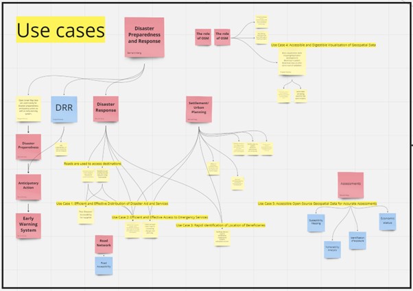
USECASE
Conclusion
This co-creation workshop wasn’t just a meeting—it was a movement toward putting Karnali on the map, literally and figuratively. Through open mapping, community collaboration, and thoughtful planning, the dream of better roads, better data, and a better future for Karnali is no longer out of reach. It starts with a map—and it grows with the people who care to draw it.
 —
-Rabi Shrestha
—
-Rabi Shrestha
Discussion