
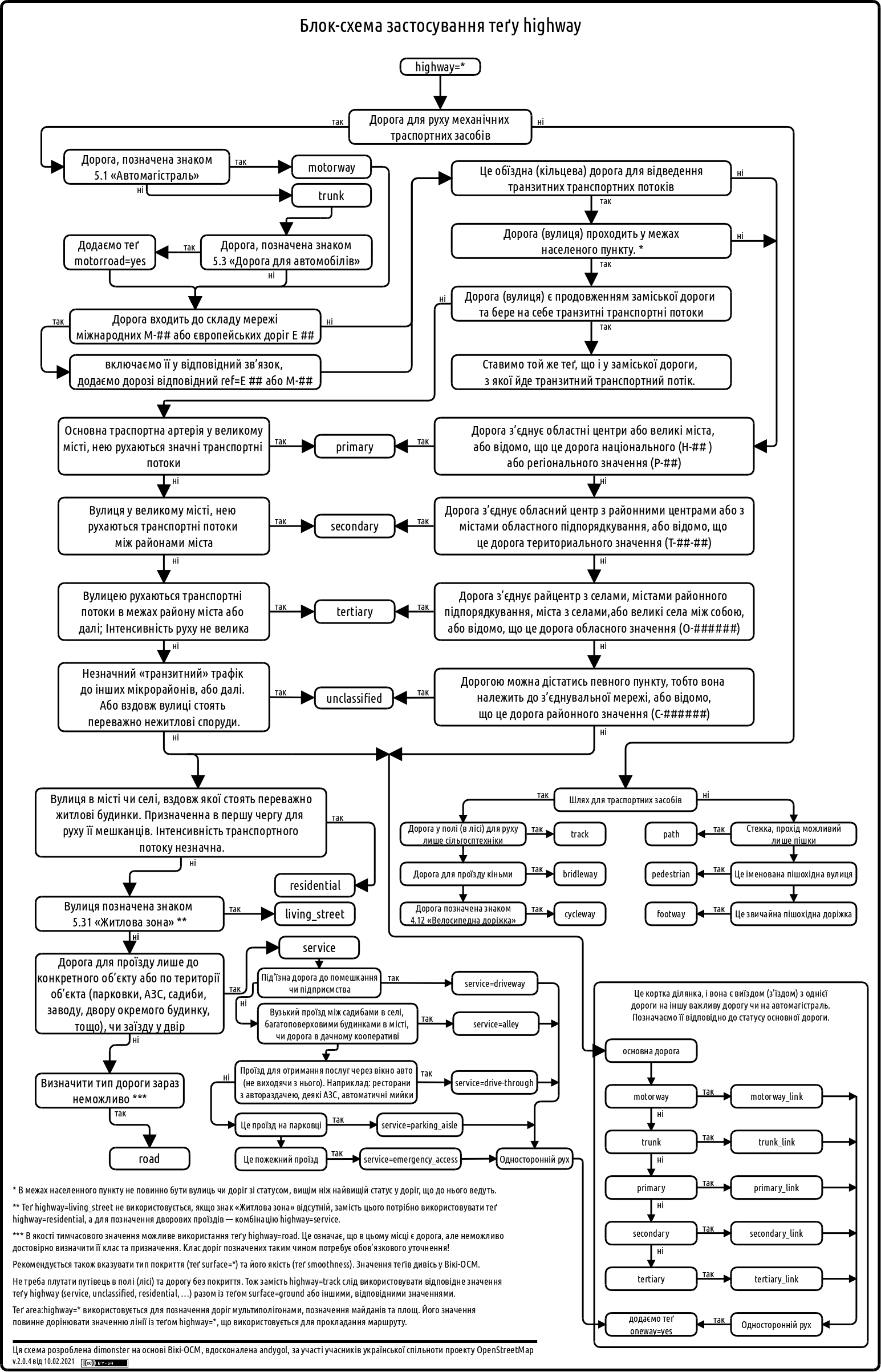
Following a suggestion by @andygol, I decided to refresh the Highway Tag Usage Scheme used by the Ukrainian OSM community. The original work on this scheme began back in 2013 — see the discussion in the Highways of Ukraine topic. I’d like to share the progress made so far and invite the community to contribute further improvements.
Previous version:
New version:
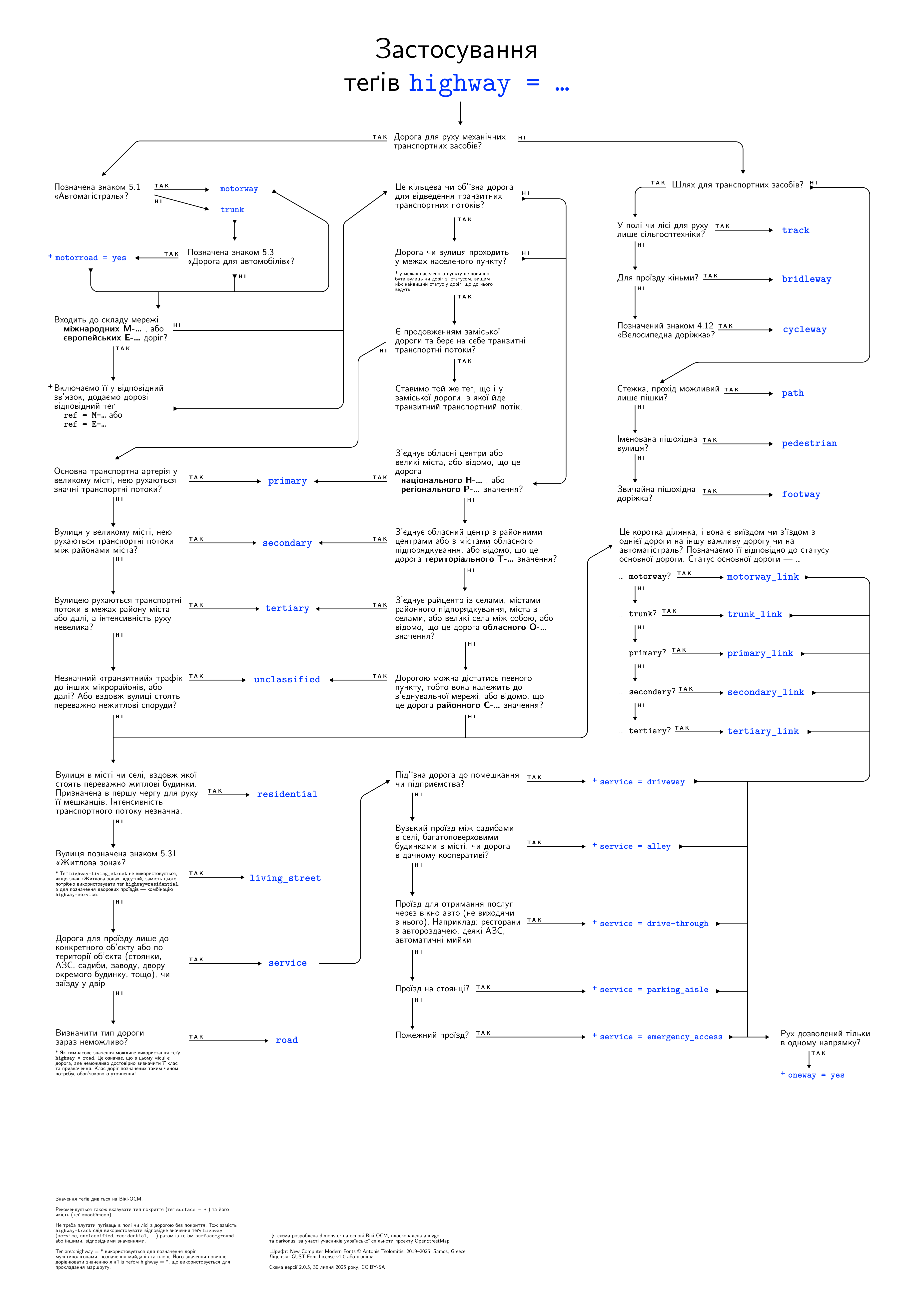
This update is mostly a visual redesign of the scheme. I’ve also slightly refined some of the wording in Ukrainian. The core structure and the logic of how road types relate to each other remain unchanged for now. However, I’m open to suggestions if anyone sees opportunities for improvement.
The scheme is available in PDF, SVG, and PNG formats.
If you have feedback or ideas, please join the discussion here: https://community.openstreetmap.org/t/highway/133408
Discussion