mapping thatched buildings
Posted by b-unicycling on 6 July 2022 in English. Last updated on 12 July 2022.I’m preparing a video tutorial on thatched buildings - it’s dead simple, but it’s an interesting topic, I thought. So I was doing a bit of research trying to learn something about local thatching traditions and came across a 1994 survey by - it turns out - a thatcher. I only came across one volume which is basically a photo album of 106 thatched buildings in Co. Kilkenny with handwritten captions given the location. Location being in most cases the townland. But because it is handwritten and because this is Ireland, I have not been able to identify all the townlands.
What I’m doing now is trying to find the townland and trying to identify the building. Most times, if there are other buildings in the picture, it is possible to spot them in the townland by comparing the arrangement of buildings. Luckily, most buildings in Co. Kilkenny are mapped thanks to our #osmIRL_buildings project. And luckily, those are mostly old buildings, so I don’t have to worry about them being built since 2019. The National Index of Architectural Heritage is somewhat helpful in that they have indexed some of those buildings, but not all. They have a map where you can find a blue dot for those marking the spot. However, they are not always correct. They also have pictures of those buildings (sometimes also the wrong ones) which I can compare to that survey/ photo album. Sometimes, rarely, because those are very rural areas, I have mapillary to work with.
If they are not too far away and accessible for a non-driver like me, I’ll go and check them out in situ, take mapillary and a photo or two for Wikimedia. #OpenData, baby!
You can kind of see on Esri World Imagery (Clarity) Beta, whether it is thatched or a slate roof, because the thatched roofs have smoother corners and the colour is a bit different.
When I think that I have positively identified one, I add roof:material and wherever I have that information, building:levels and roof:levels (only if I get a gable view or there are dormer windows) and ref:IE:niah and wikimedia and mapillary links. This will result in a much better machine readable database than NIAH, hopefully.
Future/ possible extra keys
I would like to also add thatch:material, but I can’t tell from the photos (yet), and it isn’t an established key (yet).
It would also be interesting for someone interested in vernacular architecture to record since when those buildings are thatched, because some are recently built or only recently re-thatched after having had a different roof material for decades or longer. They are not as much affected by the necessity to source the material locally as was the case a hundred or two hundred years ago.
Some are also no longer thatched; maybe I should use https://wiki.openstreetmap.org/wiki/Tag:was:roof:material=thatch, even better with a life cycle tag.
What can be learned?
Even when trying to locate the townlands, I got the impression that the few remaining thatched buildings are concentrated along rivers. That makes sense, because that is where the material used to be grown. (Not any more thanks to climate change and pollution - it now has to be imported from Turkey.)
Strangely enough, there are no old thatched houses along the main rivers. I presume this is because of the human intervention in straightening them and messing with the soil around them, so that the material couldn’t be grown there.
Side effects
-
While trying to identify the building, I have come across unmapped buildings that were overlooked during the #osmIRL_building task for Kilkenny. Some are not mapped neatly, so I can go and fix that.
-
While trying to locate the building on the NIAH map, I have found mistakes in their location where the alignment of buildings does not match their image and mine. I can report those to the NIAH, and hopefully, they will fix it. I think that they only survey every 10 years, so that is how long it can take them (if they discover that mistake) to fix it.
-
I’m filling the newly created Wikicommons category Vernacular architecture in Ireland.

Curious?
Here’s an overpass-turbo query of the buildings and the main rivers in Co. Kilkenny (I had to create relations for quite a few of them, too).
I’m using the hashtag #thatch for those changesets.
#rabbithole
Discussion
Comment from DeBigC on 7 July 2022 at 12:49
First of all, what an awesome diary post. There are lots of educational take-aways in it from a point view of the locations, materials and information resources.
Of course #osmIRL_buldings will have missed new buildings, but if it has missed older buildings it is due to mistakes by the mappers or poor clarity.
As regards the NIAH source thank heavens someone has the engagement to challenge the received mapping in it, which I know isnt wrong, but may not be detailed or accurate as you say.
Comment from SK53 on 9 July 2022 at 19:33
I know a (retired) thatcher, I’ll ask him about material.
I suspect it’s more about expense than climate change. It’s still described as Norfolk Reed in the UK & there are plenty of reed beds, but I think reed (Phragmites) was always the higher quality thatch, and many would have thatched with straw, or even sedges.
The range of thatching materials is significant because thatch is widely used elsewhere in the world. I’ve always wondered what plants thatch is sourced from in Lesotho, and whether we are mapping such resources & paths/tracks to access them.
One oddity of thatched buildings is that, as you say, from above they have rounded corners (although it may depend a bit on thatching style). Perhaps they could be rendered with a small positive buffer.
Devon is the main place I’ve observed lots of thatched buildings whilst mapping, but I know of a few in East Anglia, and a pub in Devon with thatched ‘umbrellas’ for outdoor seating.
Comment from b-unicycling on 10 July 2022 at 10:14
Very cute umbrellas. About the material, I have talked to a friend who works in the Heritage Council, and she said that the thatch (probably reeds) growing along the River Shannon is useless now.
I have contacted a thatched in the area and will hopefully learn more about materials etc.
Re Devon: I remember reading and translating a book about rural architecture in England “Traditional Houses of Rural Britain”. I really liked it, it’s all about how their styles differ because of the different local materials at disposal to the builders.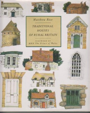
Re mapping roof shapes: I think we’re supposed to map footprint. It’s a different story for 3D mapping, of course.
Comment from SK53 on 10 July 2022 at 13:50
Apparently there are some left on the Shannon.
I have a vague recollection of Marek Strassenburg-Kleciak (perhaps at SotM-Baltics in 2013) talking about how OSM largely mapped not the footprint, but the birds-eye roof profile. I know people have mapped things like flying buttresses of cathedrals as ground level profiles (at least in part because these are available through things like the French cadastre, or OOC maps in Britain), but even if ground-level is the standard many buildings will not be mapped that way.