Fixing the Austrian-Italian border between North and South Tyrol
Posted by Zeno Kugy on 14 June 2021 in English. Last updated on 15 June 2021.I use to explore and map the area on the border between North and South Tyrol, and I have noticed that part of the border between Austria and Italy is wrong in openstreetmap. I noticed the error, because some abandoned Itallian military infrastracture had moved into Austrian territory.
Here is an example (before fixing):
 I know that the house with the geodetical tower is in Italy. The boundary stones are located some meters northern. The border between North and Tyrol runs on the watershed, so the border is exactly on the Sandjöchl Pass.
I presume that all these mapping errors where caused by someone using the South Tyrol Topomap the wrong way (here after fixing):
 On the South Tyrol Topomap a bold line between the gray and white area has been interpreted as the border, but actually the border is the line between the white and the yellow area (at least in this track).
On the basemap.at layer, below, the border is marked in a better unmistakable way (here after fixing). I am now correcting the border, based on it and confirmed by my surveys. I invite others to verify the situation of the border in their area.

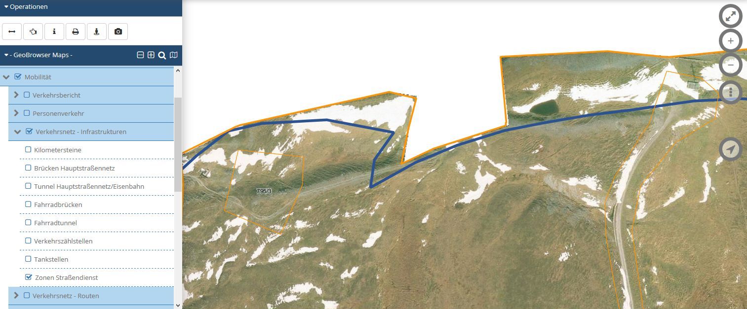
I tried to find out what that wrong border line in the South Tyrol Topomap is. By checking on the GIS of the province Bozen/Bolzano (https://maps.civis.bz.it), it turns out to be the border of “Zone Strassendienst” (road maintenance area) not the national border.
If you cannot see the pictures, here are them all together: https://serbidiola.tumblr.com/post/653951993460785152/hiking-and-mapping-in-sandj%C3%B6chl
Discussion
Comment from tyr_asd on 15 June 2021 at 19:11
Nice find and thanks for the fix!
My guess would be that both the road maintenance area and the originally imported data from OSM are based on the same outdated/imprecise border data. Probably the boundary dataset from ISTAT (Italy’s national statistics agency) – I just checked and they still seem to have this “bug” in their data set even in their 2021 release.