Udarian's Comments
| Changeset | When | Comment |
|---|---|---|
| 174915856 | about 1 month ago | this adds a duplicate node |
| 174842383 | about 1 month ago | this is inside of way way/1435702828 , since this is no longer under construction, can you please check the rest of the construction site area linked above to see if the other roads tagged as under construction are under construction any longer and update the alignments as best you can of those roads. Happy mapping,
|
| 174837499 | about 1 month ago | whats you source for this? |
| 174837586 | about 1 month ago | whats you source for this? |
| 174743442 | about 1 month ago | generally we do not map features that move around allot like cars, planes, trains and boats as they do not generally stay put, unless they are part of a monument were they would remain mostly still. You can map the piers and mooring points etc. if you want more info see the wiki osm.wiki/Marine_navigation. |
| 174751218 | about 1 month ago | according to Wikipedia and its website Pembroke Pines is a city https://en.wikipedia.org/wiki/Pembroke_Pines%2C_Florida
|
| 174751207 | about 1 month ago | according to Wikipedia and their own website Hialeah is a city. https://en.wikipedia.org/wiki/Hialeah%2C_Florida
|
| 174751190 | about 1 month ago | according to Wikipedia its a city https://en.wikipedia.org/wiki/Homestead,_Florida |
| 174743442 | about 1 month ago | I am unsure if just outlining a boat is a correct usage of amenity=boat_rental even if it is just one.
Happy mapping,
|
| 174709021 | about 1 month ago | to me this seems like a duplicate |
| 174673588 | about 1 month ago | still in the road road area, see: Happy Mapping,
|
| 174648596 | about 1 month ago | this adds a building on top of an already mapped building, does the name added apply to the whole building or only a part of it?. Happy mapping,
|
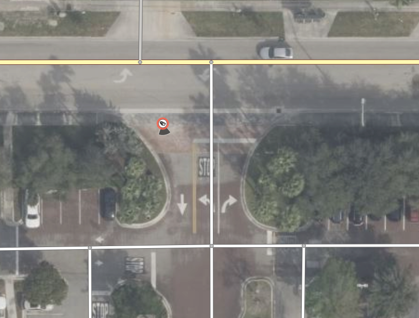
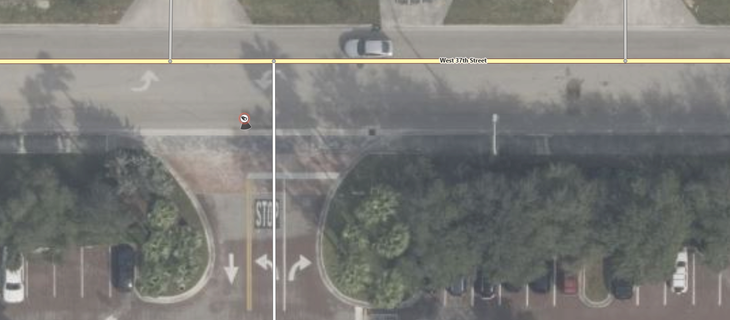
| 174574428 | about 1 month ago | the following screenshot shows that this ALPR is in the middle of the road as per Bing, and this applied to all of the other aerial imagery available in the area. So yes, it is highly unlikely that it's current position is correct. Happy mapping,
|
| 174574428 | about 1 month ago | The ALPR added in this changeset is inside of a roads area, that makes the position unlikely to be correct, please move it to the correct position. |
| 174562242 | about 1 month ago | Small note, the image tag for a picture of the features (in this case the business from the outside or something similar) not the logo of the business. |
| 174476695 | about 1 month ago | this is in the middle of a road, I doubt that the position is correct, please fix it. |
| 174476618 | about 1 month ago | this is in the middle of a road, I doubt that the position is correct, please fix it. |
| 174476660 | about 1 month ago | this is in the middle of a road, I doubt that the position is correct, please fix it. |
| 174518141 | about 1 month ago | this adds a duplicate of node/13283629251 , I have fixed it. |
| 174384252 | about 1 month ago | thank you for doing this, I was going to run this over Miami Dade County in the near future anyways as I have been wanting something like this for some time now. I have one small nitpick though, next time in the changeset comment can you please put the state or area you ran this over so its easier to tell what this is when looking at the history view zoomed in to the county or city level, understand if you don't want to, but I would find that very useful if this is ran again in Fl in the future. Again I am grateful that you ran this over Fl (well at least Miami Dade County). Happy Mapping,
|