Udarian's Comments
| Changeset | When | Comment |
|---|---|---|
| 174743442 | about 1 month ago | I am unsure if just outlining a boat is a correct usage of amenity=boat_rental even if it is just one.
Happy mapping,
|
| 174709021 | about 1 month ago | to me this seems like a duplicate |
| 174673588 | about 1 month ago | still in the road road area, see: Happy Mapping,
|
| 174648596 | about 1 month ago | this adds a building on top of an already mapped building, does the name added apply to the whole building or only a part of it?. Happy mapping,
|
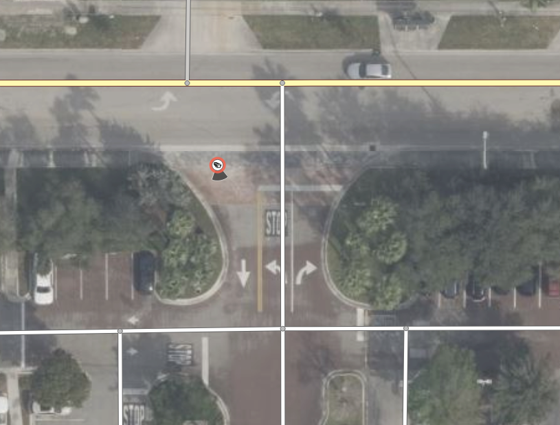
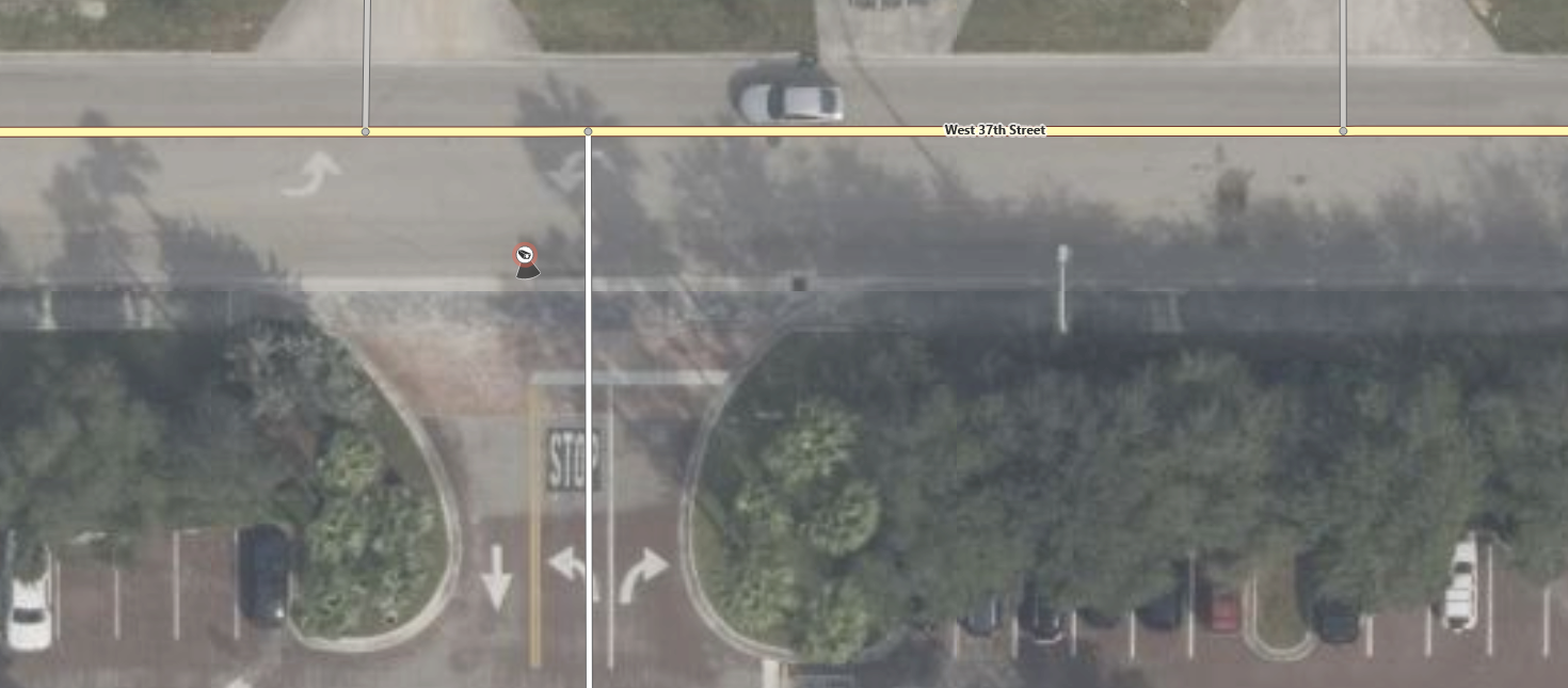
| 174574428 | about 1 month ago | the following screenshot shows that this ALPR is in the middle of the road as per Bing, and this applied to all of the other aerial imagery available in the area. So yes, it is highly unlikely that it's current position is correct. Happy mapping,
|
| 174574428 | about 1 month ago | The ALPR added in this changeset is inside of a roads area, that makes the position unlikely to be correct, please move it to the correct position. |
| 174562242 | about 1 month ago | Small note, the image tag for a picture of the features (in this case the business from the outside or something similar) not the logo of the business. |
| 174476695 | about 1 month ago | this is in the middle of a road, I doubt that the position is correct, please fix it. |
| 174476618 | about 1 month ago | this is in the middle of a road, I doubt that the position is correct, please fix it. |
| 174476660 | about 1 month ago | this is in the middle of a road, I doubt that the position is correct, please fix it. |
| 174518141 | about 1 month ago | this adds a duplicate of node/13283629251 , I have fixed it. |
| 174384252 | about 2 months ago | thank you for doing this, I was going to run this over Miami Dade County in the near future anyways as I have been wanting something like this for some time now. I have one small nitpick though, next time in the changeset comment can you please put the state or area you ran this over so its easier to tell what this is when looking at the history view zoomed in to the county or city level, understand if you don't want to, but I would find that very useful if this is ran again in Fl in the future. Again I am grateful that you ran this over Fl (well at least Miami Dade County). Happy Mapping,
|
| 174144151 | about 2 months ago | name_1 is generally frowned upon and is usually replaced with alt_name, next time please use alt_name instead of name_1. |
| 174015698 | about 2 months ago | first of all google maps is not a good source for OSM contributions as they are license incompatible with OSM (they are proprietary and we are ODBL) and second the website you link to as the businesses website is a very basic scaffold with almost nothing on it except a Hello World, so what is you source for this changeset, if it is google then this needs to be reverted. |
| 173791099 | about 2 months ago | why did you delete the bus stop (SE 13th St @ S Miami Av) that was tagged as was:highway=bus_stop showing that it is not there any longer? why did you add was:highway=bus_stop to the Metromover Tenth Street Promenade stop (the "Monorail Station"), maybe you could add was:highway=bus_stop to a new node with the note you added, Happy mapping,
|
| 173574253 | 2 months ago | Thank you for the response, I will update the relevant sidewalk by the end of the day. Happy mapping,
|
| 173609921 | 2 months ago | The project that this comes from seems to be conflicting with an existing osmus tasking manager project, https://tasks.openstreetmap.us/projects/876 . Please don’t do the tasks that overlap with the above osmus tasking manager project. |
| 173610383 | 2 months ago | The project that this comes from seems to be conflicting with an existing osmus tasking manager project, https://tasks.openstreetmap.us/projects/876 . Please don’t do the tasks that overlap with the above osmus tasking manager project. |
| 173622667 | 2 months ago | Why did you remove the address and building tags from this, it looks like a building on both bing aerial and Esri. Is the address incorrect, if so what is the correct one. |
| 173574253 | 2 months ago | can you please check if the sidewalks on the sides of this property have been also completed based on your imagery, essentially is there a sidewalk connection between ways way/1429777600 and way/1429777603 along with way/1429777612 and way/1429777603 ? Happy mapping,
|