Vector tiles with multilingual names in IE/GB
Posted by SomeoneElse on 18 October 2025 in English. Last updated on 26 October 2025.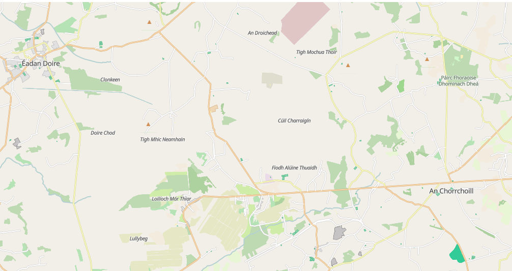
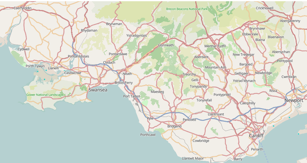
The vector tiles here have always had names in “the local language”, so Welsh-speaking parts of Wales have Welsh names shown and English-speaking parts English names:
Raster tiles can’t show multiple names in any sensible way, but with vector tiles “how the data is stored” and “how the data is displayed” are separate, so they can. Also, because there are far fewer named things than there are unnamed things, storing extra names doesn’t even make the resulting vector tiles that much larger.
I’ve added names for the native languages of the UK and Ireland, so “cy” (Welsh), “en” (English), “ga” (Irish) and “gd” (Scots Gaelic) are now supported in addition to the show names in local language ones, which are still the default.
It’s particularly useful for Irish townlands, which are mostly well-mapped in both Irish and English. Townlands are mapped as localities in Ireland, which are shown in italics (along with things such as islands etc.); populated places are shown in non-italics.
Where things don’t have a name in a particular language I’ve tried to fall back to a “nearby default” first, so here’s that same area in “Welsh”. This is only a fallback - if real Welsh names exist; they’re used.
Edit: I’ve also added a language switcher to the default page.
Discussion