The third sin of OpenStreetMap
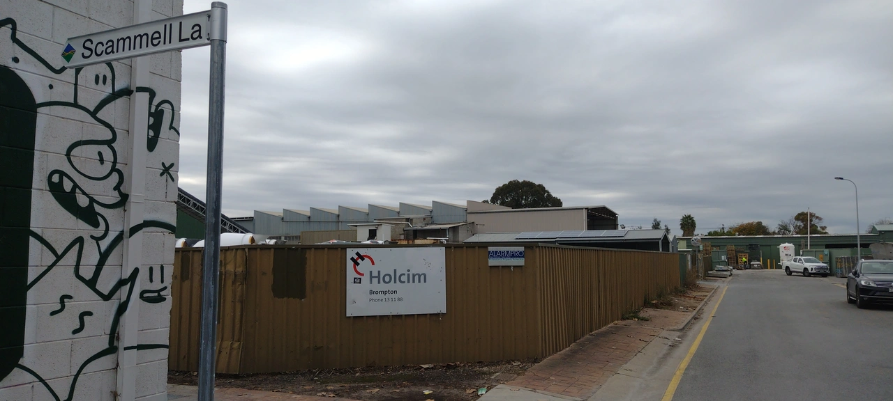
Posted by Softgrow on 24 June 2024 in English. Last updated on 25 June 2024.We all know that you should never map for the renderer and you should only map what is on the ground. But I think I’ve found the third sin, changing the ground to match the map. This nine year old way is a service lane with a name, but doesn’t give a source for the name. Doing a survey showed no signs and historic photos show it as without signs. So I contacted the local council, City of Charles Sturt and asked if they could erect signs, which they have.
I don’t feel the least bit guilty. 😊😊😊
Discussion
Comment from Endres Pelka on 24 June 2024 at 15:33
Good job!
It there were no signs, how did know what the name of the lane is?
Pretty please remove
https://wiki.openstreetmap.org/wiki/Tag:&layers=Dfrom the link, it might be overwhelming for some browsers :)Comment from radiotrefoil on 6 October 2025 at 05:10
Scammell Lane (also written as Scammell Street) is shown in historic maps from 1985 in this document: https://data.environment.sa.gov.au/content/heritage-surveys/hindmarsh-heritage-survey-part-1-general-1985.pdf So definitely the legitimate name for the alley. Named after Luther Robert Scammell, a notable resident of Hindmarsh. No idea how the original mapper knew this though.