
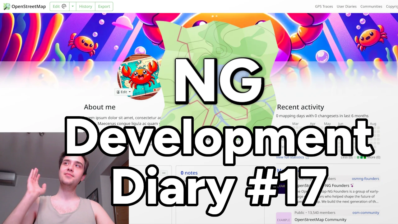
Heyy! I am very excited to share our latest OSM-NG development progress with you. Apologies for the slight delay — I wanted to wrap up some work for this week’s diary.
🔖 You can read other development diaries here:
@NorthCrab/diary/
⭐ This project is open-source — join us today:
https://github.com/openstreetmap-ng/openstreetmap-ng
🛈 This initiative is not affiliated with the OpenStreetMap Foundation.
📹 Video Summary
It’s been a while since our last video showcase, so let’s recap the recent progress in video format. It’ll also give you a better feel of the new exclusive profile backgrounds feature.
⬇ Click below to play ⬇
or click here: https://peertube.monicz.dev/w/5fKNRsq2K8jRyF22zEG5px
Profile Backgrounds
With OpenStreetMap-NG, users can now customize their profile backgrounds, making their personal pages even more personal. It’s time to show off your personality!
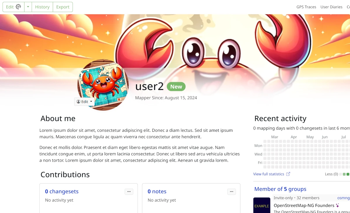
Big thanks to the contributors who made this feature possible @kkalata, @Gustavo22Soaresh, @Zaczero, and all the developers who discussed it on our Discord server. And, of course, to everyone who helps fund the development.
Context Menu Migration
This week, we completed the map context menu migration. It includes some small feature additions and is now more readable.
Kudos to @KonradowyPL, @Gustavo22Soaresh, @Zaczero, and our sponsors!
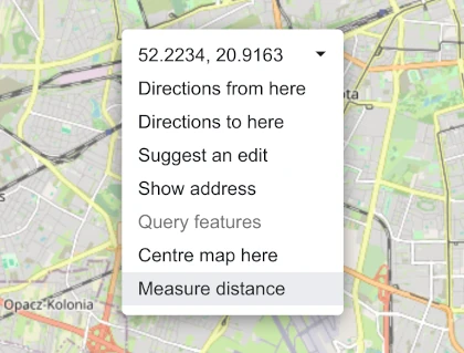
Distance Measurement
OpenStreetMap-NG now features a distance measurement tool! You can quickly measure segment distances as well as total distances in straight lines. Navigation distance summary had already been available before.
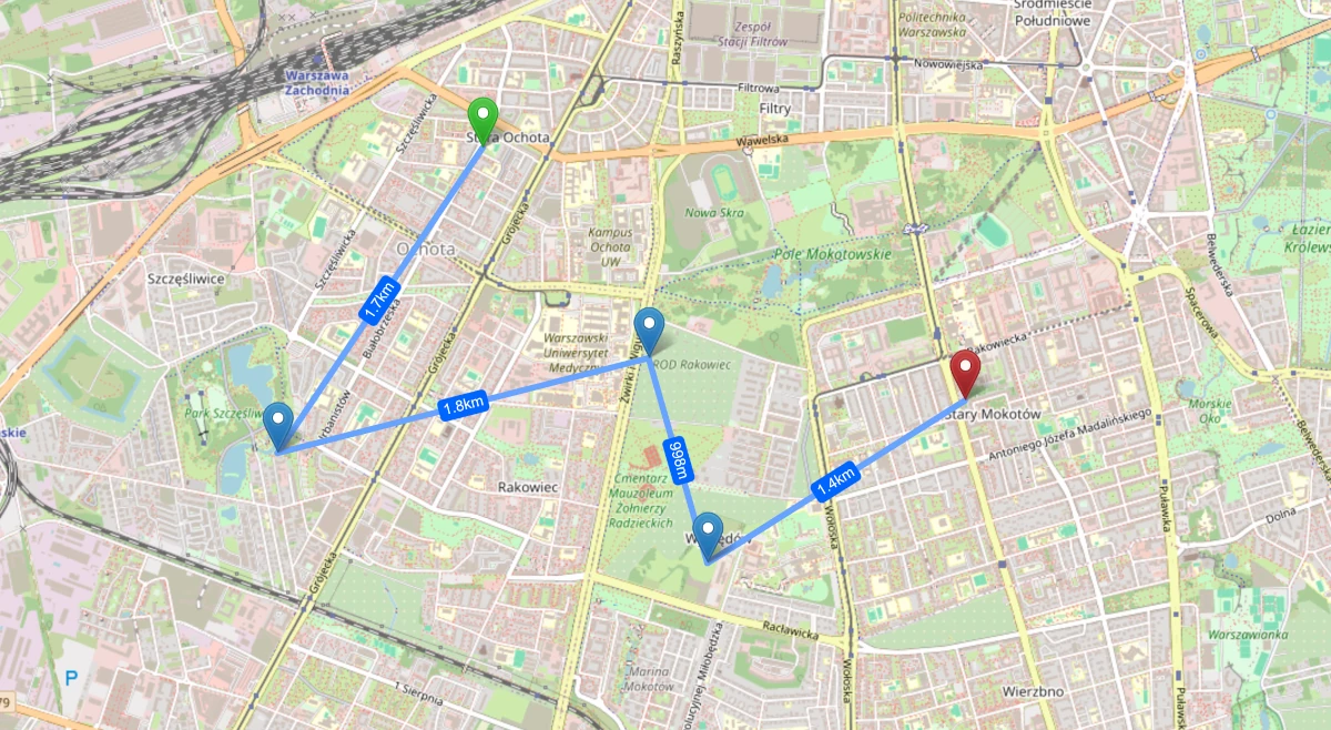
Thanks to @KonradowyPL for this well-executed new feature!
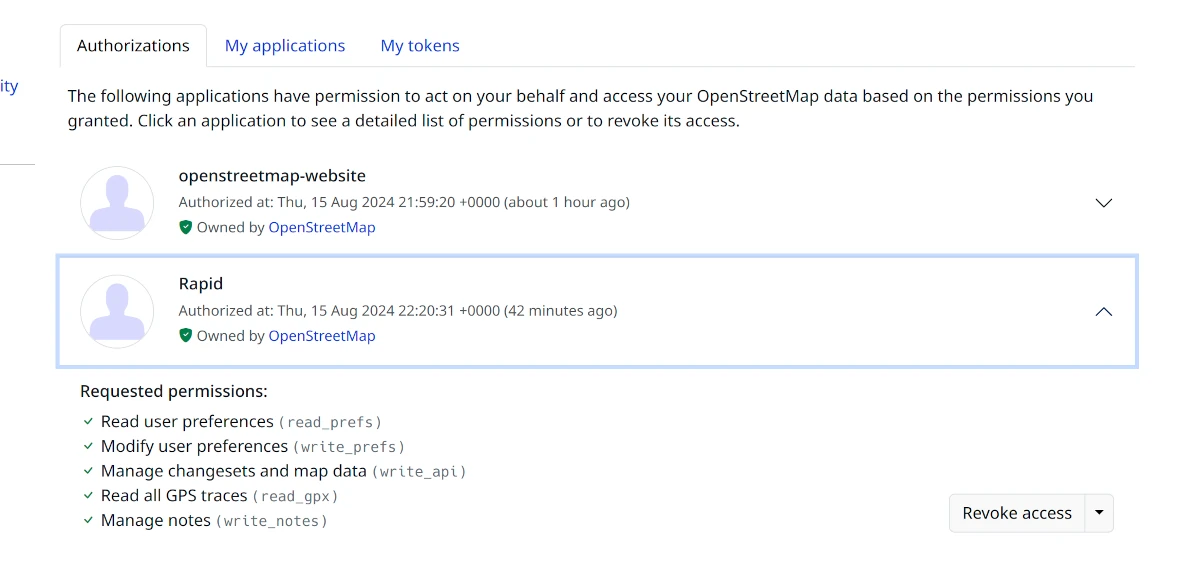
Applications Authorizations
We’ve also modernized the applications authorization view, making it more accessible to the average user. It now features application avatars (work still in progress) and additional security details.
Migrating Icons to SVGs
A new contributor has started migrating icons to SVGs, which will allow us to display them directly on the element sidebar view (issue #58). Currently, the low-resolution icons prevent us from doing so—because it doesn’t look good.
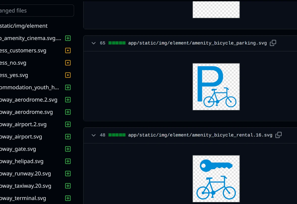
I am excited to see the final result, which I am sure will look amazing! Big thanks to @Aury88 and our sponsors who provide incentives for this work!
Did You Know: What Do We Do with the Money?
In OpenStreetMap-NG, sponsor funding is split among the contributors, rewarding them for their valuable time and effort. This is my personal take on how to make open-source development sustainable.
We have a dedicated ledger page where all incentive spending is tracked. The payout amount is determined by the difficulty of a particular task and the experience of the contributor. The guaranteed payment amount is displayed publicly on the issues tracker. It’s just fair.
The more funding we get, the more incentives we can provide, accelerating development and innovation within the project. I hope this provides valuable insight into how we operate 😊!
🌠 Sponsors
This work was sponsored by 15 people.
8 donors on Liberapay, and 7 on GitHub Sponsors.
Thank you for supporting our work! For the community, by the community!
- ~1847430
- gileri (Eric G.)
- mutipg
- RedAuburn (Harry Bond)
- ~1819511
- AurimasF (Aurimas Fišeras)
- starsep
- gander (Adam Gąsowski)
- owiecc (Szymon Bęczkowski)
- kkalata (Kamil Kalata)
Please consider chipping in to support OpenStreetMap-NG development. As a thank you, you will be eligible for the unique OpenStreetMap-NG Founder profile badge. Your contribution will also help drive the project forward 🏋.
Discussion
Comment from FajrAl on 16 August 2024 at 04:48
it looks awesome! love that recent activity feature, similar to github.
Comment from Pan on 16 August 2024 at 23:38
This is really impressive! Brushing up the main platform and adding vector tiles would surely give a new welcome look and feel to the project.
Comment from raincandy on 31 August 2024 at 14:31
This comment from fedi might be helpful for the project: https://fosstodon.org/@neatnit/113056265470762220
Comment from NorthCrab on 1 September 2024 at 01:31
@raincandy Of course, this is quite a popular idea :-) https://github.com/openstreetmap-ng/openstreetmap-ng/issues/24