
Sidewalks by popularity
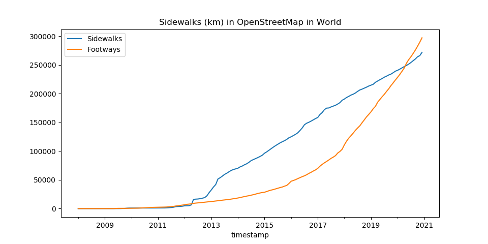
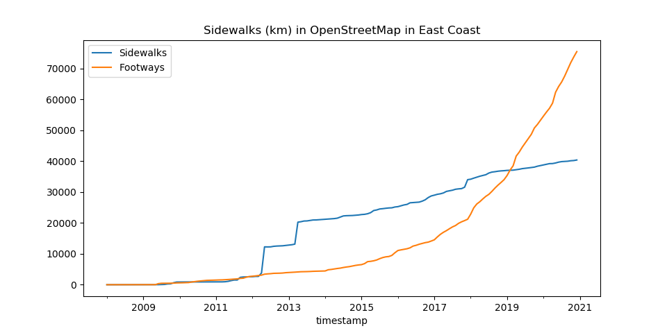
Posted by Hungerburg on 25 January 2021 in English. Last updated on 28 January 2021.[In continuation of „Sidewalks by length“ blog post.] As requested there, below chart for all of the world. Also chart for the US East coast, where, by their length, a whopping quarter of all of the worlds footway=sidewalk are located. 60% of the whole earth set is in the US alone (excluding Hawaii and Alaska.) As clearly can be seen, in the US this method trumps the other one, of mapping sidewalks as a property of the streets, they are part of.
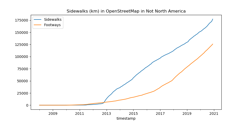
For the the world outside of the US, the ratio is not as decisive, but rather more on par. Mapping sidewalks as footways seems, to use a highbrow term in the sense it is sanctioned by the Oxford English Dictionary, prevalent in US mapping.
For a popularity contest, the total alone is sufficient to declare a winner. To determine popularity in this contest though, where every voter has an unlimited number of votes, the number of voters is of interest too, and also the distribution in the number of votes spent per voter.
This requires a bit of hand-waving, errm, a little overpass-turbo experiment, first zoom out to all of the world, sorry, that probably will timeout the query, so settle in on the area from Richmond to Boston - https://overpass-turbo.eu/s/12M7
OHSOME counts 20,000 km in cumulated length, overpass returns 160,000 objects by 2,460 users, which might not be too far off (average length 125m). Paste the data in a spreadsheet and do a bit of more hand-waving - 50% of the data was last modified by 1.6% of the users. Not quite a few have spent quite a lot of votes, so to say. Sidewalk mapping seems to be popular with a select few, most prolific individuals. In statistics speak: The mean being ten times the median being six times the mode, it’s a heavily skewed distribution, where practically all of the contributions come from the outliers.
How often are objects with a footway tag modified? Panning around the area, many are at version 1. Panning also reveals, that sidewalk mapping is quite concentrated and vast swaths of urban space have no sidewalks at all, not even ordinary footways alongside of streets. On the other hand, e.g. Boston even has “street” relations, that link sidewalks to streets.
The overpass method is not expected to bring up anything useful, when applied to the other mapping scheme, as the base objects carrying the sidewalk tag are expected to have seen several revisions with the addition of the property not necessarily being latest.
[Update: Correct accounting for sidewalk=both]
Discussion
Comment from gileri on 28 January 2021 at 19:16
Thank you for this analysis !