
I missed the last OSMLondon meet-up. Wynndale stepped in to organise, and bravely opted for an out-of-centre location, Fulham, one of the winners of the London Streets Challenge. So no diary entry (unless someone else wants to write one??) but there's photos on flickr
Obviously missing an OSM London meet-up is distressing for me, but I was away getting sun burnt in Brazil, so can't complain. And in fact I got up to quite a lot of OpenStreetMappery while I was out there...
Compared with previous Brazil trips, I could now see and use the map I was contributing to, thanks to my android phone and the Mapdroyd app. This let me download the whole of Brazil in some sneaky binary vector format, taking up just 30 Mb on my SD card, and giving me offline fluid vector browsing for the whole holiday. Unfortunately the otherwise very nifty client vector rendering engine, seems to hit some problems with rivers, which meant the map of the old town of Recife looked a bit pants. I have since added centrelines to the rivers in addition to the https://wiki.openstreetmap.org/wiki/Tag:waterway=riverbanks as per those instructions. I imagine this might help MapDroyd to at least show something. I've spotted other Brazilian rivers which are missing their centreline way.
Recife is a hot northern Brazilian city where we stayed for a week, by the beach. Here's me finally getting chance to read the openstreetmap book

I tried to gather some street names near the hotel, when we were cooling off in the evening. Still need to add these. Then there was a nice picturesque old town called Olinda. Didn't spot any street signs, but it was a bit busy in a carnivally kind of way while we were there.
Later we were in São Paulo, and so it was time for the São Paulo March 2011 meet-up.
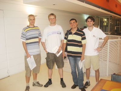
I set up the São Paulo Dec 2009 Mapping Party which was such good fun, I just had to do it again on this holiday. We didn't bother doing any mapping this time, but had a few cervejas and chatted about the state of São Paulo mapping. Since 2009 they've made some great progress I have to say. It's a mega mapping task, but they've made a pretty impressive dent in it. I was able to use MapDroyd to navigate around, preventing my girlfriend (and taxi driver) getting too lost on a few occasions.
For my part, I helped to chip away at it a little by doing some more snapping photos of street names, and things like fuel stations, out of the car window as we drove around various places, particularly in Guaruhos. This doesn't work as well as systematically mapping on foot / by bike, but it's a way of mapping without interrupting other holiday activities. I did also head out on foot around the shopping area in Guaruhos. I've got an interesting story to tell about that actually. Maybe another day.
...
So tonight it's time for a good old London OpenStreetMap meet-up. All the details on the wiki. sign up. or just show up! As this is the last of the winter pub meet-ups, I guess we'll have to come up with a plan for the summer season of OpenStreetMap mapping in London.
Discussion
Comment from Claudomiro on 24 March 2011 at 18:45
Is always a pleasure to see you my friend!
Comment from diogow on 24 March 2011 at 19:13
Nice to see you again Harry. Hope to seeing you in your side of the world later this year. All the best, Diogo
Comment from z-dude on 25 March 2011 at 02:12
I found that with mapdroyd, if you're in a coastal city, you really need the 'detailed coastline' map package so the city renders properly.