One of the reasons as to why I loved this image set was because it was almost centered completely from the top-down, which made tracing buildings far easier. This new set that was introduced makes it extremely hard now, and all of the already-traced assets like buildings and roads are now quite skewed when based off the new set. It’s frustrating.
Users' Diaries
Recent diary entries

日暮里駅南西側に所在する天王寺。毘沙門天であるが、一帯の霊園・墓地を構成する敷地を有することに今回は着目した。
「一帯の霊園・墓地」と記したが、都立谷中霊園・寛永寺墓地そして天王寺墓地が入り組んでいる。
都立霊園は比較的直線的に区画が整備されているが(マッピングされている訳では無いが)、天王寺墓地内は通路が入り組んでおり、寺のお坊さんも案内に苦労しているそうだ。また、都立霊園管理事務所で一帯の区画図が配布されているが、一応民有地ということか、配布地図では「天王寺墓地」という五文字だけで内部は空白表示である。
現地で猫と戯れつつ通路をマッピングしていった。また、銘板のある墓所は地物としてプロットした。
前述のように民有地として都の配布地図には載せていなかったが、墓地内に東京都教育委員会指定の墓所があった。なかなか筋を通すのは難しい土地の入り組みのようだ。
また、寺のお坊さんと更新した地図を見ながら、墓地内の無縁観音・千人塚、都立霊園内の天王寺銅造菩薩坐像台座跡を加えてマッピングした。
当日の天気は曇り、東京のサクラ開花宣言が気象台より出された日である。屋外行動には良い気候であった。花粉症は万全の備えで乗り切った。4時間程で現地での歩数は1万歩に達するか否かのラインであった。
天王寺境内のサクラも花開き始めており、霊園のさくら通りが見頃を迎える頃また花見に行きたいと思う。
了
i wish that we could pin locations, visible only on our account. it would make it a lot easier to keep track of multiple locations. i’m sorry if my formatting is wrong, or if i’m using this entry wrong. i’m very excited about this website, thank you!
Despite the apparent lack of public transit, Redmond Watershed Preserve is accessible with a bit of walking.
Redmond Watershed Preserve is a city park in Redmond, WA, abutting the Redmond Ridge development to the east, and the Puget Power Trail (aka PSE Trail) to the south. It is just outside of the walkshed that trip planning services use but is still reasonably easy and safe to get to using the Power Trail and some on-street walking, due to the Power Trail not actually being contiguous.
- Catch the Metro 250 bus to Avondale from Bellevue TC, South Kirkland P&R, Kirkland TC, or Redmond TC. If you are traveling on a weekday make sure you are on a bus to Avondale and not Bear Creek P&R; Metro provides 15-minute service but at the expense of dropping the Avondale tail from half of the trips.
- Get off at Avondale & Puget Power Trail and walk east.
- If you need a bathroom or want to see some farm animals, you can detour to Farrel-McWhirter Park.
- Take either the Power Trail or Perimeter Loop trail (if you detour to the park) to 196th Ave NE.
- Walk N to NE 116th St
- Walk E in the shoulder to 206th Ave NE.
- Walk S to NE 112th Street, and then walk W to the continuation of the Power Trail.
- Keep walking until you run into the Pipeline Connector Trail or Pipeline Regional Trail, both of which will take you through the Watershed Preserve.
- When returning, simply follow the directions in reverse.
During the week, Metro’s 224 DART service runs along Novelty Hill Road and makes various stops in Redmond Ridge, but its lack of frequency makes trip planning tricky unless you’re willing to wait in a suburban waste for an hour or more.
https://github.com/skylarthompson/transithikes/blob/main/puget_sound/redmond_watershed_preserve.md
غسيل
منزل سكني
Posted by مراجع محمد الفاخري on 22 March 2025 in Arabic (العربية).
مسجد لصلاة وخطبة الجمعة
Posted by Carto'Cité on 21 March 2025 in French (Français).
Last updated on 24 March 2025.
Pour la Journée Mondiale de l’Eau ce 22 mars 2025, je vous ai concocté quelques requêtes Overpass qui valorisent le modèle de données OSM décrivant les cours d’eau. Ce modèle est décrit sur cette page du wiki, la clef qui nous intéresse ici est waterway.
Les cours d’eau d’une commune
Commençons par une requête classique visant à extraire les cours d’eau se trouvant à l’intérieur d’un territoire. Prenons la commune de Nort-sur-Erdre en Loire-Atlantique, la rivière L’Erdre présentant des caractéristiques intéressantes pour la suite de cet article. Notre première requête produit tous les cours d’eau se trouvant à l’intérieur de la commune. Pour vérifier le résultat (une bonne pratique avec Overpass), la requête retourne également le contour de la commune.
Les 3 lignes de MapCSS à la suite de la requête permettent de styliser l’affichage du résultat. La clause render: native; indique d’afficher tous les tronçons sous forme de lignes, même les plus courts qui sont par défaut représentés par des cercles selon le niveau de zoom.
On observe deux problèmes :
- Les portions de cours d’eau qui longent le périmètre sont manquantes, notamment au niveau de la Plaine de la Poupinière au sud-est de la commune.
- Le résultat contient des ways qui sortent du périmètre de la commune, à l’ouest et au sud.
Pour résoudre le premier problème, nous devons prendre en compte à la fois les cours d’eau se trouvant à l’intérieur de la commune avec le filtre (area), et ceux le long de son périmètre avec le filtre (around). Celui-ci s’applique à des ways : on récupère les ways référencés par la relation avec la syntaxe way(r.commune).
Notre seconde requête utilise une distance nulle, il est aussi possible d’utiliser une distance de quelques mètres pour récupérer des cours d’eau proches de la commune.
Posted by SomeoneElse on 21 March 2025 in English.
Last updated on 21 September 2025.
Lots of people use editors such as iD, Potlatch, Vespucci, GoMap!! etc. for editing. There are entirely sensible reasons for this - I’ll always try and edit relations in Potlatch or iD since for me editing relations there is a much saner experience than in Josm. However, one thing that they miss is Josm’s Validator, which can check for relation errors that other editors can’t. Here’s how to use that to detect problems, and then fix them elsewhere.
I’ve created some test data on the dev server for this, so that I can deliberately create and fix errors. If you want to test with that data on the “dev” server, you’ll need to create an account there and tell Josm to login to that server - or you can just look at the screenshots below.
First, you’ll need to download Josm (I just downloaded the latest .jar file) . Josm’s user interface will be familiar to anyone who used CAD software in the 1980s, but may be less so to others.
Then you’ll need to download some data in the area that you were editing (file / download data / download). So that you can see what is where, it helps to have a background layer - “OpenStreetMap Carto (standard)” will work, or you can use an imagery layer if you prefer. Zoom in to your area of interest, select with the mouse and “download”.
Then click “validate” (on the row at the very bottom right of the screen). If “validate” does not appear, then “Help / Search Menu Items / Valid”, click the entry that appears, and click OK. The “validation results” area should apear with the big “Validate” button with a tick on it.
Teach GIS after school at High Point Library Work other PH content into mix with ongoing GIS training
benefits #external #internal
risks #internal #external
This blog post is part of a series of blog posts about the new OSM file format “OMA”. This is the third post. At the end of the article you’ll find links to the other blog entries.
Until now you’ve got a general idea of what the Oma file format is, and an idea of how to use it. But you do not know, where to get an Oma file from.
Well, I hope, that sooner or later someone like Geofabrik will provide a daily updated planet.oma and some excerpts. That would make sense, because converting the data takes a lot of resources, and it would be a waste if everyone had to do it themselves.
But until we have such a distributor, you have to convert OSM files to Oma files on yourself. I have written a converter for this purpose. It’s written in Java and should be easy to use.
The Converter
You need a copy of oma.jar. If your are using Linux (or any other Unix operating system) you just have to type the following command:1
java -Xmx<some number>G -jar oma.jar <some osm file>
The -Xmx part tells the Java Virtual Machine to use <some number> gigabytes of memory. For example, my computer has got 4GB of main memory, so I’ll use -Xmx3G, reducing the available memory by 1GB, because the operating system needs some memory too.
The osm file mentioned in the command, can be one of .osm, .o5m or .pbf2.
Well, that’s about it. The program will read the file and start the conversion. This can take a long time, and hopefully it won’t crash.
Huh, crash? I wish I could give you better news, but unfortunately I have not been able to write a program that does never crash. The reason for this is that Java gives no guarantees or means of dealing with out-of-memory situations.3 So: If you have enough memory (and disk space), a crash should never happen, but if you have only limited memory, a crash might be possible.4
Posted by Raquel Dezidério Souto on 20 March 2025 in Brazilian Portuguese (Português do Brasil).
Last updated on 27 March 2025.
– Read in English
Acessando informações em momentos de crise - Entrevista com a Dra. Raquel Dezidério Souto, sobre o desastre do Rio Grande do Sul (Brasil), ocorrido em abril e maio de 2024.
Esta entrevista está registrada no Zenodo.org e disponível como arquivo PDF. Como citar esta entrevista:
Acessando informações em momentos de crise: entrevista com a Dra. Raquel Dezidério Souto, sobre o desastre do Rio Grande do Sul (Brasil), ocorrido em abril e maio de 2024. Entrevistada: Raquel Dezidério Souto. Entrevistadora: Laura Bortoloni. Rio de Janeiro: IVIDES.org, 20 mar.2025. DOI: https://doi.org/10.5281/zenodo.15058822. Licenciado sob CC-BY-NC-ND 4.0 Ⓒ autoras.
Esta entrevista está disponível também em Inglês: https://doi.org/10.5281/zenodo.15058928
1. Perfil profissional
Você pode nos contar sobre o seu background e como se envolveu com a cartografia?
Meu primeiro contato com a cartografia foi na graduação em oceanografia. Depois, no mestrado em Estudos Populacionais e Pesquisas Sociais (IBGE) e no doutorado em geografia (UFRJ). Ao longo do tempo, desenvolvi linhas de pesquisa em mapeamento colaborativo, com apoio de cartografia digital e mapeamento Web. O foco do meu pós-doutorado em geografia tem sido o desenvolvimento de soluções Web para mapeamento colaborativo digital. Atualmente, desenvolvemos projetos com software livre ou projetos híbridos (misturando software livre e proprietário), no âmbito do Instituto Virtual para o Desenvolvimento Sustentável - IVIDES.orgⓇ, instituto virtual de pesquisas que criei em 2008; alguns desses projetos, sendo viabilizados pela IVIDES DATA, sua empresa gestora.
O que a atraiu para a cartografia humanitária e para os projetos de cartografia participativa?
Posted by Raquel Dezidério Souto on 20 March 2025 in English.
Last updated on 27 March 2025.
– Ler em Português
An interview with a university in Italy gives details of the collaborative mapping carried out in response to the Rio Grande do Sul disaster
This interview is registered on Zenodo.org and available as PDF file. How to cite this interview:
Accessing information in moments of crisis - Interview with Dr. Raquel Dezidério Souto about the Rio Grande do Sul (Brazil)’s disaster occurred in April and May, 2024. Respondent: Raquel Dezidério Souto. Interviewer: Laura Bortoloni. Rio de Janeiro: IVIDES.org, 20 mar. 2025. DOI: https://doi.org/10.5281/zenodo.15058928. Licensed under the CC-BY-NC-ND 4.0 Ⓒ authors.
This interview is also available in Portuguese:* https://doi.org/10.5281/zenodo.15058822
1. Professional Profile
Can you tell us about your background and how you became involved in Cartography?
My first contact with cartography was during my undergraduate studies in Oceanography. Then I got my Master Science in Population Studies and Social Research (IBGE) and my PhD in Geography (UFRJ). Over time, I developed lines of research in collaborative mapping, with the support of digital cartography and Web mapping. The focus of my post-doctorate in geography has been the development of Web solutions for digital collaborative mapping. We are currently developing projects with free software or hybrid projects (mixing free and proprietary software), within the framework of the Virtual Institute for Sustainable Development - IVIDES.orgⓇ, a virtual research institute that I created in 2008. Some of these projects are being made possible by IVIDES DATA, its management company.
What drew you to humanitarian mapping and participatory mapping projects?
Headed to Dutchess County in NY to update a smaller commercial Area. Added the parking lots, turn lanes, and buildings for the commercial areas that were missing. Still a lot of details to go.

and a detail shot
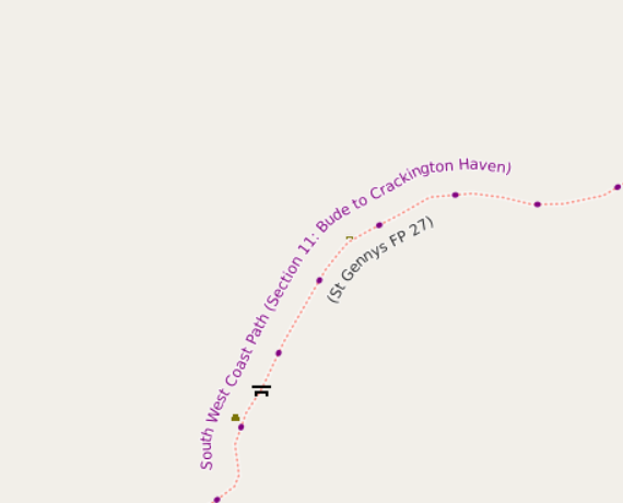
I maintain a web map style that shows walking and cycling route names. For the cycle routes, it shows the ref. For some time I’ve massaged some of the names so that e.g. National Byway loops show as “NB (loop)” just like on the signage. However, as can be seen from the example above, some hiking route names are a bit convoluted - they’re more like descriptions than names.
For example, relation/3971851 is the England Coast Path. Open up the list of members to see the names, which includes such delights as “King Charles III England Coast Path: Southend-on-Sea to Wallasea Island”. I’m pretty sure that it doesn’t say that on the signs there.
Posted by Mathias_ADAV on 19 March 2025 in French (Français).
Last updated on 26 March 2025.
Import dans Openstreetmap des espaces de stationnement de vélos et trottinettes électriques en free floating de la MEL
Contexte
La MEL a depuis mars 2024 lancé un appel à projet (s’inscrivant dans l’Action 34 du Plan de mobilité horizon 2035 ), auquel Lime et auparavant Tier ont répondu pour déployer une flotte de VAE (vélo à assistance électrique ) et de TE (trottinette électrique) sur les communes qui le souhaitent. 68 communes ont répondu favorablement au déploiement du service sur leur territoire.
La détermination des espaces de stationnement se fait de la manière suivante : - Propositions d’emplacements faites aux communes par la MEL au regard de critères d’attractivité, de maillage du territoire, d’occupation de l’espace public. - Avis des communes sur les localisations. - Formalisation des emplacements exacts inscrits dans les arrêtés municipaux d’occupation temporaire du domaine public. - Travaux de marquages au sol réalisés par la MEL après réception des arrêtés municipaux et conformément à ceux-ci.
Précision de la données
Les données de ces espaces de stationnement ont été publié en Opendata en juillet 2024 :
Le point est normalement précis, il peut y avoir quelques décalages lorsque la station est masquée par un obstacle (arbres, préau) ou lorsque l’entreprise de marquage a décalé son emplacement prévu lors de l’opération de marquage.
Après vérification avec des points connus et l’ortho photo de l’IGN, les points sont assez précis ; après croisement avec les bâtiments, seuls 2 points sur 1300 ont dû être décalé de quelques mètres.
Au total, 1387 espace de stationnement ont été définis.
Les attributs sont également bien renseigné et exhaustif sur l’ensemble du jeux, le champs type_engin permet de distinguer les espaces dédiés au seul VAE et ceux dédié au TE et VAE.
Quels tags choisir ?
جسم
تخييم
اماكن تخييم
اماكن مراعي اغنام