OpenStreetMap logo OpenStreetMap

Users' Diaries

Recent diary entries

Posted by FFWHol_Norimaki on 13 May 2024 in German (Deutsch). Last updated on 20 December 2025.

Ideale Welt 1 - weiterentwickeln

  • Jemand hat 95% des Gebietes der Wehr bereits aufgenommen
  • … warum nicht die letzten / vergessenen / übersehenen Punkte eintragen
  • … vorhandene Punkte überprüfen (Gemeine/städtischen Hydrantenplan drüberlegen … man macht halt auch Fehler)
  • … Karten für Hydrantenschau nutzen (ggf. Abhaklisten für Wartung, Funktionsprüfung, Schulung) Checkliste Beispiel Hydranten.eu
  • … Löschwasserstellen aus eigenem “Feuerwehrplan” einzeichnen (nicht überall ist ein Schild. Lokale Wehr weis aber hier würden wir ansaugen / hier kann man mit Fahrzeug ranfahren)
  • … Out-of-Scope Punkte nachtragen z.B. Überflurhydrant DN & Anschlüsse
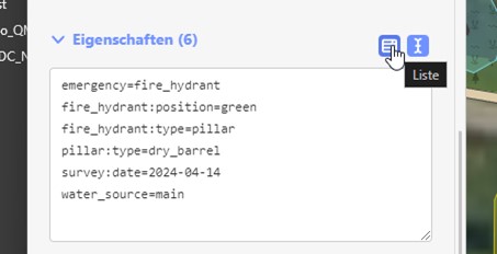
  • … Durchlauf & Druck dokumentieren (z.B. mit OSMHydrant)
  • … Wer hat das Schild geklaut
  • … Oh da ist einer zuviel eingetragen worden

Ideale Welt 2 - Überraschungen abfedern

  • Die eigene Wehr ist gerade verhindert (Status 4 - “im Einsatz” / Status 6 - “nicht einsatzbereit”)
  • Es is “viel” zu tun, z.B. mehr Löschwasser, wo kann ich sicher eine Pumpe aufstellen, wo ist Möglichkeit den Wassertank aufzufüllen?
  • Hydrant finden, ohne daran vorbei zufahren/laufen, auch wenn der LKW / RTW / Holzstapel davor steht.
  • Nähesten Wasserquelle Identifizieren für z.B Pendelverkehr usw.

Ideale Welt 3 - Bauhof

  • Als Feuerwehr direkt RefID des Bauamts nutzen.
  • Als Bauhof die OSM für Hydranten als verlängertes / günstiges GIS nutzen (z.B. Gemeinde Pechbrunn - habe keinen Kontakt, nur gesehen das dort der Bauhof mit einer Förderung die Hydranten aufgenommen hat).
  • Mit OSMHydrant können Drücke / Durchfluss / Referenznummern eingetragen werden (erleichtert Argumentation bei Anomalien/ ermöglicht Betrachtung über Zeit).

Ideale Welt - ganz weit draussen

See full entry

Posted by FFWHol_Norimaki on 13 May 2024 in German (Deutsch). Last updated on 8 July 2025.

Allgemeine Hinweise finden sich hier: Openstreetmap.org

Voraussetzungen:

  1. Openstreetmap(OSM) Account erstellen [Kartenmaterial Grundlage] -> osm.org/

Wie eintragen?

  1. Openstreetmap einloggen
  2. Goto “Bearbeiten” Button
  3. “Punkt” Button auswählen
  4. In Karte den Punkt setzen (Linke Maustaste)
  5. Objekt suchen -> fire_hydrant / Suction_point / water_tank

Es gib in OSM ein Fenster, in das man Tags als Text posten kann. Dies erleichtert die Eingabe, wenn ähnliche Objekte beschrieben werden.

Text in Feld posten auf Liste drücken und es erscheinen die Einträge weiter oben.

OSM_Beispiel_Erstellen_Eintragen_Eigenschaftenfenster.jpg

See full entry

Posted by FFWHol_Norimaki on 13 May 2024 in German (Deutsch). Last updated on 17 September 2025.

Es erreichte mich eine Mail von Nutzer rempshaener der mich auf einige Fehler / Ungeschickt erstelle Hydranten hingewiesen hat

Hydrant auf Strasse

Hydranten sollten nicht mit der Strasse verbunden sein. Wenn die Strasse gelöscht wird, fallen auch die Hydranten weg. Berichtigung so durchgeführt:

  1. Mit “e” kann man diese entbinden

  2. 1400 Hydranten angefasst

  3. Mit Overpass generierte Suche [hole mir nur die Hydranten aus der Ergebnisliste]

[out:json][timeout:100];

// Define the username to filter
{{user = "FFWHol_Norimaki"}}

// Find fire hydrants created by the user
(
  node["emergency"="fire_hydrant"](newer:"2020-01-01T00:00:00Z")(user:"FFWHol_Norimaki");
);

// Find roads (highways) near fire hydrants
way["highway"](around.node:5);

// Get only fire hydrants that are part of a way (connected to roads)
(
  node["emergency"="fire_hydrant"](newer:"2020-01-01T00:00:00Z")(user:"FFWHol_Norimaki")->.hydrants;
  way["highway"](around.hydrants:5)->.roads;
  node.hydrants(w.roads);
);

// Output results
out body;
>;
out skel qt;

BEV richtig eintragen

BEV sind keine Hydranten. Folgendes verwenden:

https://wiki.openstreetmap.org/wiki/Tag:fire_hydrant:technical=ventilation

Watertank richtig durchlesen und eintragen

Da gibt es mehrere Ansichten. Halte mich an Vorgaben Open-Fire-Map.

https://wiki.openstreetmap.org/wiki/Tag:emergency=water_tank
https://wiki.openstreetmap.org/wiki/Tag:water_tank:volume=82000

Dann wird auch Volumen Bei OSMAND & OpenFireMap in m³ dargestellt (im Beispiel 82 m³).

Terra Incognita

Landkreis WUN noch unkartographierte Gebiete/ lokale weisse Flecken auf der Karte (Tour in Planung) … sollte mir jemand zuvorkommen, bin ich auch nicht unglücklich :

  • Reste von Brand / Seußen / Arzberg (je 2-3 Strassen)
  • Grubbach (max. 1 Eintrag)
  • Karten Update -> Edeka Lager (da fehlen in OSM die Aufahrt und die [richtigen] Gebäude)

Out of Scope ( … man muss wissen wenn die Aufgaben zu groß werden)

See full entry

Posted by FFWHol_Norimaki on 13 May 2024 in German (Deutsch). Last updated on 21 November 2025.

Holenbrunn A4 Pläne

Hier ein Beispiel wie ein Hydrantenplan des Ausrückebereich zum mitnehmen auf dem Fahrzeug aufgebaut sein kann (Ausserhalb des Zuständigkeitsbereiches Holenbrunn keine Gewähr/ Karten haben keinen einheitlichen Massstab/ keine Längenangaben/ Seiten sind zum Ausdrucken auf Papiergrösse A4 optimiert. Vorlagen sind z.T. grösser, die Seite trotzdem auf ein A4 audrucken):

Satz Wachbereich

  1. Übersichtsseite Wachbereich (Vorschlag: 0 Hydranten Holenbrunn Bunt Übersicht )
  2. Detailansichten (Strassennamen /-nummern) 1-14

Satz Nachbarschaft

  1. Übersichtsseite Nachbarbereich (Vorschlag: 0 Hydranten WUN OST Bunt Übersicht)
  2. Detailansichten (Strassennamen /nummern) 1-9

Vorgehen

See full entry

Mapa dinâmico mostra dados sobre hidrografia e áreas de inundação


O Instituto Virtual para o Desenvolvimento Sustentável - IVIDES.org está elaborando mapas dinâmicos com dados importantes para o enfrentamento das consequências do evento catastrófico que acometeu o estado do Rio Grande do Sul (Brasil), desde 29 de abril de 2024 (data oficial), provocando quedas de barreiras, enchentes, inundações, destruição de estradas e pontes da região, isolando localidades e o óbito de habitantes e animais.

No uMap geral do desastre, estão disponibilizadas camadas sobre a hidrografia (trechos de drenagem) de parte do estado, especialmente, a Bacia Hidrográfica Taquari-Antas, a partir de dados da Secretaria Estadual de Meio Ambiente (SEMA-RS); também a poligonal da inundação produzida recentemente pela UFRGS; as poligonais de áreas de inundação em setores do Rio Grande do Sul, generalizadas, a partir dos dados do INPE e parceiros/ Disaster Charter. Finalmente, os pontos de disponibilidade de água potável para Porto Alegre (capital do estado) e cercanias.

Também está disponível o uMap da situação das vias, mostrando as vias totalmente bloqueadas e as vias destruídas, que foram mapeadas no OpenStreetMap.

O projeto está documentado no portal IVIDES.org

Nos mapas web disponíveis, é possível realizar o download dos dados das camadas ou do mapa completo, a partir do controle (botão) de compartilhamento do mapa, no menu à esquerda do uMap.

IVIDES.org® é uma marca registrada.


See full entry

Location: Taquari, Região Geográfica Imediata de Lajeado, Região Geográfica Intermediária de Santa Cruz do Sul - Lajeado, Rio Grande do Sul, Região Sul, 95860-000, Brasil

Mapeamento de cursos d’água com a participação especial de especialista das Nações Unidas


Tivemos grande satisfação em contar com o geógrafo Séverin Ménard (UN Mappers/UNGSC), realizando a oficina sobre o mapeamento de cursos d’água no OpenStreetMap (OSM), abordando ainda outras feições importantes, como os fords, nos pontos de cruzamento entre waterways e highways; ou as galerias, que permitem a passagem de água sob as vias.

A oficina foi organizada pelo Instituto Virtual para o Desenvolvimento Sustentável - IVIDES.org, que criou um projeto de mapeamento colaborativo no HOT Tasking Manager - https://tasks.hotosm.org/projects/16706/, para apoiar o enfrentamento da aguda crise humanitária, que acomete o estado do Rio Grande do Sul (Brasil), desde o final de abril de 2024. Neste projeto, é possível mapear os edifícios, vias e hidrovias que faltam, especialmente, na porção norte da área de interesse.

O IVIDES.org também disponibilizou um projeto de web map, que está sendo desenvolvido com uMap, com dados sobre os trechos de drenagem da região da Bacia Hidrográfica Taquari-Antas e as poligonais das áreas inundadas pelos principais rios, generalizadas dos dados produzidos pelo Instituto Nacional de Pesquisas Espaciais (INPE), disponíveis na ativação “Flooding in Brazil” no Disaster Charter.

Neste momento, o mapeamento de hidrovias é fundamental, tanto para as atividades de reposta, como as ações de socorro às vitimas do desastre, quanto para a fase da reconstrução e realocação de bairros e cidades inteiros, que foram atingidos pelo maior desastre visto no país.

Nosso agradecimento a Séverin Ménard, o palestrante especial, e a Victor Timotheo (GeoCart-UFRJ), que realizou o apoio técnico da sessão.

A agenda completa das oficinas e os recursos - documentos e vídeos, podem ser encontrados na página do treinamento.

See full entry

Location: Taquari, Região Geográfica Imediata de Lajeado, Região Geográfica Intermediária de Santa Cruz do Sul - Lajeado, Rio Grande do Sul, Região Sul, 95860-000, Brasil
Posted by KhubsuratInsaan on 12 May 2024 in English. Last updated on 14 July 2025.

Delhi Cantonment is one of the most sparsely mapped area in Delhi. It might be because it is full of military areas. As I live in the cantonment, I hope to map at least the non-sensitive areas, such as Sadar Bazar and Gopinath Bazar. By my current rate, it is likely to take at least 2 months to map these two markets alone. In future I might venture out to map the big Nangal area (gulp).

This diary entry is licensed under CC BY-NC-SA 4.0.

Location: Gopinath Bazar, Delhi Cantonment, New Delhi, Delhi, India

Edificio protegido en la subida la Coracha Edificio protegido en la subida a la Coracha, construido en 1820 y declarado patrimonio protegido en 1970, ejemplo típico de la arquitectura malagueña del siglo XIX. Fuente: trabajo propio (CC BY-SA 4.0) disponible en Wikimedia Commons.

El Ayuntamiento de Málaga mantiene un catálogo de edificios protegidos reconocidos en su Plan General de Ordenación Urbana al que se puede acceder a través de la página web de la Gerencia Municipal de Urbanismo. Dado que este catálogo supone un reconocimiento oficial de su valor patrimonial, estos edificios son susceptibles de ser añadidos al mapa de OpenStreetMap bajo la clave heritage.

See full entry

Location: Campos Elíseos, Centro, Málaga, Málaga-Costa del Sol, Málaga, Andalucía, España

With 2024 officially being the year of OpenStreetMap vector maps let’s do a deep-dive into vector maps: their history and how the underlying vector tiles work in detail.

img1

Vector Maps History

To understand how revolutionary vector maps were we have to go back in time to the early 2010s. One Direction is raising to international fame and raster maps are at the height of their popularity. Folks creating raster web maps rendering OpenStreetMap data into beautiful 256x256 pixel images.

But raster maps come with limitations: when you rotate the map the labels stop facing you; you can’t customize pre-rendered maps to specific use-cases on the fly; there is no fractional scaling between zoom levels. All of these problems are unthinkable nowadays: here is one example where Jochen wrote about Wikipedia struggling with pre-rendering multilingual maps for over 200 languages because they can’t change their map’s language on the fly.

See full entry

Welcome to the sixth OpenStreetMap NextGen development diary.

This week, I continued the preparation of the project for the first development release scheduled for the end of this month 🔨.

🔖 You can read my other development diaries here:
@NorthCrab/diary/

📖 This project is open-source and publicly available:
https://github.com/Zaczero/openstreetmap-ng

🛈 This independent initiative is not affiliated with the OpenStreetMap Foundation.

In Case You Missed It…

OpenStreetMap-NG is planned to have its first development release at the end of this month, May. After this milestone, the project will be open for new contributors! My current work focuses on delivering on that promise, finishing the core functionalities, and stabilizing the code.

Originally posted in diary #5.5.

Finishing Up the Elements Sidebar

The elements sidebar has been mostly finished. The “Part of” and “Members/Nodes” sections are now more consistent in design and have received pagination support. The orange-colored map visualization is also now working.

See full entry

Posted by bhousel on 8 May 2024 in English.

I’m excited to announce that today we released Rapid v2.3 editor for OpenStreetMap! The Rapid team has been busy working on this for the past few months - here’s 4 new features that we hope you’ll love…

🔙 Esri Wayback imagery

The world never stops changing! We added a new background layer called “Esri Wayback” to let you view historical releases of the Esri World Imagery. This background source also has a date picker to help you choose from dates likely to show changes in the current map view. Open the Background pane to try it out!

Esri Wayback

🔄 Map Rotation

Take Rapid for a spin! Now you can rotate the map to make your editing easier (and avoid straining your neck!). Rapid supports rotating with option+click-drag or shift+←/→ arrows, just like other maps you’ve used before. A new bearing control displays a north arrow, and you can click it to reset the map back to North-up.

See full entry

大家好!这里是monhiko!(/ω\)

这是本人第一次尝试在OSM上写的一篇日志(因为今天才刚刚发现原来我也能写),所以就结合最近我国OSM地图上出现的一些情况对2023版《公开地图内容表示规范》(内容详见:公开地图内容表示规范,以下简称《规范》)进行一个解读,希望相关的mapper们能够在守法的情况下绘制OSM地图,让OSM地图更好的为我们的日常科研服务!

希望各位小伙伴们看完后记得一键三连(bushi)

一、主要解读内容

由于《规范内容》实在太多,涉及到OSM的也就几点,因此此次解读主要针对以下章节点:

第十八条

第十九条

第二十条

第二十一条

第二十二条

好的,下面咱不多说,我们直接走起!

二、具体解读

第十八条

该条规定:“…我国境内公开悬挂标牌的单位可在地图上表示单位名称。用于公共服务的设施,可在地图上表示其名称等可公开属性信息”

这条意思是说,在OSM上只要你看见有关公共服务设施(机关单位)是正式挂了牌的、能够在百度高德天地图上面搜到的,那么就可以在OSM上画出来。

那么“公共服务设施”包括哪些呢?根据《城市居住区规划设计规范》,公共设施主要包括以下几类,下面带你学习/复习一下:

1. 教育设施

主要包括托儿所、幼儿园、小学、中学等,在OSM上对应“幼儿园”(托儿所、幼儿园)及“学校”(小学、中学)两个tag。

大学算什么呢?答:大学基本上算是地市及以上等级的部门管的,小小社区无权独占。注意:军事院校一般为安全起见,除985211双一流类知名院校可作为“大学”而非“军事设施”标注外其余一律不标。

2. 医疗卫生

包括医院、诊所、卫生站等,在OSM上对应“医院”、“诊所”(诊所、卫生站)这两个tag(精神病院会在后面讲)。

3. 文化体育

包括影剧院、俱乐部、图书馆、老年人活动室、会所等,在OSM上对应“剧院”、“俱乐部”(俱乐部、会所)、“图书馆”、“社区活动中心”等。

4. 商业服务

包括食品店、菜场、服装、药房、理发店等,在OSM上对应“便利店”、“市场”、“服饰店”、“药房”、“理发店”等。

5. 金融邮电

包括银行、储蓄所、邮电局、邮政所、证券交易所、快递驿站等,在OSM上对应“银行”(银行、储蓄所)、“邮局”(邮电局、邮政所、快递驿站)等。

证券交易所咋标?建议去OSMWiki查,因为我旅游的路上没有去见过(bushi)

6. 社区服务

包括居民委员会、派出所、物业管理等。居民委员会因分街道居委会和社区居委会,因此对于居委会详见OSMWiki。

物业管理咋标?如果你能确定其位置的话,那就标为“物业管理”之类的。(派出所这块会在后面讲)

7. 市政公用

包括公共厕所、变电所、消防站、垃圾站、水泵房、煤气调压站等。其中,仅允许公共厕所(对应tag为“厕所”)、消防站(对应tag为“消防站”)和垃圾站(对应tag详见OSMWiki)能标。

其他的呢?会在下面讲。

8. 行政管理

包括商业管理、街道办事处等行政管理机构。对于这一类,窃以为谨慎处理,标点、面还是行的,内部的建筑、用地这些的话。。。自己心中要有一杆秤,你经过深思熟虑、参考国内多类型地图后确定认为标这些东西出来不会危及国家安全的话你就画吧。(注意这句话,下文中我会简称为“一杆秤原则”)

综上所述,这八类公共服务设施只要上面中允许标出且能够在国内地图上搜得到,就应标尽标,以充实地图内容。

第十九条

该条规定:“…表现地为我国境内的地图平面精度应当不优于10米(不含),高程精度应当不优于15米(不含),等高线的等高距应当不小于20米(不含)。依法公布的高程点可公开表示”

这条意思是说,你在画OSM时放大精度不得大于10米(对应放大等级20级),毕竟你只是画画,不是来玩测绘的(当然如果要严格按照《测绘法》以及各省市区对该法的实施方案的有关规定,实际上哪怕精度你放宽到20米你都要报请至少县级的自然资源及测绘主管机关单位申请基础测绘资格了)。当然,在这一精度范围之内,只要你能够看得清楚且不违反前后所述禁止及限制事项的(比如一棵树、一个垃圾桶)是可以的哦!

第二十条

该条规定:“…表现地为我国境内的地图不得表示下列内容(对社会公众开放的除外):

(一)军队指挥机关、指挥工程、作战工程,军用机场、港口、码头,营区、训练场、试验场,军用洞库、仓库,军用信息基础设施,军用侦察、导航、观测台站,军用测量、导航、助航标志,军用公路、铁路专用线,军用输电线路,军用输油、输水、输气管道,边防、海防管控设施等直接用于军事目的的各种军事设施;

See full entry