Users' Diaries
Recent diary entries

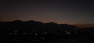
Posted by bkil on 27 September 2023 in Hungarian (Magyar).
Location:
Baross Gábor-telep, XXII. kerület, Budapest, Közép-Magyarország, 1781, Magyarország

Once upon a time, I was asked why I had only marked the south end of a trail and not the north end.
Well, I said, I haven’t been there, so I don’t have a GPS track. All I have is that USGS line and the one thing I know about it is it’s wrong. As long as it isn’t mapped, someone will be more likely to put down the correct line when they do want to map it. They might not even notice it’s needed if a bad line is there.
Then I said I might come down on the side of mapping everything you can as best you can sometime later.
Well, it’s later. Now I say map it all! And put down the source as you do it. Not just in the changeset note, but actually on the segment. And it can be good to make a guess about trail_visibility. I have more tools now.
Strava heatmap is the best as an average of GPS signals, if you can get it. I have found what is probably the firefighter loop through nearby private lands and not actually available to the public as a hike on there. It looks like a nice loop out there in Kneeland where there’s no public hiking. Only the most popular trails have enough heat to be an average. A random spattering of others have some kind of clues.
I can download system trails from the Forest Service’s data clearinghouse. Most of these match the Forest Service Topo (another source), but some have updated. Some of them match the USGS lines. Okay, a lot. And apparently Six Rivers has no system trails at all. They are seriously slacking. (And now a section of their roads has vanished from the Interactive Visitor Map. What is wrong with you, Six Rivers?)
And there’s ever more imagery. Sometimes it’s just visible. All the other lines available helps to differentiate the actual bit of trail from random fallen trees that make a line on the ground. A ridge trail might have a fuel break competing with trail, so there are plenty of bad signals just looking at photos. Down the gully, that might be just water course. Or trail. Or both.

In the previous episode…
We finally managed to tackle a very popular feature request: datalayers’ fine-grained permissions 🎉. This is a huge step forward, allowing for a given map owner to only open a particular datalayer to edition. It will help people with contributive maps who need to setup a stable/fixed base layer. It also paved the way for even more control over the objects that are allowed for addition and/or edition. Please share with us your desired workflows.
On the UX side of the project, we made a couple of adjustments and fixes to make the editor more intuitive and consistent. Do you see these new crispy icons on the screenshot above? Hopefully it will bring more users, hence more contributors! A couple of new faces jumped in recently and we’re so happy about that 🤗.
You can also look up for icons by name in the ‘Shape properties’ panel, one of our next steps will be to ease icons’ management and additions, another long-awaited feature:

Hi, I’m Mitsjol.
I’m still pretty new to the world of OpenStreetMap and this is my first diary entry here. Currently, I’m primarily focused on adding details to my charming hometown of Middelburg.
Recently, I stumbled upon a millstone in my hometown. This millstone, a large round stone once used for grinding grain, caught my attention and I wanted to add it to OSM. However, when I tried to add it to, I faced a challenge - there was no fitting tag to accurately represent it.
This got me thinking. How many other millstones around the world are missing from the map simply because there isn’t a dedicated tag for them? There must be a lot, because I’ve also seen them during travels. For instance, in the UK’s Peak District alone, there are estimated to be around 1,500 millstones scattered throughout the landscape.
So I took a significant step in contributing to the OpenStreetMap community by proposing the addition of a new tag - https://wiki.openstreetmap.org/wiki/Tag:“historic=millstone” on the OpenStreetMap Wiki.
I decided to use “historic=millstone” as the primary tag, although I considered “man_made=millstone” with an optional “historic=yes” tag as an alternative. However, I believe that “historic=millstone” is more accurate and relevant for the majority of millstones that we encounter on the map. Not many new millstones are made in this day and age.
I provided examples from various parts of the world to illustrate the diversity and ubiquity of millstones. From Ireland to Japan, these stones can be found all over the world.
Not sure why someone would want a diary, but what the heck. Not adding anything today.

Meinen Blog findet man unter https://www.christiansblog.eu
Posted by barefootstache on 24 September 2023 in English.

In Croatia some residential areas are well kept, while others are quite lacking. Example: Zadar vs Preko.
What to map?
This begs the question which entity should be mapped first with the largest gain for the effort? This can only be answered in the need of the beholder. For a tourist it would be street names, since accommodations are bound by an address and after the town name, the street name is the next factor to reduce the search area of the location.
There is a major requirement for this to fruition and that is that the town has to have varied street names. Depending where in the country one is traveling, it is quite typical that the street names are equal to the town’s name (e.g. Lazina). In such a situation latitude/longitude coordinates should be a requirement of the host to provide over the house number, because lots are not linearly arranged. Plus lots of such towns don’t have house numbers and/or buildings on the map.
Where are the buildings?
Lots of towns have buildings, though these are usually only a fraction of what actually exists. E.g. in Preko:
Abstract
Most GPS navigation systems today rely heavily on street names and place names for route guidance. While this works well in some situations, it can be confusing and less user-friendly, especially when navigating unfamiliar areas or for people with language barriers.
This project aims to change the game by introducing landmark-based navigation into Valhalla, the OpenStreetMap (OSM) routing engine. Instead of hearing complex instructions like “Turn left onto Obmannamtsgasse,” users will get simple and intuitive directions like “Turn right at the Tesco supermarket.” This landmark-based approach makes navigation more accessible and user-friendly, reducing stress and improving the overall experience.
The high level implementation overview of this project is available here
Landmark Based Navigation Project - Github
Now let’s dive into the details!
Implementation Details
In simple terms, this project enhances Valhalla’s routing capabilities by bringing in landmarks as navigation support. We pull Points of Interest (POIs) from PBF files and store them as landmarks in a special intermediate storage. Then, we associate them to the map’s edges and store them into graph tiles. When clients call Valhalla services, these landmarks become part of the route directions and make navigation easier.
About Landmark Itself: Data Source and Selection Criteria
POIs are naturally supported in OSM PBF Format (“Protocolbuffer Binary Format”), a sort of digital map format. OSM uses “tags” in the form of “key=value” to describe places and things on the map. One special key, “amenity”, helps us find places that are useful or important for folks like visitors and residents. We use this key to select landmarks.

Tracé du parcours de “Les Cortots” à Fontaine-lès-Dijon
Par ici way/1210508694
Mais toujours pas visible sur la carte OSM… :’( Peut-être un jour… il y aura une mise à jour qui permettra aux visiteurs de voir ces informations…?

Des infos par ici https://www.discjonctes.fr
Posted by CharliePlett on 24 September 2023 in English.
Why and How I Mapped all the Landcover in Belize
I joined OSM in 2016 when my friend suggested I do something useful. He knew I was interested in geography as I was trying to map on Google. But then a year later Google shut down mapping for users because of an Android pissing on Apple incident in Pakistan.
I then became really interested in OSM and started mapping. I had a desire for all the landcover to be mapped. I first started around my town of Spanish Lookout, then decided to do my entire district of Cayo.
It was slow work, but I persevered. After I completed the second and third districts of Stann Creek and Toledo, I learned a few tricks of mapping. By that time it was the year of 2022. The mapping tips I learned were so useful that by September of 2023 I had completed the other 3 districts, Corozal, Orange Walk and last of all Belize district.
There were a few other mappers that helped, but I did roughly 92% of the entire country. And in that time I would estimate that about 99% of roads and 97% of buildings have been mapped as well.
Going Forward
Going forward I’m planning on keeping the country up to date and continuing to map all buildings, power lines, speed bumps, etc.
And also I’m thinking of mapping all surrounding districts of Mexico and Guatemala, which we’ve started already.
Percentage of Landcover in Belize
| Type | Area Sq. Km. | Percentage |
|---|---|---|
| Wood/Forest | 14,813 | 64.5% |
| Meadow/Grassland | 2,366 | 10.3% |
| Wetland | 1,470 | 6.4% |
| Scrub | 1,381 | 6.0% |
| Farmland | 1,053 | 4.6% |
| Water | 782 | 3.4% |
| Orchard | 295 | 1.3% |
| Residential/Ind/Com | 224 | 1.0% |
| Beach/Sand | 2 | 0.0% |

Today is Saturday
I haven’t been very active on OSM in the past weeks and months - other than work-related reasons this was mainly because of orienteering: competitions almost every weekend, and when I did map, I mapped for orienteering, mainly features that are of no interest to OSM (cf. last blog post).
One orienteering competition, though, caused an OSM edit. The venue was a typical German sports ground consisting of a football pitch, a running track around it, a pavilion building and not much else (no bleachers, no grandstand). Mapped in OSM was the outline of the racetrack, tagged leisure=stadium.
This inaccuracy is quite frequent (a few years ago refining sports grounds was my main pastime in OSM), partly because sports grounds in German villages are often aggrandizingly called “Stadion”.
About its fence: I have to admit that I was never really strict about One feature, one element. But the OOMapper, does not interpret, for instance, “leisure=pitch barrier=fence” as fence filled with open land, which made me realize that it would be clever to abide by the OFOE rule.
So it’s (in JOSM) Ctrl+C, Ctrl+Alt+V to duplicate the area, then tag the new way barrier=fence. Where the entrance is, there is a node which I tagged entrance=main and barrier=gate. In the German Telegram group it was suggested to maybe have entrance=main on leisure=sports_centre only and barrier=gate on barrier=fence only, which I think is somehow logical but I decided against it. Maybe I’ll change my mind after looking at more examples.
Oh, and one more tip for sports mappers: When there is a short track like for 100m or long jump only and you map it as an area, don’t forget to add area=yes, because otherwise it will be interpreted as a rectangular track along the outline of the actual track.
Happy mapping everybody!
when placing these down; what is the universally accepted placement and direction of signal lights?
Is it the location of pole and direction of lights controlling traffic. Or is it attached to the Roadway and pointed in the direction of signaling? Any help would be appreciated…
The Wiki info on usage is very generic in wording..
Author: Khan Mohammad Ibtehal(Alumni, YouthMappersatBSMRMU)
Since a long journey starting from December 2020, YouthMappers at BSMRMU had been working on OpenStreetMap, connecting with other YouthMappers Chapter, OSM organization from national and international community. From September 2022 YouthMapper at BSMRMU had been majorly working with Humanitarian OpenStreetMap Team (HOT)- Open Mapping Hub Asia Pacific (AP-Hub) under student sponsorship grant that YouthMappers at BSMRMU awarded.
Celebrating International Mother’s Language Day
On 21st February, YouthMappers at BSMRMU held “Mapathon Contest and discussion session on the occasion of International Mother Language Day”. A Discussion forum was settled on the Importance of Language and using local language on contributing towards OpenStreetMap. The event was held in collaboration with YouthMappers, University of Dhaka Chapter, YouthMappers - Jahangirnagar University Chapter, CUSS YouthMappers, PSTU YouthMappers, YouthMappers at Eastern University, Bangladesh. Almost 45 participants attended the event.
Posted by Udayana RS and GIS on 22 September 2023 in English.
When people hear the word “mapping,” they often envision a complex web of points and lines on a piece of paper, which can be intimidating for newcomers. However, mapping is not as daunting as it may seem, it’s an art that can be mastered. Just like any other science, mapping requires active engagement in related activities. To make learning less challenging, we established Udayana Remote Sensing and GIS (URGis) as a mapping community to help each other grow our remote sensing and GIS skills.
Throughout our journey, we’ve harnessed the power of mapping software like OpenStreetMap (OSM) to assist students in developing their skills and confidence. OSM provides convenient tools for various mapping applications, from displaying different map themes to adding points, polygons, or polylines and populating attribute tables. We’ve witnessed this transformation through our activities. In the past semester, URGis focused on introducing OSM to students in our faculty, offering engaging materials and hands-on practice with web-based OSM. We also invited OSM experts to provide further insights into projects involving OSM.
Our main goal is to empower students by providing opportunities to participate in remote sensing and GIS projects, experiences that go beyond traditional classroom learning. Through collaboration with OpenStreetMap, we’ve engaged our members in mapping projects, with OSM funding allowing us to conduct mapping workshops and reach a wider audience, benefiting from the expertise of the OSM team.
OUR ACTIVITIES
We kicked off the OSM Workshop on July 11th, 2023, right on our campus, introducing OSM as a participatory map and emphasizing its role in disaster mitigation. Dewa Putu Adikarma Mandala (Bli Dewa) from Program Siap Siaga Bali delivered the lecture, and we had the chance to use OSM ourselves. The interactive sharing session with Bli Dewa sparked lively discussions, with everyone actively asking and answering questions.
Jumped in committed to contribute before ever downloading or selling the map and software I just knew I could help Now it’s September 22 2023 Let’s see how long it takes me to figure this out
Posted by tordans on 22 September 2023 in German (Deutsch).

Ich habe kürzlich frustriert festgestellt, dass Mecklenburg Vorpommern seine Luftbilder immer noch nicht frei (für OSM) zur Verfügung stellt. Das macht die Arbeit für dedizierte OSM Projekte wie den Radverkehrsatlas unnötig schwierig.
Jetzt frage ich mich: Wie ist das eigentlich in anderen deutschen Bundesländern?
- Sind die Luftbilder + Alkis öffentlich? Und für OSM nutzbar?
- Welche Lösung wurde für die Freigabe in OSM gewählt? In Berlin beispielweise gibt es dafür einen Brief, in Brandenburg eine Angabe in der AGB.
Ich habe eine Liste erstellt unter osm.wiki/DE:Luftbilder#%C3%9Cbersicht_Bundesl%C3%A4nder
Bitte helft mit, und tragt mit eurem lokalen Wissen ein, wie die Situation in eurem Bundesland ist.
Was machen wir mit diese Liste? Erstmal interessiert mich, wie der Stand der Dinge ist.
Es ist außerdem sehr hilfreich, die unterschiedlichen Lösungen für die Lizenzfreigabe aufzuführen als Inspiration für die Personen, die so eine Freigabe erteilen müssen.
Aber interessanter ist dann im Anschluss die Frage, wie man die jeweiligen Bundesländer (erneut) anspricht, um sie zu einer Freigabe der Daten zu bewegen…
Posted by chamchamcham on 21 September 2023 in English.

As Ausome Maps’ journey comes to a close, our focus in the past few months is how might we continue and amplify the impact that Ausome Maps has started for the years to come. The core of our project is map out therapy centers aside from tagging special education schools. Our constant problem for these datasets is maintaining credibility of information and the mechanism for updating. Looping this in with the bigger problem when it comes to accessibility of information, we decided to develop TherapEase.

TherapEase is not only a platform but a venture that aims to help Filipino families with kids in the spectrum or with developmental delay.