This is a possible site: SA Property and Planning Atlas. However (I now see) there is no copyright notice displayed - so best use the other explicitly CC licenced sites offered by the SA government.
Users' Diaries
Recent diary entries
I got tired of adding addresses to hundreds of houses, so reluctantly decided to research custom presets. What a pleasure it turned out to be - I recommend it. Here is all it took:
<?xml version="1.0" encoding="UTF-8"?>

<!--
* Put this file in ~/snap/josm/common/  [This is specific to Ubuntu Linux]
* Add to JOSM by selecting  Edit / Preferences / Tagging Presets
* and then press '+' on the top-right, then specify the path to this file.
-->

<presets
  author="xrisnik"
  version="1.0"
  shortdescription="Presets File"
  description="Setting residential building and address in JOSM">

  <item name="Residence + address" type="closedway">

    <label text="Edit"/>

    <space />

    <combo key="building" text="Residence type" values="detached,terrace,semidetached_house,apartments" display_values="Detached,Terrace,Semi,Apartments" default="detached"/>

    <text key="addr:housenumber" text="Number" default="" delete_if_empty="true"/>

    <text key="addr:street" text="Street" default="" delete_if_empty="true"/>

    <space />

  </item>

</presets>

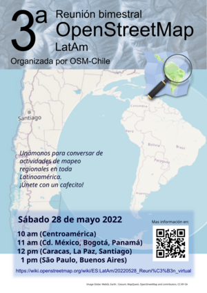
Estamos muy cerca de tener nuestra primera tercera reunión bimestral latinoamericana de mapeadores en OpenStreetMap. Será virtual y tú también puedes unirte sin importar si apenas empiezas a mapear o ya eres parte de una comunidad de ayuda de mapeo abierto.
En el wiki de OSM Chile se muestran los detalles de la reunión para este sábado 28 de mayo de 2022.
Hi This is my location
Hey world! I’m Osinachi and this is my first diary entry. I am a beginner mapper and the map my village campaign is the first project I am engaging in. I have found it really exciting for the five days I’ve mapped so far. I am thrilled by the opportunity to make my village globally accessible. I have been able to map a lot of buildings so far with the ID editor. As magnificent as it has been, I have also encountered some issues with the images. I will really appreciate it if they were clearer but all in all, it’s been great. I hope you all will contact me if there are any campaigns. I enjoy doing volunteer activities. They make me feel like my life has been worth living. Thanks so much for this space OSM! Happy mapping
Posted by Approksimator on 5 May 2022 in Ukrainian (Українська).
Last updated on 1 June 2022.

Найчастішим запитанням, з яким до мене звертаються різні перехожі – «як пройти за якоюсь адресою» та «який це номер під’їзду». Іноді складність пошуку правильного під’їзду можна спостерігати серед працівників служб доставки. Одна справа – знати тільки свій район, інша справа – охопити знаннями декілька міст.
Потреба в швидкому пошуку того чи іншого під’їзду має велике значення в різноманітних сферах: нерухомість, служби доставки, екстрені служби (швидка, пожежна, газова), таксі, поштові служби. Це може бути навіть корисно безпосередньо вам, коли ви йдете в гості до когось.
Так, бізнес має можливість створювати для власних потреб необхідні додатки для демонстрації потрібних даних. Єдине, це питання у підтримці окремого софту, його наповненні та актуалізації. А зважаючи на світові коливання останніх років (COVID-19, військові дії, кризи) – ринок потрібних додатків може швидко змінюватися, старі компанії зникають, з’являються нові і так нескінченно.
Тому довіру викликають відкриті продукти, які на ринку вже багато років і являють собою агрегатори різноманітних геопросторових даних. І чим детальніший і глибший кожен шар даних – тим краще і точніше. Особливо це стосується так званої «останньої милі».
І саме входи до будівель, номери під’їздів багатоквартирних будинків, перелік квартир в кожному під’їзді є одними з найзапитуваніших даних останніх років. Тож їх потреба у використанні неминуча.
Основним інструментом та агрегатором різноманітних геопросторових даних для потреб мікромапінгу є OpenStreetMap. Будучи відкритою платформою майже будь-яких даних та відповідаючи трьом основним критеріям даних «імпорт/експорт/відтворення» - все більше користувачів звертають увагу саме на OSM.
В даному випадку входи, під’їзди та їх нумерація не стали винятком для використання. І їх поява – це лише питання часу.
Загалом в Україні нанесено на OSM 30243 під’їзди (входи) до будинків у вигляді точок.
Декілька основних міст по кількості:
Posted by Layft Greater on 5 May 2022 in Greek (Ελληνικά).
Last updated on 19 June 2024.
Location:
Γουρρι, Gourri, Επαρχία Λευκωσίας, Κύπρος
Posted by joost schouppe on 5 May 2022 in English.

Opening up streetlevel imagery
With OpenStreetMap Belgium and our umbrella Open Knowledge Belgium, we have been lobbying to get governments to collect their street level imagery in the open.
While there are many projects to collect images, almost allways the government does not retain ownership of the imagery. Instead of paying for data collection, they pay for access to the data. This means the price is low for the individual governement organization, but in our complicated political landscape of federal, regional, provincial, intercommunal, or communal organizations, many are buying access individually. In the end, the total cost for the tax payer is higher, without there being any open products that can benefit the rest of society.
We believe payment for the data collection should happen only once, and ownership of the imagery should be transferred to the government. This would result in the lowest cost overal. By releasing the imagery as open data, its value for society is increased even more. Access to extra services can incentivise governements to pay up for the base data collection.
Slow progress
While the intercommunal organization WVI (Dutch text) has contributed open 360° imagery for most of the industrial areas in West-Flanders, and three Flemish municipalities have shared 360° imagery taken by Vansteelandt, the vast majority of projects that we hear about do not result in open data.
This is why in 2022 we are launching the Open StreetLevel Imagery Project. We are scaling up our efforts to crowdsource open street level imagery at a low cost. We are investing a very small budget which we expect to have a significant impact.
The OpenStreetMap Belgium role
Posted by SimonJames on 5 May 2022 in English.
How to add live tracking, or just live updates of pin positions while traveling and wanting to share my experiences through the map.

зміню ті міста де ніхто ними не займається
It was amazing and exiting to have our Unique mappers community joining again for the 1-week Mapathon Webinar #mapmyvillage . Good to have Raph-the HOT Global Validation Team lead joining us to handle the validation training room.And thanks to Kingsely and Chiosm Okwuchi for amazing job in the beginners room and advance mappers room. We had maore participants joining to learn how to map thier villages in OSM
Posted by Azim bahtiar on 4 May 2022 in Indonesian (Bahasa Indonesia).

Harapan saya,semoga dapat ikut berpartisipasi dalam pemetaan ini
Здравствуйте!Мы , жители поселка Айтеке би требуем убрать названия (Бомбей, Тигр , Жанаауыл, Генерал, Шанхай, Центр, Аймы агаш, ПМС). У нас законно нет такой названия.
I live in the country of Jordan and I was excited as soon as I heard of this project from a youtuber called Sebastian Lague.
Until now my modest contributions consist of the following: 1. I fixed residential area lines. 2. Fixed local features and public buildings such as mosques and churches and defined their outlines respectively. 3. Added more building tags and outlined many buildings and attractions with schools and parks.
I discovered this site a week or two ago. It seemed awesome! I definitely never knew there was a map wikipedia, where people all around the world have poured probably thousands of hours to detailing!
I discovered the project from a youtube video and it instantly caught my attention. These days cartography is mostly looked down at because with a click of a button you can pull up google maps, but this project can help others + more.
I wanted to help, so I turned to my hometown of San Diego. It definitely isn’t small, but the neighborhood I lived in for the longest time (La Jolla) is. I only recently moved away!
I have begun at northern La Jolla Village. Working my way down every little detail. I’d say I’ve done quite well so far! I look forward to mapping when I’m bored or feel like it, it’s kinda calming just drawing shapes and lines over a map for some strange reason.
Lucku signing off.
PS. I edited the original first diary because I wrote it too quickly.
One of my goals when developing note-viewer is to try various experimental features. Note-viewer started as a replacement for user’s notes pages. I could have tried changing it in the osm website code but then I’d be constrained by other things. And I want to do some things that are definitely not going to be on the osm website, maybe for a good reason because some of them will turn out to be useless and I’ll throw them away later. In fact, I’ve already thrown away some. If you were using note-viewer before did you notice that round note status icons in the table used to work as radio buttons? They don’t anymore, that was a way to select the date, now you just click the date. What does this date selection do is another topic which we won’t go into here.
Links in comments
What we are going to look into is getting links to various things mentioned in note comments. Actually when the API returns note information it sends note comments in two formats: plaintext and html. However we won’t rely on this html output because users commenting notes enter plaintext and don’t set any links themselves and in the html output everything that looks like a url gets a link, no matter how dubious the site is. We only want links to sites we trust. Obviously one of them is openstreetmap.org. Another one is StreetComplete’s image hosting. Currently that’s all what note-viewer handles, but other sites may get added in the future.
Finding this website, and learning of its potential, I have set off on an endeavor to map my hometown of Jeffersonville, Indiana. My first steps are of the quaint Grandview Drive, McBride Drive, Graceland Way, and Linden Road. My plans are, to put it lightly, ambitious: map, in as much detail, every home, driveway, and freestanding structure I can. So, I got started!
Learning the Ropes
As this is my first time using openstreetmap.org, I had to use the tutorial and play around with the interface to find how I was to approach this endeavor. However, I learn quickly and picked up how to effectively use the program after about 10 minutes of fiddling.
The Roads
The first and easiest fix for the map is aligning the roads properly with the given satellite imagery. After a bit of adjustment, the roads were aligned and ready! The next roads were a but trickier: driveways. They are very frequent, and although monotonous, the method of placement is suitably relaxing. It is very satisfying to successfully place the last one in a row.
The Buildings
Whereas the roads are monotonous yet satisfying to place, buildings are a whole other beast. Using google maps streetview and the main application itself to confirm house number, and street name, was a borderline unbearable process for me at first. However, after a few houses and adjacent buildings, I began seeing the patterns of numeration which accelerated the placement. It is still not fun to do per say, however that satisfaction as with the roads never ceases.
Duffy’s Landing
Duffy’s Landing is a public park and boat ramp upon the Ohio River in Jeffersonville. It is a relaxing place to picnic or sit, and just enjoy the warm air or watch boats mosey past. I updated the service roads, extents, and parking lot of the park proper.
Conclusion

天地图新版的 服务条款及版权申明 移除了“不能用于制图与描绘”的限制,且版权要求中仅有署名要求,目测与odbl兼容。现在可否基于天地图数据做一些批量编辑工作?
Posted by AngocA on 2 May 2022 in Spanish (Español).
Last updated on 3 May 2022.

Hace unos días hicimos una sesión de introducción al wiki de OpenStreetMap. Fue una especie de tutorial que se puede ver completamente con el video, o seguir paso a paso con la presentación:
- Video tutorial Wiki
- Presentación.
- Quiz Porque siempre es bueno probar tus conocimientos.