OpenStreetMap logo OpenStreetMap

Users' Diaries

Recent diary entries

Mapatona dia 02 de Abril 2022 - 00:00hs ás 23:59:00hs (UTC-3)

Mapathon on April 02, 2022 - 00:00hs to 23:59:00hs (UTC-3)/

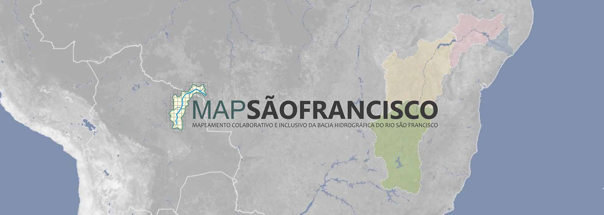
LINK HOT: https://tasks.hotosm.org/projects/12327

Mais Informações Acesse o Nosso Grupo no Telegram; https://t.me/grupoumbraosm

More Information Access Our Group on Telegram; https://t.me/grupoumbraosm

Acesse nosso Site / Access our site: https://www.umbraosm.com.br/

Raphael de Assis

UMBRAOSM

O templo parroquial de san Xoán de Louredo está adicado a san Xoán bautista, sendo a festa patronal o 24 de xuño, data precedida de novena. Algunha vez se celebrou novena, tamén, para celebrar o día do martirio, o 29 de agosto, pero o normal é que se celebre Misa ese día, sen máis. A parroquia pertence ó arciprestado de Ribadavia, sendo parte do de Cortegada anteriormente. Foi no 2013 cando este desapareceu e se pasou a aquel, na última reforma arciprestal diocesana, baixo o pastoreo de monseñor Leonardo Lemos Montanet.

De sinxela feitura, consta de unha sola nave, con espadaña sobre porta maior, con espazo para dúas campás, e dous pequenos locais a ambos lados do presbiterio, sendo un a sacristía e o outro un almacén. As campás levan dous anos diferentes: a grande é de 1923, mentres que a pequena é de 1953, sendo o fundidor Malingre (desde mesmo ano e fundidor é a estatua de bronce dedicada a monseñor Francisco Blanco Nájera, sita no claustro do Seminario Maior de Ourense). Segundo testemuña da época, as dúas campás eran do 23, pero a pequena rachou e refundiuse.

Nos laterais do templo sobresaen dous contrafortes.

Tres son os retablos, de factura local, da man do artista de Remuíño, José “O Choio”. Segundo se mira cara o altar maior, o da esquerda contén figuras de varios santos: san Antonio abade na cima, debaixo del santo Antón de Padua, ca Virxe do Carme á súa esquerda e santa Rita á dereita; o da dereita está adicado a diferentes advocacións marianas: na cima a Virxe de Luján, estando por debaixo a Inmaculada (ou Ascensión), acompañada da de Fátima á esquerda e a Dorosa á dereita; e no central temos no alto un Neno Xesús que aperta á cruz, por riba dunha preciosa talla en madeira do patrono san Xoán, que se acompaña do Sagrado Corazón á esquerda e san Xosé á dereita.

See full entry

Location: Casa Grande da Canliña, Louredo, Cortegada, O Ribeiro, Ourense, Galicia, 32200, España
Posted by DeLouredo on 17 March 2022 in Spanish (Español).

Español-Spanish:

Un cruceiro en un cruce, en A Telleira, a un paso de Louredo (Cortegada, Ourense).

El autor vive frente a él y el año de construcción está en la base (1993). Los caminos que lo rodean son: una carretera asfaltada a Louredo que pasa por el monte Cadaval, el camino que continúa hasta la salida de la carretera Celanova-Cortegada y el que lleva a O Rabiño. Todo angosto, pero con espacio suficiente para dos autos, con tramos de uno.

A pocos metros, por un camino de tierra que une Louredo y A Telleira, pasando por los campos de A Alfarrapa, tenemos el crucero homónimo.

MÁS INFORMACIÓN:

Vídeo de 2017, visitando el cruceiro y obteniendo visual de la cara que da al camino de Alfarrapa: https://youtu.be/SiIqqfLQGpg

Location: Casa Grande da Granxa, Rabiño, Cortegada, Ribeiro, Orense, Galicia, 32200, España

The inspiration for this diary comes from the email sent to the HOT mailing list. I must say that I’m not involved in Missing Maps anymore, so I don’t currently use the HOT Tasking Manager (TM). Also, I’m the author of the competing project. That’s the disclaimer.

I will start with the point since when the HOT Tasking Manager became unacceptable for me. That was when mappers began to be forced to provide their email addresses. The reason was: just 4% of the mappers shared it.

The purpose of a Tasking Manager is to divide big area into smaller squares that a human can map. Then, let mappers communicate on what they are working on by changing the states of the squares. So, TM helps with a group mapping management.

However, the changes go to the OpenStreetMap. You don’t have to use Tasking Manager to update OpenStreetMap, but you (must) use OpenStreetMap when working with a Tasking Manager. OpenStreetMap itself provides communication channels for mappers, particularly changeset discussions and private messages.

Changeset discussion is used to discuss changes mappers do in the OpenStreetMap. Private messaging is used to send direct messages between mappers. In both cases a notification is sent by email.

We are almost there. So, why is the communication within the HOT Tasking Manager wrong? Because the HOT TM duplicates the communication about things it does not manage – changes to the OpenStreetMap. Because it allows group and automated messages/emails that are, by definition, depersonalized. Because it confuses beginner mappers about which communication channels are really important.

I would like to end with a proposal for the HOT Tasking Manager developers. Please, keep the functionality of the HOT Tasking Manager non-overlapping with the OpenStreetMap. Please, do leverage OpenStreetMap for the rest.

Barangay Santa Ana Geography and Location Barangay Sta. Ana is the second largest barangay in the Municipality with a total of 810.3 hectares covering 20.90% of The municipal land area. It is bounded in the north by the municipality of Cainta, by the cities of Pasig and Taguig in the west, Barangay San Juan in the east, and by the Laguna Lake in The south. The barangays general topography is generally low lying and flat. Sta. Ana is dissected by the Mangahan Floodway which divides the barangay into two sections—Sta. Ana Poblacion located in the east, and Floodway and Lupang Arenda in the west. The poblacion is drained by Taytay River which flows southwestward towards Manggahan Floodway while Lupang Arenda is drained by Napindan Channel, both of which empties the Laguna Lake.

BarangaySantaAna Population and Density Accordingto the 2015 Philippine Statistics Authority Census, Barangay Sta. Ana has a population of 91, 343. In 2018, through a barangay initiated census, the population Of the barangay is now projected at 110,000, with majority of the population coming from the Poblacion and Lupang Arenda. With its large population size and limited land area, Barangay Sta. Ana has the highest population density in the entire municipality with an estimate of 112 persons per square kilometer.

Lupang Arenda Housing and Settlement In the early 90’s, then President Fidel Ramos declared the area of Lupang Arenda (Presidential Decree [PD] 704) and Floodway (PD 458 and 1160) as government relocation sites for the poor families of Taytay and the relocates of the Pasig River Rehabilitation project. However, the areas were flocked by families from different provinces all over the country, and has now an estimate of 15,000 families.

See full entry

Posted by HSL_HRT on 16 March 2022 in Finnish (Suomi).

Viime viikolla OpenStreetMap nousi Suomessa otsikoihin kun HSL:n reittioppaaseen ilmestyi Volydymyr Zelenskyin puisto. Kyseessä oli OSM:ään tehty muokkaus, joka datanlatausprosessiemme kautta päätyi HSL:n taustakarttaan.

Asiana ja eleenä mainittu muokkaus oli hyvä muistutus meille kaikille Euroopan tilanteesta ja siksi siihen ei poikkipuolista sanaa. Toivottavasti näkyvyys tuotti tarvittua tukea Ukrainaan.

OpenStreetMapin kaltainen globaali sisällön joukkoistaminen mahdollistaa monia asioita kuten kattavan tiedon, muutosten tekemisen nopeasti ja maailmanlaajuisestikin kehitettyjen työkalujen hyödyntämisen. Toki tähän toimintatapaan voi liittyä joskus myös todellisia väärinkäytöksiä, mutta toivottavasti tämä tapaus myös toi julki seuraavan yksityiskohdan; jokainen meistä voi helposti korjata sisältöä jos esimerkiksi Reittioppaan kävelyreitti on puutteellinen tai palvelun tai toimijan osoite on virheellinen. Keinoja tähän on avattu tarkemmin OpenStreetMap-wikissä. Nämä ohjeet pätevät kaikkiin Digitransit-pohjaisiin reittioppaisiin.

Siksi yksittäistapaukset eivät vaikuta HSL:n periaatteeseen käyttää avointa dataa ja yleisemmin joukkoistaa asioita jatkossakin. HSL:ssä pyrimme pikeminkin jatkuvasti miettimään miten voisimme erilaisilla ohjeistuksilla entisestään helpottaa vapaaehtoisten yhteisön jäsenten osallistumista yhteiseen kartoitustyöhön ja samalla myös datan validonnin avulla varmistamaan sitä että karttatuotteemme myös vastaavaisivat entistä paremmin todellista tilannetta maastossa - OSM:n “Map what’s on the ground”-periaate.

Tätä HSL:n osallistumista OpenStreetMapin dataekosysteemiin on kuvattu tarkemmin OpenStreetMapin wikissä.

Sen nämä joukkoistamiskokemukset ovat jo aikoja sitten opettaneet että kaikkea ei voi tehdä itse, joten jos asia herättää ideoita tai kysymyksiä niin ottakaa ihmeessä yhteyttä … paikkatieto@hsl.fi.

See full entry

Location: Itä-Pasila, Pasila, Keskinen suurpiiri, Helsinki, Helsingin seutukunta, Uusimaa, Manner-Suomi, 00077, Suomi

Today, I was introduced to RapID editor, it was an interactive session with the tutors across the globe, i see no difference between RapiD and iDEditor. Everyday I learnt something new on cartography, i thank God for the blessings of Uniquemappers Network Team National coordinator Victor Sunday for the opportunity given. If not his blessing, I will just be a cartographer by title. God bless u sir.

Location: Ogbomosho, Ogbomosho North, Oyo State, 210271, Nigeria
Posted by unen on 15 March 2022 in English. Last updated on 16 March 2022.

What a week!

I have conducted two OSM Help Desk sessions as announced, on February 28 and March 2 where I was able to meet and discuss with a total of five different OSM contributors about the issues troubling them. From the discussion topics and the feedback from the attendees I can say that it was a fruitful conversation for all involved. I want to thank all who attended for the friendly environment.

The OSM Help Desk had to enter a small hiatus just after it had started due to my unavailability because of the in-person meet-up of the Open Mapping Hub Asia-Pacific team in Pokhara and Kathmandu last week. It was a completely different experience, and it was great to meet with the actively engaging student communities of the geomatics engineering departments of Kathmandu University and Tribhuvan University Western Regional College. You can follow what happened (and what’s more to happen) via the Hub’s accounts via Twitter and Facebook.

Discussion Topics:

  • How can I be a HOT Validator? Is filling a Google Form enough?

In order to become a part of the global validator team, one should be an experienced and active OSM contributor (account older than 6 months and OSM activity within the past 12 months) with experience on editing on JOSM and Tasking Manager. There people then are required to take the validation training . Then depending on the quality of both edits and validation, the contributor can be a part of the validator trainee or the global validator team. You can learn about how to become a validator via here. It is also strongly recommended that you enroll and complete the HOT Validation course within the activation training available via HOT Training Center.

  • What are the points around the frame of FieldPapers atlases?

See full entry

Location: Küçükyalı, Küçükyalı Merkez Mahallesi, Maltepe, Istanbul, Marmara Region, 34840, Turkey

Néha levelezgetünk arról, hogy a területfunkciók (lakott terület, erdő, ipari terület,…) vonala fusson-e külön a közutak vonalától.

Íme egy újabb indok, amiért én a különválasztást preferálom. Egyetlen pont arrébb mozgatásával és egy másik törlésével kibővítettem az ipari területet az erdő rovására.

Gif anim amin 3 egyszerű mozdulattal kibővítek egy ipari területet az erdő rovására

(Ha utakkal futott volna, akkor “unglue” szétválasztgatás stb.)

Location: Laposok, Veresegyház, Gödöllői járás, Pest vármegye, Közép-Magyarország, 2112, Magyarország
Posted by bob3bob3 on 14 March 2022 in English.

14th March 2022

I am now starting to tackle (mainly my own) fixme’s.

Something like a farm gate and station name is not always readable on my imagery, but even after creating a feature and merging in other sources (like overheads), there are information gaps. A fixme is handy, but I need to action them as well!

I ran a simple overpass query for all node and way fixme’s in a boundary box, then exported it to gpx. I initially thought a Viking moving (GPS) map would work well, but the laptop is on the passenger seat away from my driving vision. I ended up (default) converting the gpx to a Garmin poi file with gpsbabel. set to warn at 800m distance . The “name” is displayed if that feature field is populated, else the node/way number. Additionally if one calls up the POI information on the GPS navigating unit the fixme text is displayed.

Basically I just navigate to the nearest fixme POI using the Garmin GPS display/selection tools. (Note that most of my work is in rural/remote areas, not urban)

I can then drive up close to the “problem” with the dash camera and capture for later editing. I also use the audio from the dashcam mp4 which is me talking into it! Each movie and frame are time referenced to the audio, so it is easy to correlate. I can for example read a fine print sign at a distance that the camera doesn’t capture as well.

Uma Iniciativa da UMBRAOSM - União dos Mapeadores Brasileiros do Openstreetmap

An Initiative by UMBRAOSM - Union of Brazilian Openstreetmap Mappers

PROJETO PEGADAS DE CONSTRUÇÃO NO BRASIL COM DADOS DA MICROSOFT

CONSTRUCTION FOOTPRINTS PROJECT IN BRAZIL WITH MICROSOFT DATA:

Esse projeto consiste em Mapear Edifícios ou Casas com os dados da microsoft-building-footprints - Disponível em https://github.com/microsoft/SouthAmericaBuildingFootprintspara

Mapeamento N.01

BRASIL - PRAIA LUCENA - JOÃO PESSOA (PB) - EDIFÍCIOS.

O Mapeamento na Praia Lucena - João Pessoa -(PB) - Brasil poderá ser feito por Mapeadores que tem conhecimento com o Editor Rapid.

Mapping in Praia Lucena - João Pessoa -(PB) - Brazil can be done by Mappers who are familiar with the Rapid Editor. https://tasks.hotosm.org/projects/12292

See full entry

Location: Cohab, Recife, Região Geográfica Imediata do Recife, Região Metropolitana do Recife, Região Geográfica Intermediária do Recife, Pernambuco, Região Nordeste, Brasil

O MapSãoFrancisco é uma iniciativa da Canoa de Tolda e do InfoSãoFrancisco que se propõe a desenvolver projetos de mapeamento colaborativo em toda a bacia hidrográfica do rio São Francisco.

MapSãoFrancisco is an initiative of Canoa de Tolda and InfoSãoFrancisco that aims to develop collaborative mapping projects throughout the São Francisco river basin.

https://canoadetolda.org.br/iniciativas/projetos-permanentes/mapsaofrancisco/

A cartografia pública disponibilizada pelo MapSãoFrancisco na plataforma OpenStreetMap buscará preencher a desatualização da cartografia oficial, uma vez que esta não representa de forma adequada a evolução do panorama socioambiental verificada ao longo do território do Velho Chico ao longo de várias décadas.

A BACIA HIDROGRÁFICA DO RIO SÃO FRANCISCO E SUAS REGIÕES FISIOGRÁFICAS

COMO SURGIU

See full entry

Location: Cohab, Recife, Região Geográfica Imediata do Recife, Região Metropolitana do Recife, Região Geográfica Intermediária do Recife, Pernambuco, Região Nordeste, Brasil

Mapa interativo permite visualizar dados sobre violações ambientais no Brasil

Interactive map allows viewing data on environmental violations in Brazil.

O CNJ – Conselho Nacional de Justiça e o PNUD – Programa das Nações Unidas para o Desenvolvimento lançam, através de cooperação, mapa/painel interativo público com geolocalização de ações ambientais, cíveis e criminais em todo o Brasil.

O mapeamento das áreas ameaçadas por crimes e danos ambientais acaba de se tornar realidade para o Judiciário e toda a população. O painel interativo SireneJud tem o objetivo de ampliar a transparência dos dados do Poder Judiciário sobre ações ambientais, cíveis e criminais. A ferramenta foi desenvolvida no âmbito da parceria firmada entre o Conselho Nacional de Justiça (CNJ) e o PNUD, que visa consolidar Laboratórios de Inovação e ODS no âmbito do Poder Judiciário e fortalecer as capacidades do CNJ para a produção de pesquisas em temas relacionados à Agenda 2030.

See full entry

Location: Cohab, Recife, Região Geográfica Imediata do Recife, Região Metropolitana do Recife, Região Geográfica Intermediária do Recife, Pernambuco, Região Nordeste, Brasil

Last week, we launched a new OpenStreetMap-based website: “Pin je Punt”.

This application -based on mapComplete- was commissioned by the flemish touristical agency Visit Flanders. The application is a map viewer and map editor, which requests information about charging stations for ebikes, bicycle rental, benches, playgrounds and a few more POIs.

Why?

This project was started for two reasons:

  • No one in Belgium does know where all the charging stations for bikes are
  • There are five different, provincial touristical offices. They all keep their own database of POI as benches and bicycle rental. ‘Visit Flanders’ (which is responsible for the five smaller ones) wants to unify and integrate these databases. And where better to store all the data then on the biggest geodata repository?

This project builds upon MapComplete, which aims to be an easy-to-use map viewer and editor.

The launch

The project is live since the 7th of march, the (dutch only) project page can be found here

A former radio presentator made an advertisment video as well, which can be seen on youtube (dutch only). As far as I know, this is the first professionaly made commercial which asks to contribute to OpenStreetMap!

There has been quite a few edits done by now too:

See full entry

Location: Treft, Heuveldal, Strombeek-Bever, Strombeek, Grimbergen, Halle-Vilvoorde, Flemish Brabant, Flanders, 1853, Belgium

Vídeo Aula de mapeamento com OpenstreetMap

Video Mapping Lesson with OpenstreetMap

https://www.youtube.com/watch?v=Jm5l8M989j4&t=26s

Mapeamento para resiliência com OpenStreetMap - aula introdutória com Prof João Porto -12/05/2020

Mapping for resilience with OpenStreetMap - introductory class with Prof João Porto -12/05/2020 https://www.youtube.com/watch?v=mjTOZevgmyk

Mapeamento para resiliência com OpenStreetMap (Pt) - Webinar - 17/04/2020

Mapping for resilience with OpenStreetMap (Pt) - Webinar - 17/04/2020 https://www.youtube.com/watch?v=gSBBNTBwLTU

Canal Youtube Openstreetmap

Openstreetmap Youtube Channel https://www.youtube.com/channel/UCzKJ-y53Zu4dEISCRmPrcWg/videos

Raphael de Assis

UMBRAOSM - União dos Mapeadores Brasileiros do Openstreetmap

Union of Brazilian Openstreetmap Mappers

WWW.UMBRAOSM.COM.BR