OpenStreetMap logo OpenStreetMap

Users' Diaries

Recent diary entries

Posted by dónal on 6 August 2023 in English.

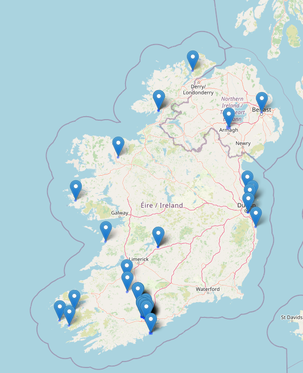
It’s a long weekend this weekend in Ireland so I found some time today to catch up on some OpenStreetMap tasks.

Primary objective: Send welcome messages to new contributors in Ireland.

Objective status: Completed. \o/

Other observations:

  • new contributors add lots of good information. some mistakes but we also did that at the start.
  • lots of buildings still to add in Ireland.
  • impressed by the amount of organisations trying to contribute updates. Saw new contributions from libraries, public transport organisations, business improvement organisations.
  • A new contributor with a username that may signify they work in the waste industry has been adding information for new estates. Love it!
  • Terracing tool rocks! Added a whole estate in Blarney, Co. Cork in about an hour using it today.
  • Map Roulette (see maproulette.org ) is cool.

Map of recent edits for dónal

Map of Ireland showing openstreetmap edits by dónal

Location: Centre A ED, Cork, County Cork, Munster, Ireland

Немного поразбирался с тегами, участвующими в 3D-рендеринге и отредактировал пока в черновом варианте собор в Болграде. Но вот увидел такую красоту (собор Святого Петра в Ватикане): https://demo.f4map.com/#lat=41.9025964&lon=12.4542521&zoom=19&camera.phi=-39.534

Стало интересно, как там задают скульптуры. Они, похоже, указаны как векторные изображения, отбрасывают правильные тени:

See full entry

Yesterday which was the 5th of August, 2023 we ha our weekly mapathon. This holds every Saturday of every week. I trained our newbie from last week on how to use Maproulette and how to map road. Then I also opened a new account and trained a newbie yesterday on how to map. We had two newbies yesterday but I could only open an account for the other because our time was up. We all also had refreshments and had fun mapping. We were a total of 6.

Posted by stephnwakonobi on 6 August 2023 in English.

I attended the monthly coordination meeting that took place on the 5th August from 9:45am-11am. The Agenda for the meeting 1. Map Nigeria Mapathon Project -progress and concerns 2. Other community Activities- 3. Reports from Mapathon centers/State Chapters/Campus Team 4. SotM Nigeria 2023-updates and Actions required

I also invited 2 persons to attend the meeting. It was quite nice.

Posted by SomeoneElse on 6 August 2023 in English. Last updated on 22 December 2025.

There’s lots of software around to work with OpenStreetMap data - querying it, creating maps from it, using it for navigation. One area that there has historically been less support is analysing OSM changeset data. As an example, here is one of mine.

However, many years ago Toby Murray wrote ChangesetMD. That can be used to maintain a database of changeset information (tags, discussions, etc.). Martijn van Exel updated that to a recent version of Python and I made a couple more changes to support very recent Python versions and made the replication more scriptable.

Downloading changeset data

Over on the planet.osm.org site, there’s a download for all the changeets generated at the same time as the weekly “planet” file is created, and also one for all the changeets and discussions as well. The changesets-only one is just over 6GB (bzipped), and the one with discussions as well is only about 250MB more, because most changesets don’t have discussions.

If you’re not interested in changeset data dating back to 2012 you don’t need to download this file; you can just start replicating from whatever point in the past you are intereted in starting from.

Installing the software

If you’re on Debian or Ubuntu, you’ll likely want to follow these instructions from a non-root user account of your choice (substitute that account for “youruseraccount” in the instructions).

Running it for the first time

From the virtual account created by the installation, which you can reenter by running

cd /home/${youruseraccount}/src/ChangesetMD
source .venv/bin/activate

Run something like this

python changesetmd.py -d changesets -c -g

The “-g” is optional and initialises the database to story geometric data. “changesets” in the line above is just the database name.

Loading a changeset dump file

To load the database with changesets and discussions:

python changesetmd.py -d changesets -g  -f ~/data/discussions-latest.osm.bz2

See full entry

Location: Charlesworth, Higher Chisworth, High Peak, Derbyshire, East Midlands, England, United Kingdom
Posted by fudoreaper on 4 August 2023 in English.

Editied OSM again this week.

I’ve spent time at Sargent Park (Winnipeg, Canada), and noticed a lot of missing pathways, which I can use on a bike or walking. I’ve made several updates to paths, roads, parking, fences, building names, facility names, etc.

I’m quite happy with the changes.

I haven’t found a good android app for OSM, either. Someone must know something decent– a kind of google maps competitor.

Location: Portage & Main, Point Douglas, Winnipeg, Manitoba, Canada
Posted by 38446 on 4 August 2023 in English. Last updated on 5 August 2023.

Today I came to think again about on-demand bus service areas. There is one mention on the OSM wiki: this explanation from Belgium, but I’m not sure if it really refers to a service area rather than a line with on-demand stops. The idea of the on-demand bus service area is that from one central stop a small bus will take you wherever you want to go, almost like a taxi, but only at certain times, and together with other passengers (if there are any). The concept has been quite common for some time in rural areas all over Europe. In my opinion, we could just draw the area, give it some tag so it is put down in the data that this rural area is generally accessible by public transport.

Mapper BroccoliB did so here, and his attempt was also what made me think about it again.

The reason I came across his edit was that my wife and I had a day off and used it for a bike ride through the sparsely-populated area north-east of Wolfsburg, just across the former border between West and East Germany. It was nice cycling along the Mittellandkanal - but I have to say that we are quite used to gravel tracks and have equipped our bikes with appropriate puncture-safe tyres. Some excellent pear trees along the road here. No traffic at all because of a road closure further south. When we came to the nearest larger village, we had to decide if we wanted to continue on the road in heavier traffic now or use a track running parallel. To our surprise (it wasn’t mapped as such yet), it had excellently smooth asphalt. For the way back we had opted for a bus line that also carries up to five bicycles (for free!). It’s really amazing what the land of Saxony-Anhalt with its limited resources and sparse population does for an attractive public transport. Lower Saxony could take a page from its book!

Location: Klötze, Altmarkkreis Salzwedel, Saxony-Anhalt, Germany
Posted by NorthCrab on 3 August 2023 in Polish (Polski). Last updated on 11 August 2023.

🗺️🦀 Witajcie, społeczność OpenStreetMap,

Dziś dzielę się z Wami moim najnowszym projektem, osm-yolo-crossings — nowym narzędziem wykorzystującym zaawansowaną technologię AI do samodzielnej detekcji i mapowania przejść dla pieszych (zebry) w OpenStreetMap. Po udanym imporcie budynków w Polsce za pomocą AI, przyszedł czas na poprawę bezpieczeństwa pieszych!

Baner aplikacji

Dzięki mocy detekcji obiektów YOLOv8, to narzędzie automatyzuje mapowanie brakujących przejść dla pieszych na naszych mapach. Z imponującą precyzją wynoszącą ponad 99,7%, jest w stanie zaimportować około 88% wszystkich wykrytych przejść. Pozostałe 12% jest odrzucane z powodu niskiego poziomu pewności. Dzięki inteligentnemu filtrowaniu, system ten jest niesamowicie wydajny. Na przykład, jest w stanie zmapować całą Polskę w ciągu zaledwie dwóch miesięcy, używając pojedynczego serwera bez karty graficznej. To AI pracuje mądrze, a nie ciężko!

Przykładowy zestaw zmian.

See full entry

Posted by NorthCrab on 3 August 2023 in English. Last updated on 15 August 2023.

🗺️🦀 Hello OpenStreetMap community,

I am excited to share with you my latest invention, osm-yolo-crossings — a new tool that harnesses cutting-edge AI technology to autonomously detect and map pedestrian crossings (zebras) in OpenStreetMap. After the successful AI building import in Poland, it’s now time to expand and improve pedestrian safety!

Application banner

Leveraging the power of YOLOv8 object detection, this tool is designed to ensure that we no longer miss pedestrian crossings on our maps. With an impressive >99.7% precision rate, it’s able to import around 88% of all detected crossings. The tool discards the remaining 12% due to low confidence levels. Thanks to smart filtering, this system is incredibly efficient. For instance, it can map the entirety of Poland in just about two months using a single server without GPU. This is AI working smart, not hard!

See an example changeset.

See full entry

Posted by MetroBot on 3 August 2023 in Chinese (China) (‪中文(中国大陆)‬). Last updated on 6 August 2023.

背景

大约两周前通过Subway Validation检查工具发现长沙地铁部分地铁关系出现严重错误。这里涉及的编辑包含138741823138790779等。

尝试了解动机,通过在138741823的评论、站内消息和编辑者有少量沟通。猜测是因为线路是单线,没有拆分成上下行两条线的原因。另一位在138790779也有英文提问,未有答复。从过往的编辑历史看,不是故意破坏,应该只是对地铁关系的规范或iD编辑器不熟悉导致的错误。

问题

目前发现1号线的部分问题。总结如下

  1. 1号线开福福区政府 –> 尚双塘方向线路关系被删除
  2. 1号线线路关系中的地铁线被删除
  3. 添加了重复的1号线主关系,原始主关系新主关系。新主关系错误,用的是type=route标签,而不是type=route_master,而且主关系中错误的加入了地铁站点。
  4. 添加了重复的1号线线路关系。开福福区政府 –> 尚双塘方向原始关系(已被删除)新关系。尚双塘 –> 开福区政府方向原始关系新关系。新线路关系未添加地铁线。

其他线路的类似问题

  1. 2号线光达 –> 梅溪湖西方向线路关系被删除
  2. 2号线主关系被删除
  3. 4号线单方向线路关系被删除
  4. 4号线主关系被删除
  5. 5号线的单方向线路关系的所有标签被删除。添加了重复关系。
  6. 磁浮快线单方向线路关系被删除,之后添加了不完整的新关系,新关系后续被其他编辑者修复
  7. 重复添加的西环线

参考规范

With the new release of more than 59 million points of interest (POIs) from Overture, consisting of Microsoft and Meta POI datasets combined, the natural question arises: how can this be useful for OpenStreetMap?

Challenges to consider

The most important challenge in getting this data into OSM is making sure the place labels in Overture have an equivalent in OSM. This is mostly doable with automation, but many cases require context.

Validation of these is a forthcoming challenge: street-level imagery from Mapillary will be especially helpful, but being there in person to validate is also a big advantage. That aside, even if the data can be added to OSM one-by-one (not imported) with validation, the tags need to have a proper format.

Loading up the data to analyze

I got started by referencing Feye Andal’s great and succinct guide on viewing the data in AWS Athena. I found a slight lack of clarity in the instructions: you need to make sure your Athena instance, and your S3 bucket where queries are saved, are on us-west-2 region, same as the Overture dataset, unless you copy the dataset first to a bucket in your other region. So make sure the regions are the same, and the instructions should work flawlessly!

Analyzing the data

Exploring the dataset, there are 1037 unique place labels in it. 86,000+ are structure_and_geography which can refer to a wide range of natural geography or built structures in OSM, difficult to match with any specific tag without context. Others translate directly, such as a laundromat.

Some example tags include: "forest", "stadium_arena", "farm", "professional_services", "baptist_church", "park", "print_media", "spas", "passport_and_visa_services", "restaurant", "dentist"

To get most of the tags matched, I used Python to import the OpenAI module, and connect to my OpenAI account, which charges a few fractions of a penny per request.

I set a system message, which defines the role the AI should play or assume. My message was:

See full entry

Location: Schönegg, Oberarth, Goldau, Arth, Schwyz, 6410, Switzerland

Pre začiatok tu máme všetky oficiálne trasy KST a SCK. Tie majú dohodnuté značenie a tagovanie.

Následne sú tu náučné chodníky ktorých systém značenia sa líši. Áno väčšina náučných chodníkov je značená zeleným backslash. Stretol som sa už aj s takým chodníkom, ktorý značenie nemal a trasa bola len na náučnej tabuli.

Lokálne trasy sa tiež značením líšia od miesta k miestu. Niektoré sú označené len pomocou smerovníkov alebo route_marker. Niektoré sa nachádzajú len na nejakej tabuli.

Náboženské trasy, ktoré sú dôležité pre pútnikov, ale bežným turistov len zavadzajú na mape, pretože sú väčšinou neznačené.

Bežecké trasy, ktoré sa behajú raz za rok.

Vlastné trasy.

Mtb trasy tiež väčšinou v teréne nie sú značené. Trasy sa nachádzajú buď len na tabuli s mapou, alebo na internete.

Odlíšenie ciest, po ktorých je v národnom parku povolené pohybovať sa na bicykli. Jeden nemenovaný požívateľ pridáva trasy v národných parkoch. Nie sú to ale cyklotrasy, ale cesty, kde je povolené v návštevnom poriadku národného parku pohybovať sa na bicykli. Je toto vhodné riešenie?

Mestské cyklotrasy, ktoré nie sú značené v teréne, ale len niekde na stránke mesta/obce.

Mestské cykotrasy, ktoré majú vlastné značenie.

Cyklochodníky vybudovené za nejakým účelom spájajúce rôzne miesta ako súčasťou relácie cyklotrasy.

O reláciách cyklotrasy, na ceste, kde sa dobre bicykluje ani nepíšem, pretože tá v OSM jednoducho nemá čo robiť.

  • route=hiking
  • route=running
  • route=foot
  • route=bicycle
  • route=mtb

Po sprístupnení DMR 5.0 prišlo obdobie, kedy konečne začali byť v lese viditeľné lesné cesty, mnohé prírodné úkazy, zrázy, skaly a mnoho iného. Po čase sa mi ale naskytá otázka: “Mapovať každý jeden objekt, ktorý je vidno na DMR 5.0?”.

  • Máme mapovať každú jednu dieru v zemi?
  • Máme mapovať každú jednu lesnú cestu?
  • Máme mapovať každú jednu baňu a hlušinu pred nimi?
  • Máme mapovať každý jeden vrchol?
  • Máme mapovať každé jedno koryto potoka?
  • Máme mapovať každú jednu skalu?
  • Máme mapovať každý jeden strom?

A to všetko bez overenia v teréne?

Viem, že nie je v ľudských silách prejsť všetky vymenované veci, ale fakt majú byť všetky v OSM?