OpenStreetMap logo OpenStreetMap

Users' Diaries

Recent diary entries

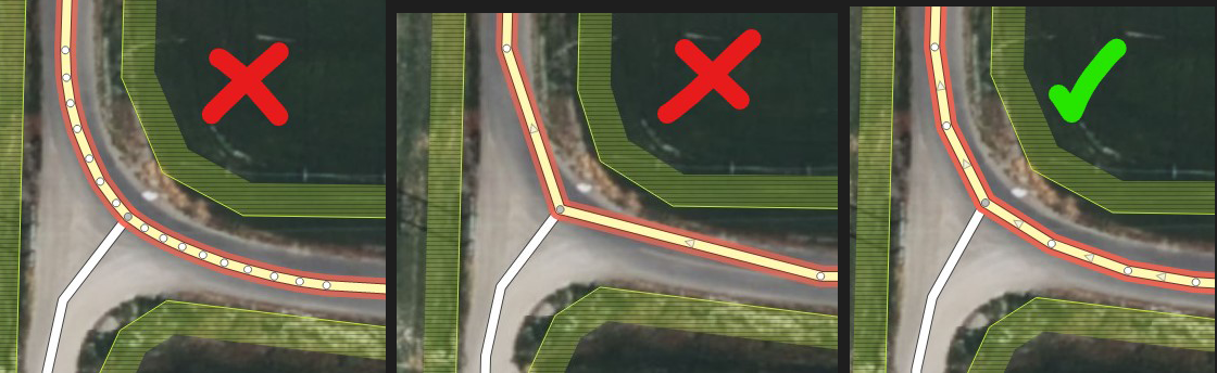
Mapear la gran masa forestal de una gran zona es algo que ya había probado antes en una de las ciudades costeras de mi país, a petición indirecta de un nuevo usuario de allí que ha hecho buenos esfuerzos por mapear su ciudad con buen detalle, y se esmeraba por mapear los bosques de su ciudad:

See full entry

Location: Llano Adentro, Urbanización Táchira, Porlamar, Parroquia Mariño, Municipio Mariño, Estado Nueva Esparta, 6301, Venezuela

Oh, Mulberry Grove, Bond County, Illinois A village of only 520 people. I forget how, but me and my colleague Lovelyfurball88, found out about this place. We have been micro-mapping it for a while, and progress has been slow, as micro-mapping goes. Why? why not man, this place had only roads so it deserves something. https://mulberrygroveil.org/ I don’t even live near it, I’m just using the satellite photos.

The simple joys of micro mapping I guess.

Mulberry Grove on map

Location: Lopnur, Ruoqiang County, Bayingolin, Xinjiang, China
Posted by vpaul on 25 May 2023 in German (Deutsch).

Beim autofreien Sonntag Mai 2023 dort langgeradelt. Eine Karte gibt es hier: https://www.radwanderland.de/radrouten/Wied-Radweg Vergleiche mit: https://osmrm.openstreetmap.de/relation.jsp?id=544300 und: https://cycling.waymarkedtrails.org/#route?id=544300&type=relation

Dabei habe ich Fehler festgestellt und denen gemeldet:

Die offizielle Route von der Internetseite entspricht nicht immer den Gegebenheiten vor Ort. Beim Mappen kann man sich also auf die offizielle Route nicht verlassen.

beim autofreien Sonntag habe ich mir den Wied-Radweg etwas genauer angesehen und mit der Karte verglichen in: https://www.radwanderland.de/radrouten/Wied-Radweg

Dabei habe ich die „Details der Routenführung“ aktiviert.

Aber es sind mir einige Differenzen aufgefallen:

Burglahr bis Peterslahr (Heckerfeld, Kur-Kölner Straße, Auf dem Heidstock, Kirchstraße): Eingezeichnet grün für “Streckenverlauf abseits von Straßen (z.B. auf Wirtschaftswegen)”, aber das sind Straßen, wenn auch ruhige, richtig wäre also nach Ihrer Legende hellblau für “Streckenverlauf auf Straßen ohne Radweg mit geringer Verkehrsbelastung”. (Bild 01)

Der Tunnel hinter Peterslahr ist gesperrt wegen einer Baustelle. Auch wenn das eine temporäre Maßnahme ist, eine Internetseite anzupassen geht schneller als diese Baustelle fertigzustellen. (Bild 02)

Hinter Mettelshahn führt der Radweg laut Karte auf der L269 bis zum Kreuzbruderweg beim Kloster Ehrenstein, dann links über die Wiedbrücke zum Rad- und Fußweg auf dem alten Bahndamm. Laut Beschilderung führt er aber gleich hinter der Mettelshahner Schweiz bei einem Parkplatz schräg hoch auf eine Wiedbrücke und den Bahndamm. Siehe Bild 03 und 04: Wegweiser bei Abzweig zum Kloster - Wied-Radweg führt geradeaus weiter.

See full entry

Location: Oberhoppen, Neustadt (Wied), Asbach, Landkreis Neuwied, Rheinland-Pfalz, 53562, Deutschland

Junto con Rafael Isturiz - risturiz, hemos estudiado las notas de OSM en sus diferentes aspectos. Como parte de esto, nos dimos cuenta de que las notas sirven para permitir la comunicación entre personas en terreno con personas en el computador (arm-chair mappers). Por lo que le solicitamos a Qeef algunas modificaciones en DAMN-project / Divide and Map, Now., para que detecte las nuevas notas de un área, y así poder resolver las notas recientemente creadas. En otras palabras, poder resolver notas en tiempo real. Aquí explico cómo preparar un evento de estos, con un caso concreto.

El capítulo de YouthMappers de la Universidad Nacional de Colombia (UN GeoParche) está organizando varias actividades de mapeo del área de Mosquera (un municipio cerca de Bogotá). Una de esas actividades es un mapping party donde van a participar personas de la comunidad OSM Colombia, entre esos yo, AngocA. Como todo mapping party, se captura información en terreno con diversas aplicaciones, y entre las actividades, vamos a estar creando notas sobre elementos que no estén en el mapa gracias a la aplicación Fediphoto. En paralelo, se realizará un evento en línea por OSMvideo – BigBlueButton, por el canal de Notathones LatAm, el cual dirigirá Rafael. Parte del evento en línea consiste en explicar el funcionamiento básico de DAMN-project client en JOSM, para tomar un parte del área de Mosquera y monitorear la creación de nuevas notas; de esta manera se detectan y se resuelven al instante.

Lo primero que toca hacer es definir el área donde se va a trabajar. En este caso, el mapping party se va a realizar en la zona central de Mosquera, por lo que el área donde se pueden llegar a crear las notas será la misma área.

See full entry

Location: Mosquera, Sabana Occidente, Cundinamarca, RAP (Especial) Central, Colombia
Posted by nickjohnston on 24 May 2023 in English. Last updated on 14 February 2024.

A section of the Cotswold Way National Trail on Leckhampton Hill was recently improved to make it suitable for off-road Tramper wheelchairs and mobility scooters.

The path has been widened and resurfaced:

Resurfaced path on Leckhampton Hill

Steps where the path meets Hartley Lane have been replaced with a ramp:

See full entry

Location: Shurdington, Tewkesbury, Gloucestershire, England, United Kingdom

Today was an eventful one, Members of our group (LMT, Nsukka) came together to get it right as we opened the 14788 project on HOTosm titled ENUGU STATE -MAP NIGERIA MAPATHON CAMPAIGN -LET’S MAP NSUKKA LGA FOR SDGS AND SOCIAL GOOD and we commenced to map with iD Editor meanwhile with my little knowledge I also help to direct and answer some of my teammates questions like “how do I put #tags?, why is my task showing error instead of submitting?, How many edits will get me to become an advance mapper?” etc.

I benefited mostly when our trainer Miss Juliet from Lion Mappers Team Enugu Campus expanded my knowledge on mapping with JOSM and even much more when she introduced RapiD which I believe is easier and faster compared to ID Editor.

I am confident that my mapping skills have improved today more than what it was yesterday. I and my Team members have gained greatly today and we are really excited about it.

A big thanks to Unique Mappers Network and their contribution to open-source data sets.

Posted by mikko_tamura on 22 May 2023 in English.

Greetings everyone! Would love to invite you to a series of mapping nights in the following weeks!

I will be hosting the MapRoulette Nights every Sunday 9PM Philippine Time (UTC +8) via Google Meet.

No prizes, no shizz, just plain mapping with people with the same interest. Let’s spin the Mapping Wheel and see where it lands.

MapRouletteNights

To join us, please sign up here. We will send the calendar invite with the GMeet Room link.

Posted by pnorman on 22 May 2023 in English.

I added functionality to tilelog to generate per-country usage information for the OSMF Standard Map Layer. The output of this is a CSV file, generated every day, which contains country code, number of unique IPs that day, tiles per second, and tiles per second that were a cache miss, all for each country code.

With a bit of work, I manipulated the files to give me the usage from the 10 countries with the most usage, for the first four months of 2023.

Tile usage per country by date

Perhaps more interesting is looking at the usage for each country by the day of week.

See full entry

Becky Candy 님께서 올리신 Common Feedback I give while Validating Building Projects on HOT’s Tasking Manager를 번역한 내용입니다.


HOT 태스킹 매니저(Tasking Manager)에서 작업물을 검토하는 동안 편집자(매퍼)에게 피드백을 제공하는 것은 매우 중요합니다. 피드백을 통해 작업의 질을 개선하고 편집 작업을 계속하도록 장려할 수 있기 때문입니다. 초보자는 매우 많은 오류를 범하기 때문에 가능한 한 오류를 빨리 발견해 건설적인 피드백을 제공하면 오류의 양을 줄이고 올바른 방향으로의 편집을 유도할 수 있습니다. 이는 전반적인 데이터 품질 향상으로 이어질 수 있습니다.

건물 추가와 관련된 프로젝트를 검토하면서 기여자들에게 매우 자주 보내는 몇 가지 피드백을 간략하게 설명하고 개입의 중요성을 설명했습니다. HOT 태스킹 매니저에서 검토 작업을 할 때 이러한 의견을 자유롭게 활용하시기 바랍니다.

See full entry

If I don’t conquer, am I conquered?

Posted by LMResearcher on 19 May 2023 in English. Last updated on 23 May 2023.

Background

This Peer to Peer Learning Exchange Workshop Series is aimed at providing a space for knowledge exchange to benefit the newly emerging OSM communities in Dominica and Saint Lucia. OSM community representatives from across the globe joined this 1-hour virtual session. It was extremely interesting to note that there were attendees from several different countries among the 36 persons who were in this April 25th peer to peer learning session. This was the first of six online sessions. The sessions are spearheaded by the Humanitarian OpenStreetmap Team (HOT) Community Working Group.

What is the OSM Community?

The Peer to Peer learning session kicked off with a discussion on “What is an OSM Community?” While some persons defined it in a broader sense, a group of like-minded people, who come together to map and some went into further detail. This included explaining the importance of charging a small membership fee in order to keep the group accessible for persons from all income brackets. One representative also mentioned the importance of having multiple members on the board of directors for continuity and accountability.

What should be the vision and mission of an OSM Community?

The general consensus was that the mission was to be a representative organization for mappers and mapping in their country/region. Further, it is important that clear goals and objectives are developed for example, increasing the number of mappers in the community, improving the quality of data and promoting the use of OSM data for community development

What should be the values to promote as an OSM community?

The dominant theme was that of inclusivity: ensuring that the OSM community was a welcoming and accessible space for all. In documenting the values the common approach is to have an informal policy at first, but written documents can be prepared and shared on the OSM Wiki.

Is there a need to register as an OSM community, either at a country or regional level?

See full entry

Today, I made my first big modification on the town of ath

that consisted by correcting a whole neighborhood :

  • I added buildings
  • I also removed/modified some of the originals buildings to make them fit to the PICC wallonia layer
  • I also changed the position of some nodes to place them just on the door of each shops

here is the changeset link : ath

Ps : My main goal is to reshape the entire town of ath.

Location: Ath, Hainaut, Wallonie, 7800, Belgique