File:Schild Naturschutzgebiet Forsthaus Proesa 27.jpg
From OpenStreetMap Wiki
Jump to navigation
Jump to search
Size of this preview: 353 × 600 pixels. Other resolutions: 141 × 240 pixels | 282 × 480 pixels | 452 × 768 pixels | 602 × 1,024 pixels | 1,205 × 2,048 pixels | 2,895 × 4,919 pixels.
Original file (2,895 × 4,919 pixels, file size: 7.48 MB, MIME type: image/jpeg)
This file and its description are from Wikimedia Commons.
Summary
| DescriptionSchild Naturschutzgebiet Forsthaus Proesa 27.jpg |
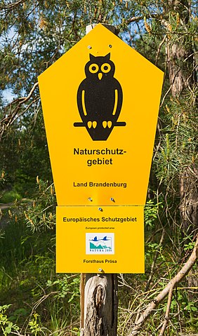
English: Signs at Prösa Forester's Lodge Nature Reserve (Naturschutzgebiet Forsthaus Prösa) near Elsterwerda, Landkreis Elbe-Elster, Brandenburg, Germany. It forms part of the Liebenwerda Heathland (Liebenwerdaer Heide).
Deutsch: Hinweisschilder eingangs des Naturschutzgebiets Forsthaus Prösa. Dieser Teil des Naturschutzgebiets liegt im Gebiet der Stadt Elsterwerda, Landkreis Elbe-Elster, Brandenburg, Deutschland. Es ist Teil der ausgedehnten Liebenwerdaer Heide. |
||||||||||||||||||||||||||
| Date | |||||||||||||||||||||||||||
| Source | Own work | ||||||||||||||||||||||||||
| Author |
creator QS:P170,Q61974823 |
||||||||||||||||||||||||||
| Camera location | 51° 30′ 15.4″ N, 13° 30′ 15.28″ E | View this and other nearby images on: OpenStreetMap |
|---|
Licensing
I, the copyright holder of this work, hereby publish it under the following license:
| This file is made available under the Creative Commons CC0 1.0 Universal Public Domain Dedication. | |
| The person who associated a work with this deed has dedicated the work to the public domain by waiving all of their rights to the work worldwide under copyright law, including all related and neighboring rights, to the extent allowed by law. You can copy, modify, distribute and perform the work, even for commercial purposes, all without asking permission.
http://creativecommons.org/publicdomain/zero/1.0/deed.enCC0Creative Commons Zero, Public Domain Dedicationfalsefalse |
Captions
Add a one-line explanation of what this file represents
Naturschutzgebiet Forsthaus Prösa
Items portrayed in this file
depicts
51°30'15.401"N, 13°30'15.282"E
6 June 2021
0.0125 second
40 millimetre
100
image/jpeg
7,848,182 byte
4,919 pixel
2,895 pixel
5834420ab1e82985ec30a9e49c487eed426faf00
File history
Click on a date/time to view the file as it appeared at that time.
| Date/Time | Thumbnail | Dimensions | User | Comment | |
|---|---|---|---|---|---|
| current | 19:55, 14 May 2022 | 2,895 × 4,919 (7.48 MB) | wikimediacommons>J.-H. Janßen | Uploaded own work with UploadWizard |
File usage
The following page uses this file:
Metadata
This file contains additional information, probably added from the digital camera or scanner used to create or digitize it.
If the file has been modified from its original state, some details may not fully reflect the modified file.
| Camera manufacturer | Canon |
|---|---|
| Camera model | Canon EOS 6D |
| Author | Jan-Herm Janssen |
| Exposure time | 1/80 sec (0.0125) |
| F Number | f/9 |
| ISO speed rating | 100 |
| Date and time of data generation | 17:42, 6 June 2021 |
| Lens focal length | 40 mm |
| Latitude | 51° 30′ 15.4″ N |
| Longitude | 13° 30′ 15.28″ E |
| Altitude | 110.3 meters above sea level |
| Horizontal resolution | 300 dpi |
| Vertical resolution | 300 dpi |
| Software used | Adobe Photoshop Lightroom 5.7.1 (Windows) |
| File change date and time | 15:01, 1 May 2022 |
| Exposure Program | Landscape mode (for landscape photos with the background in focus) |
| Exif version | 2.3 |
| Date and time of digitizing | 17:42, 6 June 2021 |
| APEX shutter speed | 6.321928 |
| APEX aperture | 6.33985 |
| APEX exposure bias | 0 |
| Maximum land aperture | 4 APEX (f/4) |
| Metering mode | Pattern |
| Flash | Flash did not fire, compulsory flash suppression |
| DateTimeOriginal subseconds | 44 |
| DateTimeDigitized subseconds | 44 |
| Color space | sRGB |
| Focal plane X resolution | 1,520 |
| Focal plane Y resolution | 1,520 |
| Focal plane resolution unit | 3 |
| Custom image processing | Normal process |
| Exposure mode | Auto exposure |
| White balance | Manual white balance |
| Scene capture type | Standard |
| GPS time (atomic clock) | 15:41:51.698 |
| Satellites used for measurement | 12 |
| Receiver status | Measurement in progress |
| Measurement mode | 3-dimensional measurement |
| Measurement precision | Excellent (11.4) |
| Geodetic survey data used | WGS-84 |
| GPS date | 6 June 2021 |
| GPS tag version | 0.0.3.2 |
| Serial number of camera | 033024001627 |
| Lens used | EF24-105mm f/4L IS USM |
| Date metadata was last modified | 17:01, 1 May 2022 |
| Unique ID of original document | 194E54F2F4CCA570AF151544BFBAA7A2 |
| IIM version | 4 |