File:Nederland kieskringen.svg
Jump to navigation
Jump to search

Size of this PNG preview of this SVG file: 520 × 600 pixels. Other resolutions: 208 × 240 pixels | 416 × 480 pixels | 666 × 768 pixels | 888 × 1,024 pixels | 801 × 924 pixels.
Original file (SVG file, nominally 801 × 924 pixels, file size: 355 KB)
This file and its description are from Wikimedia Commons.

|
This file has been superseded by Electoral districts Netherlands map.svg. It is recommended to use the other file. Please note that deleting superseded images requires consent.
|

|
Summary
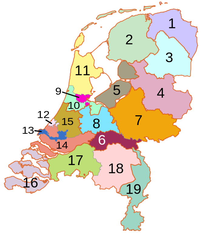
| Description | Map of the kieskringen (electoral districts) in the Netherlands. Orange lines are province (and land/water) borders, grey lines are between districts. |
| Date | |
| Source | Own work, based on freely available GIS data |
| Author | User:Mtcv |
| Permission (Reusing this file) |
Data: attribution required; my work: PD |
Licensing

|
The copyright holder of this file, Centraal Bureau voor de Statistiek, allows anyone to use it for any purpose, provided that the copyright holder is properly attributed. Redistribution, derivative work, commercial use, and all other use is permitted. |
Attribution:
|
File history
Click on a date/time to view the file as it appeared at that time.
| Date/Time | Thumbnail | Dimensions | User | Comment | |
|---|---|---|---|---|---|
| current | 18:07, 23 March 2007 | | 801 × 924 (355 KB) | wikimediacommons>Mtcv | {{Information| |Description=Map of the ''kieskringen'' (electoral districts) in the Netherlands. |Source=Own work, based on freely available GIS data |Date=2007-03-23 |Author=User:Mtcv |Permission=Data: attribution required; my work: PD }} |
File usage
The following page uses this file: