File:Kaulsdorfer Str Kaulsdorf 2011-04-22 AMA fec.JPG
Jump to navigation
Jump to search

Size of this preview: 800 × 600 pixels. Other resolutions: 320 × 240 pixels | 640 × 480 pixels | 1,024 × 768 pixels | 1,280 × 960 pixels | 2,560 × 1,920 pixels | 3,072 × 2,304 pixels.
Original file (3,072 × 2,304 pixels, file size: 1.71 MB, MIME type: image/jpeg)
This file and its description are from Wikimedia Commons.
Summary
| Description |
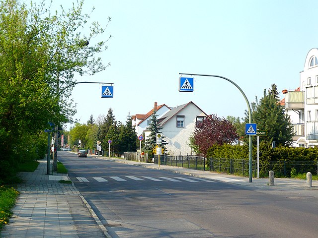
Deutsch: Berlin-Kaulsdorf in der Kaulsdorfer Straße mit gezoomtem Blick nördlich. Der Standort ist an der Ecke zur Bismarcksfelder Straße. Voraus ist rechts an der Grundstücksecke das Ortsschild für Kaulsdorf zu sehen, aber auch der Bereich am Standort gehört zu Kausdorf dazu. Wenig hinter dem Betrachter verläuft der „Eichwaldgraben“ (vermutlich auch abseits der Straße verrohrt unter der Erde) schräg über die Straße hinweg zur Wuhle, dies ist die Grenzlinie zwischen Köpenick und Kaulsdorf. Dies ist zwischen Nr. 93 und 95 auf der rechten und Nr. 98 und 94 (Supermarkt) auf der linken Seite. Vor dem Fußgängerüberweg geht rechts die Feuersteiner Straße ab. Das angeschnitten zu sehende Gebäude rechts an der Bildkante ist die Kaulsdorfer Straße 87. Links, wo auch die gepflasterte Zufahrt hin führt, liegt nur als üppiger Grünwuchs erkennbar das Gelände vom ehemaligen „Zwangsarbeiterlager“ / „Lager Kaulsdorfer Straße 90“. Von diesem ist nur eine Baracke verblieben, welche heutzutage als Privathaus dient. Der Rest des Geländes ist als Eigenheimsiedlung mit der Straße „Am Wuhlebogen“ als Zubringer längs durch den Streifen, von der Kaulsdorfer Straße abgekapselt bebaut worden. Die Grundstückszäune stehen heutzutage direkt an der Befestigung des Fußweges, welche sich laut Google Streetview Bildern von Aprill 2022 dort noch so erhalten hat. Auch die Pflasterung der Einfahrt ist danach noch erhalten geblieben, es gibt dort aber kein Tor im Zaun. Dort liegt heutzutage das Grundstück Am Wuhlebogen 10. Ebenso hat sich bis mindestens zu diesem Zeitpunkt die Straßenlaterne links hinter dem Überweg erhalten. Diese stammt noch aus DDR Zeiten und trägt am Doppelausleger auf ihrem Betonmast zwei „BG 0“ Leuchten vom VEB Leuchtenbau Leipzig. Rechts hinter dem Überweg liegt die Bushaltestelle „Feuersteiner Straße“. Nach links herüber verläuft hinter dem Siedlungsstreifen nur ca. 105m entfernt die Wuhle, welche auf Höhe der Bismarcksfelder Straße für Fußgänger und Radfahrer per Bismarcksfelder Brücke nach Biesdorf überquerbar ist. |
| Date | |
| Source | Own work |
| Author | 44penguins (Angela M. Arnold) |
| Camera location | | View this and other nearby images on: OpenStreetMap |
|---|
The geographical information in this file was retrospectively estimated.
The location may therefore be somewhat imprecise. Verifying and refining these coordinates is strongly encouraged. |
Licensing
I, the copyright holder of this work, hereby publish it under the following licenses:

|
Permission is granted to copy, distribute and/or modify this document under the terms of the GNU Free Documentation License, Version 1.2 or any later version published by the Free Software Foundation; with no Invariant Sections, no Front-Cover Texts, and no Back-Cover Texts. A copy of the license is included in the section entitled GNU Free Documentation License. |
This file is licensed under the Creative Commons Attribution-Share Alike 3.0 Unported, 2.5 Generic, 2.0 Generic and 1.0 Generic license.
- You are free:
- to share – to copy, distribute and transmit the work
- to remix – to adapt the work
- Under the following conditions:
- attribution – You must give appropriate credit, provide a link to the license, and indicate if changes were made. You may do so in any reasonable manner, but not in any way that suggests the licensor endorses you or your use.
- share alike – If you remix, transform, or build upon the material, you must distribute your contributions under the same or compatible license as the original.
You may select the license of your choice.
I, the copyright holder of this work, hereby publish it under the following license:

|
The copyright holder of this file allows anyone to use it for any purpose, provided that the copyright holder is properly attributed. Redistribution, derivative work, commercial use, and all other use is permitted. |
|
|
File history
Click on a date/time to view the file as it appeared at that time.
| Date/Time | Thumbnail | Dimensions | User | Comment | |
|---|---|---|---|---|---|
| current | 12:34, 8 September 2011 | | 3,072 × 2,304 (1.71 MB) | wikimediacommons>44penguins | {{Information |Description= Berlin-Kaulsdorf, Kaulsdorfer Str. |date= 2011-04-22 |source= own work |Author= 44penguins (Angela M. Arnold) |Permission= |Other_versions= }} {{self|GFDL|cc-by-sa-3.0,2.5,2.0,1.0}} {{self|attribution}} [[Category:Streets in |
File usage
The following 2 pages use this file: