File:AUS orthographic.svg
Jump to navigation
Jump to search

Size of this PNG preview of this SVG file: 600 × 600 pixels. Other resolutions: 240 × 240 pixels | 480 × 480 pixels | 768 × 768 pixels | 1,024 × 1,024 pixels | 801 × 801 pixels.
Original file (SVG file, nominally 801 × 801 pixels, file size: 7.95 MB)
This file and its description are from Wikimedia Commons.
Summary
English: This map (in {ISO} orthographic.svg format) is part of the Spanish Wikipedia style conventions. Please do not edit unless a consensus has been reached on the Spanish Wikipedia. If the conventions of other wikis are violated, upload an alternative version or use other available maps.
Español: Este mapa (en formato {ISO} orthographic.svg) forma parte de las convenciones de estilo de Wikipedia en español. Por favor, no editar a menos que se haya llegado a un concenso en Wikipedia en español. En caso de que se incumplan convenciones de otras wikis, subir una versión alternativa o usar otros mapas disponibles.
| Description |
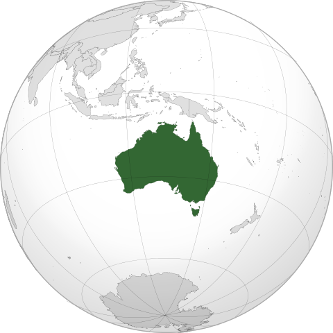
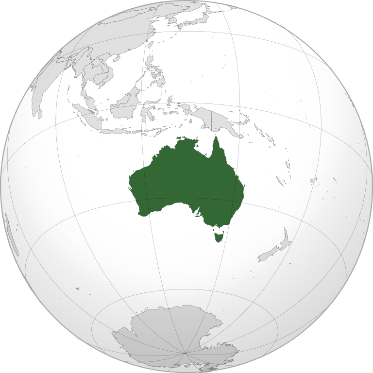
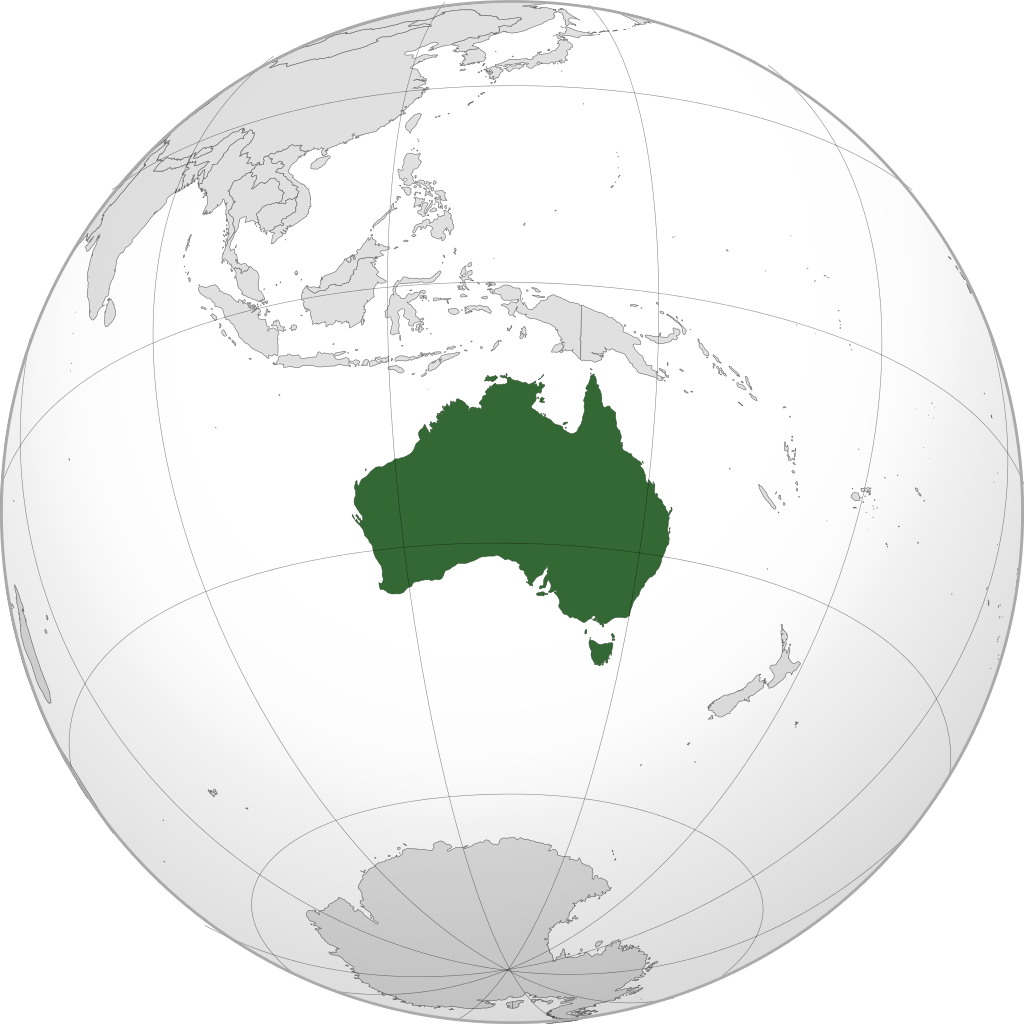
English: A map of the hemisphere centred on -27°, 133°, using an orthographic projection. Australia is highlighted in green. Solid areas represent sovereign territories. In the exclusive economic zone (EEZ) the state does not have full sovereignty, but rather "sovereign rights". Dashed areas represent disputed territories or unrecognized territories.
Sources:
Software used: Español: Mapa del hemisferio centrado en -27°, 133°, usando una proyección ortográfica. Australia está resaltado en verde. Los colores sólidos representan territorios soberanos. En las zonas económicas exclusivas (ZEE) el estado no tiene soberanía absoluta, pero tiene "derechos de soberanía". Las áreas discontinuas representan territorios en disputa o no reconocidos.
Zona económica exclusiva.
Fuentes:
Software usado: |
| Date | |
| Source | Own work |
| Author | David Ayala |
| SVG development |
Licensing
I, the copyright holder of this work, hereby publish it under the following license:
This file is licensed under the Creative Commons Attribution-Share Alike 3.0 Unported license.
- You are free:
- to share – to copy, distribute and transmit the work
- to remix – to adapt the work
- Under the following conditions:
- attribution – You must give appropriate credit, provide a link to the license, and indicate if changes were made. You may do so in any reasonable manner, but not in any way that suggests the licensor endorses you or your use.
- share alike – If you remix, transform, or build upon the material, you must distribute your contributions under the same or compatible license as the original.
File history
Click on a date/time to view the file as it appeared at that time.
| Date/Time | Thumbnail | Dimensions | User | Comment | |
|---|---|---|---|---|---|
| current | 00:04, 17 July 2025 | | 801 × 801 (7.95 MB) | wikimediacommons>Addicted04 | EEZ |
File usage
The following page uses this file: