user_10901495's Comments
| Changeset | When | Comment |
|---|---|---|
| 123042972 | over 3 years ago | Luzern is definetely a city, as Lugano.
Biel, on the other hand, can be safely described as a town, although an important one. |
| 125903637 | over 3 years ago | Non occupa l'intero edificio, occupa anche l'area intorno all'edificio. Sì in effetti la chiesa era meglio prima, adesso reverto direttamente questo changeset e cambio quelle piccole cose che avevo ragione a modificare, come i nomi delle vie e delle scuole. |
| 125902235 | over 3 years ago | Ho connesso le due strade tertiary, che è buona regola che non finiscano nel nulla |
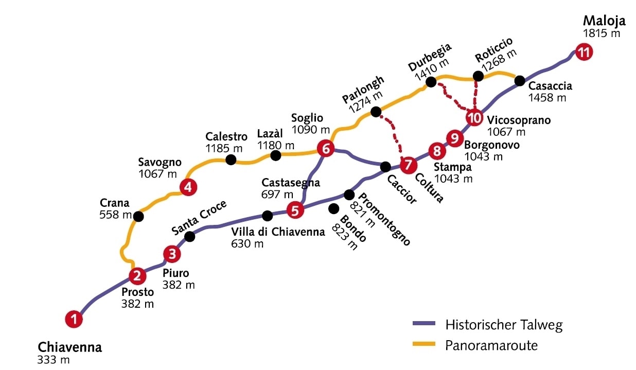
| 124772603 | over 3 years ago | <There are no signposts along the way after Soglio, are there?>
<(The Via Bregaglia actually doesn't have a number on the Swiss side, either. I guess you meant the Via Panoramica.)>
<They were based on surveys, GPS traces and current information from the responsible tourist office.>
<Your source is only a schematic map that doesn't even include the Bondo variant>
<The new Via Bregaglia variants you introduced are actually only dotted lines on your source map, indicating that they are not part of the official Via.>
Two other things: the map comes from the website bregaglia.ch, that is the official tourism website for the Val Bregaglia, so nothing particularly untrustworthy, and, just to be precise, I deleted only one relation.
I hope I made myself clear. |
| 124772603 | over 3 years ago | [I followed this when creating variants, and when determining startpoints and endpoints](https://www.bregaglia.ch/images/VIA--BREGAGLIA.jpg) In the rest I simply tidied up all the different relations, creating a relation for the official routes of Switzerland and a relation for informal routes that encompass also the italian part of these official routes.
|
| 124813476 | over 3 years ago | Right, just fixed :) |
| 124813476 | over 3 years ago | Yeah, you're right.
|