OpenStreetMap logo OpenStreetMap

species's Diary

Recent diary entries

Efficiently adding direction=* to highway=give_way/stop

Posted by species on 20 October 2015 in English. Last updated on 25 October 2015.

I recently stumbled upon the https://wiki.openstreetmap.org/wiki/Tag:direction=forward/backward key. It can be used to denote from which side a https://wiki.openstreetmap.org/wiki/Tag:highway=give_way or stop is valid. Without that tag, a router would add a penalty also when crossing from the ‘wrong’ side, which would lead to wrongly calculated travel times.

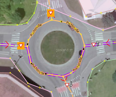
As we have a lot of give_way- and stop-signs mapped in Graz (~1500), I was looking for an efficient way to add the direction=* info on it.

For adding “direction”, you need to know the direction of the underlying way. In the default JOSM map style this is only visible if you click on it. I was looking for a style that shows the way direction on default. I found none, so I wrote one. It is now available in JOSM via Settings → Map Paint Styles. Screenshot of style "Directions for traffic signs"

See full entry

I’m working as a freelancer for opendi AG (Munich), where I did set up an OSM Rendering-Server with Mapnik/PostGIS.

Performance after initial setup was way too slow, so i’ve done some work for rendering speed tuning. I’ve written a small How-To because i haven’t found one in the OSM-Wiki:

osm.wiki/User:Species/PostGIS_Tuning

Having some ideas for improving PostgreSQL performance too? It’s a wiki, add it ☺

Ich wurde am 21.6.2013 zu einem Gastvortrag über OSM an die FH Kärnten nach Villach eingeladen.

Folgende Themen wurden behandelt:

  • Community-Building in OSM
  • Open (Government) Data
  • JOSM-Tipps für Fortgeschrittenen (Praxis-Teil)

Die Folien stelle ich unter CC-BY-SA auf Github zur Verfügung:
PDF.

Den Quelltext dazu gibts hier:
https://github.com/species/vortrag-osm-fh_ktn_6-2013

Vielen Dank an den Studiengang Geoinformation und Umwelttechnologien für die Einladung!

Location: St. Agathen, St. Leonhard, Prossowitsch, Villach, Kärnten, 9500, Österreich

Convert OSM Data into Shapefiles

Posted by species on 9 June 2013 in English.

I’ve long searched for a straightforward way to convert OSM XML Data into shapefiles for use in common GIS applications. I’ve even set up my own PostgreSQL/PostGIS server for this task - a long and painful way to get data into QGIS.

But today I found a much simpler and faster approach (at least for points):

  • Load data into JOSM
  • Save as .geojson (use file-ending .geojson, not .json!)
  • in GGIS, Layer -> Add Vector Layer… : choose type GeoJSON, open file.
  • in Layers tab, right click “Save As… : ESRI Shapefile”

Note: for ways and polygons, you have to split up the data in JOSM first. Export an extra .geojson for nodes, ways and polygons each because QGIS only handles one datatype a time.

OpenStreetMap-Stammtisch in Graz

Posted by species on 7 November 2011 in German (Deutsch).

Nächster OpenStreetMap-Stammtisch in Graz Ende November!

eine Doodle-Umfrage zwecks Terminabstimmung findet ihr hier:
http://doodle.com/88eve3z3mmtm62zr

Diesmal werde ich den Stammtisch Aufgrund mehrheitlicher Bitte früher,
um 18:00 ansetzen - aber ohne Zwang, wir sitzen sicher länger ;-)

Zwecks Agenda und sonstigem bitte die Wiki-Seite konsultieren:
osm.wiki/Graz/Stammtisch

Die Termin-Abstimmung läuft bis Montag, 14.11. 23:59.
Ich werde danach gleich der Doodle-Anmeldung entsprechend den Tisch
reservieren.

Ich freue mich auf Euer kommen!

lg, Michael

Location: Annenviertel, Lend, Graz, Steiermark, 8020, Österreich

Bike tour to Kumberg

Posted by species on 19 July 2010 in English.

My second bike tour, where i contributed my experience to OSM!

Graz-Kumberg exactly 1h with only a small astray in the LKH area of Graz - but found some unmapped footways and a Cafe :-)

Swimming in Kumberg - 27°C water - wonderful!

Back to Graz some more inconvenience ... i should avoid those mtb tracks ...
but i found a new track alongside an small astray. Also corrected surface and incline here.

Just before Graz i found a dangerous error... A street marked as pedestrial, and the last meters as residential - but in reality it was a track type 2 and then type 4 at very steep slope ... even a tractor wouldnt crawl up here...

Location: Frindorf, Kumberg, Bezirk Graz-Umgebung, Styria, 8062, Austria

I've carried my Freerunner at almost all Bike tours the last years for map and GPS and logging, but this time i first found time to get myself into mapping with JOSM and using the collected data :-)

- added a small footway at Thalersee as well as a short bicycle way from Thalersee southwards.
- added Parking areas near Thalersee

Location: Windhof, Thal, Bezirk Graz-Umgebung, Styria, 8052, Austria