
Mapped a new bit of The Meadoway this morning. It’s not quite open yet so there are construction gates (TIL they’re called https://wiki.openstreetmap.org/wiki/Tag:barrier=hampshire_gate). I will have to remember to remove them when the trail opens (December, they say).
As this is likely to be one of the very few ways with road_marking:colour=blue, I want to show people that it really does:
 (or if that didn’t work: →).
I really should add a relation for The Meadoway, but I use iD and relation editing happens for other people. This new path should probably be part of the Gatineau Corridor Recreational Trail and Trans Canada Trail - Toronto relations, but probably shouldn’t be part of the Pan Am Path relation since this was built more than a decade after the 2015 Toronto Pan Am Games.
GPS Trace: 2025_10_21_07_47_571.gpx
Changeset: 173584061
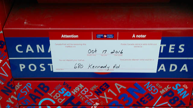 So that means by the middle of the month my leisurely 400 metre round trip to post letters is going to be over a kilometre, either to