migurski's Comments
| Post | When | Comment |
|---|---|---|
| Everything You Wanted to Know About Vector Tiles (But Were Afraid to Ask) | Nice to see those weird demos I put together 11 years ago! I wish they still functioned but the experimental JSON tile service I was hosting on openstreetmap.us didn’t survive a server move several years afterwards. |
|
| The State of OpenStreetMap in Africa 2023 | Thank you for sharing, love to see this! |
|
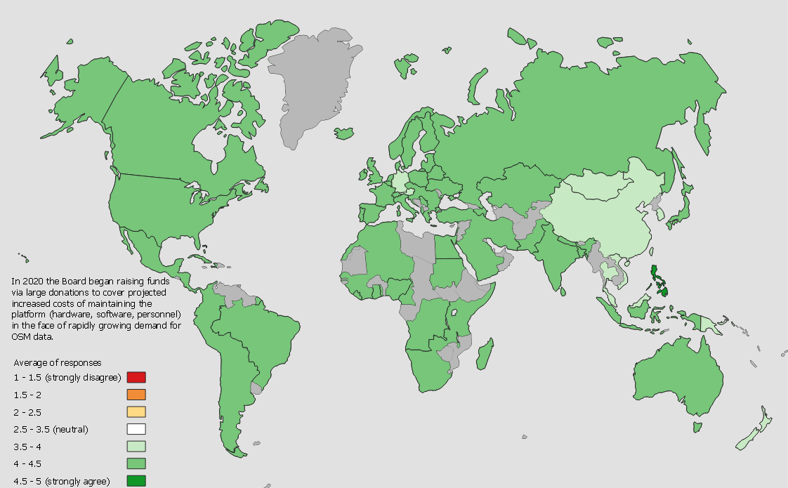
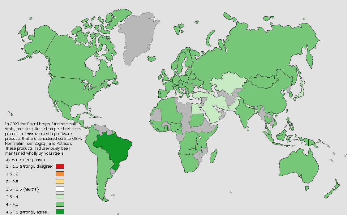
| A very quick and dirty stab at visualising OSMF 2021 survey results | The board grouped some countries to preserve anonymity where individual countries fell under a threshold of response count. |
|
| It’s Easier To Contribute to OSM’s Website Now | Thanks for the explanation @mmd. I learned from the site maintainers that contributors to the site codebase should touch only the English translation, with Translatewiki contributors picking up the other supported languages: https://github.com/openstreetmap/openstreetmap-website/pull/2740 |
|
| A very quick and dirty stab at visualising OSMF 2021 survey results | Looks great! |
|
| A very quick and dirty stab at visualising OSMF 2021 survey results | This is great, Øukasz! The hot-linked images don’t show in my browser (Mac Safari) so I mirrored them here in case you’d like to edit:
|
|
| Just Released: Third Update to Daylight Map Distribution | Thanks mmd! This explains an issue that Ian was reporting. Seems like negative IDs are too small and big IDs are too big. We’ll dig in a little, perhaps maintainers of some of these tools would be receptive to uint64’s. |