gurglypipe's Comments
| Changeset | When | Comment |
|---|---|---|
| 171457594 | 4 months ago | Did you intend to add bicycle=no to way/1427124073? It seems unlikely that cars are allowed on that road but bicycles aren’t. If it’s a weird signage setup, I suggest adding a note:bicycle tag to the road to explain it, otherwise someone might remove it in future because they don’t understand the situation on the ground. |
| 171126371 | 4 months ago | Right, thanks for surveying. The fact that the church access road was previously 5mph would surely mean that
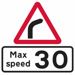
In changeset/171457594 you added maxspeed:advisory=5mph, but I think maxspeed=5mph would be better for it. aiui, maxspeed:advisory is meant for advisory speed limits on bends (sign: https://www.drivingtesttips.biz/images/recommended-speed-limit.jpg). See maxspeed:advisory=* |
| 171728765 | 4 months ago | The alignment on the second load of houses you added looks fine. Basically you need to align property boundaries to the OSMUK Cadastral Parcels overlay, as that’s a source of ground truth about alignment. The aerial imagery can be offset by up to about 2m in either direction, and that offset varies unpredictably across the country. It also changes every few years when the imagery is updated. The Cadastral Parcels don’t as they come from the Land Registry which is surveyed on the ground quite accurately. There’s also parallax error to account for, so if you can see the side of a house in the aerial imagery, then move the geometry you’ve drawn so it lines up with the base of the house (not the roof). It’s a bit complicated, but once the geometry is drawn and lined up, it should basically never need to change :) |
| 171728765 | 4 months ago | Thanks for your edits around Torrisholme recently, and thanks for picking up the detailed mapping style and aerial imagery offsets after I tweaked the houses on Holbeck Avenue. :) I’m local and happy to answer any questions you might have, though it seems like you’re getting along just fine. Happy mapping! |
| 171126371 | 4 months ago | Hi. You changed the speed limit on the church access road (way/70457804) from 5mph to 20mph in this changeset. Was that as the result of a survey? It was previously surveyed as 5mph in changeset/70506361 |
| 171105292 | 4 months ago | Great, thanks for checking :) |
| 170781834 | 4 months ago | That sounds fantastic :D |
| 170781834 | 4 months ago | Sounds good! I assume the ranger team have a way of feeding back path changes to you so the map continues to be updated over time? |
| 171105292 | 4 months ago | Yeah, there’s a watercourse visible on the OS OpenData StreetView imagery. It might be seasonal, if it wasn’t visible when you cycled through. I originally mapped this as a bridge on a survey in 2019 (changeset/70642115), but I might have been lax about the difference between bridge and culvert. I’ve added the stream/ditch and changed the bridge to a culvert in changeset/171142902. Please let me know if that matches what you saw, as I haven’t visited for a few months :) |
| 170744031 | 4 months ago | OK, that reasoning makes sense. Thank you for sharing it. It’s not completely clear cut, because councils have historically labelled quite a few different standards of path as a cycle path (narrow ones, ones without repeater signs, ones with unsuitable surfaces) and I’ve had the misfortune of cycling along them. Given the signage on the opposite side, as you say, that does make it more likely that this path isn’t meant as a cycle route, despite linking to a toucan crossing. Perhaps they put the toucan crossing in for future proofing. I’ve added a note to the way in changeset/171142314 to point other mappers to this discussion in case they think it’s mistagged in future. |
| 170768572 | 4 months ago | OK, thanks, that clears that up. That kind of information would have been very useful to have in your changeset comment :) I’ve added a note to the way in changeset/171129521 pointing to this discussion so hopefully future mappers don’t undo the changes, because to a mapper without a really detailed knowledge of cycle path design/law, that pavement does look like it should be a cycle path. |
| 170481238 | 4 months ago | Firstly, it’s good to hear about the reasoning for you changing the speed limit. It sounds unusual that the speed limit signs were removed, but stuff like that does happen, and I agree that waiting to see if it was a permanent or temporary change made sense. That resolves my question about the 20mph → 30mph change, thank you. I gave a reason for why I removed those tags at the time. Changing the speed limit from 20mph to 30mph is a really unusual change (the council almost never increases speed limits), and unusual changes, even more so than other map changes, need to come with supporting evidence. Your changeset comment at the time said “swarthmoor 20 zone”, with no mention of a change to 30mph or why that might be. If you’d have mentioned in your changeset at the time about the speed limit signs being removed, that would have made everything clear to other mappers who look at this in future. I care about the quality of the map. While you might interpret my comments and changes as “personal animosity”, that’s not my intention. I only comment when something is questionable or provably wrong (on _any_ edits in the north west, not targeting yours), and you’ve made a lot of edits like that. List your sources, as the DWG requested you to, and as many other mappers manage to do on a routine basis, and I will stop. My comments on your changesets have become more blunt over the months only because you don’t reply to any of them. I’m open to a friendlier working relationship — we’re both obviously quite invested in editing the map, and that’s not going to change. I think the first step towards that is continuing a dialogue. :) |
| 171105292 | 4 months ago | Hiya, did you mean to delete the bridge on way/692645075 ? |
| 171044053 | 5 months ago | Nice! |
| 170715281 | 5 months ago | Thanks for fixing it! (Fixed in changeset/170782235, for anyone reading this in future) |
| 170781834 | 5 months ago | Heya, thanks for these improvements! I noticed that way/26486939 is part of the walking route, but it has a note (from before your changes) which says “closed to the public since 2007”, and its access tagging is private. Is it open again, and does the access tagging need updating? Thanks :) |
| 170715281 | 5 months ago | Heya, thanks for these updates, this looks like a nice new route. One question — did you intend to change the speed limit on way/42862328 from 20mph to 50? That looks a bit unlikely for a residential road. Ta :) |
| 170744031 | 5 months ago | What are your sources? |
| 170768572 | 5 months ago | What are your sources? Two other people have surveyed this pavement/cycle path in person and cannot work out whether it’s meant to be a cycle path or pedestrian only. Please share where you’re getting your information from. |
| 170685186 | 5 months ago | Sounds good to me, thanks for checking :) |