azsr's Comments
| Changeset | When | Comment |
|---|---|---|
| 82549139 | over 5 years ago | Correct me if I'm wrong, but isn't "access=delivery" more restrictive than "access=private" in that it excludes delivery vehicles? azsr |
| 83969813 | over 5 years ago | No problem. Thanks for making the change. |
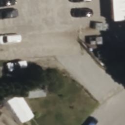
| 83969813 | over 5 years ago | Hi, thanks for contributing. But next time could you please cross-check against newer imagery? In this area, Maxar is generally the most recent vintage, and it clearly shows that 1) the house in Esri Clarity has been demolished, and 2) the driveway is more of a "straight shot" into the garage. This is also shown on normal Esri and Mapbox. Thanks!
|
| 82549139 | over 5 years ago | Hey, thanks for contributing. However, I'm pretty sure that this road is not private. It's an access road leading to a shop floor where (I think) they manufacture metal parts. I've seen delivery trucks pull up into this area. Also, I think this is how the employees access the shop. So, based on that, I think this should be "access=destination" rather than "access=private".
|
| 82415421 | over 5 years ago | Hey,
(sorry for the long links. I'll be using numbers and putting the links at the bottom of the comment)
Now, I'm not sure if we can use RIGIS imagery as a source for OSM because the imagery databases are licensed under CC-BY 4.0. I'm going to send an email to the relevant persons asking for special permission. But I think this is enough evidence to show that this is not an actual service road. Thanks,
Links:
p.s. thanks for keeping up with this :) |
| 83321700 | over 5 years ago | Hey, thanks for contributing to OSM! Just a matter of convention: Usually we use the "parking lot" preset for multiple parking spaces, not single ones. If you want to map parking spaces for one car, you can use the "parking space" preset. Thanks!
|
| 82415421 | over 5 years ago | Yeah, now that I think about it, "access=permissive" probably isn't the best tag. My reasoning is based on the fact that Oakland Beach is a public/state school, so public access is expected as events may be held there. Also, the service roads provide access/parking space for the playground and fields during non-school periods.
|
| 83810734 | over 5 years ago | I've updated it in changeset changeset/83894895
|
| 83810734 | over 5 years ago | Hey, thanks for contributing. But could you please cross-check against other imagery next time? In this area, Maxar tends to be the most recent imagery, and it clearly shows a new building (Flash Car Wash) built on the site. I will be updating this area to reflect the change. Thanks!
|
| 83890836 | over 5 years ago | Hey, thanks for contributing. But next time, could you please cross-check against newer imagery? Mapbox, Maxar, and Bing all clearly show the parking aisles. On the other hand, Esri Clarity was captured when there was apparently a game going on in the diamond, so there were many more cars than usual.
|
| 83875562 | over 5 years ago | Hey, I'm not sure that this service road should be tagged "access=private" given that the service road provides access to a community center, which is generally open to the public. A better tag would probably be "access=customers" or "access=permissive".
|
| 82415421 | over 5 years ago | Hey, thanks for contributing. I think the service roads that you added near Oakland Beach Elementary School should not be tagged as "access=private", since they are accessible by the general public. I have changed the tags to "access=permissive" in changeset changeset/83890036
|
| 83348377 | over 5 years ago | Hey, thanks for this driveway. Even though there is a fence on both sides of the driveway, there doesn't actually seem to be a gate blocking it, so I have removed it in changeset changeset/83839873
|
| 83505259 | over 5 years ago | Thanks for fixing it! |
| 82182867 | over 5 years ago | Hi! Thanks for contributing. Out of curiosity, why did you delete the area enscribing the club's premises? Thanks!
|
| 80290547 | over 5 years ago | Hi! Thanks for contributing to OSM. Unfortunately, Esri Clarity is quite outdated and the driveway leading to 356 Cedar Ave that you added has been realigned. Could you please crosscheck this with newer imagery and update it? Thanks!
|
| 80290384 | over 5 years ago | Hi! Thanks for contributing. Unfortunately, it seems that Esri Clarity imagery is outdated by quite a bit and the driveway has been realigned to the west, possibly connecting to the access to Temple Torat Yisrael. Could you please correct the error using a more recent imagery source? Thanks!
|
| 63734254 | over 6 years ago | Hey, I was wondering why you placed the tag area:highway=other on an airport runway. Shouldn't a better tag be area:aeroway=runway? Thanks. |
| 58249418 | almost 7 years ago | Hey, thanks for editing! Unfortunately, the leisure=pitch -es you modified are *actually* softball fields, not baseball fields. |
| 65791455 | almost 7 years ago | Hey, thanks for doing this! Just an FYI that RIDOT are going to renumber the exits on RI 78 very soon (in the coming month or two). [See here.](http://www.dot.ri.gov/projects/exitnumbers/index.php) I've also commented this on your other changeset which affects RI 78. |