arcth's Comments
| Changeset | When | Comment |
|---|---|---|
| 51827482 | about 8 years ago | The address system in Latvia is defined by the Address Regulations[1] based on the Administrative Territories and Populated Areas law[2]. Adresses are assigned by municipal government and kept in the State Address Register[3] which is the source of addresses shown at kadastrs.lv, geolatvija.lv etc. As specified in [1], an address must have either a house name or a street and a number. Since there are no officially named streets in most hamlets of Saulkrati parish, properties there have house names consisting of a hamlet name and a number. These house names were assigned by the Saulkrasi municipality council resolution[4] on 30.06.2010, paragraphs 26--39. In the OSM wiki article on disputes there is a section[5] regarding the On the Ground Rule which suggests using an official source of names if available. Probably this also applies to addresses. [1] https://m.likumi.lv/doc.php?id=278402
|
| 51827482 | over 8 years ago | Hello HellMap, Actually, these addresses were correct. Please consider an address in Silmala[1]: the part inside quotation marks -- Silmala 223 -- is the house name. [1]: https://www.kadastrs.lv/buildings/search?cad_num=80330020789001 |
| 40146426 | over 8 years ago | Если правильно помню, на ЛЭП [406374626](way/406374626) две цепи -- 35 кВ и 110 кВ, и цепь 35 кВ заканчивается на опоре [4082344784](node/4082344784) или [4082344785](node/4082344785). |
| 24402623 | over 8 years ago | Здравствуйте! Да, в основном, исходя из некоторого представления об устройстве электросетей и опыта. |
| 45095815 | almost 9 years ago | Hi, The deleted building polygons were replaced by nodes since they were identical rectangles with rounded corners imported from a PDF map (changeset/6131373), not the actual building footprints. The wiki page Tag:building allows the building=* tag on nodes where building footprints are not yet available. Regards,
|
| 39885528 | over 9 years ago | Thanks! |
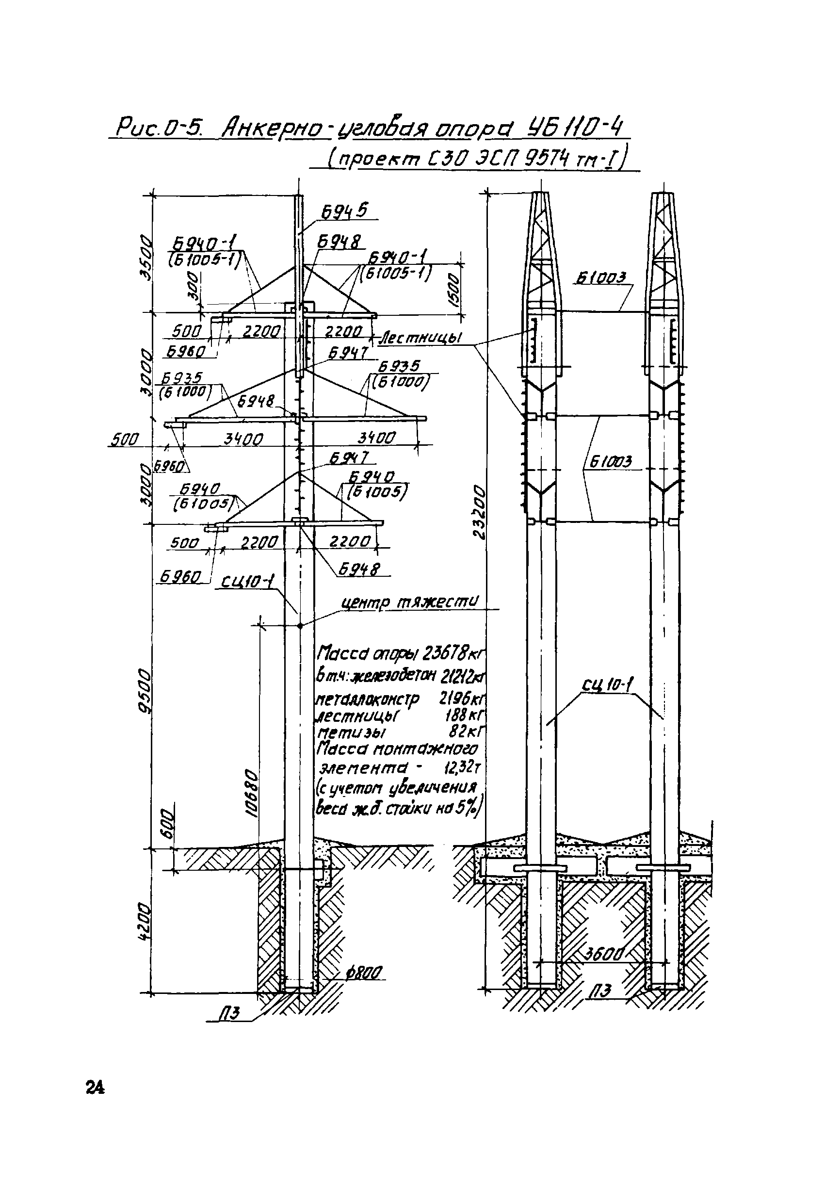
| 39885528 | over 9 years ago | Hello AkageMuk, These are towers of type УБ110-4 (catalogue 5713тм), please see the drawing[1]. The two concrete poles are fastened together making a single structure; they shouldn't be mapped separately. [1]: http://meganorm.ru/Data2/1/4293769/4293769414.files/24.gif |
| 39676815 | over 9 years ago | Hello AkageMuk, Changeset [39721601][1] should at least partially fix this. |