OpenStreetMap logo OpenStreetMap

Sawan Shariar's Diary

Recent diary entries

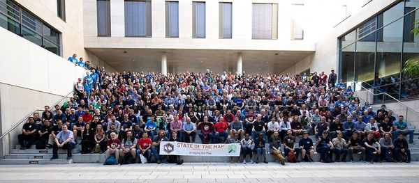
On November 30 and December 1, 2024, the breathtaking shores of Cox’s Bazar played host to an extraordinary gathering of mapping enthusiasts, community leaders, and changemakers at State of the Map Asia 2024! This landmark event brought together the OpenStreetMap community to celebrate achievements, share knowledge, and drive the open mapping movement forward. Here’s a glimpse into what we accomplished together:

SotMAsia2024 Photo

Event Highlights

💡 02 Keynote Sessions: We were inspired by two visionary keynote speakers who shared powerful insights and sparked meaningful conversations about the future of open mapping. Their perspectives served as a catalyst for fresh ideas and bold innovations.

🔊 31 Lightning Talks: These bite-sized presentations delivered bursts of inspiration, highlighting unique stories and experiences from mappers across Asia and beyond. Each talk was a testament to the diversity and creativity of our community.

See full entry

Location: Monipuri Para, Tejgaon, Dhaka, Dhaka Metropolitan, Dhaka District, Dhaka Division, 1215, Bangladesh

Alt text

Calling all campus influencers!

Are you a dynamic, and enthusiastic student looking to make a mark at your campus? Are you passionate about frontier technologies, open mapping, and community development? If yes, join us as a campus ambassador and be the face of our exciting upcoming events! we invite you to be part of this incredible journey!

We are excited to announce that the next State of the Map Asia and State of the Map Bangladesh will be held in the beautiful sandy seashore of Cox’s Bazar, and we’re looking for enthusiastic Campus Ambassadors to help make the event a grand success!

As a Campus Ambassador, you will play a crucial role in spreading awareness and engaging with your university community to promote these significant events. This is your chance to develop valuable skills, connect with like-minded individuals, and contribute to impactful projects that make a real difference.

What you’ll do?

See full entry

🌟 Calling all designers and creatives! 🎨✨

We’re on the hunt for the perfect logo for #SotMAsia24! 🌏✏️ If you’ve got a knack for design, we want YOU to paint the face of this year’s State of the Map Asia event in Cox’s Bazar, Bangladesh. 🇧🇩🗺️

Check out the details and submit your masterpiece by June 15th, 2024!

Check out the details here: osm.wiki/Call_for_Logo

Let’s make this year’s logo shine! 💫

Alt text

Greetings!

We are thrilled to share some exciting news from OpenStreetMap Bangladesh (OSMBD). For the first time ever, the OSM Bangladesh community has successfully formed an elected Executive Committee, consisting of a team of dedicated individuals who will guide our community’s activities and initiatives.

We are proud to introduce the newly elected Executive Committee:

President: S M Sawan Shariar

Vice-President: Atikur Rahman

Secretary: Samsul Arafin

Treasurer: Nahid Ferdous

Member-at-large: Mehedi Hasan Ovi

Member-at-large: Afia Tahmin Jahin

Member-at-large: Laila Sharmin Nova

Alt text

The committee is committed to upholding OSMBD’s core values of collaboration, community-driven initiatives, openness, and accessibility. Our focus is on promoting the use and development of OpenStreetMap in Bangladesh, building and maintaining a comprehensive map of Bangladesh that is freely accessible, and supporting OSM groups and initiatives through training, events, and more.

See full entry

Location: Monipuri Para, Tejgaon, Dhaka, Dhaka Metropolitan, Dhaka District, Dhaka Division, 1215, Bangladesh

Dear OSM Bangladesh Voting Members,

The elected Election Commission has announced the exciting news about the upcoming OSM Bangladesh Election 2024! Since the formalization of our official structure in February 2023, we’ve witnessed incredible growth and collaboration within our community.

🔔 Important Dates:

Nomination Submission Period: Jan 05-12, 2024

Nomination Verification: January13-14, 2024

Nomination Announcement: January 15, 2024

Nomination Withdraw Final Date: January 17, 2024

Candidate Campaign: January 18-25, 2024

Manifesto Presentation and Q&A Session: January 20, 2024

Election Day: January 26, 2024

Results Announcement: January 26, 2024

🌐 Election Process Overview:

The nomination period is now open! We invite dedicated individuals and passionate voting members about contributing to the OpenStreetMap Bangladesh community to submit their nominations.

Engage in community meetings and campaigns where voting members discuss and deliberate on candidates’ contributions, visions, and goals.

Cast your votes on the specified date to elect the representatives who will shape the future of OpenStreetMap Bangladesh.

Here is the Election RULES & REGULATIONS

📝 How to Nominate:

Fill out the nomination form with your details. Share your vision for OpenStreetMap Bangladesh.

Submit your nomination through NOMINATION SUBMIT FORM

🤝 Get Involved:

Participate actively in the upcoming election process to help shape the future of our community. Your involvement is crucial in building a stronger, more vibrant OpenStreetMap Bangladesh.

Let’s make this election a testament to the collaborative spirit and dedication within our community. Together, we can continue to map a better future for OpenStreetMap Bangladesh.

If you have any queries, reach the Chair of EC +8801713120157 (Whats app text only) [email protected] (Email)

A joyful journey with HOT

Posted by Sawan Shariar on 9 May 2020 in English.

Humanitarian OpenStreetMap Team (HOT) is the dedicated team to take humanitarian action and develop the community through Open Mapping. It is the active team of OpenStreetMap data for disasters and preparedness mapping. I really appreciate the value of open data and the way that HOT has created for the people around the world to contribute in a meaningful way.

I am S M Sawan Shariar, deputy volunteer coordinators for OpenStreetMap Bangladesh Foundation (OSMBDF), as well as deputy coordinators & validation lead of Bangladesh Humanitarian OpenStreetMap Operational Team; known to all as BHOOT. Recently chosen as Data Quality Intern for HOT. Currently supervising the Map Your City project commenced by team BHOOT to bring the whole Bangladesh into the map. It is noteworthy to mention that, I am listed as the top contributor on MissingMaps Global Leaderboard.

I have been involved with HOT activities over 5 years, which starts with the Data4Action project initiated by American Red Cross in 2015. Since then I have been an active contributor to OpenStreetMap, HOT & MissingMaps mapping activities through remote tracing, field mapping & validation both in Bangladesh & other parts of the world.

I have also been involved with YouthMappers network since 2016 and was the founder president of YouthMappers Dhaka College Chapter, one of the vibrant chapters in the global YouthMappers network. Currently advising and providing support to the beloved Dhaka College chapter and as well as all the local chapters in Bangladesh.

I have joined all HOT initiatives, campaigns, and activations and spread HOT motives and code of conduct by arranging seminars, parties, training, and open discussion in the local community.

See full entry

Location: Monipuri Para, Tejgaon, Dhaka, Dhaka Metropolitan, Dhaka District, Dhaka Division, 1215, Bangladesh

State of The Map Asia 2019: Scholars Diary

Posted by Sawan Shariar on 12 November 2019 in English. Last updated on 19 November 2019.

Posts by SotM Asia 2019 scholars: Please note that scholars are required to share something about their time at State of the Map Asia.. If what is shared is a post, its content, language and length is up to each scholar.

  1. State of the Map Asia 2019 in Dhaka, Bangladesh by Monica May from Philipines

  2. Attending My Very First State of the Map Asia by Tri Selasa from Indonesia

  3. State of the Map Asia 2019 - Dhaka, Bangladesh by Yeni Primasari from Indonesia

  4. SotM Asia 2019 Bangladeshは凄かったぜ by Kouki Takesue from Japan

  5. My First Experience in State of The Map Asia by Silvia Dwi Wardhani from Indonesia

  6. My Experience at SOTM ASIA’2019 - Dhaka, Bangladesh by Neena from India

  7. State of the Map (SotM) Asia 2019 at Dhaka, Bangladesh: A Travel through Time! by Sidhant Bansal from India

  8. SOTM Asia 2019 Conference by Suthakaran from Sri Lanka

  9. State of the Map Asia 2019: My First International Conference by Rabin Ojha from Nepal

  10. My Diary: SotM Asia 2019 by Aman KC from Nepal

  11. Experience at SotM Asia 2019 by Anirban Roy from India

  12. First International Trip! SotM Asia 2019 at Dhaka by Asish Abraham Joseph from India

  13. SOTM Asia 2019- Dhaka,Bangladesh by Rashmita Patro from India

Bridging the Map: A tale of Diversity

Posted by Sawan Shariar on 15 October 2019 in English. Last updated on 4 November 2019.

State of the Map (SotM) is an annual meeting of mappers from around the world with discussions and workshops all around the free and open map of the world. The conference is hosted by the OpenStreetMap Foundation, an international not-for-profit organization that is dedicated to encouraging the growth, development and distribution of free geospatial data and providing geospatial data for anyone to use and share.

The 2019 State of the Map event happened on September 21-23, 2019. This year SotM 2019 was held in partnership with the Institute of Geography of Heidelberg University in Germany. The event was themed Bridging the Map and invited people coming from different regions who in one way or another used OpenStreetMap in their works or fields share their knowledge, expertise and experience at the Neuenheimer Feld campus.

As YouthMappers selected as the Global Challenge winners coming from different chapters in different countries; Michael Kaluba of the Goodmappers from Uganda, Confidence Kpodo of the UCCYouthMappers from Ghana, Sawan Shariar from Dhaka College YouthMappers in Bangladesh, Aman KC from Geomatics Engineering Students Association of Nepal, Erneste Ntakobangize from Rwanda YouthMappers, and Diana Carolina Ortega Espinosa of the GeoLAB UdeA from Colombia, this was an opportunity for us to understand the extent to which our activities as YouthMappers could go in addressing issues or sectors we may not have thought of before.

See full entry

Bridging the Map: My Experiences

Posted by Sawan Shariar on 8 October 2019 in English. Last updated on 18 November 2019.

The State of the Map 2019 event happened on September 21-23, 2019. This year SotM 2019 was held in partnership with the Institute of Geography of Heidelberg University in Germany. The event was themed on Bridging the Map, people coming from different regions who in one way or another used OpenStreetMap in their works or fields shared their knowledge, expertise and experience at the Neuenheimer Feld campus.

Alt text

See full entry

#LetGirlsMap for all boys YouthMappers chapter in Bangladesh

Posted by Sawan Shariar on 28 September 2019 in English. Last updated on 29 September 2019.

It is really a challenging part to work with female for all boys institute. And our society has conservative outlook of treating gender equally.But I believe in gender equality and it is the main key of every successful achievement. Nothing can exist without mutual participation of both boys and girls. And I am decided to do that for the sustainable community. So that we regularly collaboratively works with other educational institutes and local community in our country to increase engaging new mappers, especially girls.

Challenges: we have faced

To engage female mappers always we have faced many challenges. First of all it was the primary challenge to engaging female for all boy’s institute. But we are relentlessly working to increase engaging girls beside boys.

  • Ensure a safe environment

    In an under developing country it is a very crucial part is that every woman is concerned about the safe environment for her. So we have to ensure them that the mapping platform is a safe environment to the female.

See full entry

“I will do it. I want to do. I wish I will do it one day…” those sentences are not for this team. There is no place for a single performer. It’s a team. Here is not any places for the word ‘I’ without the word ‘We’. They are loves to say “We did it. We had done it.” The team is know that The word ‘We’ is more stronger than ‘I’. But here is a problem is that we don’t want to show the team’s work more than they talks. But by this blog we are wanting to inspire others for a competition of humanitarian work. We are a ultimate ghost. No one know us but feels so much by our works.

Missingmaps Leaderboard:

See the top 10 mappers of the missingmaps leaderboard. Here staying the three mappers (red marked).And if you see top 50 you will find more mappers of the team. missingmaps leaderboard

YouthMappersBD@Mapillary:

See full entry

Location: Nilkhet, Azimpur, Dhaka, Dhaka Metropolitan, Dhaka District, Dhaka Division, 1205, Bangladesh

OpenStreetMap(OSM) is the greatest invention of modern mapping system in this digitalized world. It is a great source of open data. It is more helpful and informative from any other online Map. In this MAP we get specific data. It is very helpful for peoples. By this map anyone can get information about his queries. Anyone can upload data and also can use data in their necessity. It is also helpful for the organizations that help vulnerable peoples. In this map we get the information about vulnerable area, way of passing, important point, water point etc. that is necessary for any kind of search and rescue operation in disaster. In this map data is free, so it is granted by everyone. It is easy to upload information in this map so anyone can contribute with the information from anywhere, anytime. OSM data is helpful for Vulnerable Capacity Assessment (VCA). By using this data different NGO, Government and International organizations can continue their relief operation. It is also helpful for research work. After all we can say, OSM data is very helpful for people for society as well as country. OSM data is very helpful for disaster risk management. In this map we get the data about identification of vulnerable places, way of passing, important key indicator as building condition, material, and structure by research this information govt. or relevant authority will identify the vulnerable places and take necessary steps to reduce the vulnerability, to reduce the damage of any kind of disaster. By using this data Bangladesh Red Crescent Society or this type of voluntary organization or Government organization like fire service, civil defense can plan their search & rescue operation.

See full entry

Some Important Questions for YouthMappers Trainer (From my Experienced)

Posted by Sawan Shariar on 14 August 2016 in English. Last updated on 27 October 2016.

If you are a Trainer of OSM or YouthMappers Platform you may have to face some common but very important questions. I want to try to find out this kinds of questions and give its suitable answer.

01. What is Map?

—–> Answer: A map is a symbolic depiction highlighting relationships between elements of some space, such as objects, regions, and themes.

02. What is OpenStreetMap?

—–> Answer: OpenStreetMap is a free, editable map of the whole world that is being built by volunteers largely from scratch and released with an open-content license. OpenStreetMap is, as the name suggests, an open source map of the world (www.openstreetmap.org). It has been built up in a concept similar to Wikipedia. It is called the free wiki world map, a collaborative project to create a free editable map of the world. A digital map is always handy for various purposes. It can be used in navigation, in research, in development of location based applications. When the map is free, its usability is guaranteed for everyone. And as OpenStreetMap is open source, its development is rapid and dynamic.

03. Why OpenStreetMap?

—-> Answer: OpenStreetMap is a free, editable map of the whole world that is being built by volunteers largely from scratch and released with an open-content license.

04. Why don’t you just use Google Maps/whoever for your data?

—-> Answer: Because that data is copyrighted and owned by multiple organisations like the Ordnance Survey. Google/whoever just licenses it. If we were to use it, we’d have to pay for it.

05. Who owns OpenStreetMap?

—-> Answer: You do. The data and software is owned by you, the contributors. There is an organisation called the OpenStreetMap Foundation which exists to protect, promote, and support the project, but does not own the data.

06. Why would you use OpenStreetMap if there is Google Maps?

See full entry

Location: Nilkhet, Azimpur, Dhaka, Dhaka Metropolitan, Dhaka District, Dhaka Division, 1205, Bangladesh

The key highway=* is the main key used for identifying any kind of road, street or path. The value of the key helps indicate the importance of the highway within the road network as a whole. See the table below for an ordered list from most important (motorway) to least important (service).

“Highway tagging samples”

Roads: motorway, trunk, primary, secondary, tertiary, unclassified, residential, service

Link Roads: motorway_link, trunk_link, primary_link, secondary_link, motorway_junction

Special: living street, pedestrian, bicycle road, track, bus guideway, raceway, road, construction, escape

Paths: footway, cycleway, path, bridleway, steps, escalator

Sidewalks : sidewalk, cycleway lane, cycleway tracks, bus and cyclists, lanes:psv, busway

Lanes: number of lanes, direction instructions (“turn lanes”), signposts

Data Source: highway=* osm.wiki/WikiProject_Bangladesh#To_Know_more_about_Bangladesh

Location: Katabon, Shahbag, Dhaka, Dhaka Metropolitan, Dhaka District, Dhaka Division, 1205, Bangladesh