OpenStreetMap logo OpenStreetMap

PlaneMad's Diary

Recent diary entries

The description of the https://wiki.openstreetmap.org/wiki/Tag:railway=halt wiki, says:

A place along a railway line where trains stop. It’s not a station because it has no switches.

If we take this to mean that trains cannot crossover at this facility, then most subway/metro stations should actually be tagged halt rather than a station.

This actually makes a lot of sense since stations with crossovers/switches are usually more important in the railway network like junctions, terminals and crossing stations. Proper tagging of subway stations as halts will help to bring better hierarchy among the stops in the system.

Im going to try retagging the stops for the subway in my city and compare the results.

Location: Sampangirama Nagar, Bengaluru Central City Corporation, Bengaluru, Bangalore North, Bengaluru Urban, Karnataka, 560001, India

Just found that the raw satellite imagery from ESA’s Sentinal-2 project is now open. The resolution of the imagery is 10m/pixel, so not good enough for street level detail, but can be quite useful to monitor vegetation changes and infrastructure construction progress since the update cycle seems to be around 1 month.

Band 8 imagery with false color mapping showing the 5km long Bandra-Worli Sea Link in Mumbai

This is a great source for multiband imagery that you can use to do some interesting raster analysis in QGIS.

License

EU law grants free access to Copernicus Sentinel Data and Service Information for the purpose of the following use in so far as it is lawful4:

  1. reproduction;
  2. distribution;
  3. communication to the public;
  4. adaptation, modification and combination with other data and information;
  5. any combination of points 2 to 4.

Attribution

See full entry

A few months back in the OSM India community, we were curious to know how much of the trunk network of National Highways has been mapped compared to the official statistics released by the government.

We started off by aggregating all the statistics we could find from various official sources on the road lengths for different types of roads into a common spreadsheet.

Next was to calculate the corresponding length of roads in each state mapped on OSM. To do this, I used the osm-coverage tile reduce processor with added support for Admin-1 regions from natural earth vectors.

All it takes to run this for the Indian subcontinent is:

npm install

node download.js --all

node index.js https://wiki.openstreetmap.org/wiki/Tag:--area=[56,-12,116,42] > output.json

To generate per highway tag road length in kms for each state in the bbox. The processing should not take more than 5 minutes.

These numbers were used to compare with the official figures and generate a list of states where the national highway coverage needs to be improved.

See full entry

Mudslide in Shenzen, on the map

Posted by PlaneMad on 21 December 2015 in English.

As news of the Shenzen mudslide hit, I was curious to look at the map of the area to understand the geography and the potential damage. Not a single news source had a map or a reference to help locate the spot.

It occurred to me a little late that I just had to peek into the OSM history for clues.

The location seems unverified but matches the coordinates mentioned in this piece. For now I have traced more buildings in the industrial park hoping it may be of use to someone helping in the relief work.

Hopefully we’ll have some more sources to help verify the location by tomorrow.

Location: Changzhen, Yutang Sub-District, Guangming District, Shenzhen, Guangdong Province, 518107, China

Sidewalks and crossings

Posted by PlaneMad on 11 December 2015 in English.

Experimented with a style highlighting footways tagged with https://wiki.openstreetmap.org/wiki/Tag:footway=sidewalk and https://wiki.openstreetmap.org/wiki/Tag:footway=crossing

screenshot 2015-12-11 12 00 30 Play with the Pedestrian QA style

The mapping of sidewalks as separate ways seems to be more of an issue in US than in other places. This style of mapping increases visual noise on the map especially if the sidewalk or crossing tags are missing.

Styling subway networks in Overpass Turbo

Posted by PlaneMad on 30 November 2015 in English.

Overpass Turbo is one of my favorite OSM data tools - a simple man’s GIS.

Using the wizard, its relatively trivial to make simple queries like river to query for all the rivers from the map view.

Hidden in the cryptic query code editor is support for simple MapCSS based styling of the data.

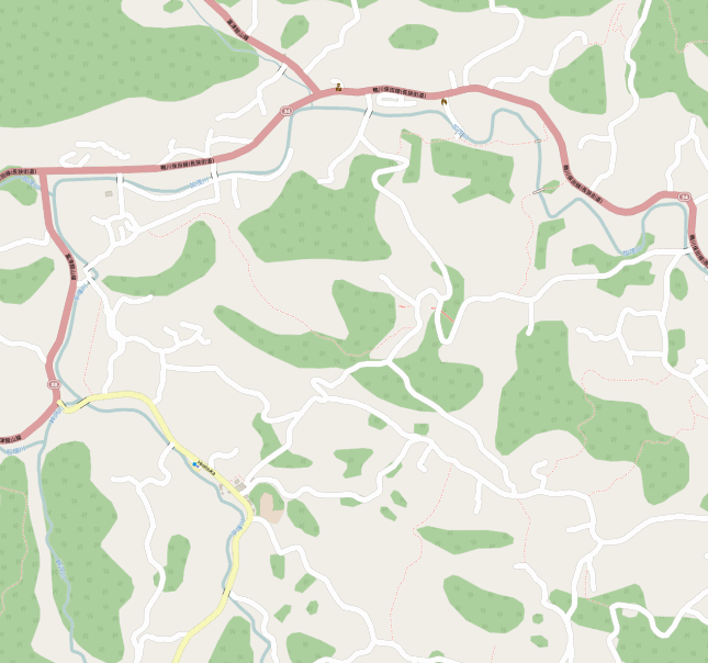
The subway network in New Delhi (blue) and under construction (red) - View

Also try adding this piece to the query style block to display popups of all the station names

node[railway=station]{ text : name; }

#Spotted - 1

Posted by PlaneMad on 9 November 2015 in English.

While contributing fixes worldwide to OpenStreetMap 24 hours a day, the data team at Mapbox gets to see beautiful views of our planet on a large scale. We usually spot curiosities of human life and nature that we love to share with others in the team, but given that our earth deserves a wider audience, we’re going to start sharing these on our diaries too on a regular basis.

Feel free to guess what/where on earth:

screen shot 2015-10-12 at 2 47 19 pm Shower head

See full entry

Data issues in Japan

Posted by PlaneMad on 8 October 2015 in English. Last updated on 14 October 2015.

A Japanese translation of this post is available on @MAPconcierge/diary/36106

Over the last few weeks, the data team at Mapbox have been investigating the unusually large number of unconnected highways in Japan which otherwise looked comprehensively mapped.

screenshot 2015-10-08 17 25 25 Broken highways in Japan. Bigger circles indicate highways of higher classification

Looking into the data threw up quite a few interesting findings:

See full entry

Data disaster: Nukus, Uzbekistan

Posted by PlaneMad on 9 September 2015 in English.

While inspecting routing errors using the OSM Inspector unconnected issues, stumbled on this town called Nukus which seemed to have some duplicated data.

screenshot 2015-09-09 10 53 44

JOSM Validator report for the area:

  • Errors 6432
  • Duplicated ways 1355
  • Duplicated nodes 5059
  • Duplicated relations 14
  • Warnings 10299
  • Crossing ways 5748
  • Way end near highway 524
  • Overlapping highways 265
  • Duplicated nodes 192

The changeset which caused this seems to be the case of a large upload gone wrong. Wondering if JOSM should have never allowed such a massive upload without splitting it into chunks.

What a disaster.

See full entry

Location: №51 Ǵarezsizlik MPJ, Nukus, Nókis qalası hákimiyatı, Republic of Karakalpakstan, Uzbekistan

While looking for missing paths to trace using the Strava Routing Errors tool, noticed the heatmap picking up a lot of activity going into one particular office.

On a closer look, turned out to be a tech company by the name Linear Technology (roof logo!).

screenshot 2015-08-21 15 03 50

Here’s a thank you map for all those awesome bikers from there contributing to the open map. Keep biking!

See full entry

Location: Linear Technology, Milpitas, Santa Clara County, California, United States

Not usually do I look back, but this has been a fun path. Its been over 8 years since I accidentally hit the edit button on this interesting project called OpenStreetMap during my student years creating maps of India on Wikipedia.

untitled

There’s been some interesting incidents, people and epiphanies on this rather eventful journey, a spicy cocktail of open source, geography and life in India. My contemporary https://www.openstreetmap.org/user/geohacker and I were somehow sucked into this crazy world in our own ways in different places, our passion driven by this common conviction that being open is right, and that maps can change lives, and be beautiful and inspiring, just like art.

See full entry

Location: Thippasandra, Indiranagar, Bengaluru Central City Corporation, Bengaluru, Bangalore East, Bengaluru Urban, Karnataka, 560075, India

I have always wanted a map style that can be printed on a single A4 sheet that I can keep in my wallet anytime I need a quick reference for cycling or using the bus across the city. India lacks any maps in public spaces and I rarely carry a phone, so this would be quite handy.

Tried to skin OSM last night with this in mind and I think i’ve got off to a good start. The roads are styled similar to a traffic map to give me an idea of Bengaluru’s complex oneway system. The labels are prioritized for suburbs, neighborhoods and streets.

High res(600dpi) . Global slippy map

Did a test print and pretty happy with the grayscale result. Need to tweak the colors a bit more though to make it more visually appealing.

Location: Sampangirama Nagar, Bengaluru Central City Corporation, Bengaluru, Bangalore North, Bengaluru Urban, Karnataka, 560001, India