PlanMan1717's Notes
Notes submitted or commented on by PlanMan1717
| Id | Creator | Description | Created at | Last changed | |
|---|---|---|---|---|---|
| 2329620 | PlanMan1717 | Someone... is there a turn restriction here? |
|||
| 2329659 | PlanMan1717 | Mismatched stuff. (a bit TMI) |
|||
| 2634503 | PlanMan1717 | What are these lines? Are they speed bumps? |
|||
| 2329634 | PlanMan1717 | Help! How do I make this a dry cleaner AND tailor? |
|||
| 2488191 | PlanMan1717 | Why does this have a key that is THIS DOES OT EXIST |
|||
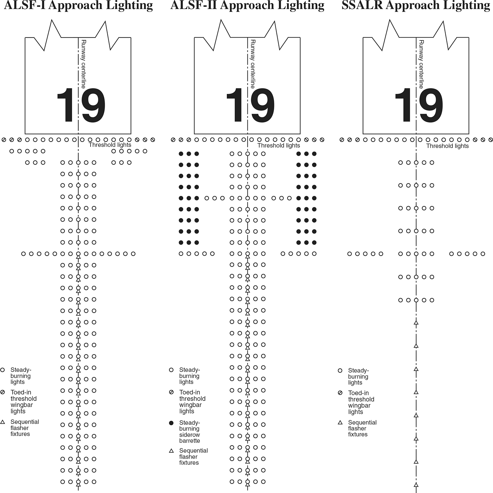
| 2724448 | PlanMan1717 | ALSF-II Approach Lighting System for Runway 1C is incomplete.
|
|||
| 2649975 | PlanMan1717 | The C&O canal is not open to civilian vehicles, although I have noticed ATVs driven by rangers on occasion. I think the tags are misleading. Plus, the speed limit for bikes is technically unlimited. |
|||
| 2410248 | PlanMan1717 | What is this building? If it's a business, consider adding its website. |
|||
| 1824981 | HeyItsAdam | could someone confirm if these taxiways (J3, faded out on recent imagery scans) are there or not? FAA airport diagram does show a possibility, but that goes against up to date imagery. |
|||
| 2378858 | PlanMan1717 | The CCT was a railway. The railway has been removed and paved over. Unless you have a keen eye, you wouldn't even know this. The tag "railway"="abandoned" seems inappropriate in this case. What should be done? |